


Chapel path Visperterminen and Bodmeri Suone


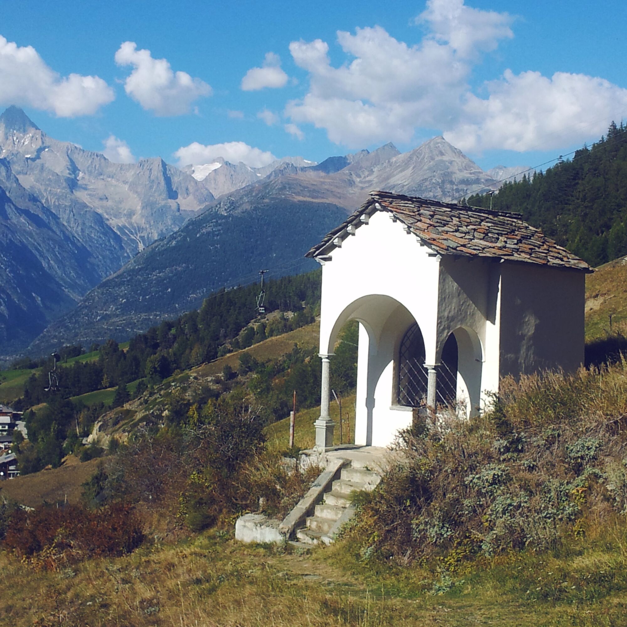
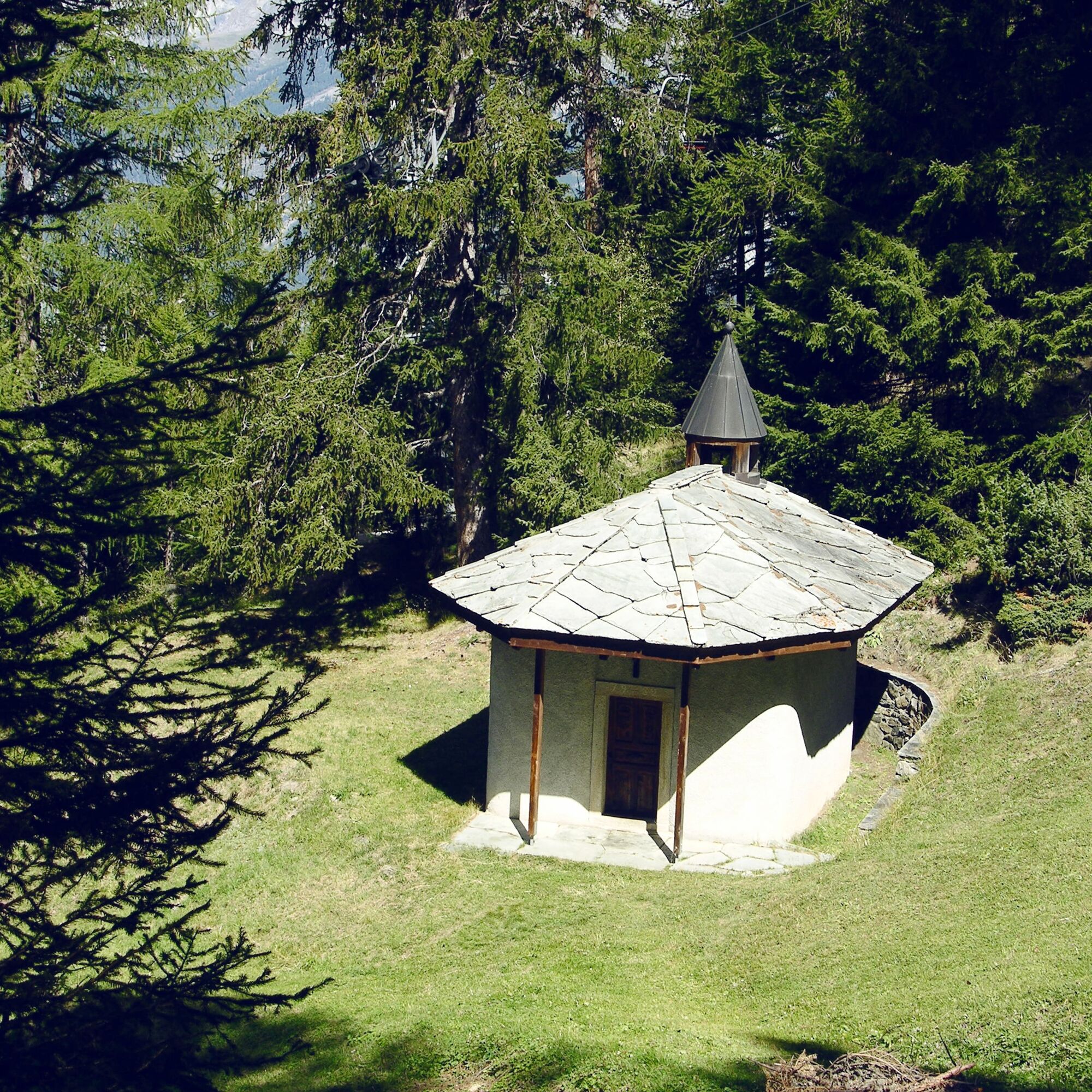
Each hamlet in Visperterminen has its own chapel and along the footpaths from the valley to the peaks, smaller chapels or wayside shrines line the way. The so-called Sacri Monti originated in Piedmont...
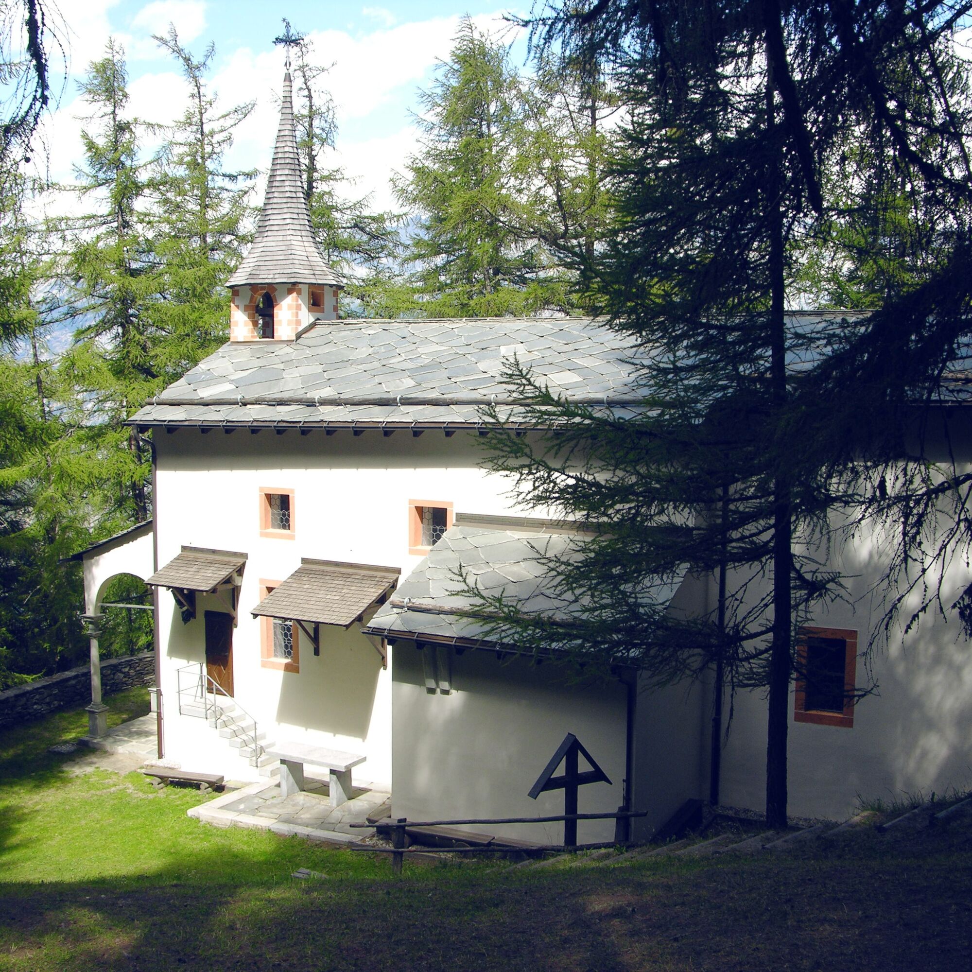
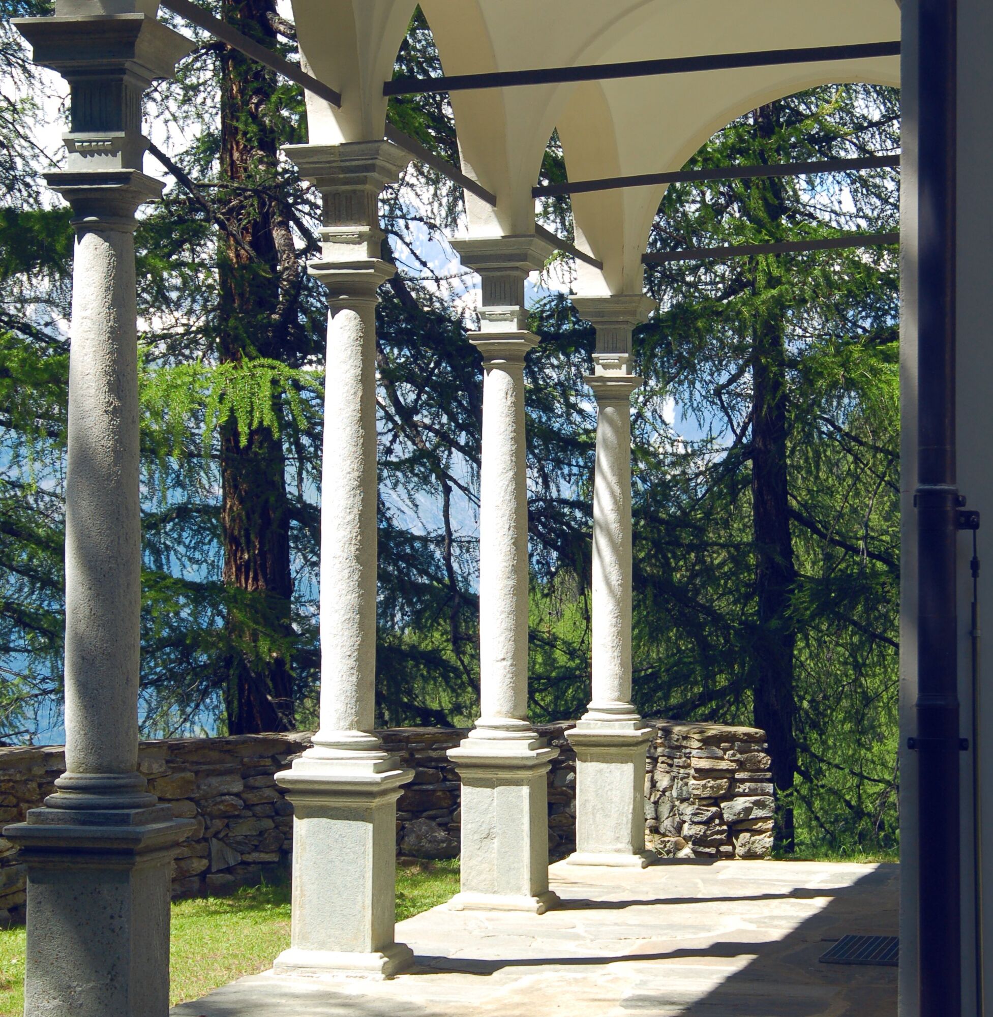
Each hamlet in Visperterminen has its own chapel and along the footpaths from the valley to the peaks, smaller chapels or wayside shrines line the way. The so-called Sacri Monti originated in Piedmont and Lombardy. In Visperterminen, a series of ten historic chapels leads up to the forest chapel "Mary’s Visitation." Over the past centuries, the faithful walked from one rosary chapel to the next. Today, the hike to the pilgrimage site is one of the most beautiful hikes in Valais.
The second part of the circular hike leads along one of the historic Suones. The "Bodmeri" was constructed in 1915 and begins in Muttji, where water is led through a tunnel from the Nanztal to Visperterminen. The Suone is still used from early April to mid-September.
The path then leads to the junction with the Niwa, an older Suone replaced by the Bodmeri. The hike follows the Niwa for a short section, where hikers pass the Hüoterhüsi, the former guardhouse.
The hike continues through the forest and through clearings, glimpses of the Rhone valley and the high peaks can occasionally be seen. Now the path leaves the Suone and leads south back to the village of Visperterminen.
Highlights
Ascent along ten historic chapels to the forest chapel. Pleasant hike along the Bodmeri Suone.

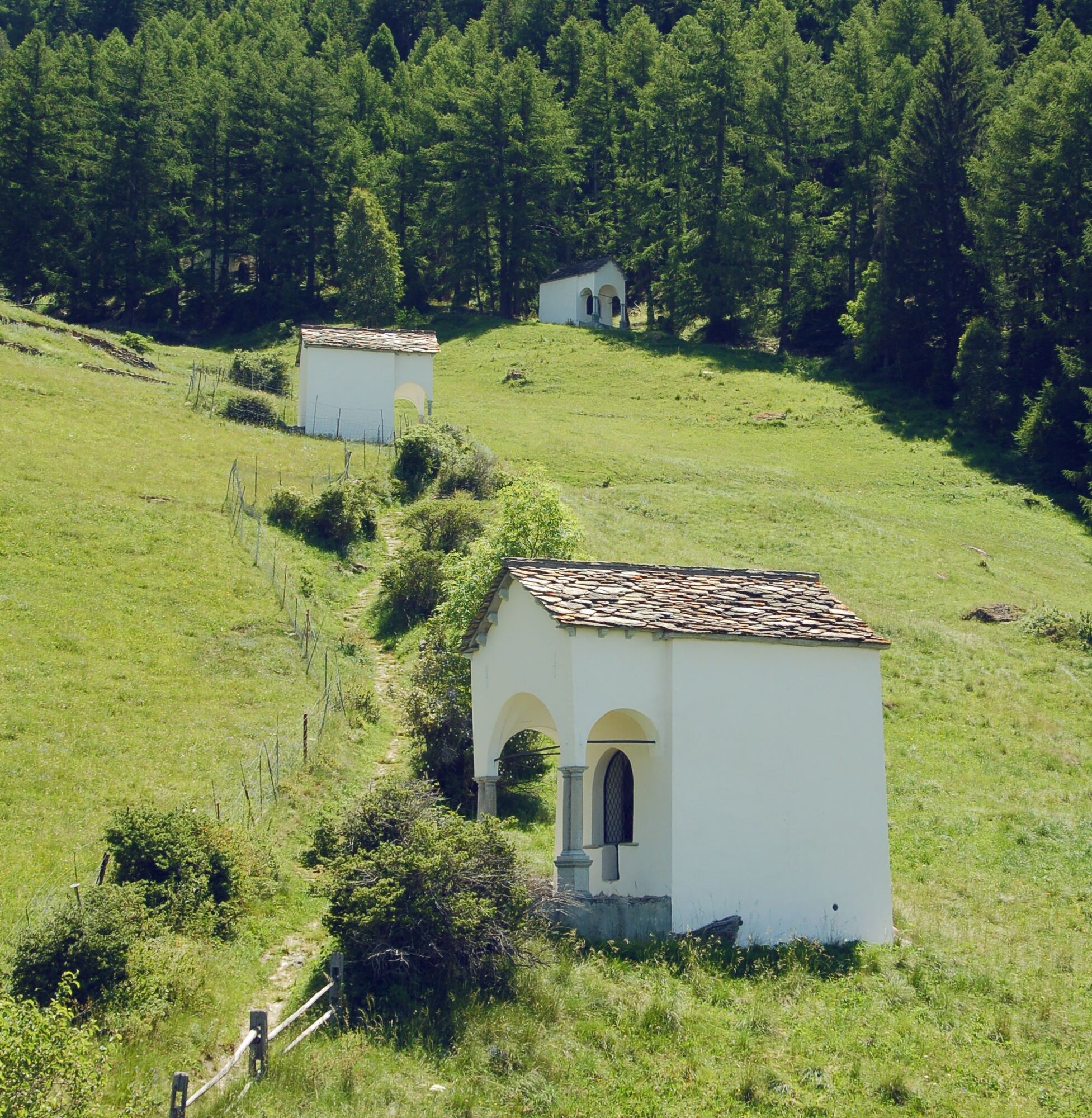
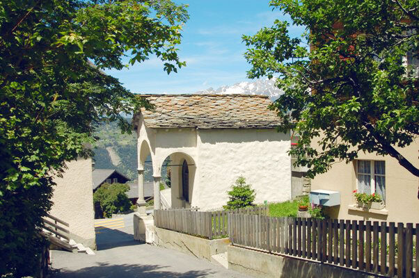
The path begins in the village of Visperterminen and leads zigzagging along the chapels uphill. Upon reaching the forest chapel, the hike continues a bit further through the forest uphill before the Bodmeri Suone is reached in a northern direction.
At the junction with the Niwa, the path follows this old Suone for a short distance before the descent towards Visperterminen begins.
Da
We recommend:
Good footwear Weather-dependent clothing: always carry a waterproof vest Headgear Sunscreen Water bottle Picnic Camera Binoculars (optional) Trekking poles (optional) Printout of the hiking trail (click "Print" to download)
For certain hikes:
Swimsuit
The mountains are a place of joy to share and respect. The mountain world is a place to meet and experience unforgettable moments together – whether by bike or on foot. So that all users can benefit, it is essential to share this space with respect towards nature and agriculture. Respectful behavior allows everyone to pursue their leisure activities under the best conditions. Inform yourself about recommendations and rules. Assess your own skills and fitness well. Using the various routes is fundamentally at your own risk.
For all hikes:
Carry a map. Download the complete description of the hiking trail with a large-scale map by clicking "Print" at the top right of the page. Use only marked hiking trails and consider all signposts and instructions – for your own safety, to protect grazing animals, and out of respect for wildlife. Close gates after passing through. Act considerately towards other trail users, plants, and animals.
For mountain hikes:
Carry additional sun protection. UV rays can be very strong at high altitudes, even in cloudy weather. Plan your hike carefully: Consider the required fitness level of all participants, weather forecasts, and seasonal conditions. Weather conditions in the mountains can change very quickly and without warning. Appropriate clothing and sufficient provisions (food and drink) are very important. In unsettled weather, it is better to turn back early.
For high alpine hikes:
Inform your family about your hiking route. If possible, avoid going alone. Do not go on glaciers without a mountain guide. Observe warning signs indicating dangers at riverbanks, along waterways below dams and reservoirs: water levels can rise quickly and without warning.
There are various ways to get to Visp:
Lötschberg car shuttle to Gampel and canton road to Visp. Furka (pass and/or car shuttle) and via Goms - Brig to Visp. Motorway A9 via Sion and Sierre and canton road to Visp.
Then follow the signs to Visperterminen.
Regular train connections from all over Switzerland to Visp. Then post bus to Visperterminen. Detailed timetables for trains and post buses can be found at sbb.ch.
Parking lot at the chairlift in Visperterminen. Follow the local parking guidance system in Visperterminen for this.
Further information about the destination can be found here: Visperterminen
Enjoy a glass of Visperterminer wine after the hike, grown in the highest vineyard in Europe. The local Heida wine is also known as the pearl of Alpine wines. The white wine is often served with a Valais platter.
Tururi populare în vecinătate
-
3,8
Höhenweg Saas-Fee - Grächen
Excursie 12,0 km -
CIRCULAR WALK MASSEGGA SUSPENSION BRIDGE
luminăExcursie 6,44 km -
5,0
Via ferrata Jägihorn
greleVia ferrata 6,14 km -
Panoramaweg Visperterminen
luminăExcursie 9,72 km -
4,0
NATICHERBERG CIRCULAR TRAIL
mediuExcursie 12,1 km -
5,0
Moosalp Panoramaweg
luminăExcursie 6,36 km -
5,0
Jolischlucht
mediuExcursie 8,06 km -
Gibidumpass
luminăExcursie 11,6 km -
4,0
WILDLIFE EDUCATIONAL PATH BELALP - BLATTEN
luminăTraseu tematic 6,67 km -
HISTORICAL ROAD NATERS - BELALP
greleExcursie 12,7 km

Drumeții și urmărire


Nu ratați ofertele și inspirația pentru următoarea dvs. vacanță
Adresa dvs. de e-mail a fost adăugat la lista de corespondență.