


Moosalp Panoramaweg


Fotografii ale utilizatorilor noștri
Adventure takes you to Moosalp, above the Rhône valley. Surrounded by many giants such as the Bietschhorn, the Weisshorn, and the Mischabel massif, which includes the Nadelhorn, the Dom, and the Täschhorn,...
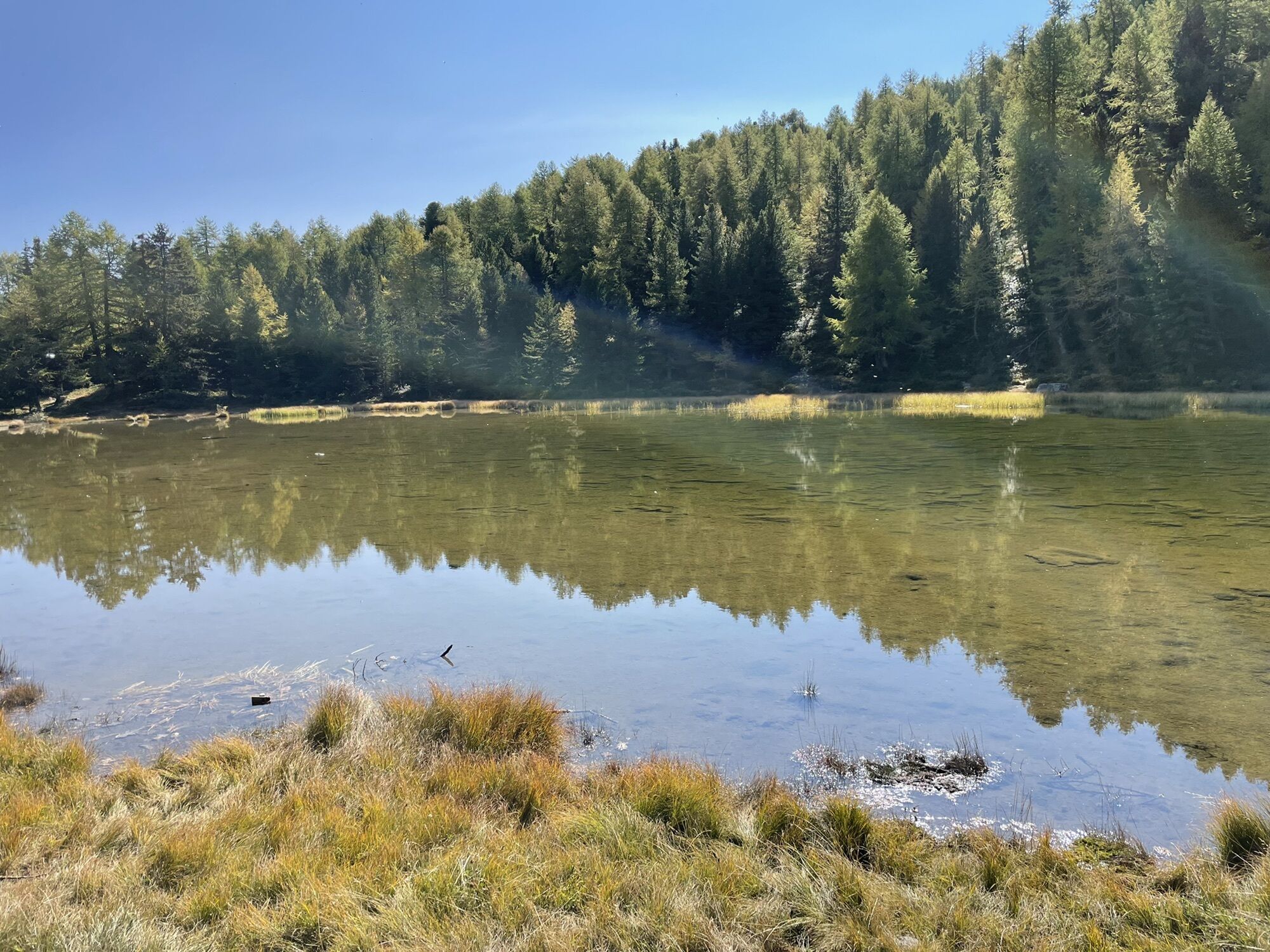
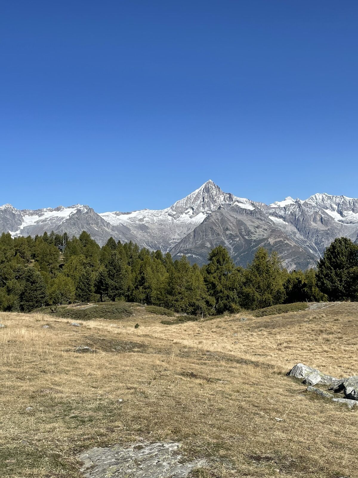
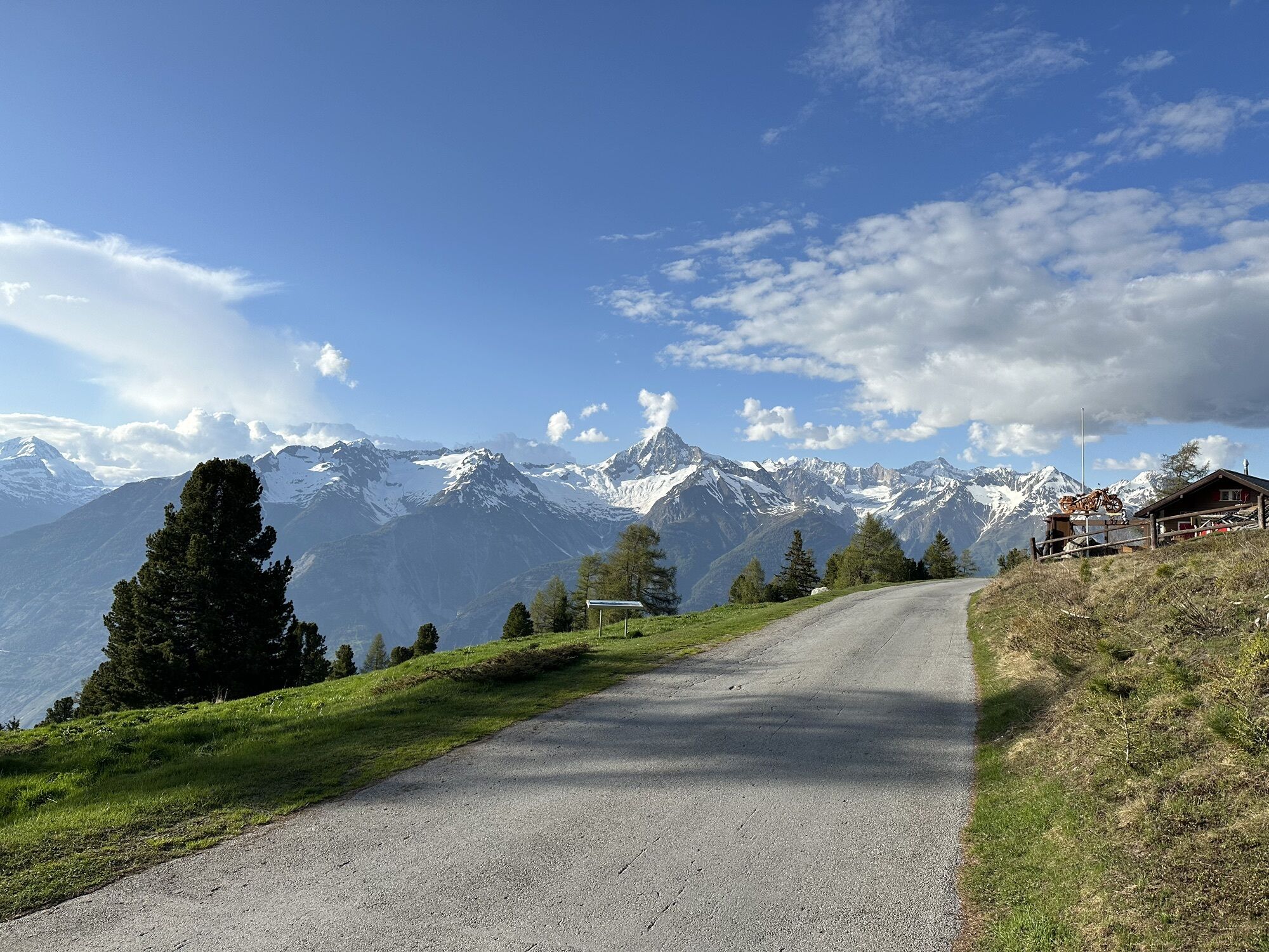
Adventure takes you to Moosalp, above the Rhône valley. Surrounded by many giants such as the Bietschhorn, the Weisshorn, and the Mischabel massif, which includes the Nadelhorn, the Dom, and the Täschhorn, this region is perfect for hikes and excursions. From Visp (Viège), you can reach the start of the panoramic trail by bus. At Bürchneralp, make a first stop at the Panorama Restaurant, which offers you to enjoy raclette or other Valais specialties from its panoramic terrace. At Breitmattusee, a small beautifully arranged lake, it is worth making another break and capturing the breathtaking landscape with some photos. Finally, reach the highest point of the route: the "Stand" viewpoint, which is accessible by various paths and is one of the most popular spots in Moosalp for views of the Bernese and Valais Alps and four-thousand-meter peaks.

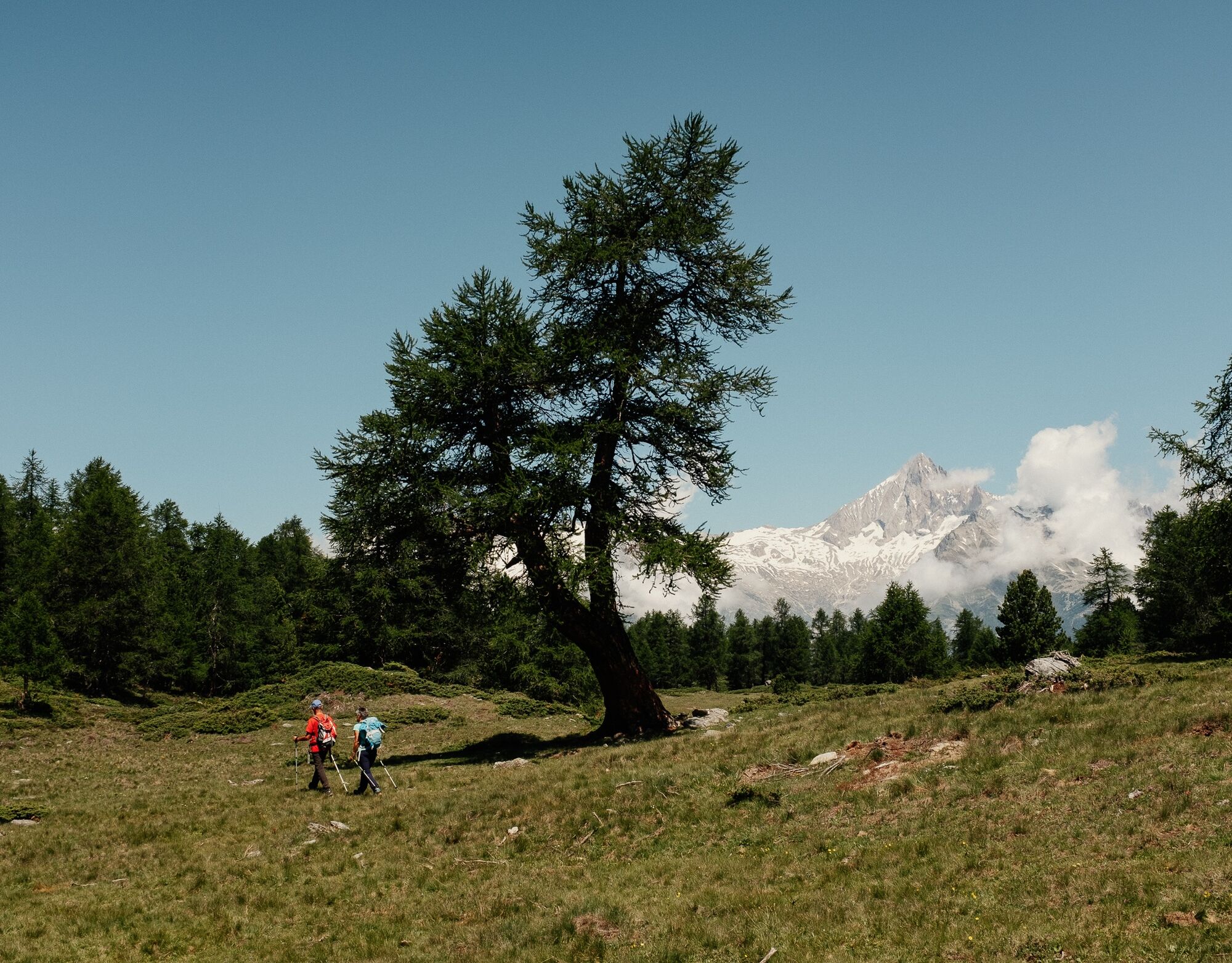
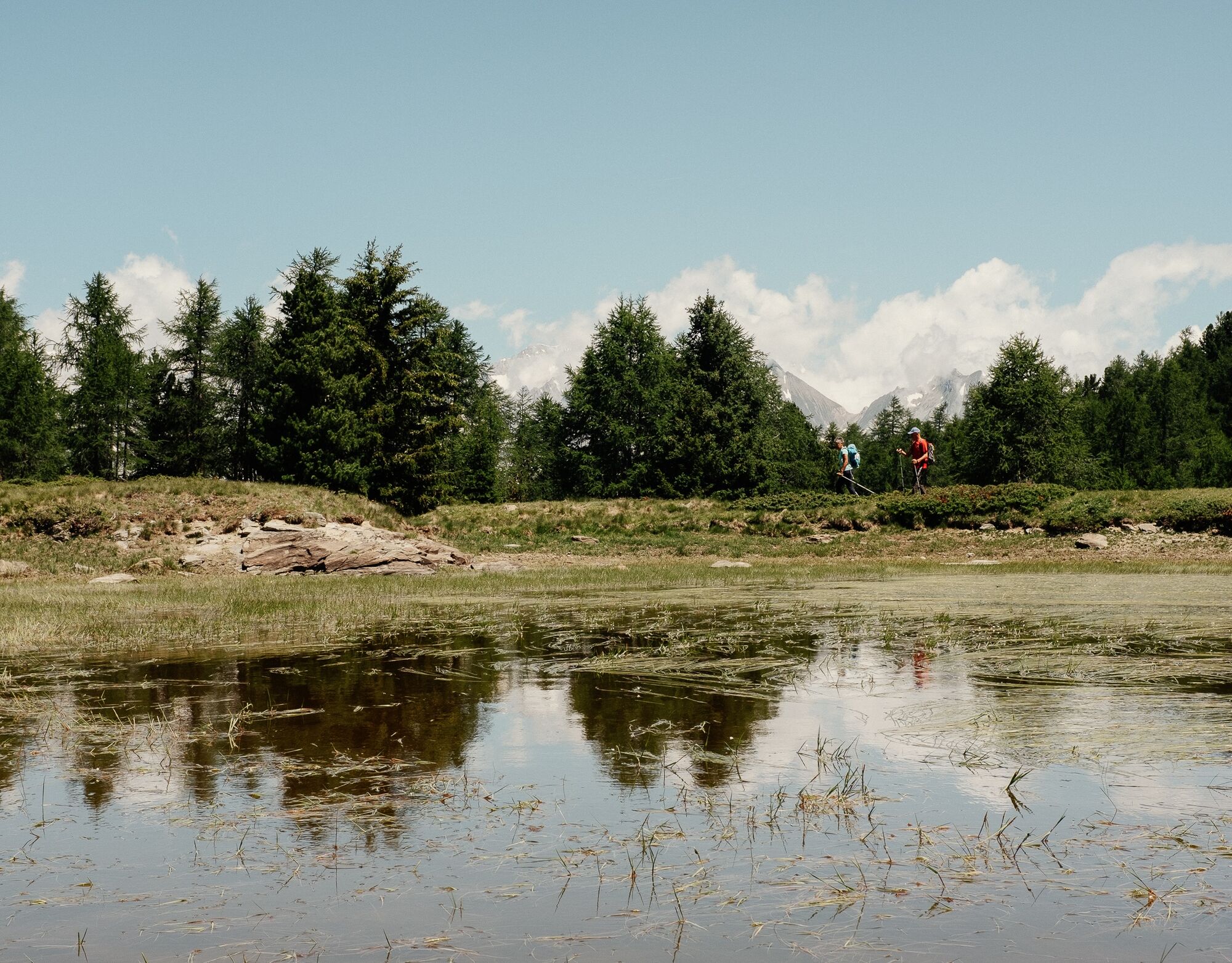
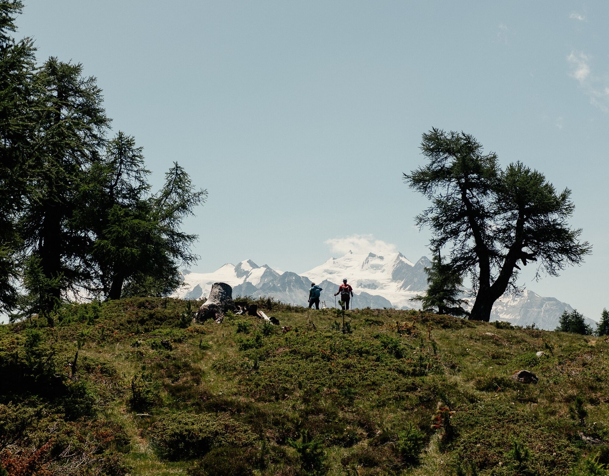
The start and end point of this circular hike is at Moosalp. You can easily reach it by bus from Visp (Viège) via Bürchen, or from Stalden via Törbel. The trail first takes you onto alpine pastures, past mountain barns. Once you arrive at Bürchneralp, the path initially ascends gently, then descends to the hamlet of Ledi. This is followed by an ascent to Beitmatte, where there is a large clearing, then after a large stone house, take the path to Breitmattusee lake and continue to Boningersee lake, although the latter is more of a marsh. You then reach the highest point of the hike, the "Stand" observation platform, which offers a unique panoramic view. After enjoying the view, you approach the final section and return to your starting point at Moosalp.
Da
Da
Da
We recommend:
Good shoes Weather-appropriate clothing: always have a waterproof jacket Hat or cap Sunscreen Water bottle Picnic Camera Walking poles (optional) Binoculars (optional) Printed version of the route (click on "print" to download)
For some walks:
Swimsuit
The mountain, a space of enjoyment to be shared and respected. The mountain offers a place to reconnect and share unforgettable moments, by bike or on foot. For all lovers of the great outdoors to enjoy it, it is essential to share this space with respect for nature and agriculture. Respectful behavior allows everyone to enjoy their activity in the best conditions. Inform yourself about the recommendations and rules in place. Carefully assess your physical condition and capabilities. Using the various routes is always at your own risk.
For all hikes:
Carry a map. Download the complete route description with a large-scale map by clicking on the "print" icon at the top right of the page. Use only marked paths and observe all signs – for your safety, to protect livestock, and to avoid disturbing wild animals. Close gates after passing. Be respectful of other users, as well as plants and animals.
For mountain hikes:
Pay particular attention to protecting yourself from the sun at altitude. UV rays can be very strong, even under cloudy skies. Plan your hike carefully: consider the physical level of each participant, weather forecasts and the season. Weather conditions can change rapidly and unexpectedly in the mountains. It is essential to have appropriate clothing and sufficient food and water reserves. In case of uncertain weather, turn back in time.
For high mountain hikes:
Inform others about your itinerary. If possible, avoid going alone. Do not venture onto glaciers without a mountain guide. Be aware of warning signs about constant danger in riverbeds, along waterways below dams or reservoirs: water level can rise quickly and unexpectedly.
Via Visp (Viège) – Bürchen or Stalden – Törbel. It is worth taking public transport from Visp (Viège) or Stalden (see description in the "arrival by public transport" section).
It is recommended to take the PostBus from Visp (Viège) train station to Moosalp, the starting point of the hike. After the hike, the PostBus will comfortably bring you back to Visp (Viège) train station.
We recommend parking your car in the multi-story car park near the Visp (Viège) train station and taking the bus to Moosalp.
See the route on SuisseMobile: No. 191 Moosalp Panoramaweg
Learn more about the Moosalpregion destination
MoosalpregionEnd this eventful day with a delicious cream cake at the Moosalp Restaurant, at the top of the pass.
Camere web ale turului
-
Brandalp - Skilift Seefeld
-
Moosalp - Restaurant Moosalp - Törbel
-
Moosalp - Bergrestaurant Dorbia
-
Air Zermatt - Station Raron
-
Air Zermatt - Station Raron
-
Brandalp - Skilift Seefeld
-
Brandalp - Skilift Seefeld
-
Brandalp - Skilift Seefeld
-
Brandalp - Skilift Seefeld
-
Rothorli
-
Rothorli
-
Air Zermatt - Station Raron
-
Heidabahn Talstation
-
Brandalp - Skilift Seefeld
-
Brandalp - Skilift Seefeld
-
Brandalp - Skilift Seefeld
-
Brandalp - Skilift Seefeld
-
Törbel - Chalet Dolores
-
Yakfarm - Embd
Tururi populare în vecinătate
-
3,8
Höhenweg Saas-Fee - Grächen
Excursie 12,0 km -
CIRCULAR WALK MASSEGGA SUSPENSION BRIDGE
luminăExcursie 6,44 km -
Panoramaweg Visperterminen
luminăExcursie 9,72 km -
4,0
NATICHERBERG CIRCULAR TRAIL
mediuExcursie 12,1 km -
5,0
Jolischlucht
mediuExcursie 8,06 km -
Gibidumpass
luminăExcursie 11,6 km -
Hannigalp-Seetal-Hannigalp
mediuExcursie 10,4 km -
BLATTEN - TRÄMEL - NATERS
luminăExcursie 7,42 km -
BELALP - NESSELALP - BIRGIST
mediuExcursie 9,68 km -
5,0
BELALP-NESSEL CIRCULAR HIKE
mediuExcursie 9,92 km

Drumeții și urmărire


Nu ratați ofertele și inspirația pentru următoarea dvs. vacanță
Adresa dvs. de e-mail a fost adăugat la lista de corespondență.