


Monte dell'Orso - Lago del Vedes


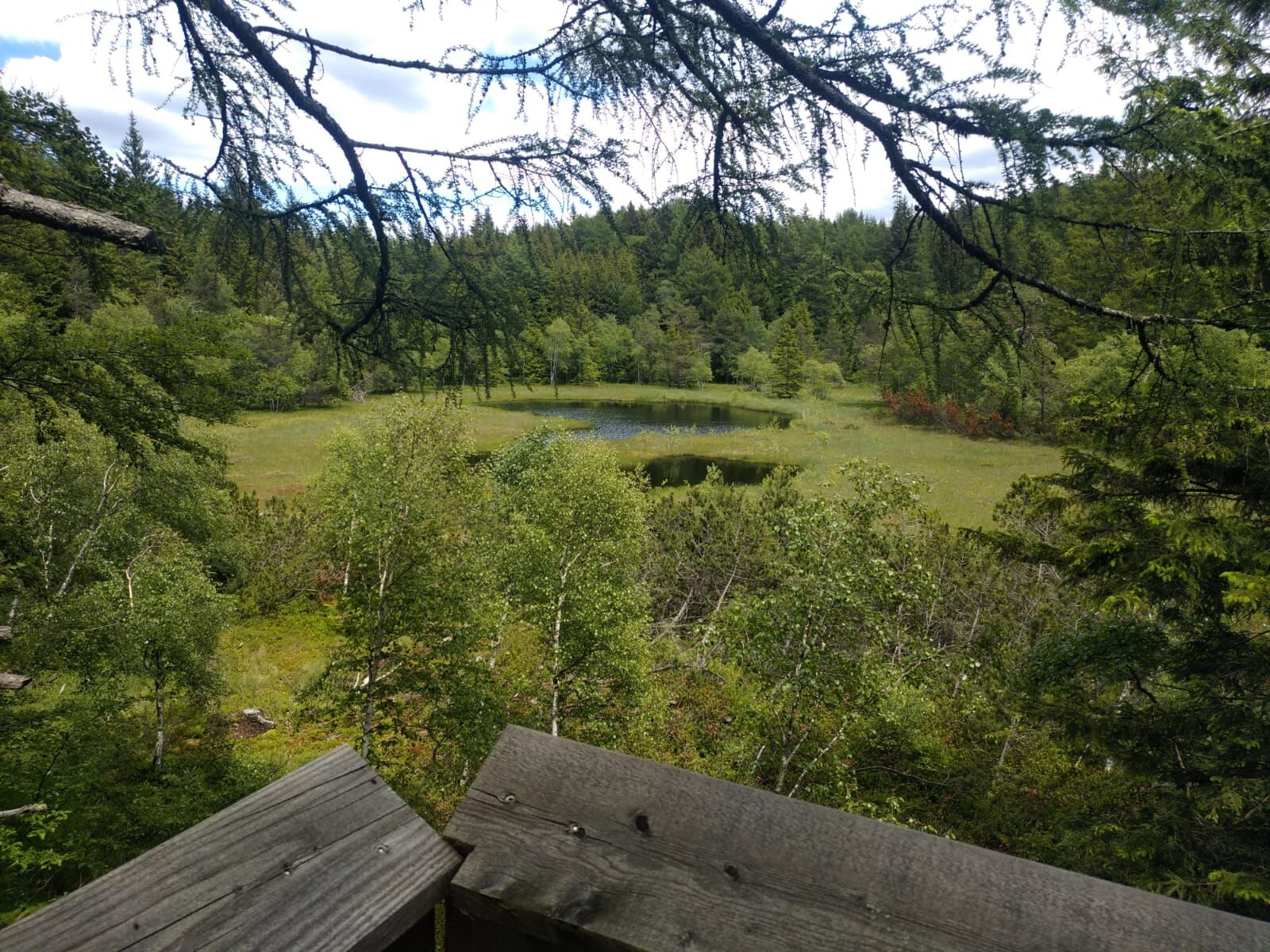
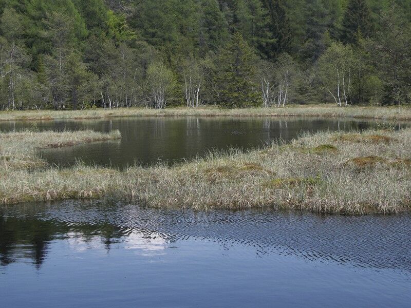
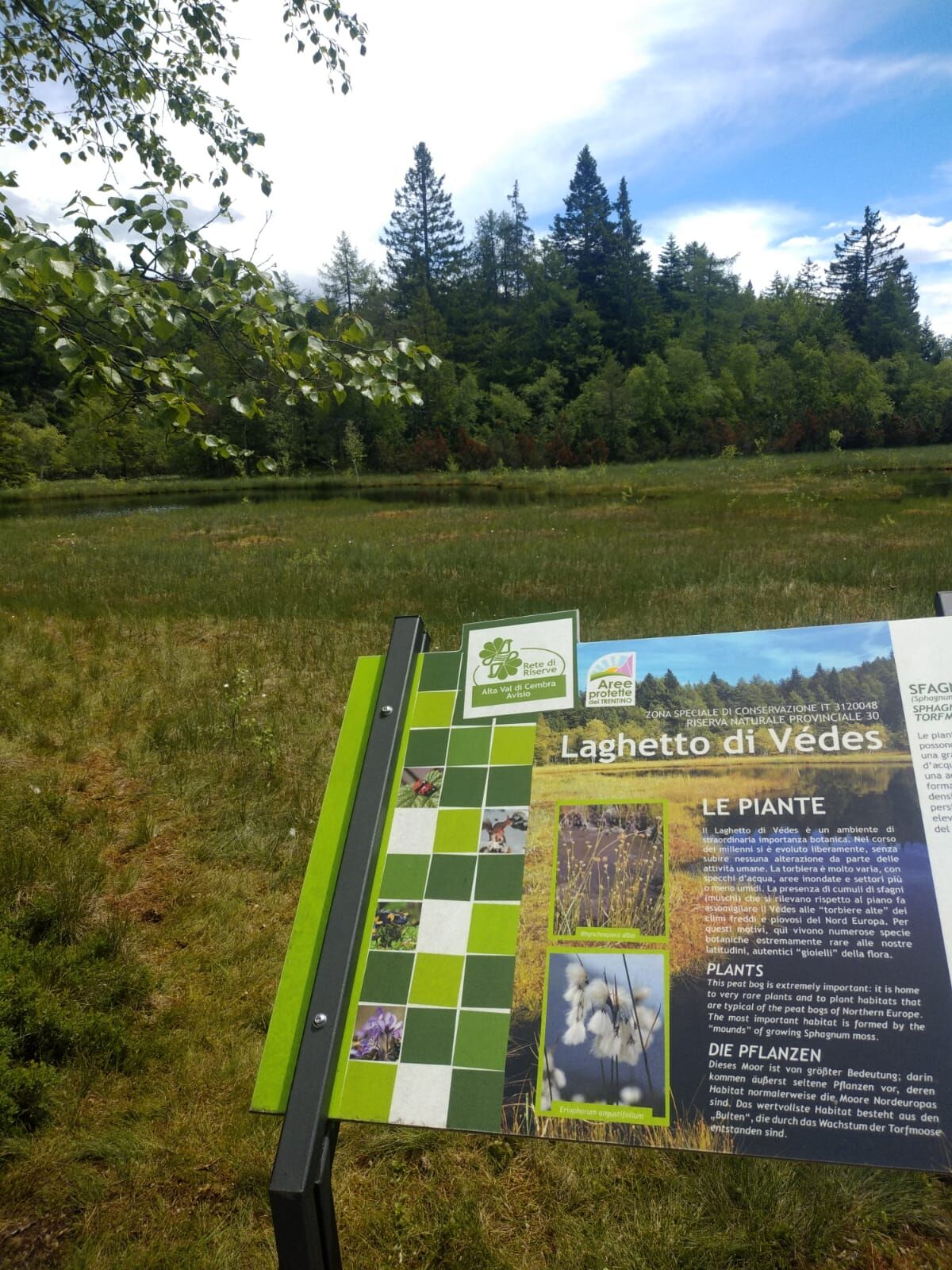
The route goes into the Monte Corno Natural Park in South Tyrol, then passes by the peat bog called Lago del Vedes, an area with a particular microclimate and rich biodiversity.
The start is at the parking lot of the roundabout at the entrance of Grauno. Take Via Siori and then at the fountain, the paved road to the left, uphill until you join a dirt road marked "Sentiero dei vecchi mestieri" - Mulino Cristofori. At Mulino Cristofori, the road ends and you take the path by the creek. The Sentiero dei vecchi mestieri leads to the paved road rising from Grumés, which is followed northward to the foothills of Monte dell'Orso. This is the most strenuous part of the entire route, a constant climb on the ancient paved roads.
Always keep to the left and ignore various forks; at a hairpin bend, take the farm track continuing straight north. At the first fork of Monte dell'Orso keep right; at the second fork turn left until reaching Baita Motta. The road enters the Monte Corno Natural Park, immediately take path E5 which proceeds through the woods dotted with huts. At the Valdonega fork (crucifix) turn right on E5 towards Passo Potzmauer-Possmar (also called Passo della Cima), which is reached by following the various branches of path E5.
Take the forest road to Lago del Vedes; the road then fades to a trail, until again reaching a dirt road near the biotope. It is worth spending a few minutes contemplating this vulnerable peat bog, subject of research and studies for the rarity of its flora, its microclimate, and its rich biodiversity. Follow the dirt road downhill to a junction of various roads (chapel and pond); here continue straight on the paved forest road towards the Palude de la Lot biotope. At the forest road junction keep right and after about ten meters on the right a larch with numerous woodpecker holes confirms you are on the right track. The peat basin hosts some huts and is a good spot to rest among cherry and birch trees. Continue until reaching the outbound road, following it downhill back to the starting point.
Da
Trekking shoes, waterproof jacket, trekking poles, water, snacks and sunscreen.
THE 10 RULES FOR HIKERS
Study and prepare your itinerary well Choose a path suitable for your physical condition Bring suitable clothing and equipment Check the weather forecast Starting alone is risky, bring your mobile phone Leave information about your route and approximate return time If unsure, do not hesitate to rely on a professional Pay attention to the signs and markings along the path If tired or having problems, do not hesitate to turn back In case of accident call 112
As you can imagine, the passability of itineraries in a mountain environment is closely linked to current conditions and depends on natural phenomena, environmental changes, and weather. For this reason, the information contained in this sheet may have changed. Before leaving, check the trail status by contacting the refuge managers on your route, alpine guides, nature park visitor centers, and tourist offices.
Coming from the A22 Brenner Highway, from both south and north, exit at the Trento north toll booth (distance from toll booth 22.5 km), travel the S.S. 12 Brenner road northward until the Lavis junction, then take the S.S. 612 Lavis – Castello di Fiemme which leads to the Cembra Valley.
Parking lot of the roundabout at the entrance of Grauno
Cembra Tourist Office - Tel. +39 0461 683110 - info@visitvaldicembra.it – www.visitvaldicembra.it
The Lago del Vedes is a special place because on its shores you can also find carnivorous plants. The Drosera rotundifolia blooms from April to September with small white flowers. It is 10–20 cm tall and feeds on small insects trapped in its tentacles.
Tururi populare în vecinătate
-
3,8
Rio Secco (D)
Via ferrata 2,42 km -
4,7
Burrone Klettersteig (B)
Via ferrata 4,30 km -
4,8
Malga Cislon
mediuExcursie 9,37 km -
5,0
Cisloner Hütte Rundweg Truden
luminăExcursie 10,6 km -
4,3
Klettersteig Rio Secco
mediuVia ferrata 2,84 km -
Malga Monte Corno
mediuExcursie 10,3 km -
3,7
Fiemme Old Railway
greleCiclism 24,3 km -
3,0
Rund um den Castelfelder
luminăExcursie 6,68 km -
Naturerlebnisweg Tramin
luminăTraseu tematic 3,34 km -
Giro del Roen
mediuExcursie 7,71 km
Drumeții și urmărire


Nu ratați ofertele și inspirația pentru următoarea dvs. vacanță
Adresa dvs. de e-mail a fost adăugat la lista de corespondență.