


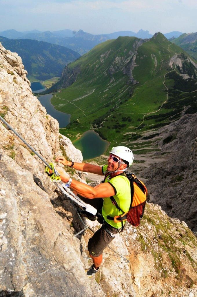
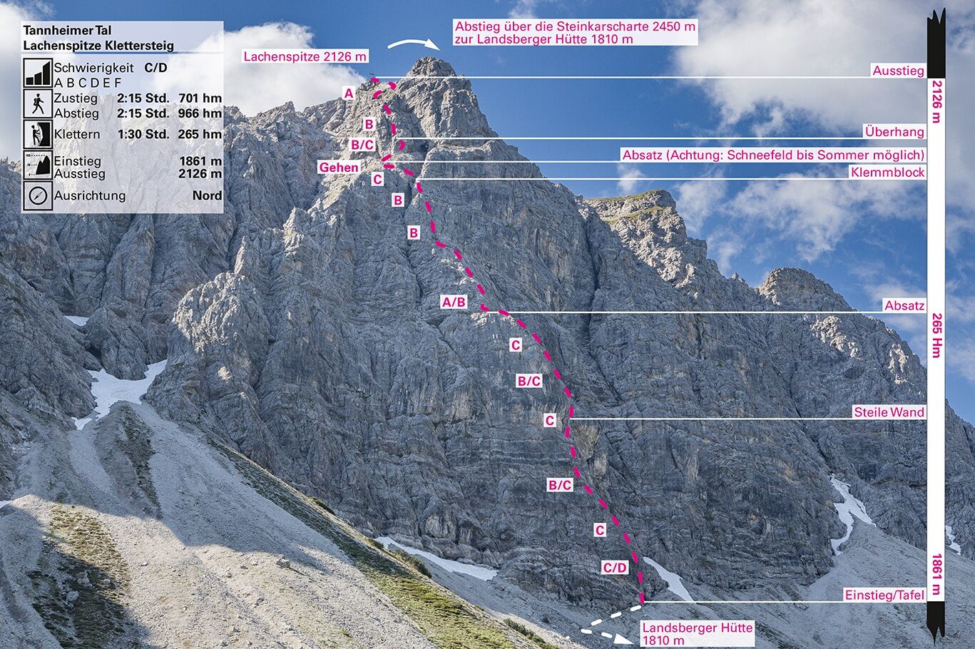
Via ferrata Lachenspitze
Nivelul de dificultate: C/D


Fotografii ale utilizatorilor noștri
-
 © Christian BaeckeCreat pe 04.05.2024
 -
 © Christian BaeckeCreat pe 04.05.2024
 -
 © Alpenfun.euCreat pe 24.06.2025
 -
 © Alpenfun.euCreat pe 24.06.2025
 -
 © Alpenfun.euCreat pe 24.06.2025
 -
 © Alpenfun.euCreat pe 24.06.2025
 -
 © Alpenfun.euCreat pe 24.06.2025
 -
 © Alpenfun.euCreat pe 24.06.2025
 -
 © Alpenfun.euCreat pe 24.06.2025
 -
 © Alpenfun.euCreat pe 24.06.2025
 -
 © Alpenfun.euCreat pe 24.06.2025
 -
 © Alpenfun.euCreat pe 24.06.2025
 -
 © Alpenfun.euCreat pe 24.06.2025
 -
 © Alpenfun.euCreat pe 24.06.2025
 -
 © Alpenfun.euCreat pe 24.06.2025
 -
 © Alpenfun.euCreat pe 24.06.2025
 -
 © Alpenfun.euCreat pe 24.06.2025
 -
 © Alpenfun.euCreat pe 24.06.2025
 -
 © Alpenfun.euCreat pe 24.06.2025
 -
 © Christopher HerbelCreat pe 24.09.2023
 -
 © Kay ErlerCreat pe 30.07.2021
 -
 © Kay ErlerCreat pe 30.07.2021
 -

 © Siegfried StreckhardtCreat pe 20.07.2025
 -

 © YakovCreat pe 21.09.2024
 -
 © YakovCreat pe 21.09.2024
 -
 © YakovCreat pe 21.09.2024
 -
 © Christian BaeckeCreat pe 04.05.2024
 -
 © Christian BaeckeCreat pe 04.05.2024
 -
 © Christian BaeckeCreat pe 04.05.2024
 -
 © Christian BaeckeCreat pe 04.05.2024
 -
 © Christian BaeckeCreat pe 04.05.2024
 -
 © Christian BaeckeCreat pe 04.05.2024
 -
 © Christian BaeckeCreat pe 04.05.2024
 -
 © Christian BaeckeCreat pe 04.05.2024
 -
 © Christian BaeckeCreat pe 04.05.2024
 -
 © Christian BaeckeCreat pe 04.05.2024
 -
 © Karin PetroviciCreat pe 04.10.2025
 -
 © Karin PetroviciCreat pe 04.10.2025
 -
 © Karin PetroviciCreat pe 04.10.2025
 -
 © M KremsiCreat pe 29.09.2025
 -
 © Sandra HillCreat pe 15.09.2025
 -
 © Sandra HillCreat pe 15.09.2025
 -
 © Sandra HillCreat pe 15.09.2025
 -

 © Tobias RudolphCreat pe 25.08.2025
 -
 © Tobias RudolphCreat pe 25.08.2025
 -
 © Kerstin LimperCreat pe 11.08.2025
 -
 © Christoph SeikelCreat pe 09.08.2025
 -
 © Christoph SeikelCreat pe 09.08.2025


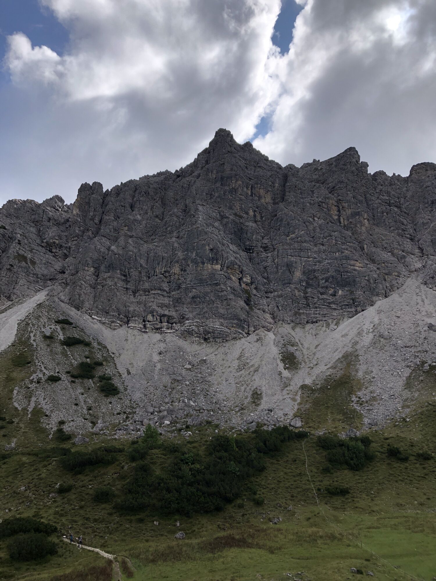


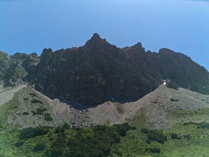
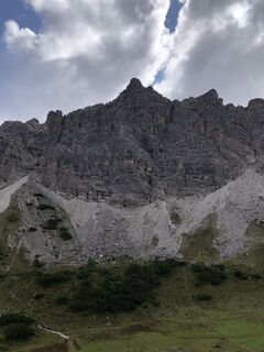
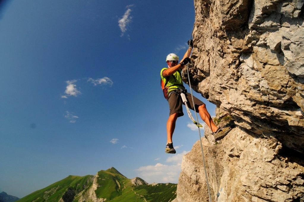
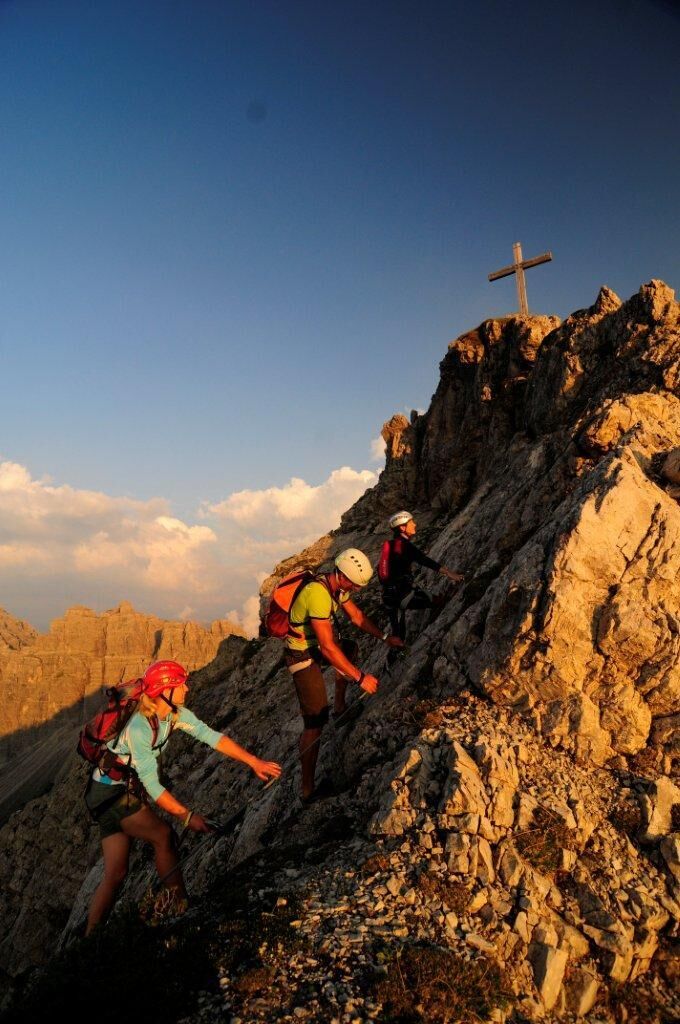
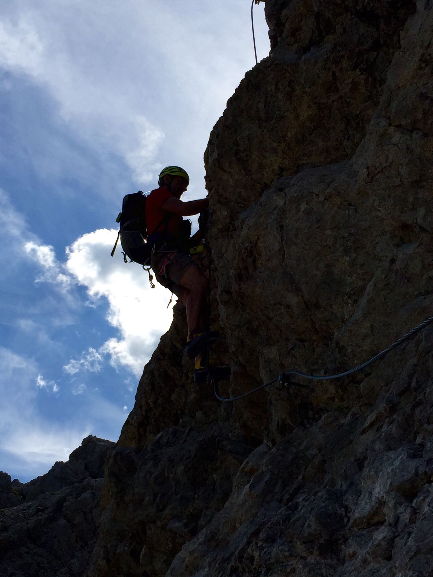
The via ferrata is well signposted and also very well secured. It takes about 2 hours to climb the via ferrata. The via ferrata has no emergency exit and has some exposed passages. The difficulty level...
The via ferrata is well signposted and also very well secured. It takes about 2 hours to climb the via ferrata. The via ferrata has no emergency exit and has some exposed passages. The difficulty level is C with a few D passages or level 3 (of 6). The descent is via the marked normal route back to the Landsberger Hütte. There you can also rent some via ferrata sets.
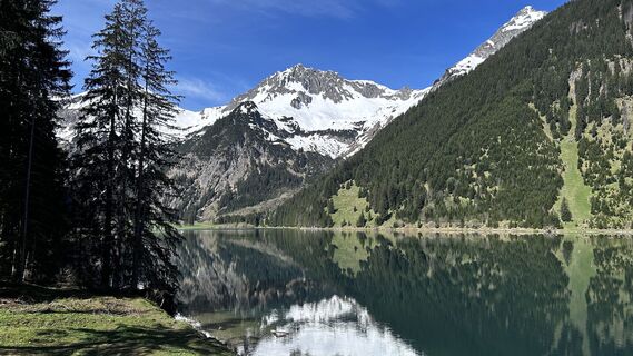
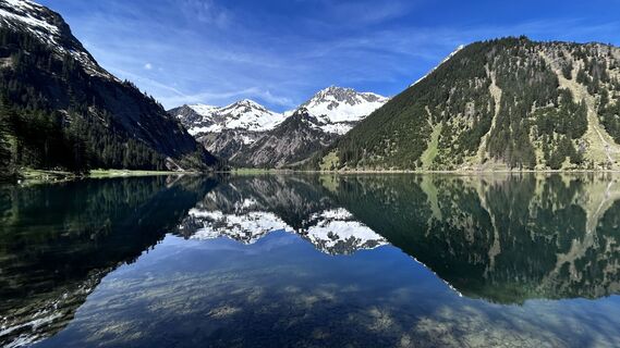
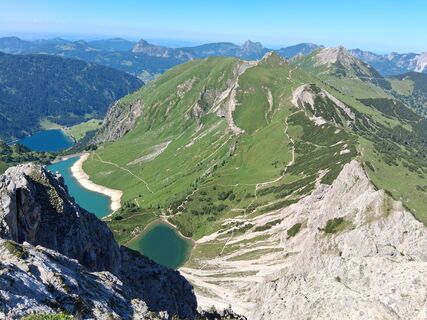
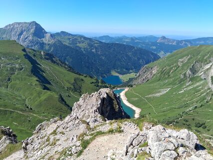
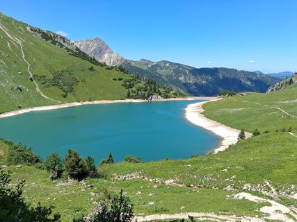
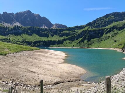
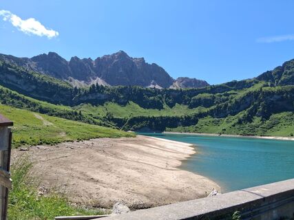
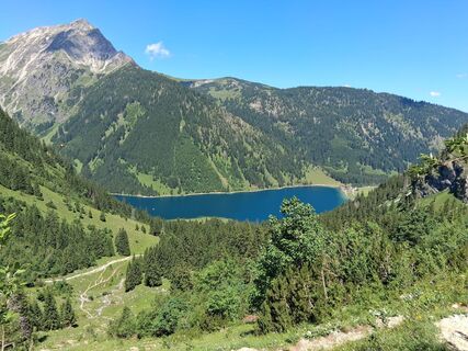
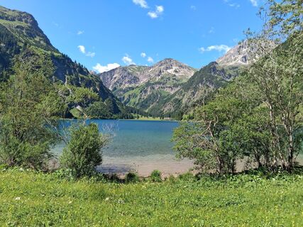
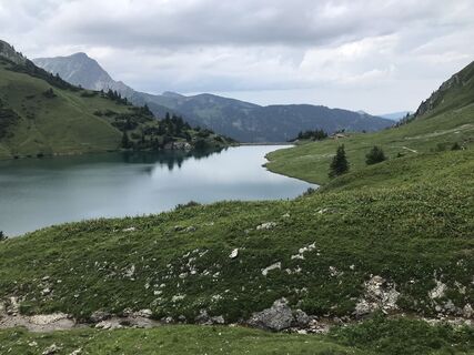
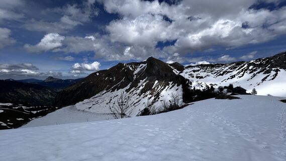
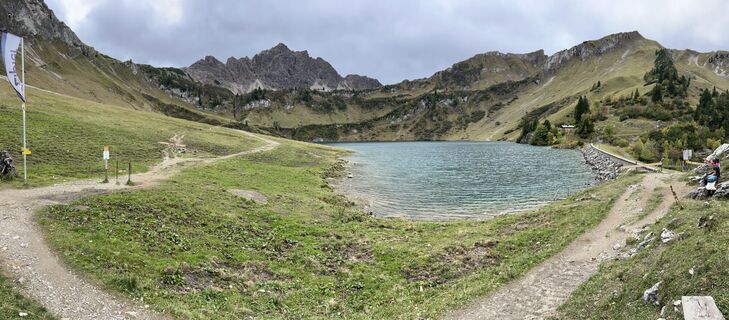
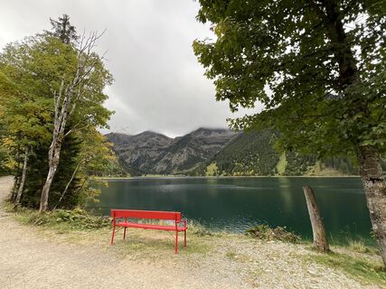
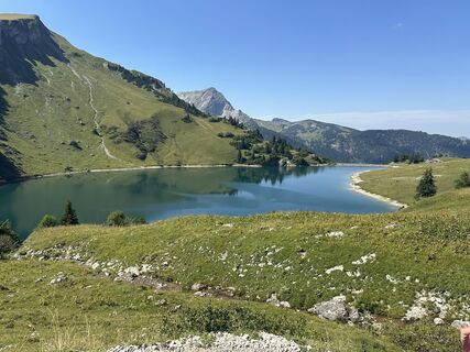
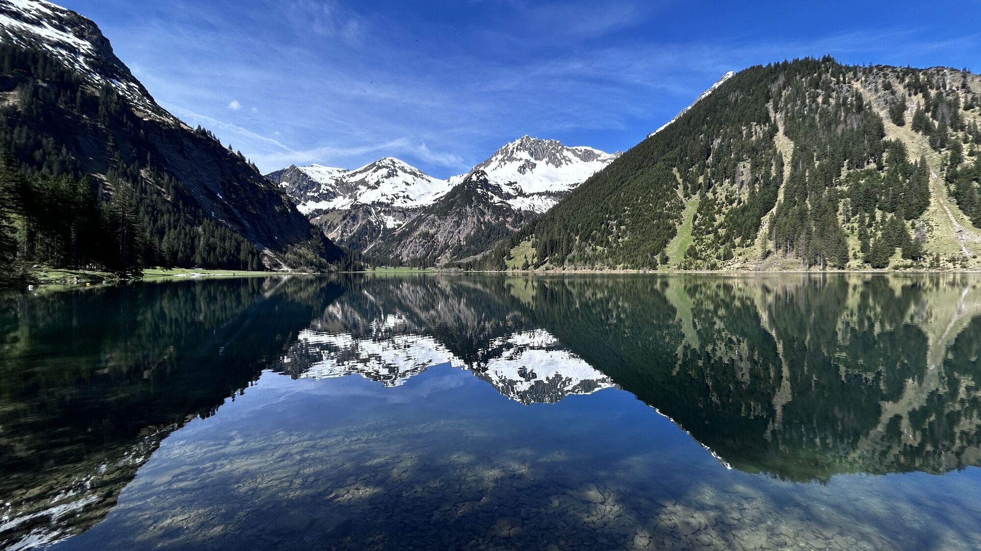
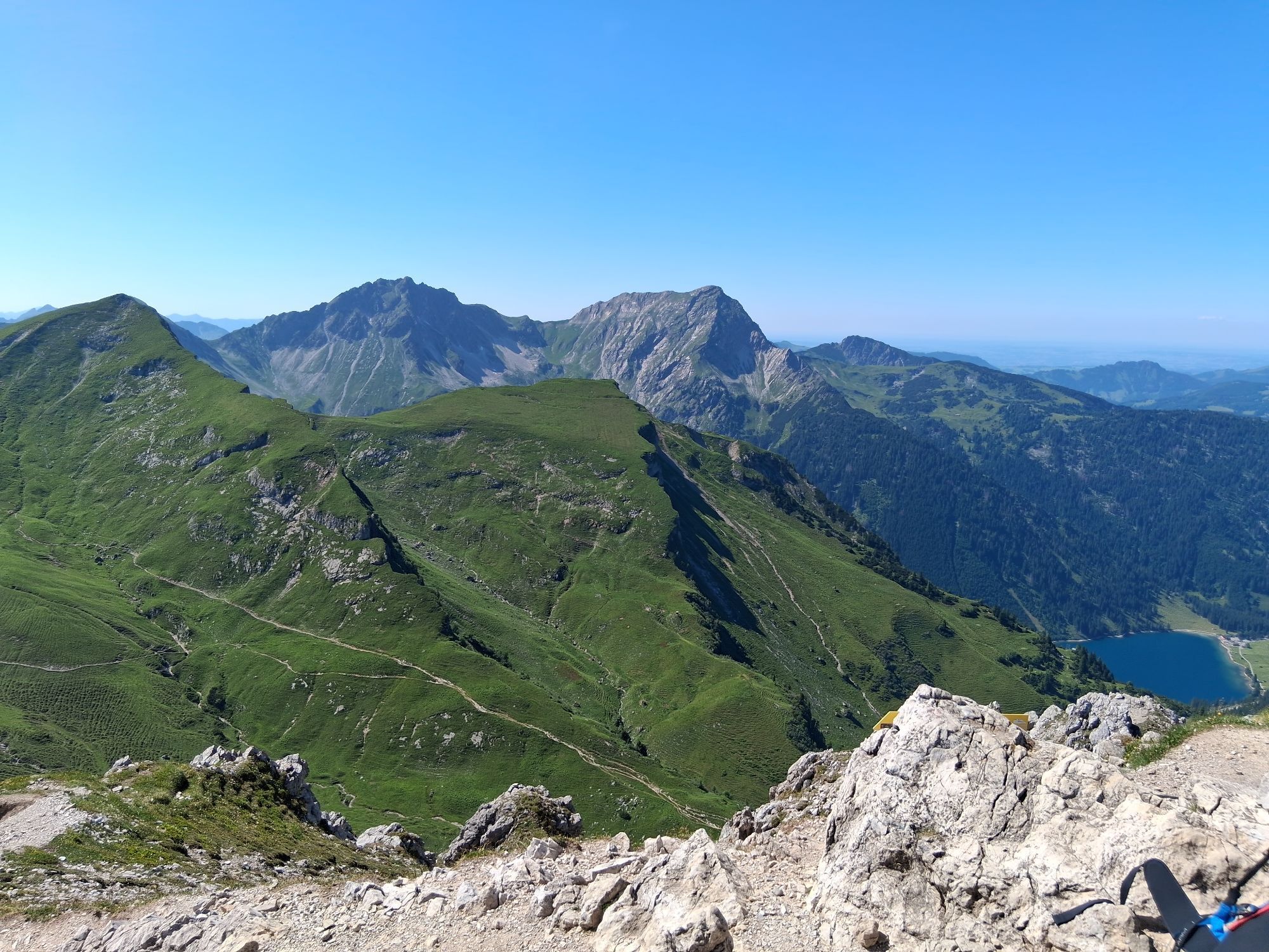
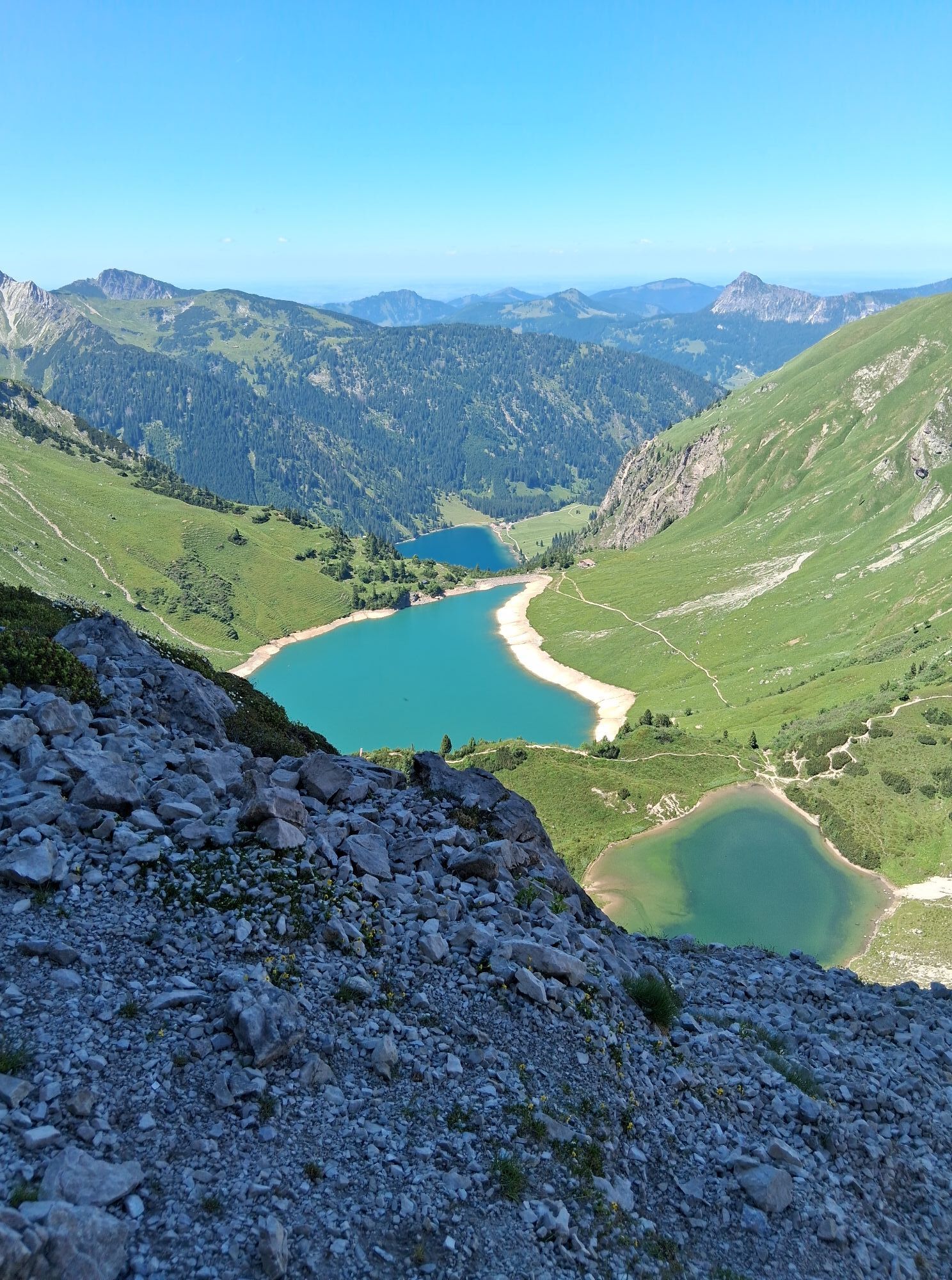
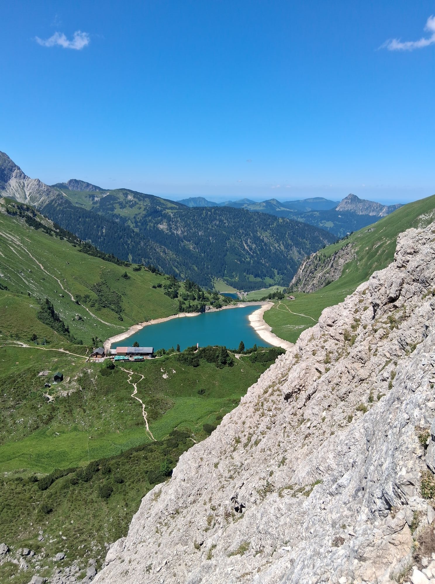
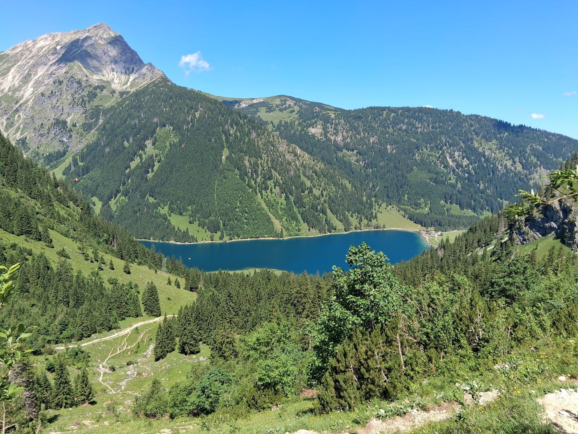
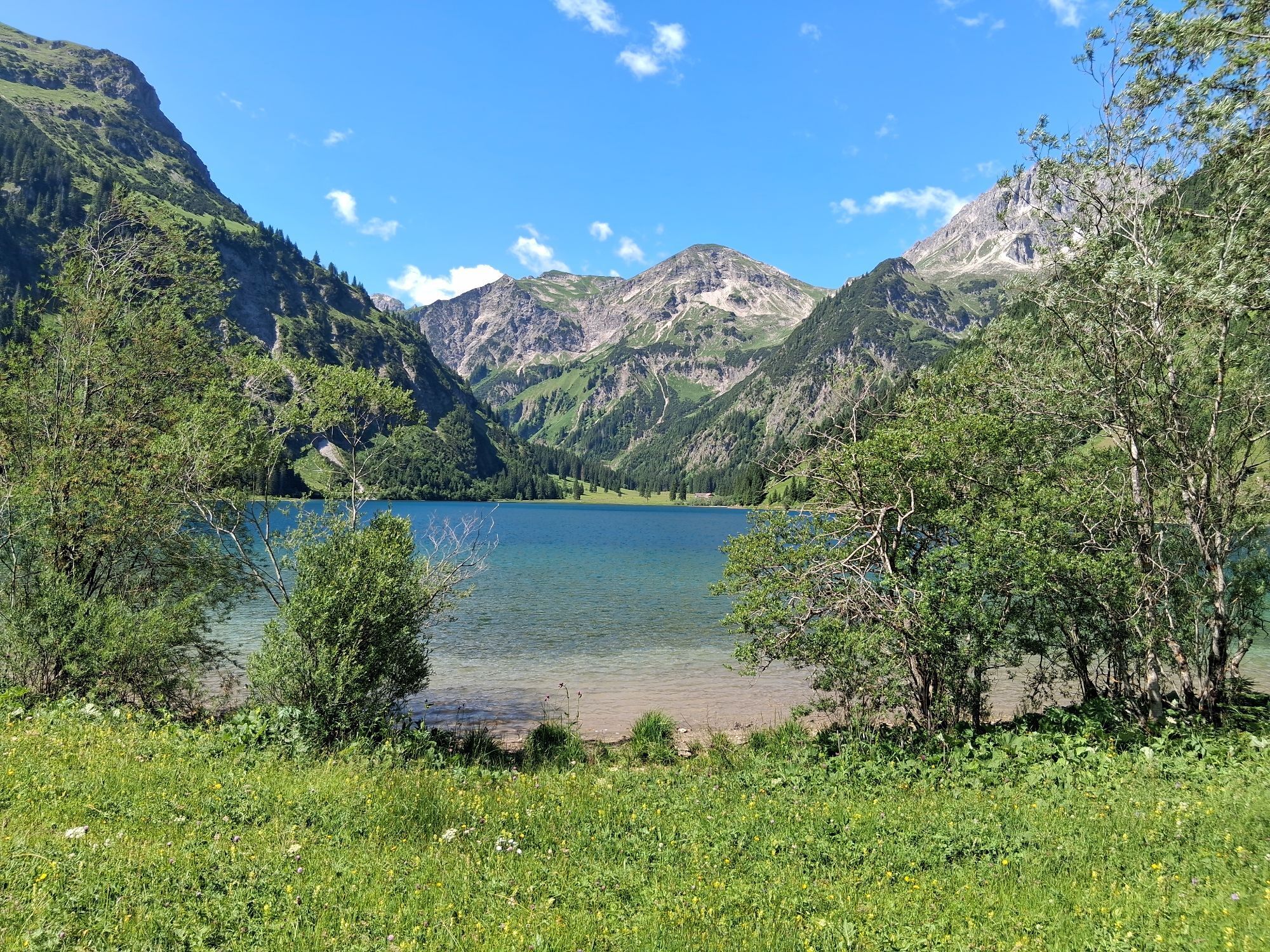
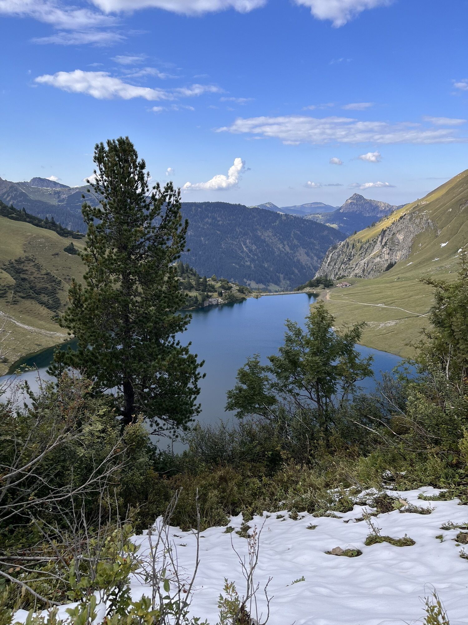
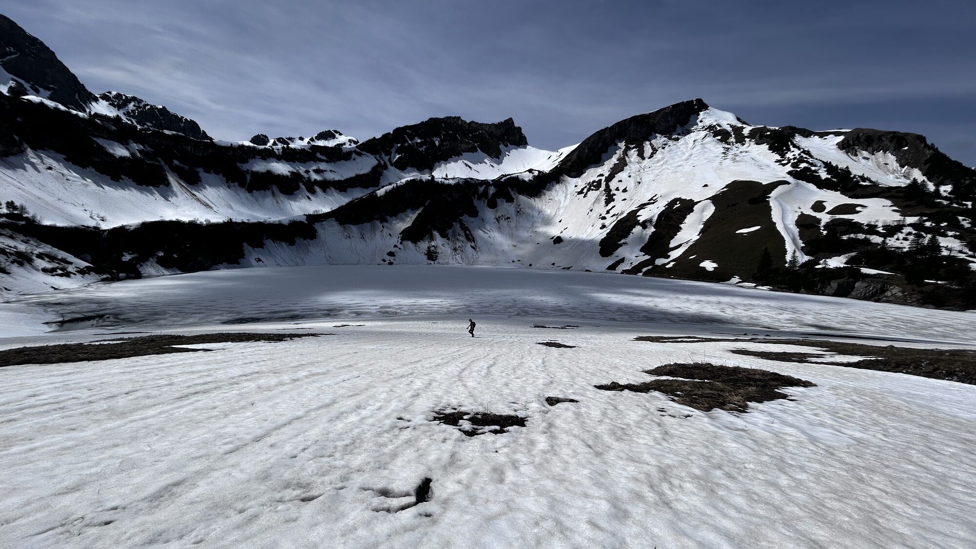
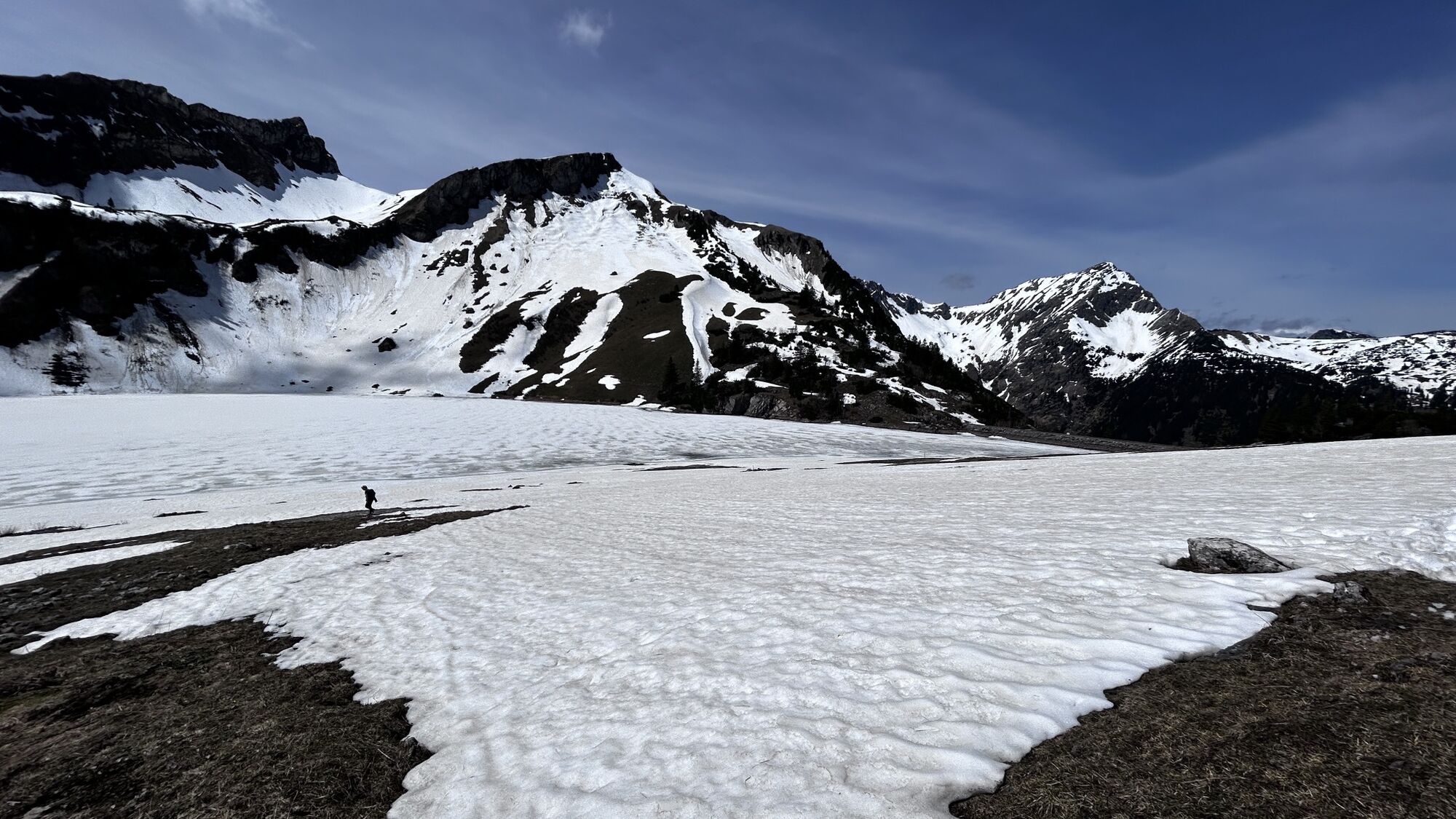
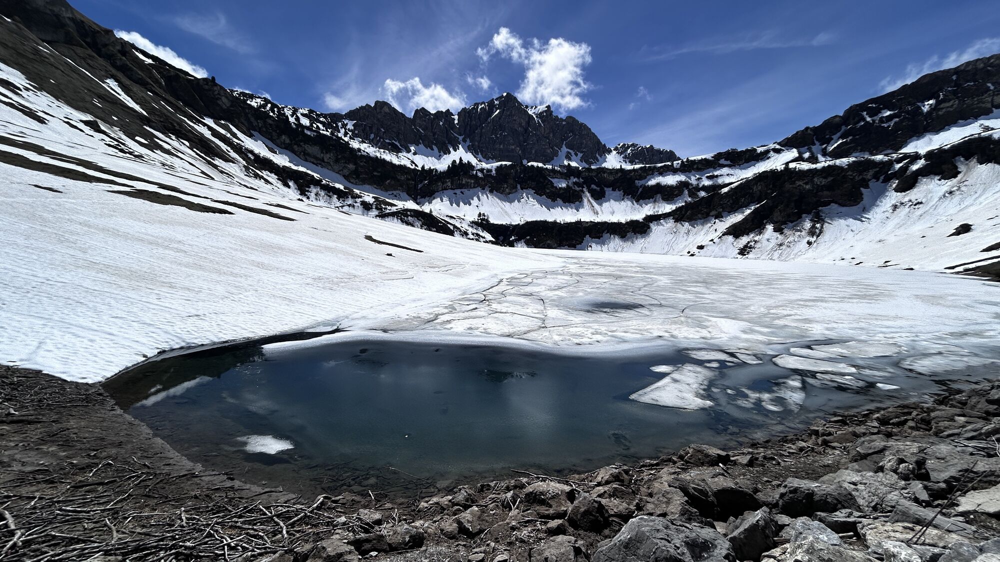
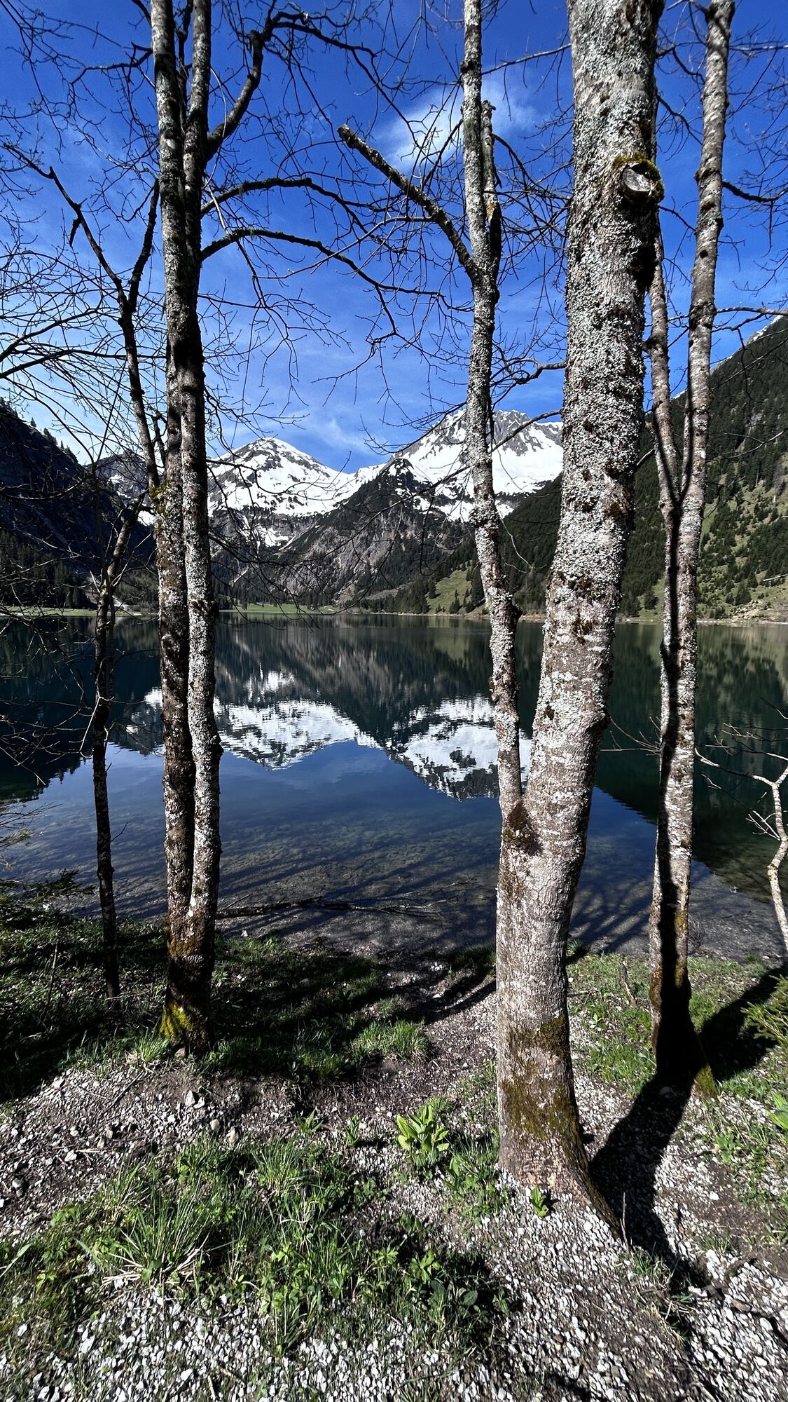
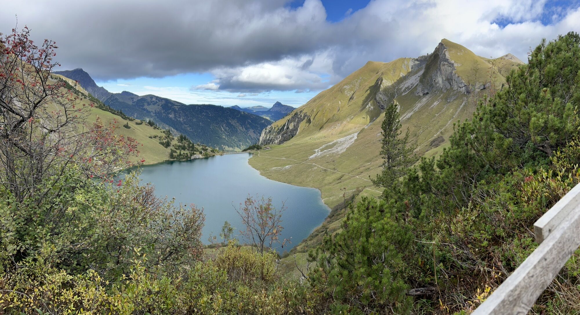
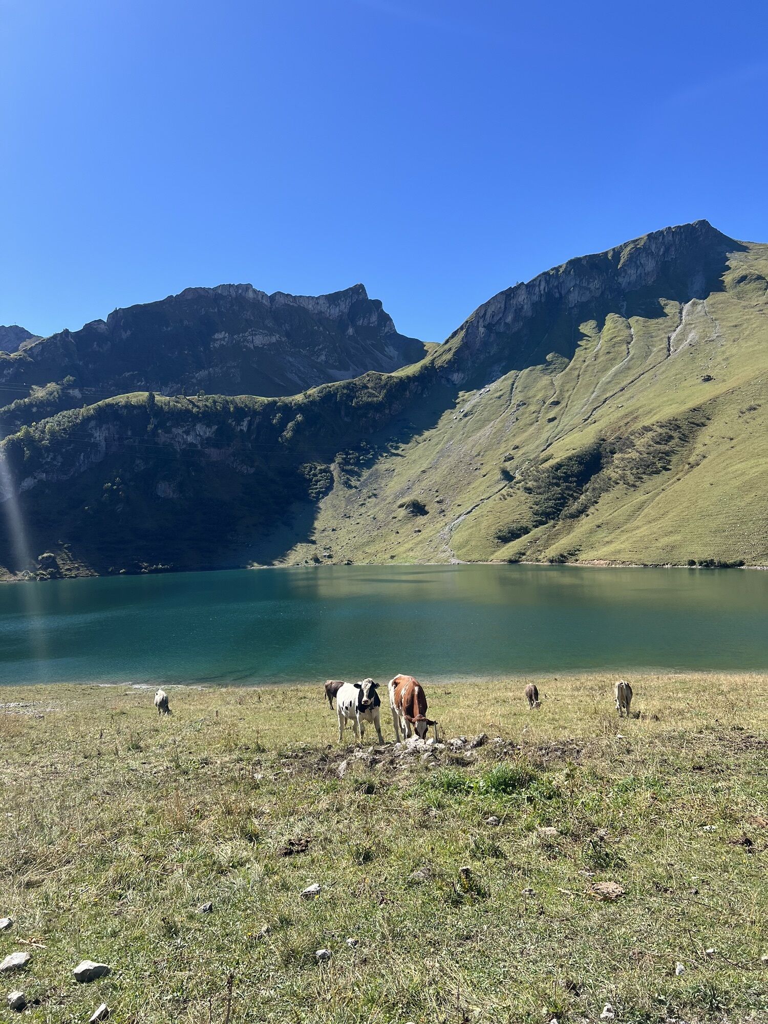
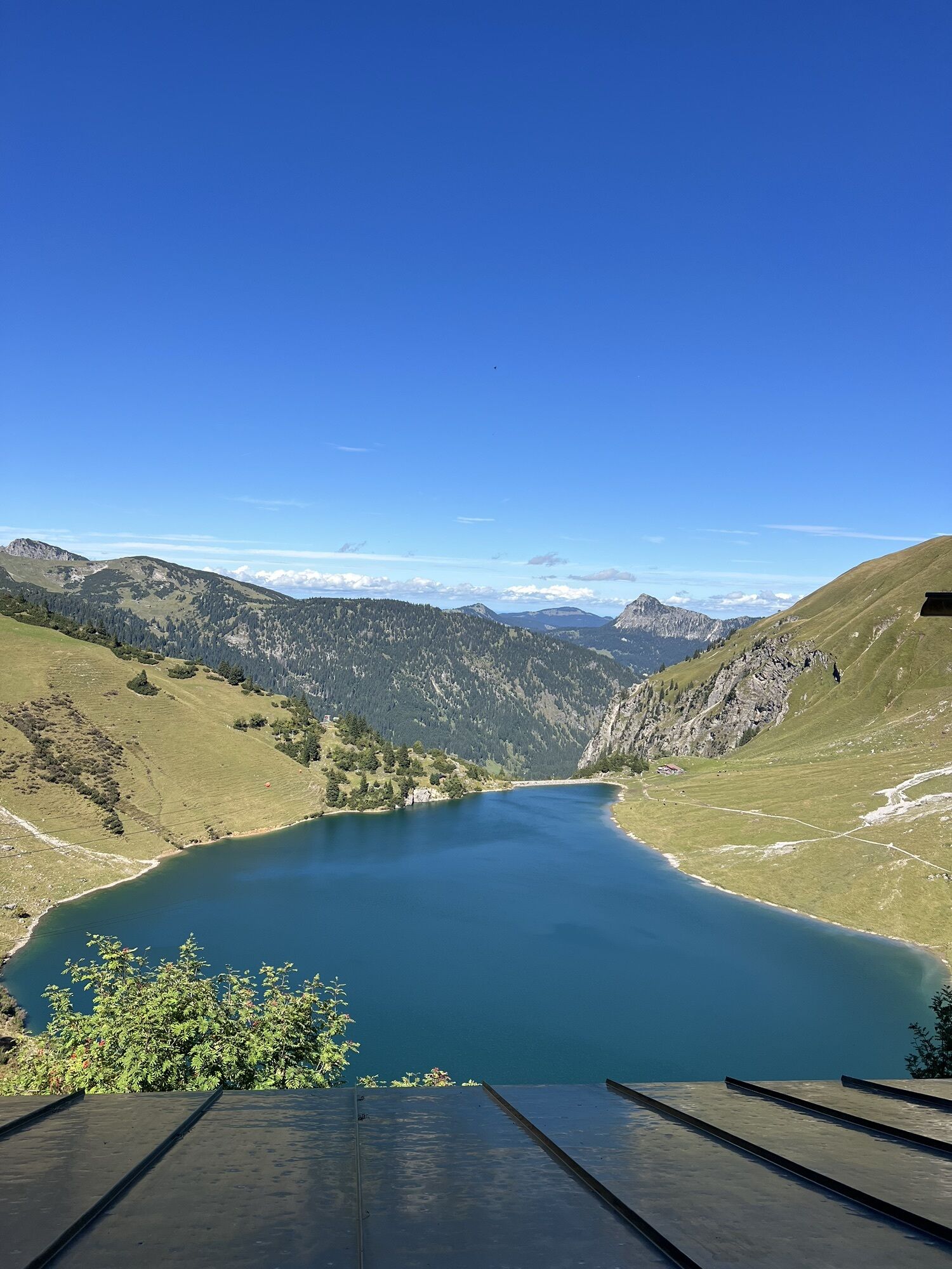
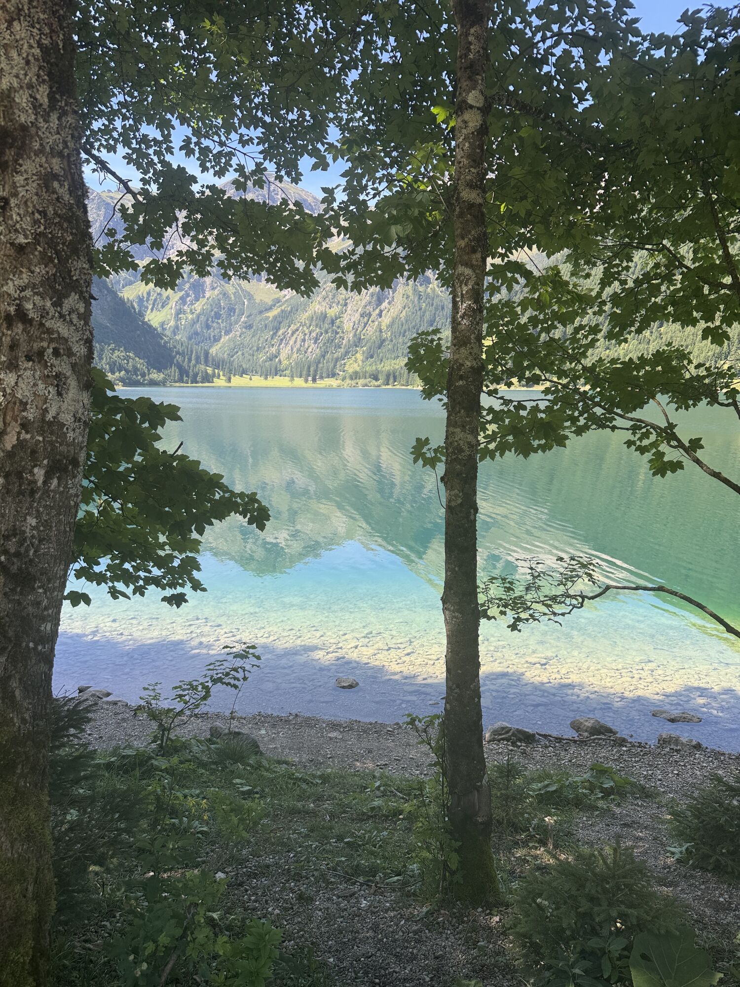
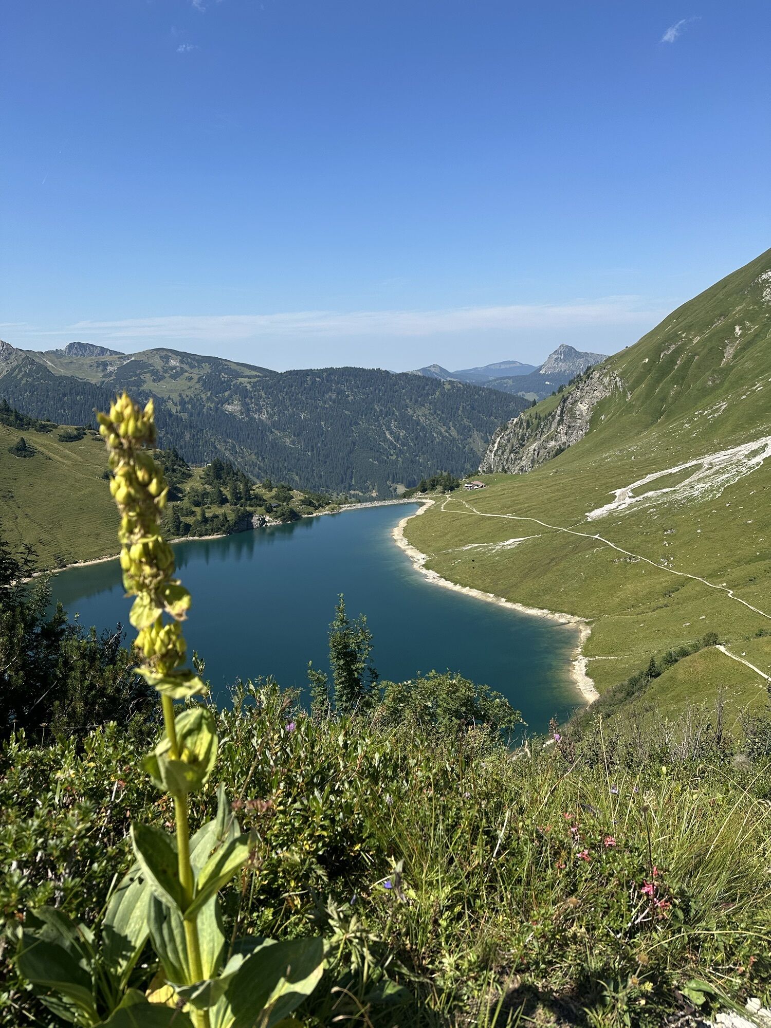
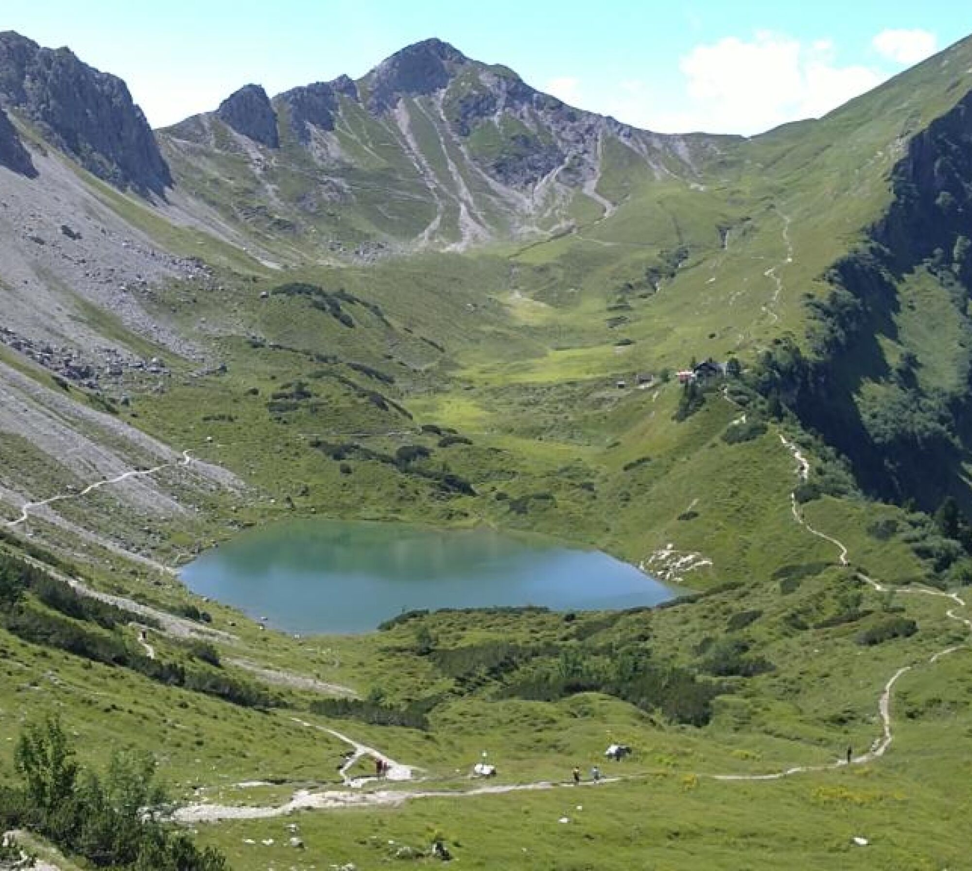
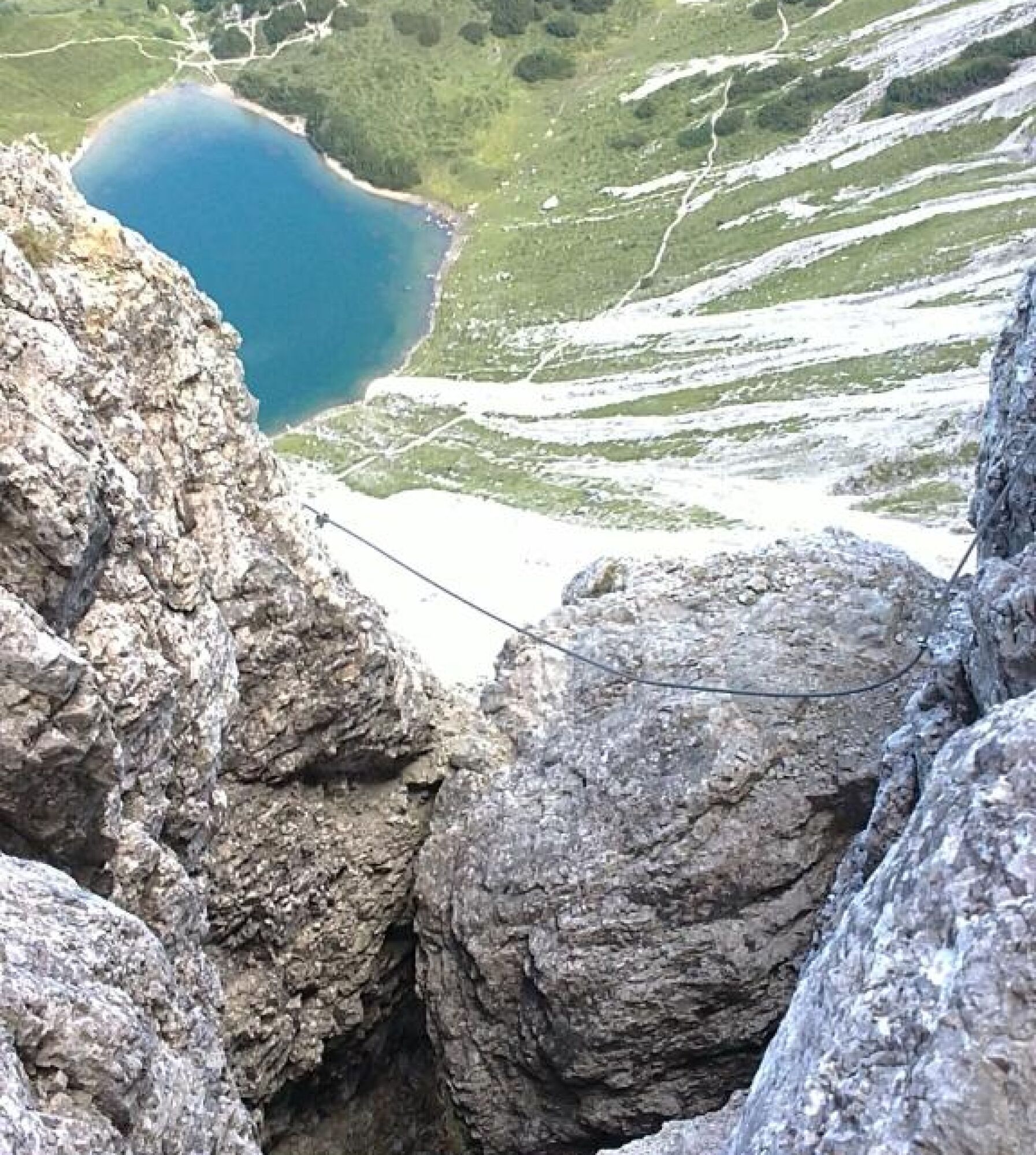
Enjoy this indescribably beautiful 3-lake view from the Lachenspitze...


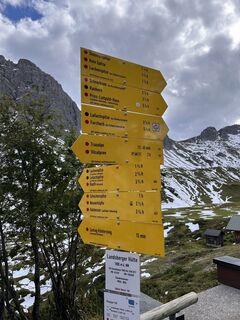
Approach
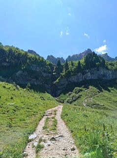
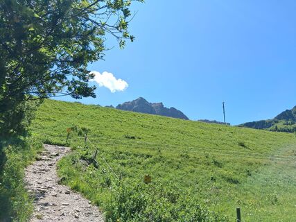
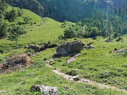
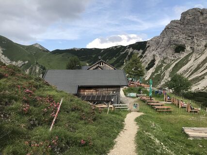
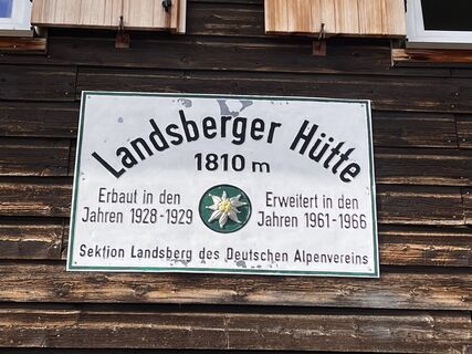
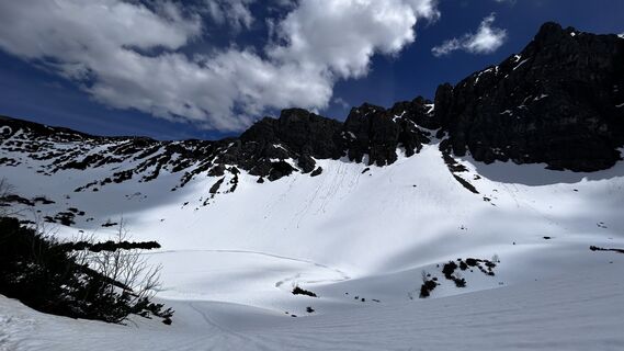
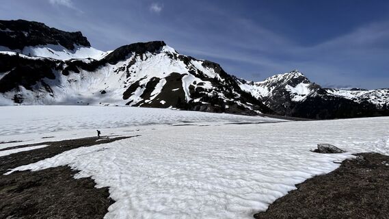
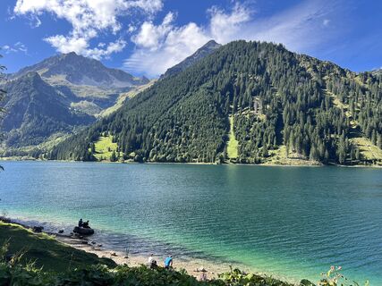
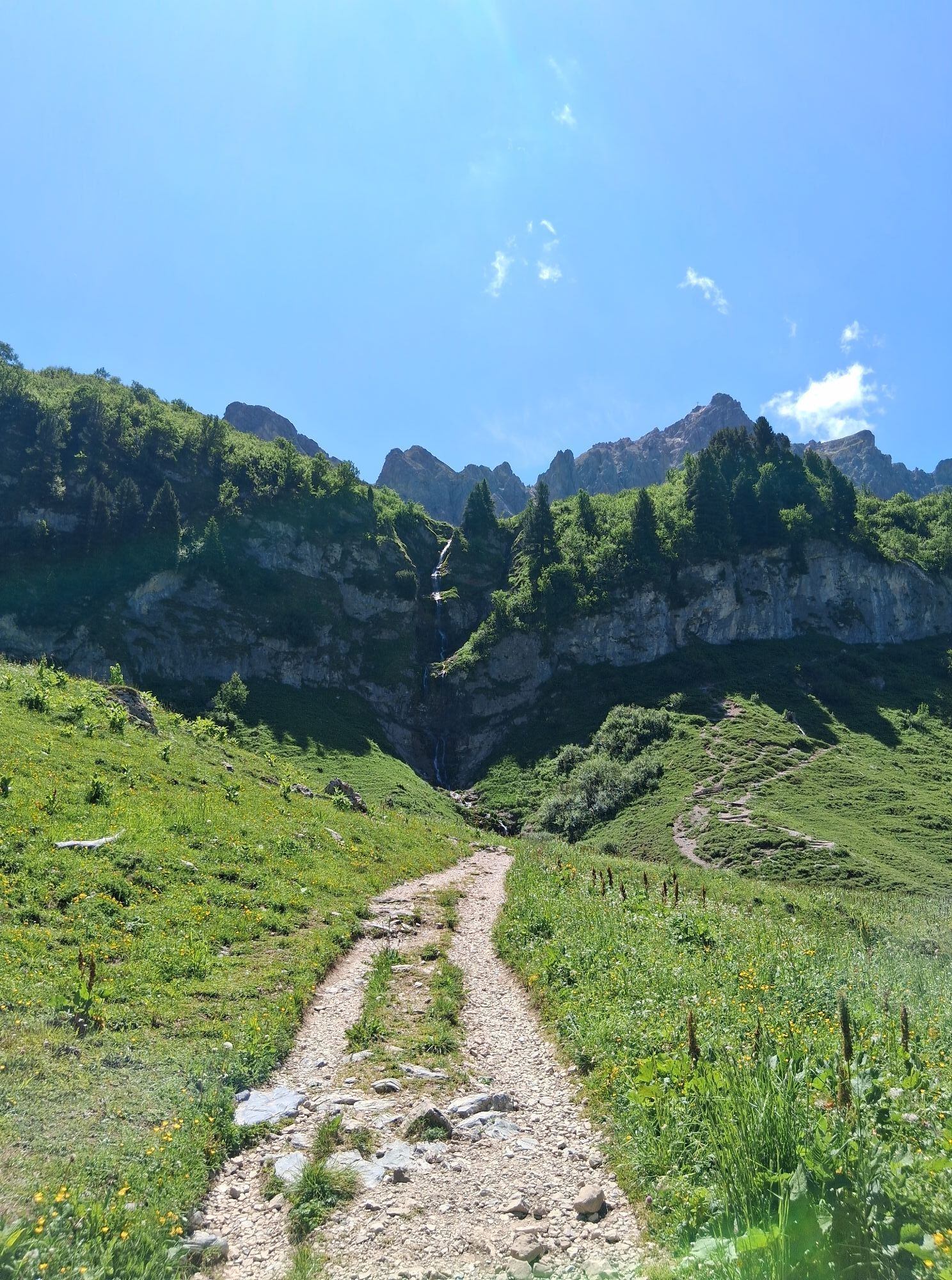
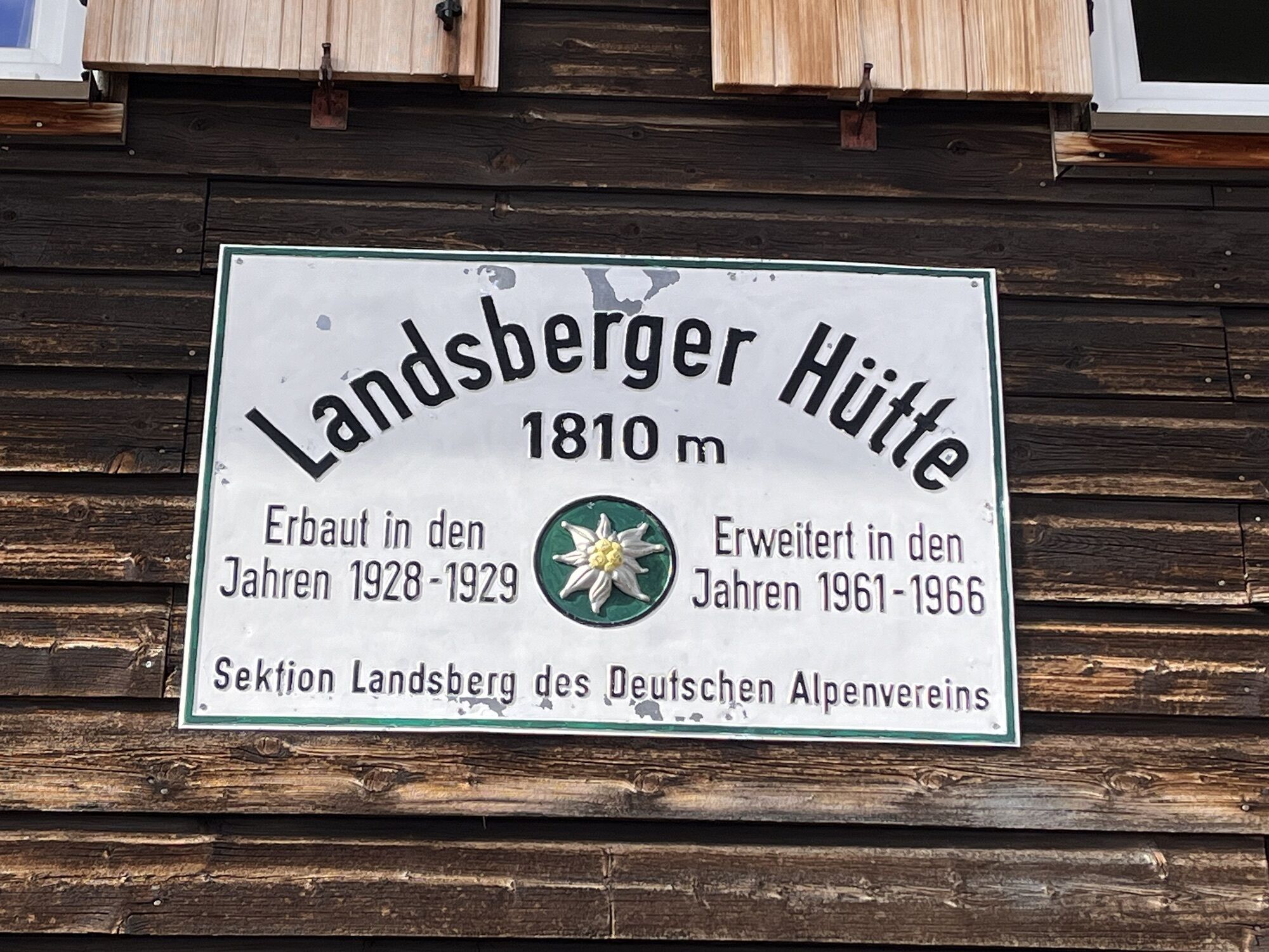
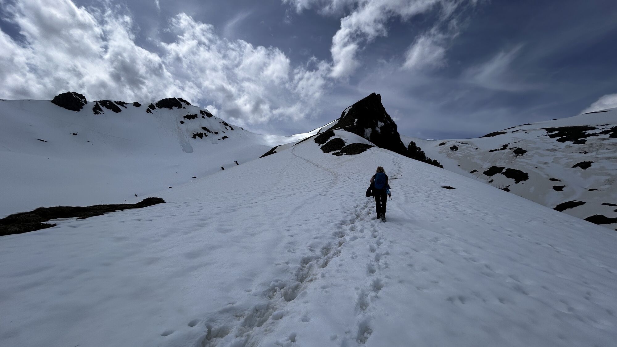
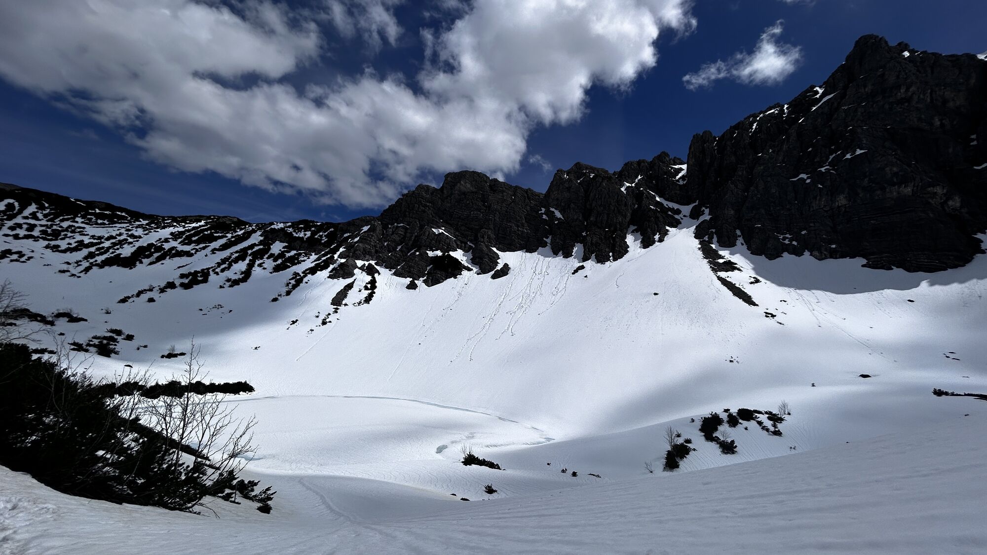
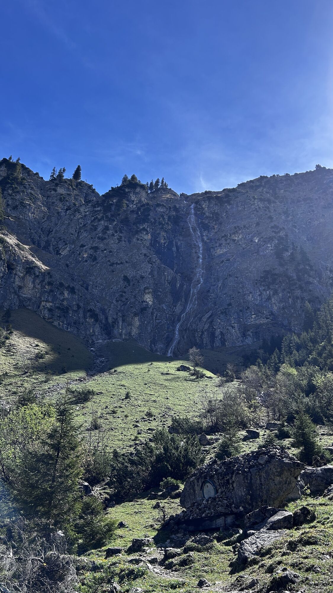
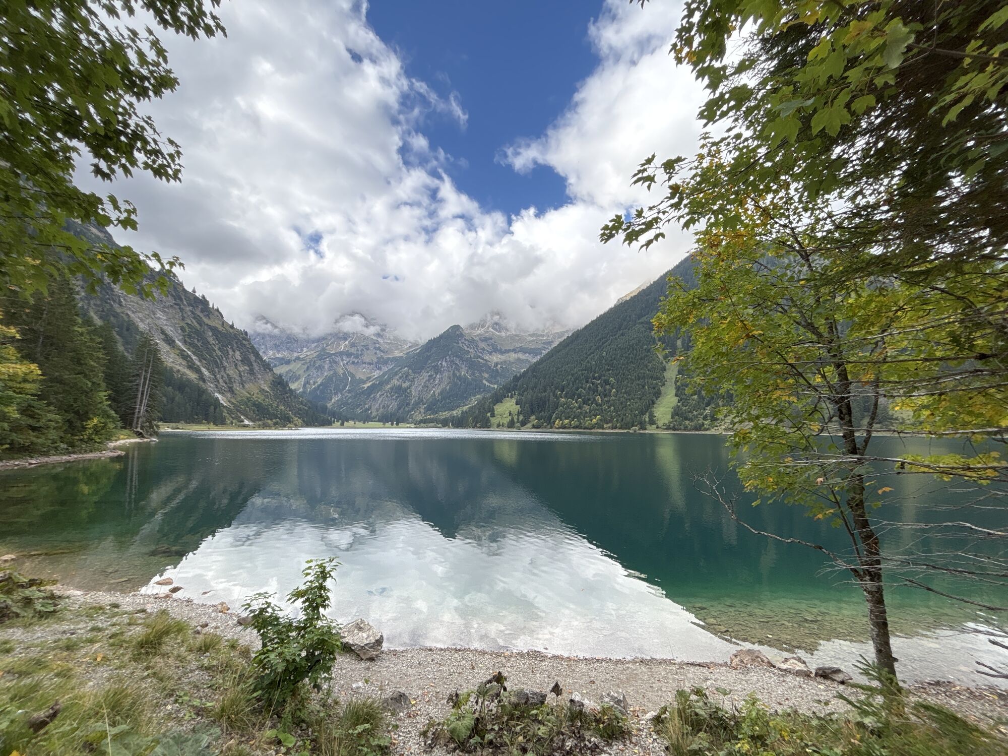
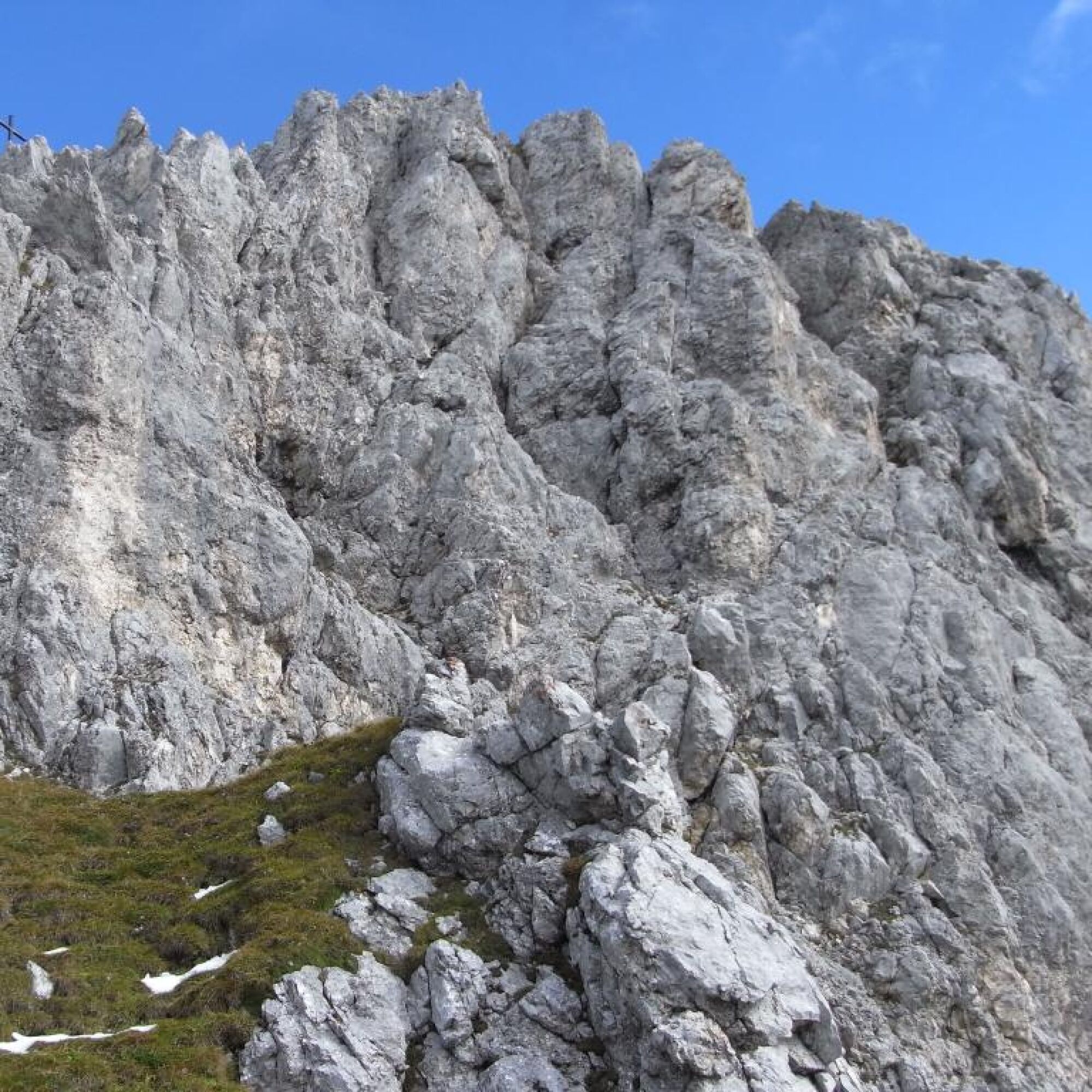
The starting point is Vilsalpsee or the Neunerköpfle valley station in Tannheim. From there over the Landsberger Hütte (1,805 m), it is about a 2.5–3 hour ascent to the entry at Lachesee. The path is marked and leads through beautiful alpine meadows into high alpine terrain.
Descent
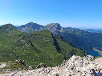
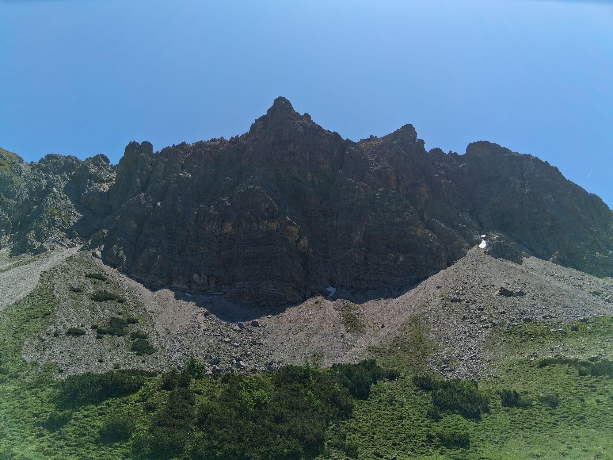
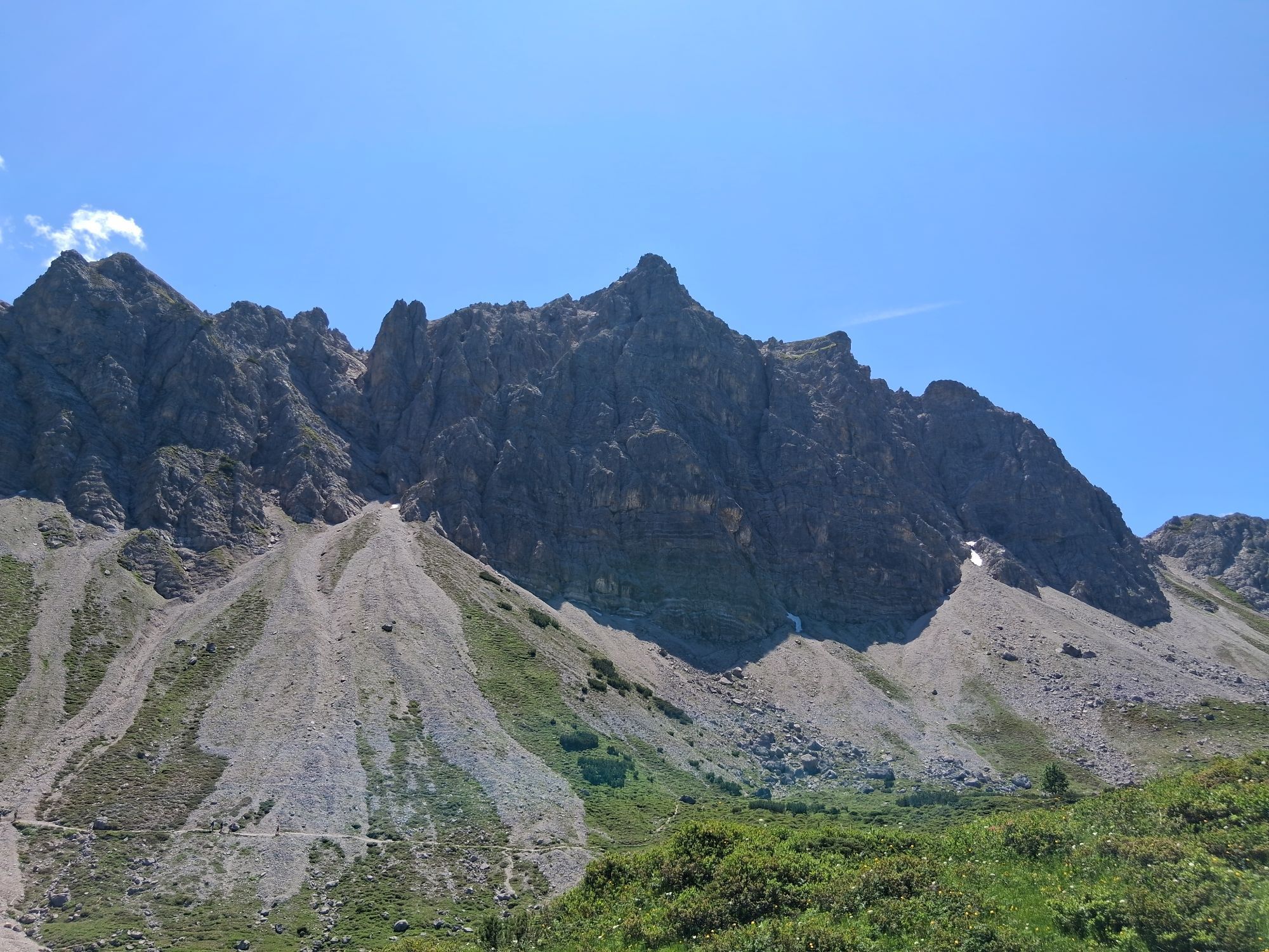
From the summit, return either via the normal route (marked trail, sections up to I) back toward Lachesee and the Landsberger Hütte or continue as a round tour over the neighboring peaks (e.g., Rote Spitze or Steinkarspitze). From the hut, continue back down to the valley to the starting point. Total descent time about 3–3.5 hours.
Da
Da
Personal mountaineering equipment must be safe, serviceable, and conform to current technical standards. Every hiker is advised to inform themselves about the planned routes through alpine specialist literature or on site.
Complete via ferrata equipment (via ferrata set, harness, and helmet) is strongly recommended even for experienced climbers!
Mountaineering inherently carries an increased risk of accidents and injuries. Even with careful planning, a residual risk remains. Good preparation through endurance training, technical practice, further education, and careful behavior can reduce the risk of accidents. Weather changes often occur very quickly in the mountains and should always be taken into account. It is recommended to stay on marked trails.
On the A7 motorway, exit "Oy-Mittelberg" onto the B310 toward Wertach and then to Oberjoch. Follow the signs for "Tannheimer Tal" B199, exit Tannheim. Continue to Vilsalpsee and to the Landsberger Hütte (on foot).
From the Tyrol side via Reutte on B198 toward Lechtal to Weißenbach, over Gaichtpass along B199 to exit Tannheim. Continue toward Vilsalpsee, turn left at the gravel pit toward Gappfenfeldalpe and continue to the Landsberger Hütte (on foot).
By train to Sonthofen, Pfronten/Ried, or Reutte, then continue by bus to Tannheim.
In Tannheim at the mountain railways. (Access to the lake is closed between 8:00 a.m. and 5:00 p.m.).
C/D
Tourist office Tannheimer Tal
Landsberger Hütte
Besides the via ferrata there is a "practice via ferrata" with all difficulties. Here you can test all difficulties.
Tururi populare în vecinătate
-
4,2
Three-lake route (awarded the Tyrolean Hiking Trail Seal of Quality)
mediuExcursie 14,8 km -
4,6
3-Seen Rundtour Vilsalpsee / Schrecksee / Traualpsee
mediuExcursie 17,1 km -
4,8
3-Gipfel-Tour
mediuExcursie 11,2 km -
4,5
Mountain hike to the Aggenstein
greleExcursie 15,3 km -
4,0
De la Tannheim la Sulzspitze
mediuExcursie 15,6 km -
5,0
Hiking tour to Breitenberg
greleExcursie 15,6 km -
5,0
Gemeinde Grän, Tirol/Österreich Aggenstein Rundtour über Höhenweg
mediuExcursie 9,84 km -
4,8
To the Bad Kissinger Hut via the Gräner Höhenweg
mediuExcursie 13,0 km -
4,8
Bad Hindelang, Hinterstein, Deutschland
mediuExcursie 14,1 km -
4,8
Hindelanger Klettersteig ab Edmund-Probst-Haus + Rückweg
mediuVia ferrata 10,7 km
Drumeții și urmărire


Nu ratați ofertele și inspirația pentru următoarea dvs. vacanță
Adresa dvs. de e-mail a fost adăugat la lista de corespondență.