


Circular hiking trail - gorge tour near Eisenach - Thuringian Forest
Nivelul de dificultate: T1


Fotografii ale utilizatorilor noștri
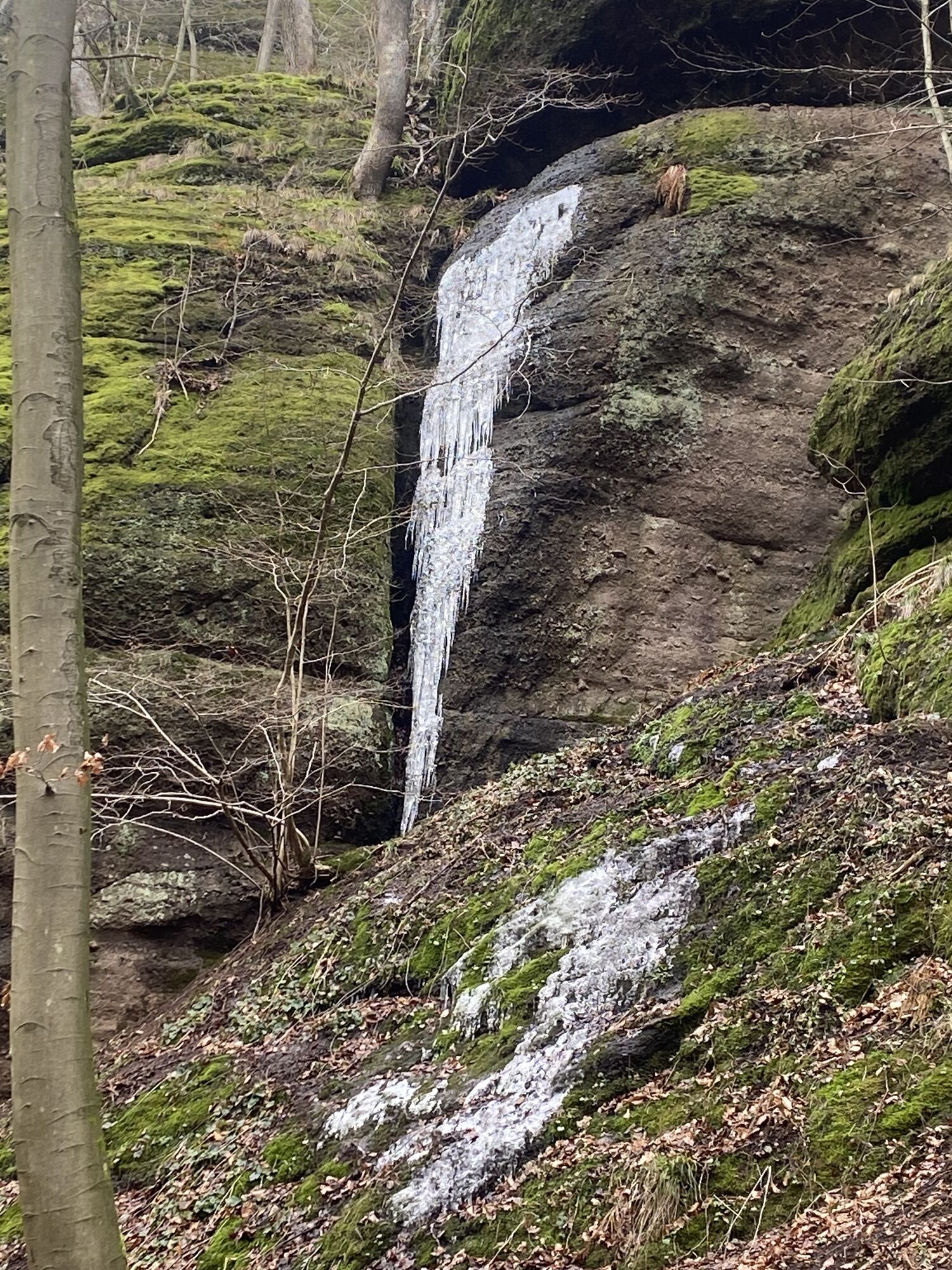
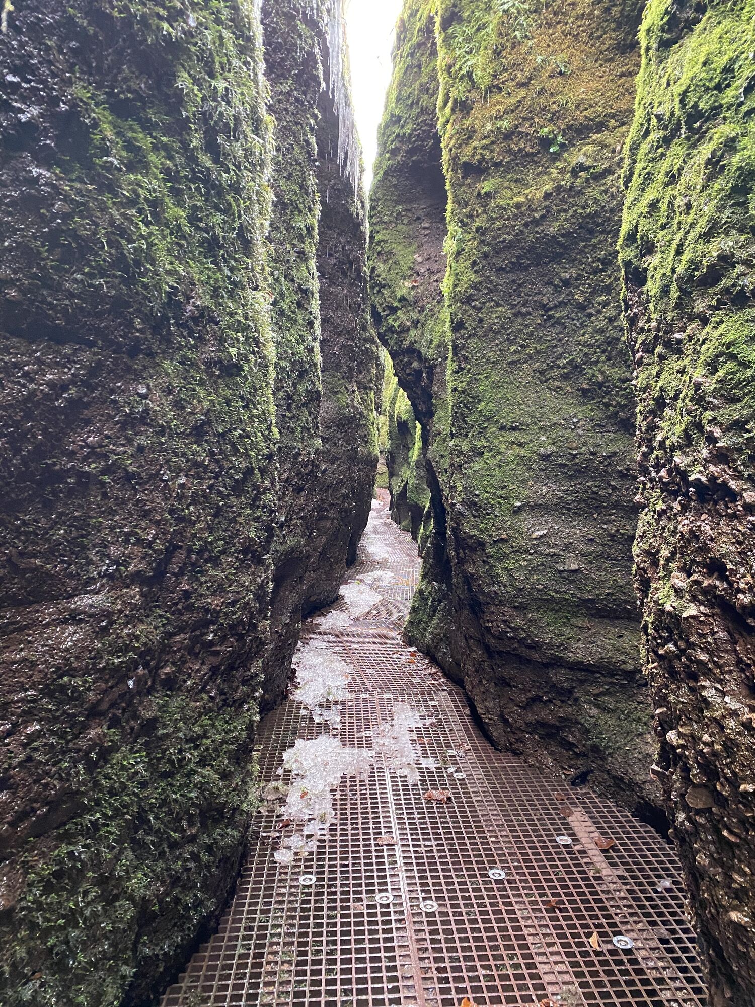
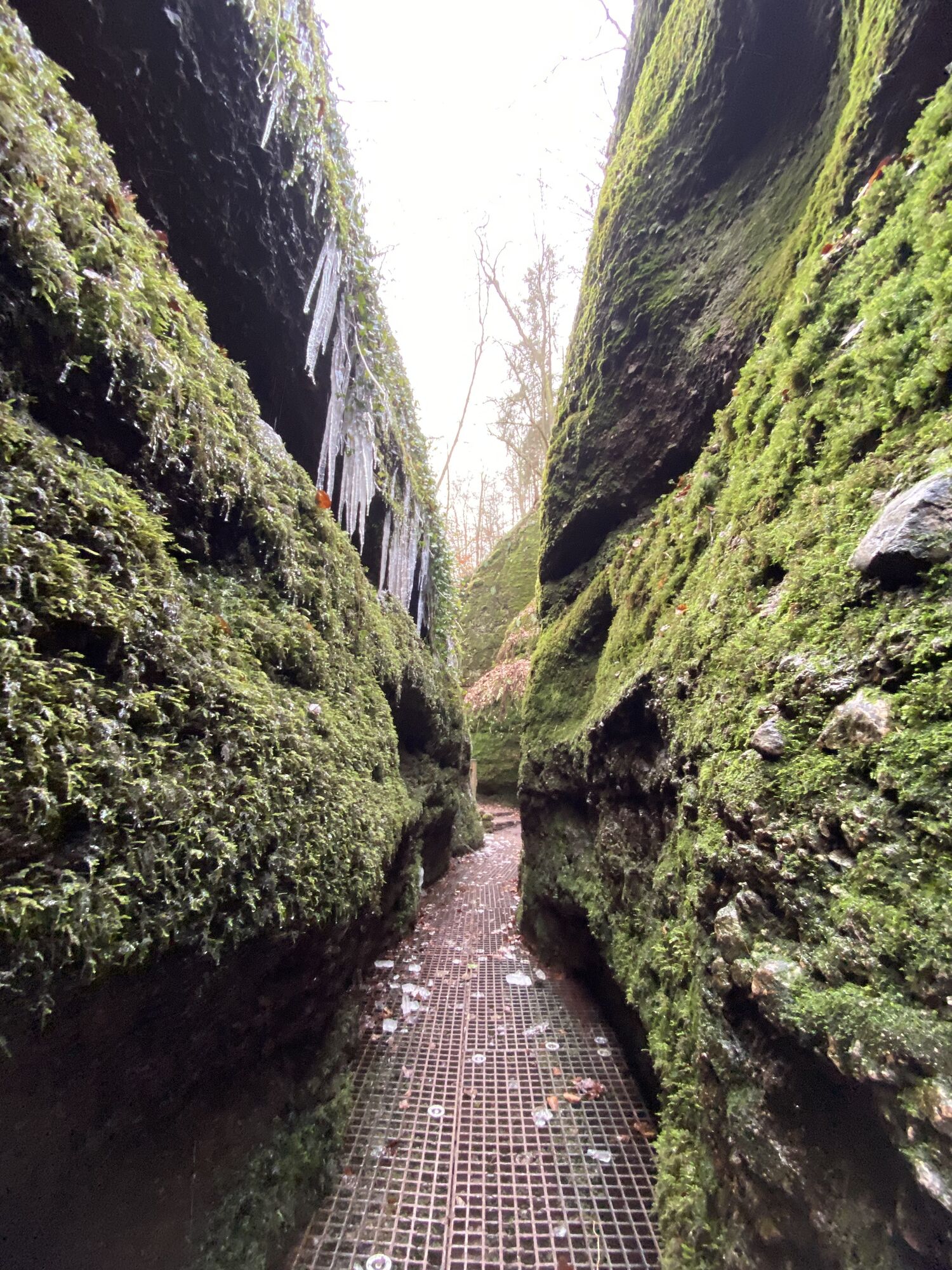
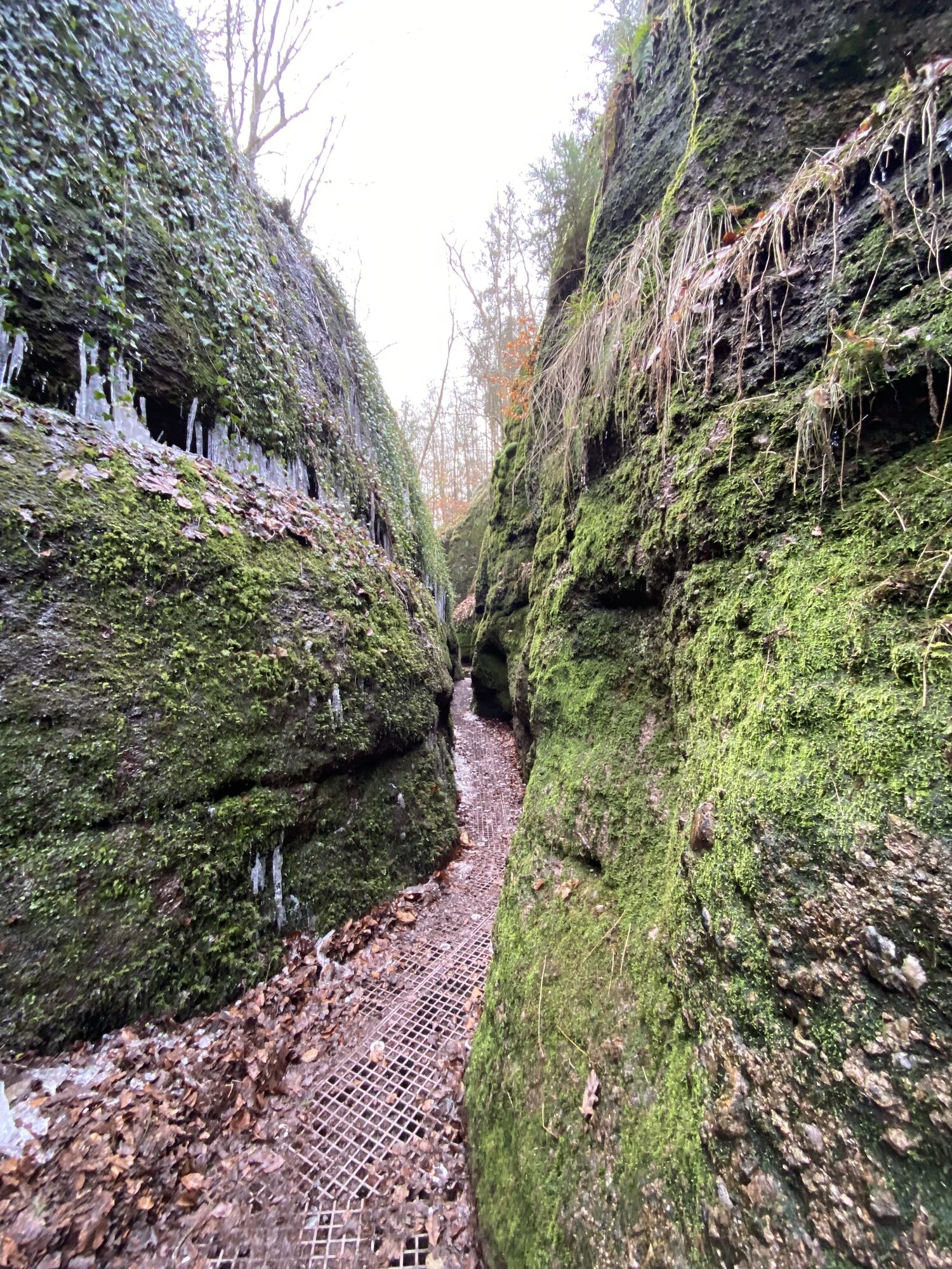
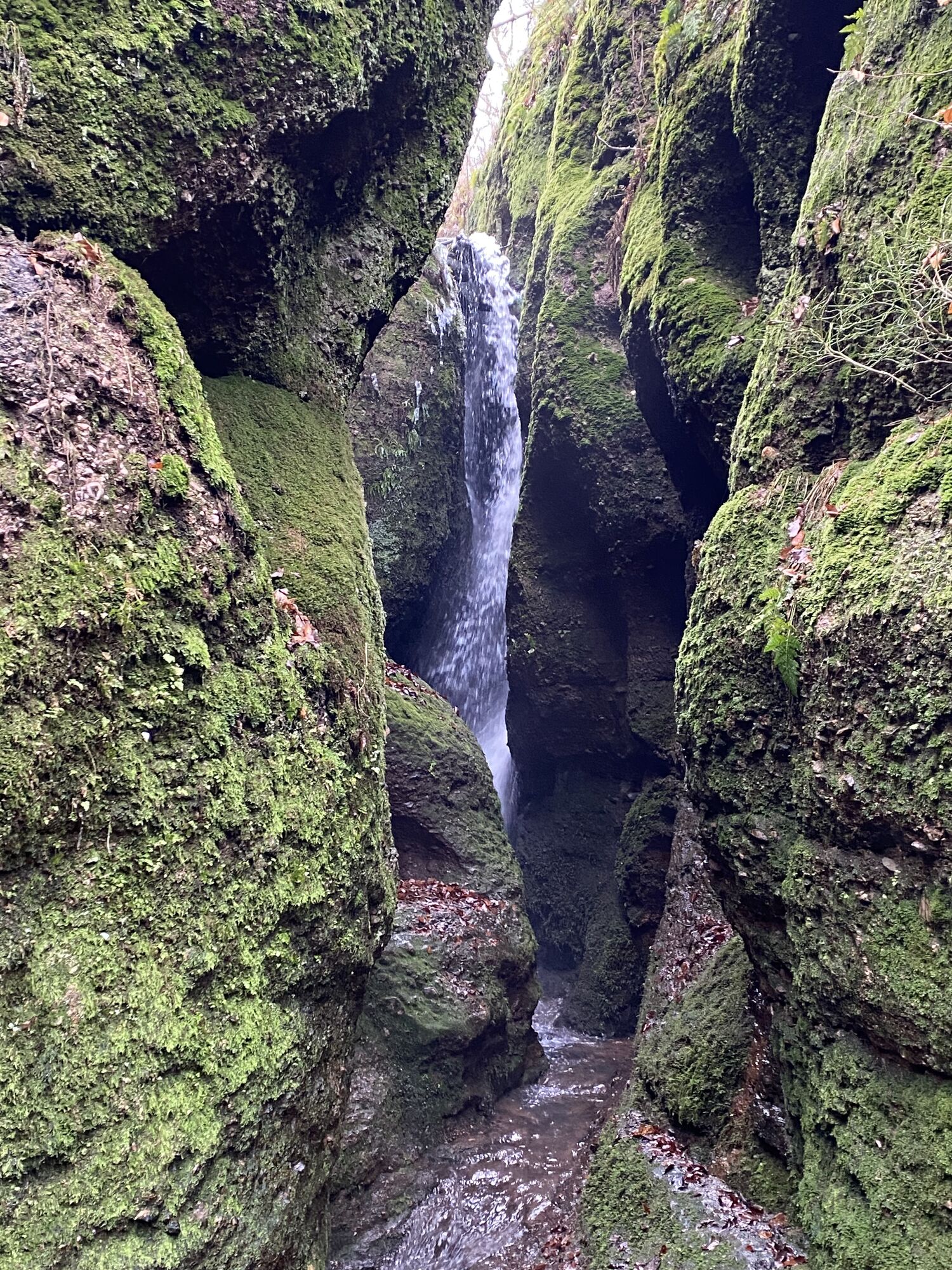
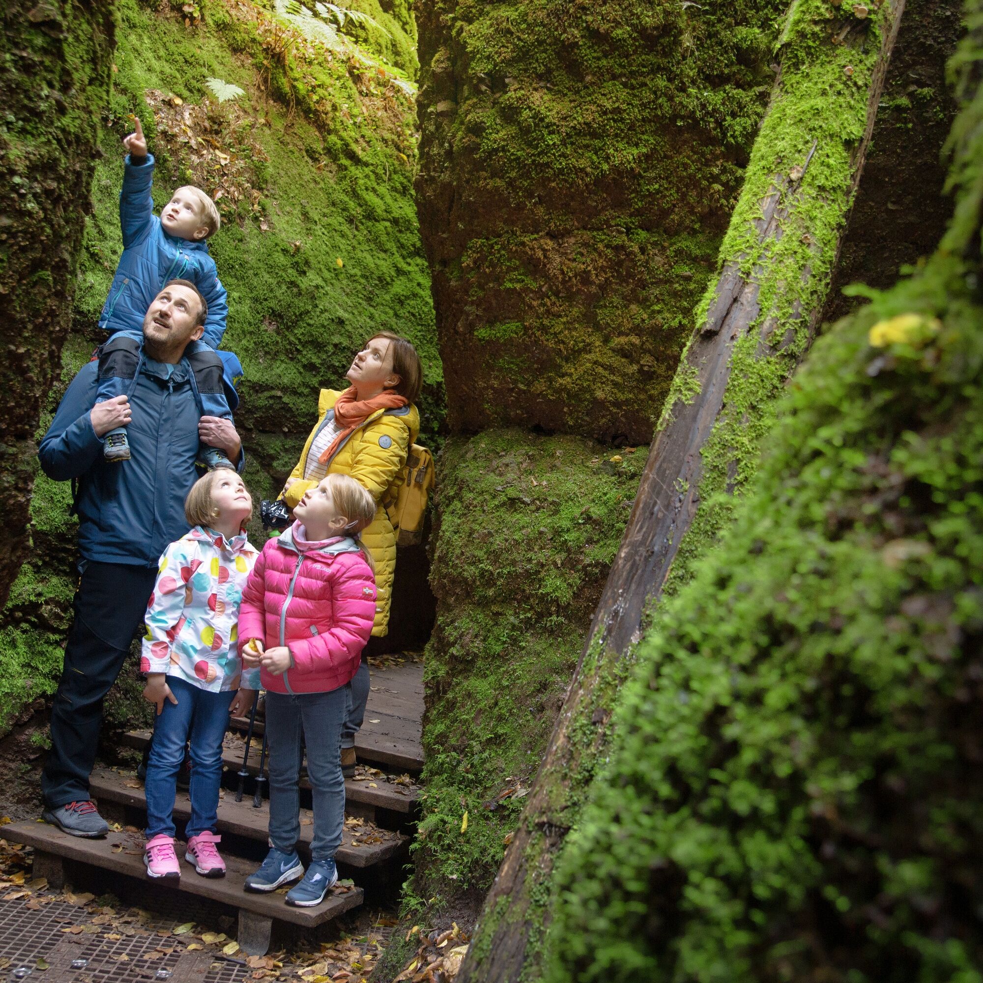
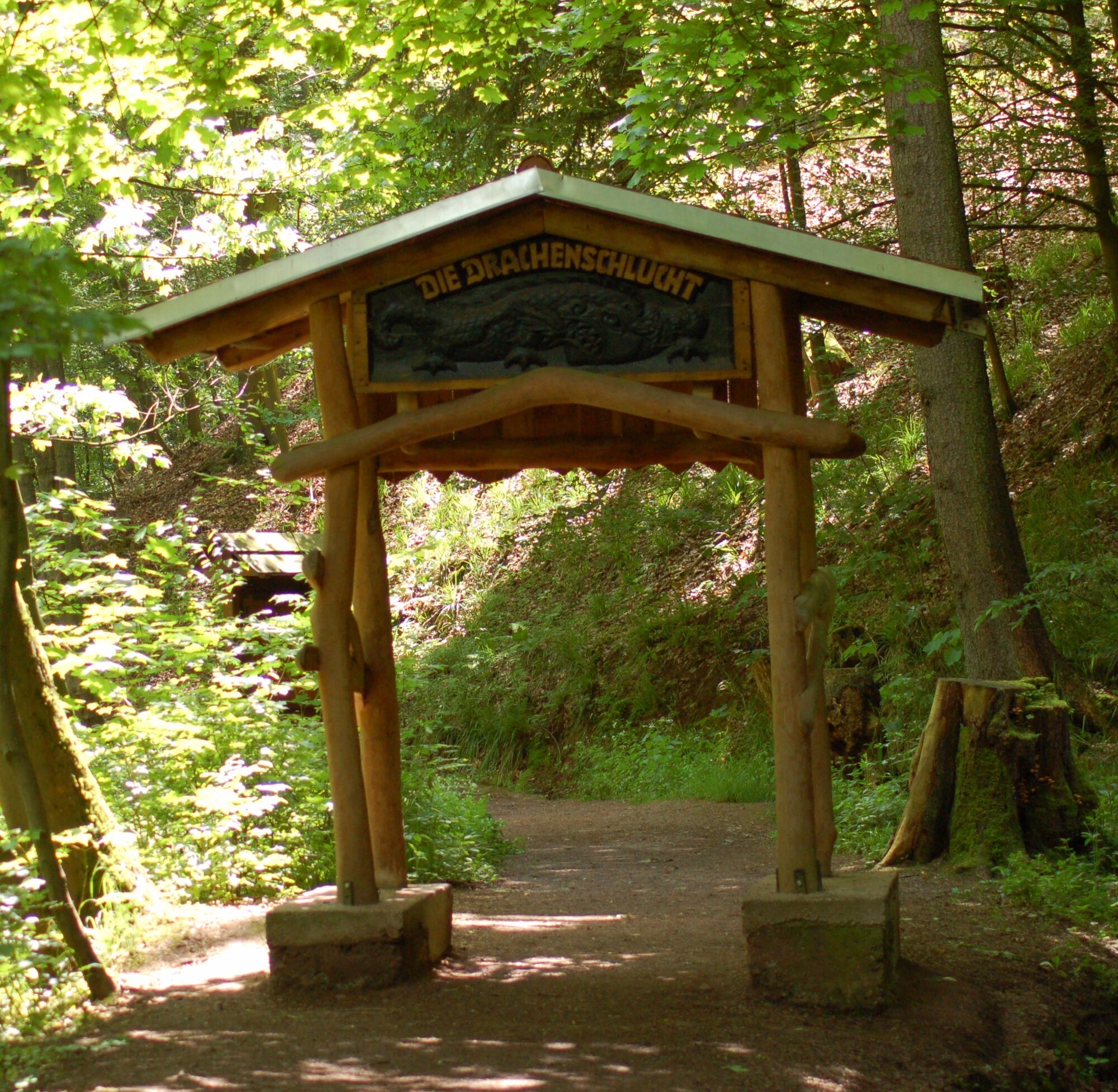
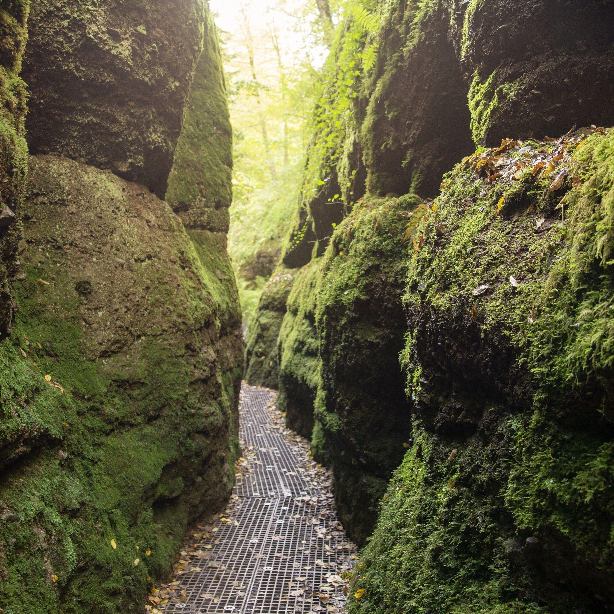
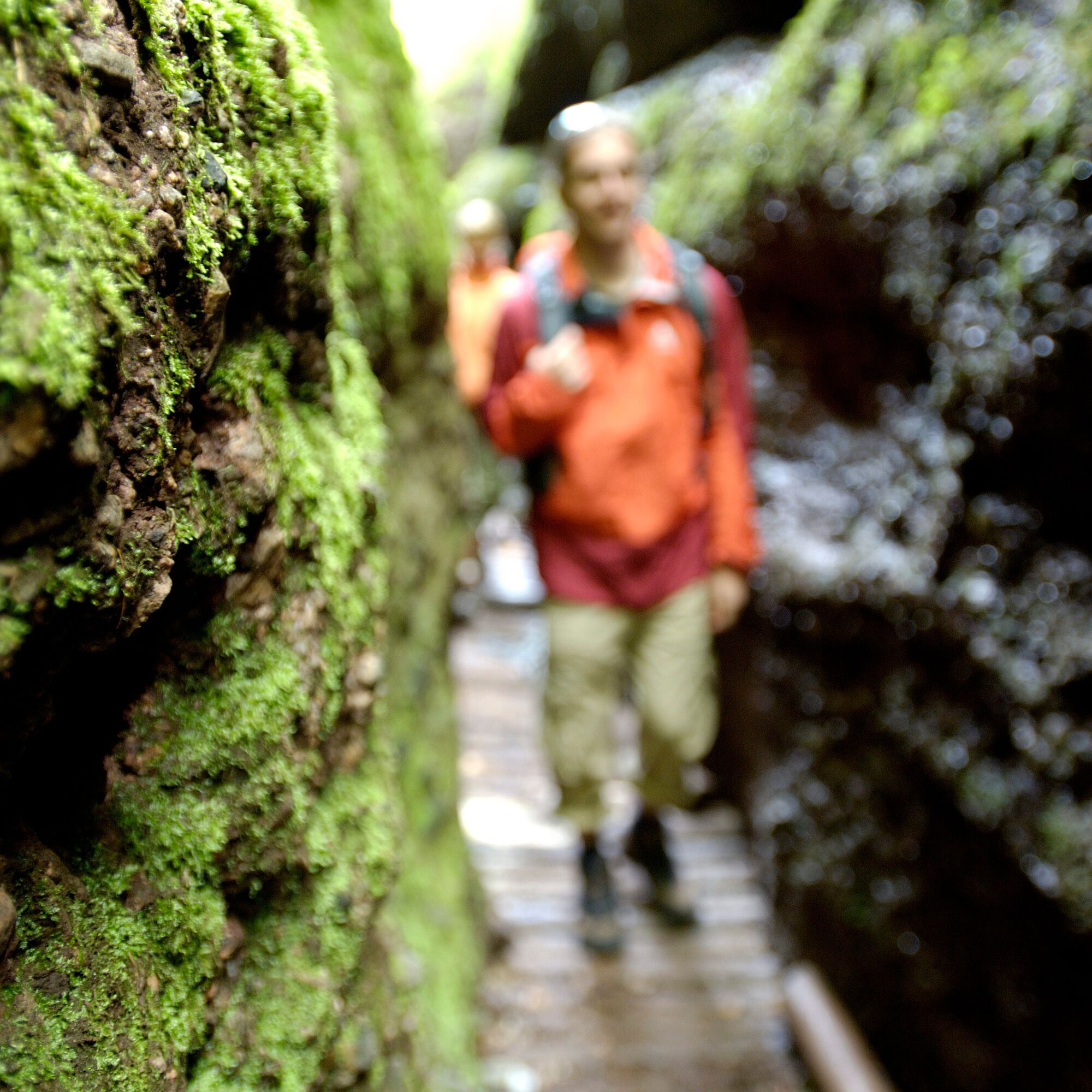
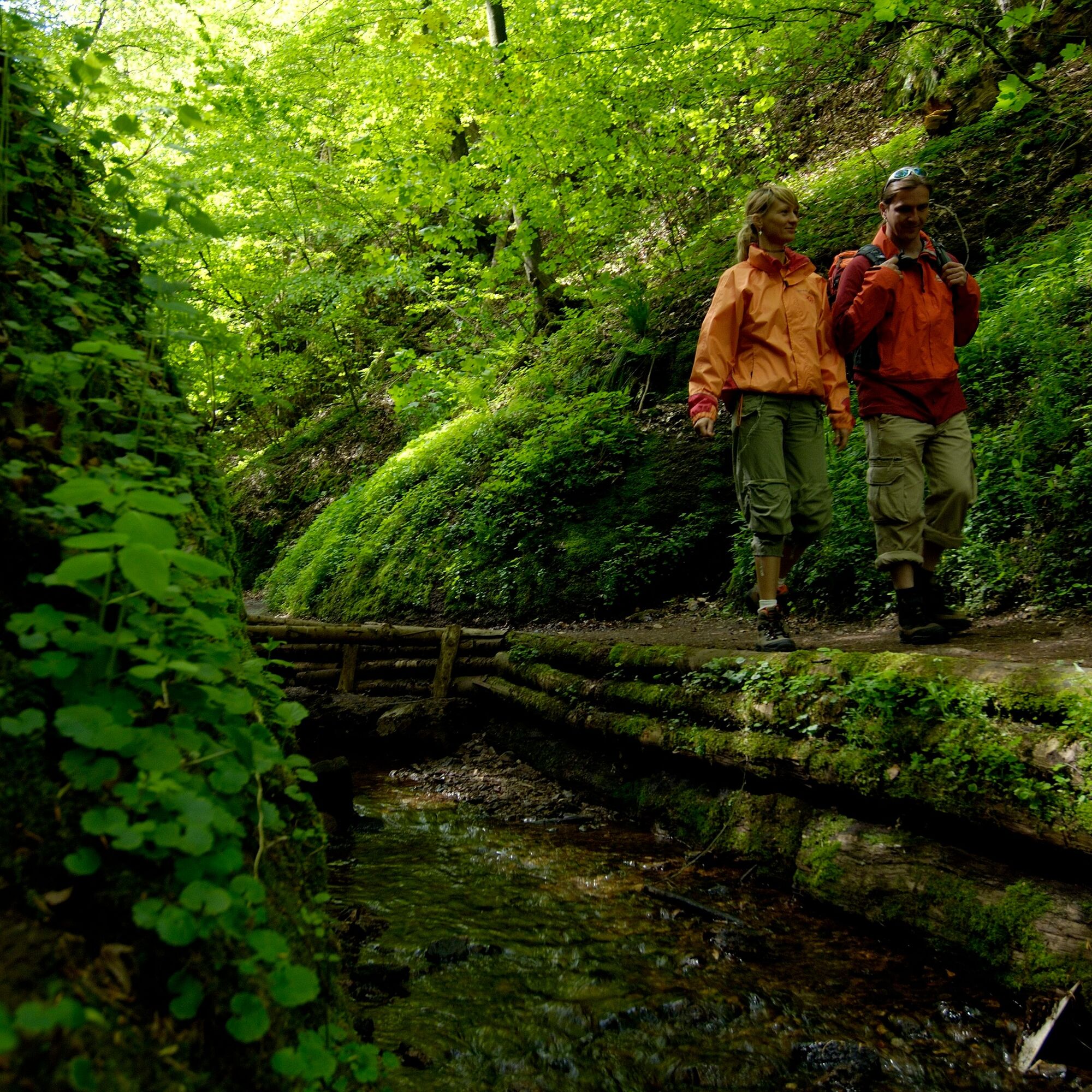
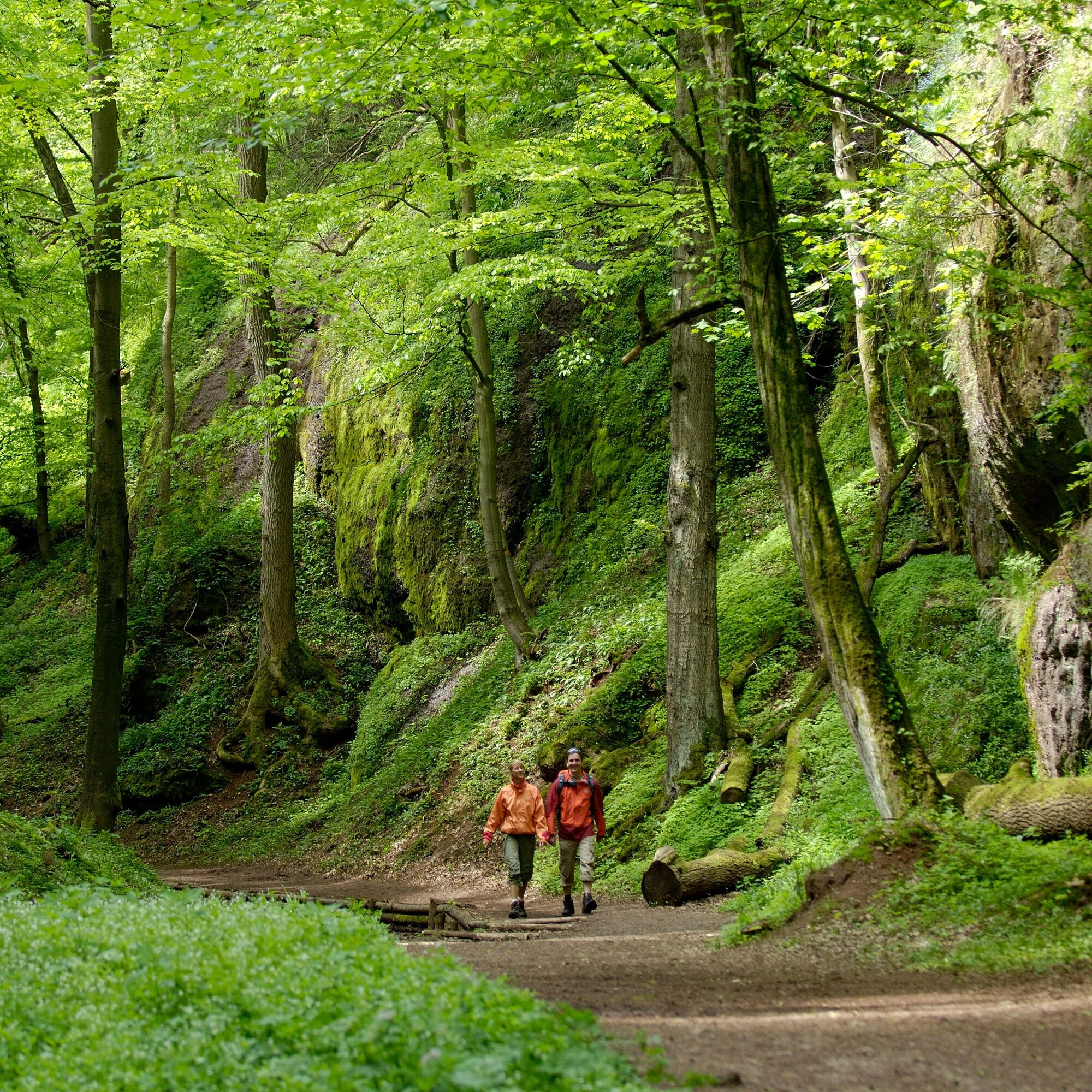
Experience nature literally first hand and let the walls come closer. In the legendary Drachenschlucht (Dragon Gorge) south of Eisenach, the narrowest point on the hiking trail is no wider than 70 cm....
Experience nature literally first hand and let the walls come closer. In the legendary Drachenschlucht (Dragon Gorge) south of Eisenach, the narrowest point on the hiking trail is no wider than 70 cm. Romantics, nature lovers and geologists alike get their money's worth on this tour.
The gorge tour through the wild and romantic Dragon Gorge and the unspoilt rock formations of the Landgrafenschlucht (Landgrave Gorge) is one of the most beautiful hikes of all.
Starting from the Mariental, which can be reached on foot or by public transport, the hike leads through the mossy rocks of the Dragon Gorge - the rushing Marienbach directly below the grating.
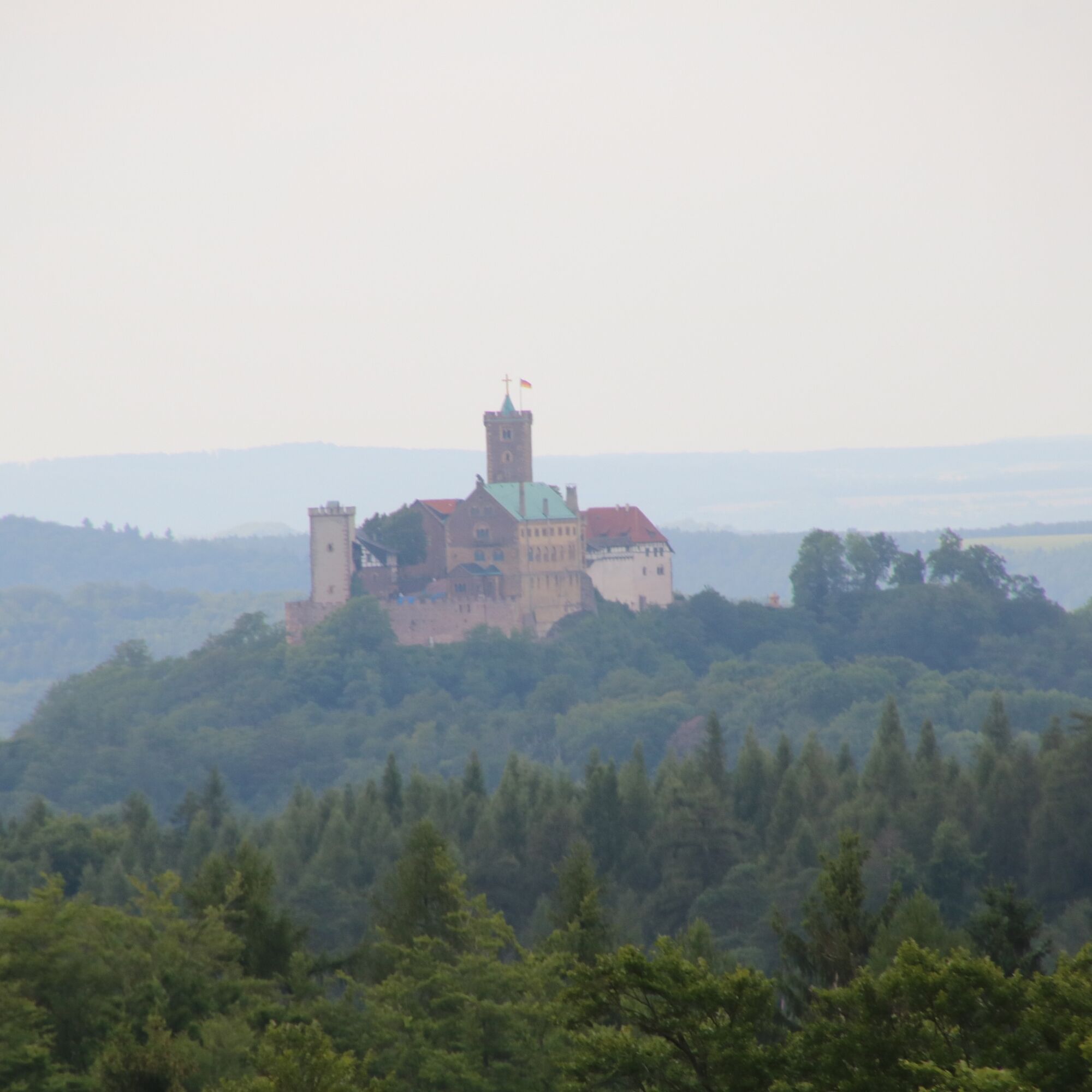
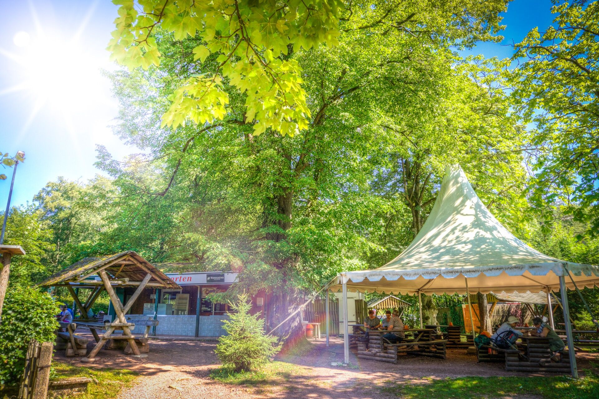
Arrived at the "Hohe Sonne" (snack bar Hohe Sonne (barbecue) on the Rennsteig, you can enjoy a Thuringian bratwurst on the grill and enjoy the view of the Wartburg. Continuing along the Weinstraße (Wine Route), you will reach the Großer Drachenstein (Big Dragron’s Stone), from where you will enjoy a beautiful view of the Hörselberge and the Inselsberg. The way back through the impressive Landgrafenschlucht leads to the starting point in Mariental near Eisenach.
ATTENTION: The Mariental is a popular excursion destination, especially on weekends many day trippers visit the region. Please do NOT park your car along the busy main road when the car parks are full. It is therefore recommended to travel by public transport. More information about the departure times can be found under Arrival.
DOWNLOADS and LINKS:
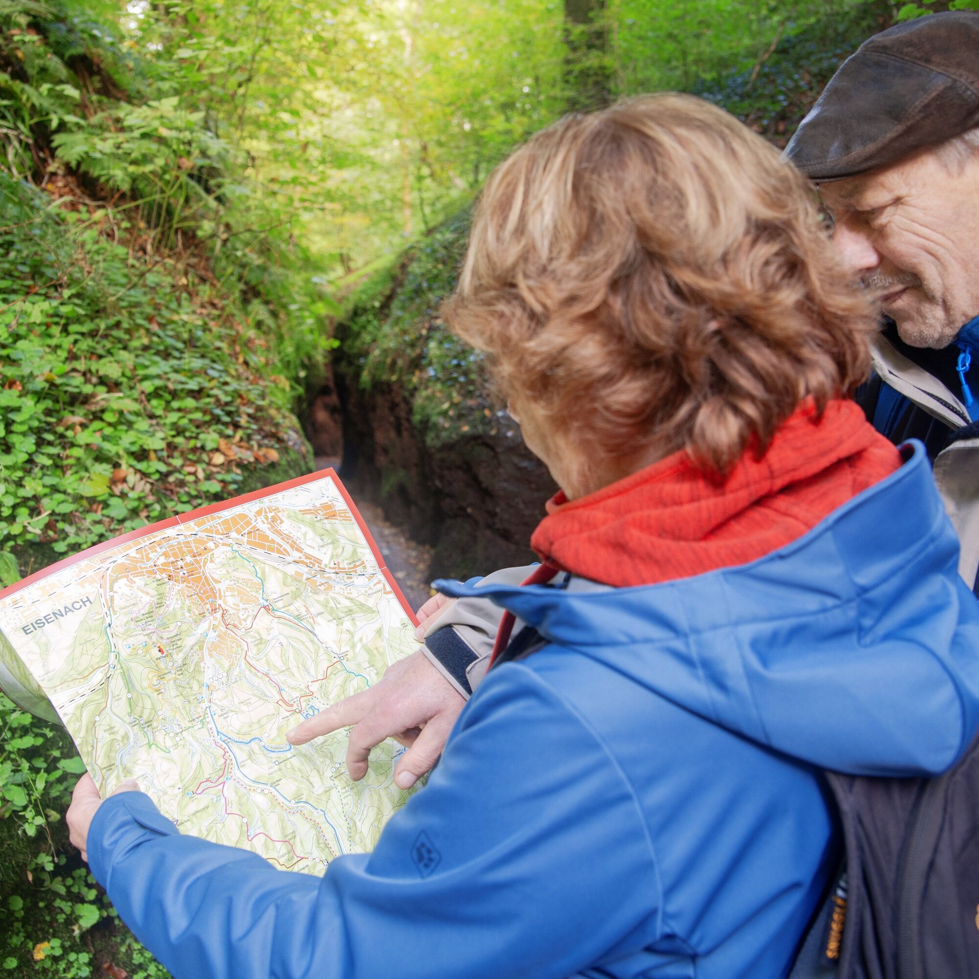
Hiking map of the Drachen Gorge and Landgrafen Gorge in PDF format
The Dragon Gorge - Website of the Tourist-Information Eisenach
Eisenach Hike through another gorge near Eisenach: Circular hike - "Through the romantic Johannistal" near Eisenach

Mariental – Wichmannpromenade - Gorge Drachenschlucht – Hohe Sonne – Weinstrasse – View Großer Drachenstein – Gorge Landgrafenschlucht – Mariental
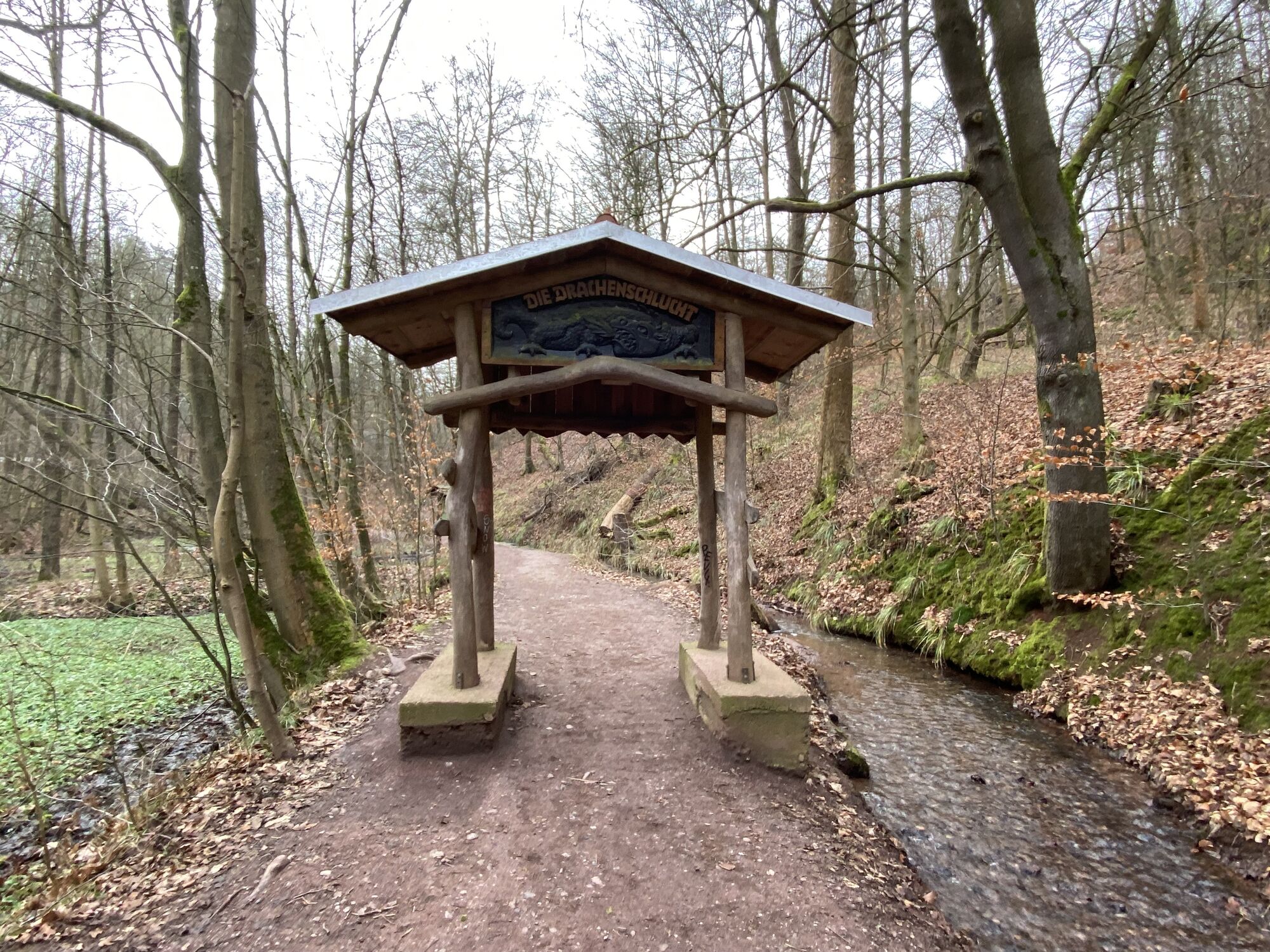
Gorge Drachenschlucht:
Mariental – Wichmannpromenade - Gorge Drachenschlucht – Hohe Sonne (branch to Wartburg possible) or vice versa
Da
sturdy shoes, rainwear
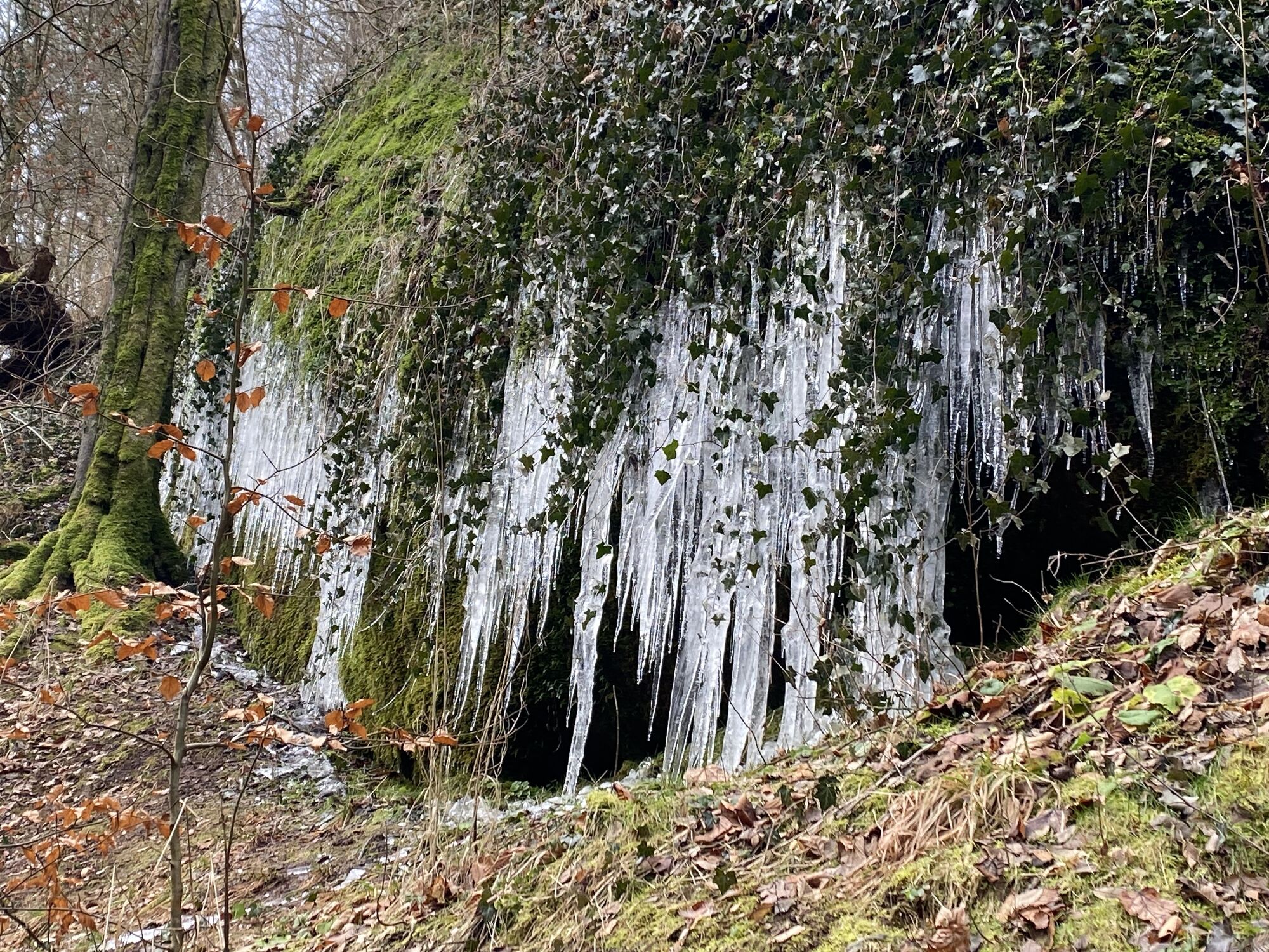
When walking on the clamp, pay attention to slippery and slippery areas. The watercourse of the stream is partly located directly under the hiking trail. In the case of ice and snow there is limited accessibility.Please be considerate and quiet in the forest to protect the flora and fauna. Follow the instructions of the forest staff and pay attention to restrictions caused by forest work.
Coming from the Motorway A4 take exit 40a (Eisenach-Ost). Then continue on the National Road B84 in the direction of Eisenach until the junction "Eisenach-Oststadt". Continue straight ahead on National Road B19 to the railway station and then south through the city. Follow National Road B19 in the direction of Wilhelmstahl / Etterwinden and Bad Salzungen. Follow the road for about 4 km until "Hohe Sonne".
ATTENTION: The Mariental is a popular destination for day trips, especially on weekends many day trippers visit the region. Please do NOT park along the busy main road when the parking spots are full. We reccomend the to use the local public transport.
Use the travel information of Deutsche Bahn. All regional transport providers are also listed in this portal.
Eisenach city bus: Line 13 from ZOB/main station or Karslplatz to the stop Mariental/Drachenschlucht (Dragon Gorge) or to the stop Hohe Sonne
City bus line: 13
Regional bus line: 145
Parking lots:
Hohe Sonne
P+R-Parkplatz an der Phantasie
P+R-Parkplatz Liliengrund
Parkplatz am Prinzenteich
T1
Directly at the Hohe Sonne you have a wonderful view to the Wartburg. The atmosphere in the morning or evening hours is particularly impressive.
Tururi populare în vecinătate
-
4,5
IVV PW + GTW "Auf Luthers Spuren - Luther, Drachen, Landgrafen, Rosenwunder..."
mediuExcursie 15,8 km -
Wartburg und Drachenschlucht
mediuExcursie 15,1 km -
4,5
Rundwanderung - Sagenhafte Hörselberge - Großer Hörselberg bei Eisenach - Thüringer Wald
mediuExcursie 10,6 km -
4,5
Wanderung - "Rennsteig-Leiter Eisenach" Thüringer Wald
mediuExcursie 3,58 km -
3,7
EISENACH | Drachenschlucht - Wartburg
luminăExcursie 13,0 km -
4,0
Rundwanderung - "Kultur-NaTour" - Bad Liebenstein - Thüringer Wald
mediuExcursie 10,8 km -
Rundwanderung - Vom Rennsteigbeginn über den "Stedtfelder Bergbaulehrpfad" bei Eisenach - Thüringer Wald
mediuExcursie 11,0 km -
4,0
Rundwanderweg - "Große Bermerrunde" - Ruhla - Thüringer Wald
luminăExcursie 8,14 km -
Rundwanderweg - "Die schönen Unbekannten" - Wutha-Farnroda
mediuExcursie 10,8 km -
4,5
Rundwanderweg - "Gerberstein" - Ruhla - Thüringer Wald
mediuExcursie 5,40 km
Drumeții și urmărire


Nu ratați ofertele și inspirația pentru următoarea dvs. vacanță
Adresa dvs. de e-mail a fost adăugat la lista de corespondență.