


Hike – „Rennsteig-Leiter Rotterode“ Thuringian Forest


You could hardly find a better starting point for a hike to the Rennsteig. Rotterode is particularly idyllic between Oberhof and Schmalkalden.
From Rotteroder Höhe you have a wonderful view of Knüllfeld...
You could hardly find a better starting point for a hike to the Rennsteig. Rotterode is particularly idyllic between Oberhof and Schmalkalden.
From Rotteroder Höhe you have a wonderful view of Knüllfeld and the Große Hermannsberg. To the west rises the famous ridge trail. Your path to it leads along Tambacher Straße. In winter, this route is also prepared as a ski hiking trail.
The small mountain village Rotterode is said to have emerged with the destruction of Moosburg at the beginning of the 14th century. The castle was already important to the landgraves on the Wartburg at the beginning of the 12th century. The Moosburg knights controlled the trade route Hohe Straße and secured the border area.
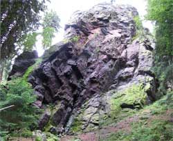
On your hike to the Rennsteig, you will experience the charming Mossbach valley. You will also pass the archaeological monument of the former castle. The people in Rotterode used to live from agriculture, woodworking, and nail smithing. Nearby you will also find the Koppenstein. The rock is especially popular with climbers. With its variety of routes in almost all difficulty levels, it offers the right challenge for everyone. However, professional climbing equipment is necessary for that. But even for “normal hikers,” the Koppenstein is an impressive sight.

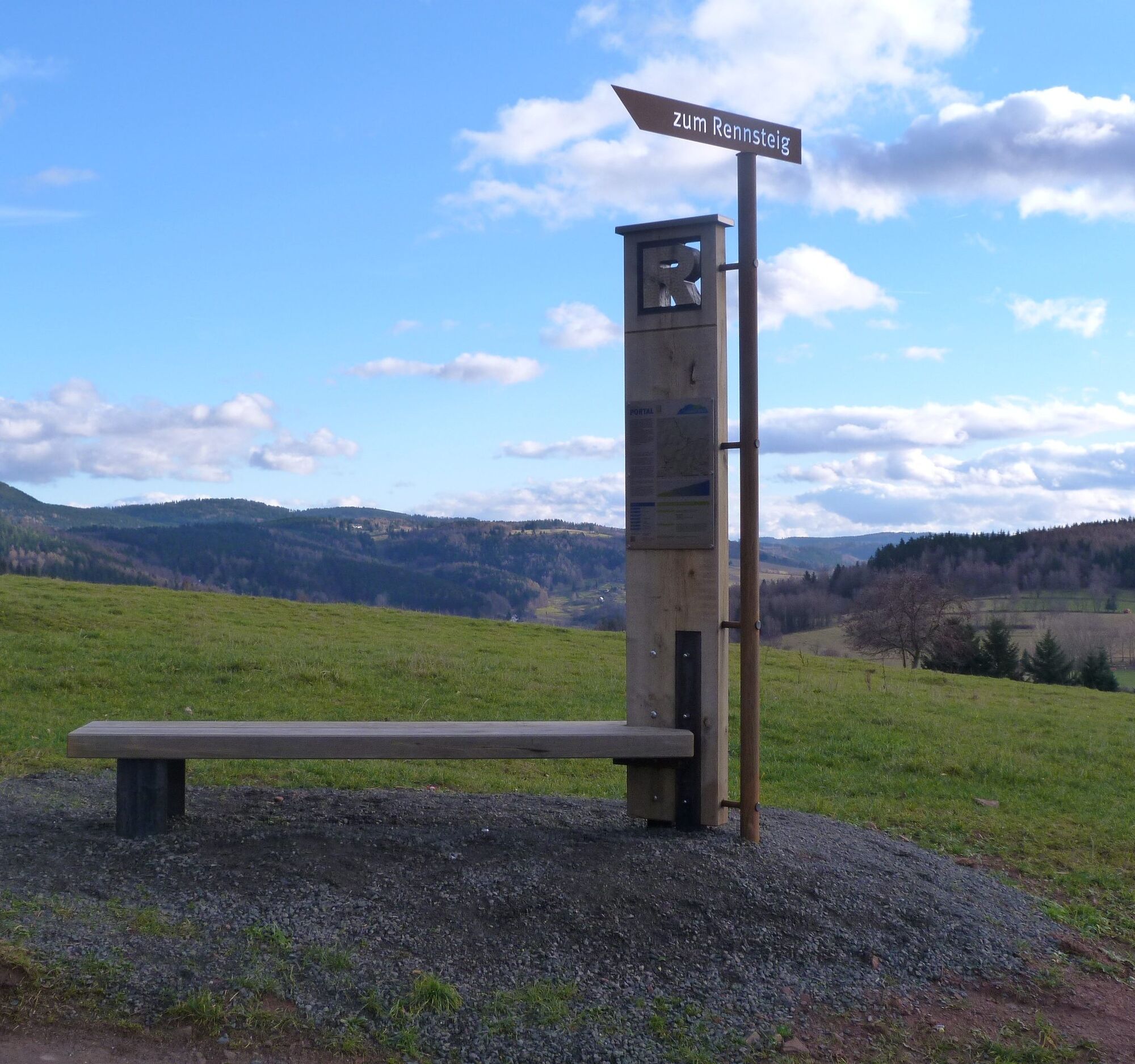
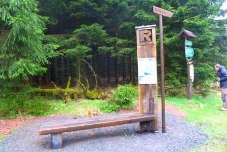
Rotterode - Rotteroder Höhe - Tambacher Strasse - Silberwiese - Neuhöfer Wiese/ Rennsteig
Da
sturdy footwear
rainwear
drink supply
first aid kit
GPS navigation device or smartphone
The hiking trail requires sturdy footwear. You will partly hike on narrow paths. Avoid stepping on moss-covered stones and rocks due to slipping hazards and watch out for deadwood, branches, and fallen trees.
Note the typical dangers of the forest!
Hiking is at your own risk!
For arrival via the A71, use the Zella-Mehlis exit. Follow the signs towards Schmalkalden/Steinbach-Hallenberg. After passing through Zella-Mehlis, continue towards Benshausen. At the roundabout, take the first exit towards Viernau. Drive through Viernau and in the district Herges-Hallenberg continue straight ahead to the center of Steinbach-Hallenberg. Follow the main street straight ahead, passing the town hall on the left and the Heimatlon on the right. A little further, at house number 138, keep left and turn into Kälberzeil Street, shortly after turn right into Rotteroder Street. Then continue via Steinbacher Street – Rotteroder main street – Smalkalder Street and then turn right onto Tambacher Street where the parking lot is located.
Arrival is possible by Deutsche Bahn to Steinbach-Hallenberg or by bus lines of MBB to the stop "Rotterode Wendeschleife." From here it is about 500 m to the start of the hike.
Rotteroder Höhe (Google NAV point)
Koppenstein
Tururi populare în vecinătate
-
4,1
Rund um die Ohratalsperre
luminăExcursie 14,5 km -
3,8
Wanderung zum Spitterfall
mediuExcursie 14,6 km -
5,0
Rundwanderweg- Ohratalsperre- Luisenthal- Thüringer Wald
luminăExcursie 14,3 km -
4,0
Rundwanderweg "Oberschönauer Felsenwanderung" - Steinbach-Hallenberg - Thüringer Wald
greleExcursie 12,0 km -
Rundwanderung Ohratalsperre
mediuExcursie 14,6 km -
4,5
Wanderung über den Rennsteig & den Schneekopf zur Schmücke
greleExcursie 20,9 km -
Ohra Talsperre
luminăExcursie 16,8 km -
5,0
Circular hiking trail - Lütsche raft ditch - Frankenhain - Thuringian Forest
mediuExcursie 13,8 km -
Rundwanderung zum Bärenstein & Pfanntalsteich
mediuExcursie 9,10 km -
4,0
Circular route - Spießberghaus - Friedrichroda - Thuringian Forest
mediuExcursie 10,7 km
Drumeții și urmărire


Nu ratați ofertele și inspirația pentru următoarea dvs. vacanță
Adresa dvs. de e-mail a fost adăugat la lista de corespondență.