Mountain hike to Schwarzsee (2455m) and mountain Hochkreuzspitze (2739m)
grele
Drumeții montane
Navigați
Navigați
Obțineți acest tur pe telefonul dvs. mobil
Harta
Mountain hike to Schwarzsee (2455m) and mountain Hochkreuzspitze (2739m)
grele
Drumeții montane
17,16 km
Scanați codul QR și începeți navigarea în aplicația bergfex
QR Code
Drumeții și urmărire

Mountain hike to Schwarzsee (2455m) and mountain Hochkreuzspitze (2739m)

Distanța
17,16 km
Durată
06:00 h
Ascensiune
1.307 hm
Nivelul mării
1.462 - 2.733 m
Descărcare piesă
Harta
Mountain hike to Schwarzsee (2455m) and mountain Hochkreuzspitze (2739m)
grele
Drumeții montane
17,16 km

Starting from the valley head in San Maddalena/Val Casies Valley (1460m, refreshment point, parking), turn right over the stream of the valley and follow the markings no. 12 up to the Pfoital Valley and...


Descrierea

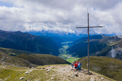
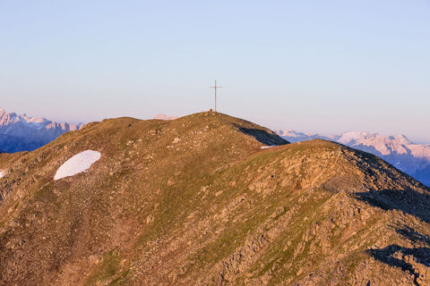
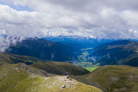
Starting from the valley head in San Maddalena/Val Casies Valley (1460m, refreshment point, parking), turn right over the stream of the valley and follow the markings no. 12 up to the Pfoital Valley and the alpine tree line. Continue straight into the valley to the Pfoialm (2134m, not a refreshment point) and through the Almtal, on a comfortable road, uphill to the fork. There, turn right, and by following the markings no. 13 climb upwards into the rear Hintere Gsieser Lenke (2539 m; beyond it, reach the lake Schwarzsee in just a few minutes via a trail (2455m). From the lake Schwarzsee, return to the rear Hintere Gsieser Lenke, turn right and follow the signs up and northwards to the mounds “Hellböden” (2710m). Continue along the ridge north-westwards down into the Pfoischarte (2617m). From there, follow the signs up and north-westwards to the mountain Hochkreuzspitze (2739m). Return: From the Hochkreuzspitze, return to the Pfoischarte and continue on path no. 12 over the southern back of the mountain to the Uwaldalm (2042m, refreshment point). Still on path no. 12, return to your starting point.

Descrierea

Schwarzsee (2455m) and mountain Hochkreuzspitze (2739m)
Mountain tour into uppermost Villgraten (Austria)

Starting point: Val Casies Valley/S.Maddalena head of the valley.
Length of the tour: 17 km
Circular hiking tour
Duration: 07:00 h
Difficulty: difficult
Difference in altitude: 1387 m

Tehnologie
5 / 6
Stare
5 / 6
Peisaj
5 / 6
Experiență
5 / 6
Cea mai bună perioadă a anului
Jan
Feb
Mar
Apr
Mai
Jun
Jul
Aug
Sep
Oct
Noi
Dec
Autor
Furnizat de Tourismusgenossenschaft Gsiesertal-Welsberg-Taisten
Creat pe 03. martie 2022
2.223 Apeluri
Tur de partajare
Harta
Mountain hike to Schwarzsee (2455m) and mountain Hochkreuzspitze (2739m)
grele
Drumeții montane
17,16 km
Eroare
S-a produs o eroare. Vă rugăm să încercați din nou.
Încă nu există recenzii
Scrieți o recenzie

Comentariile ajută alți utilizatori să își aleagă următoarea aventură. Vă rugăm să evaluați doar turul, nu și vremea sau gustarea dumneavoastră.

Selectați una dintre stele pentru a evalua turul
Tur rău
Tur slab
Tur mediocru
Tur bun
Tur excelent
bergfex logo Obțineți informații Întotdeauna live la fața locului cu peste 9.500 de camere web. bergfex Ca utilizator Pro, acum puteți vedea camerele web corespunzătoare pentru multe tururi în aplicația tururi de la. Acest lucru vă permite să vizualizați direct condițiile actuale.
Drumeții și urmărire

Drumeții și urmărire

Drumeții și urmărire
Peste 550.000 de sugestii de excursii, hărți detaliate și un planificator de traseu intuitiv fac din această aplicație un must-have pentru toți pasionații de natură.
Drumeții și urmărire