


Bruck: 732+736+730 | Drei Brüder


From the paid hiking parking lot above the holiday farm Oberreit, hike up the forest road through the forest; in some curves and switchbacks - past streams and wildflowers - to the alpine pasture area....
From the paid hiking parking lot above the holiday farm Oberreit, hike up the forest road through the forest; in some curves and switchbacks - past streams and wildflowers - to the alpine pasture area. At the fork in the path, either turn left to Erlhofalm or right to Heubergalm (both not managed).
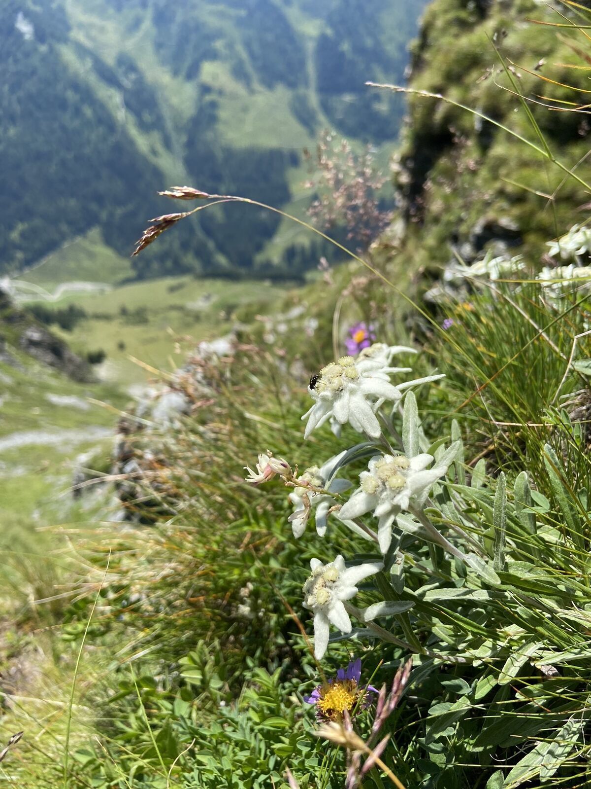
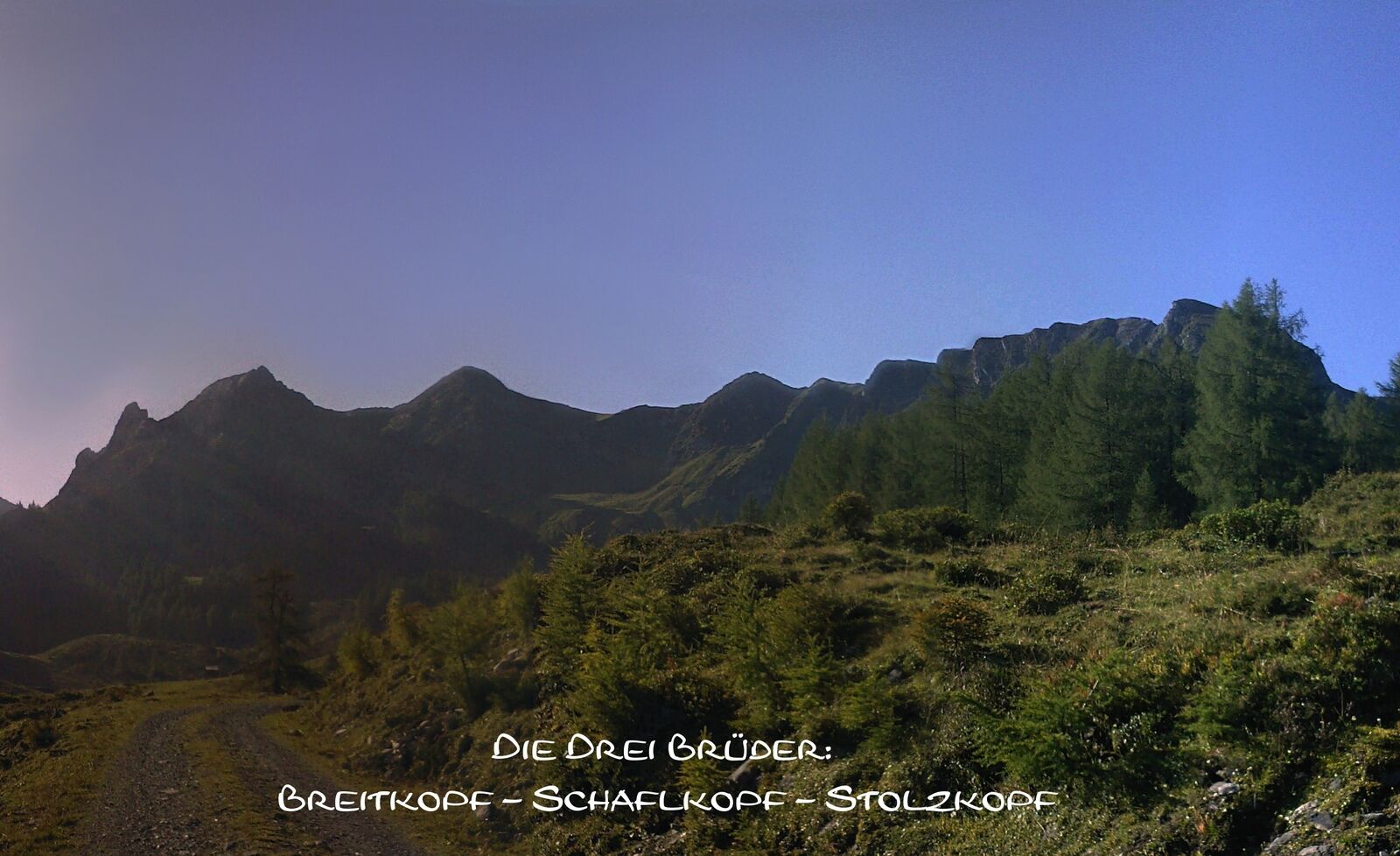
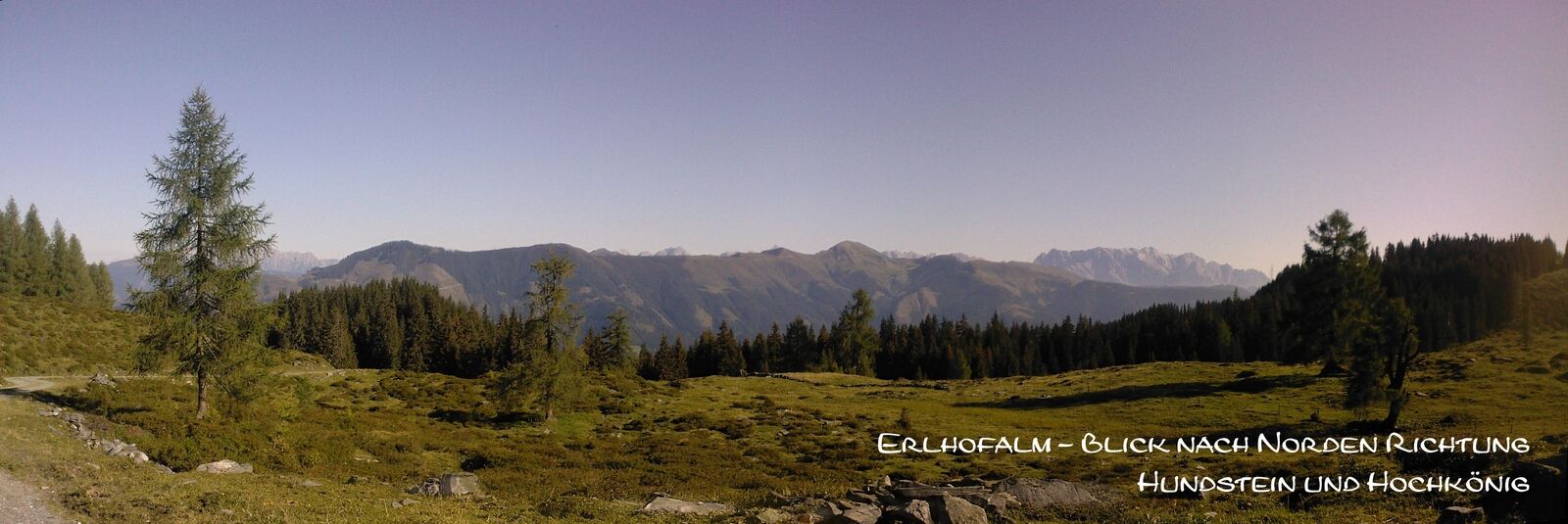
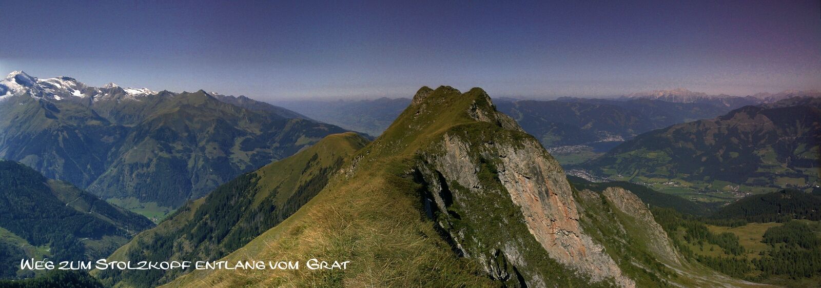
If you follow the path southeast to the Erlhofalm (1,653 m), you can already see the northern flank of the Drei Brüder above the meadows and pastures.
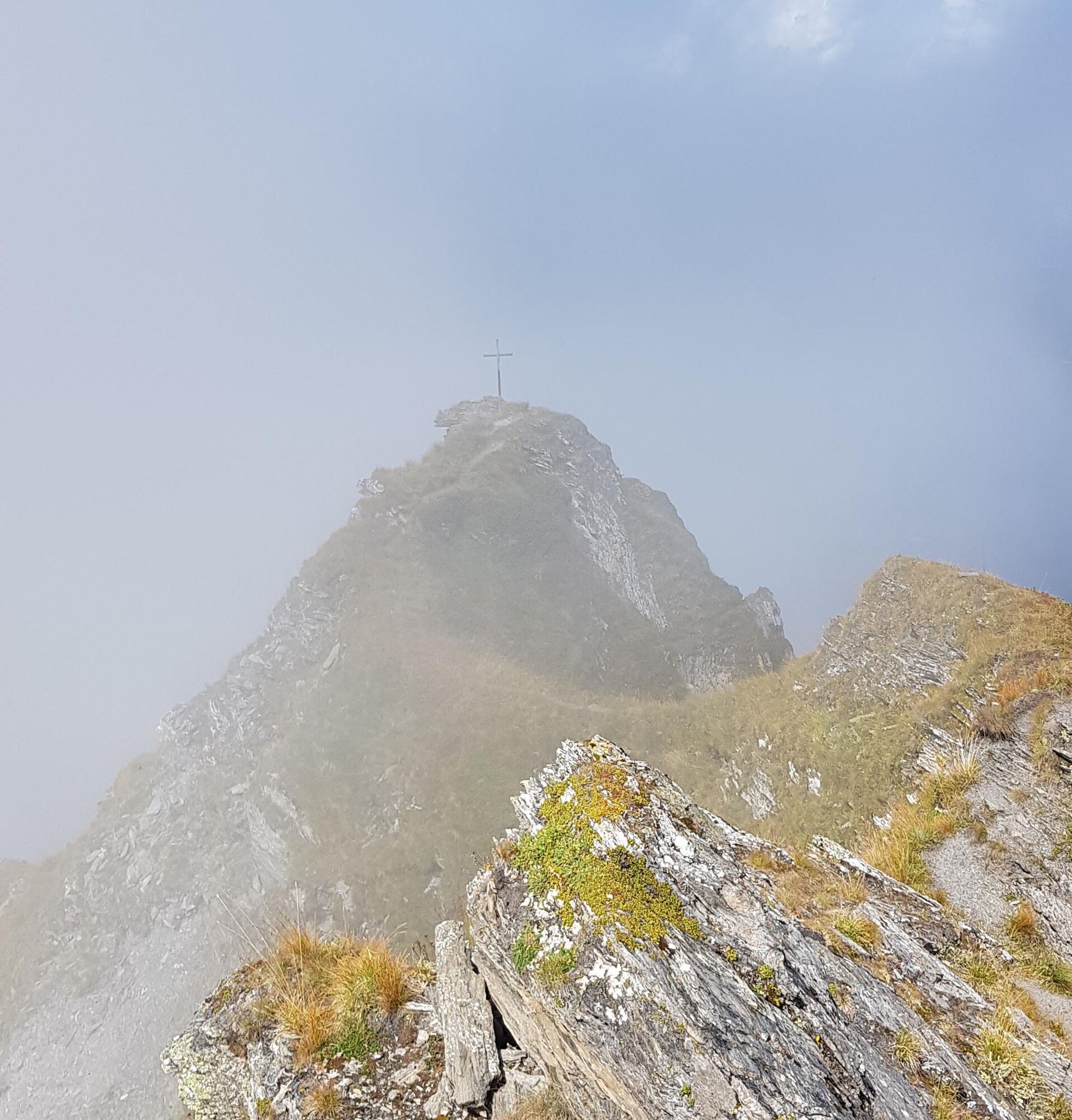
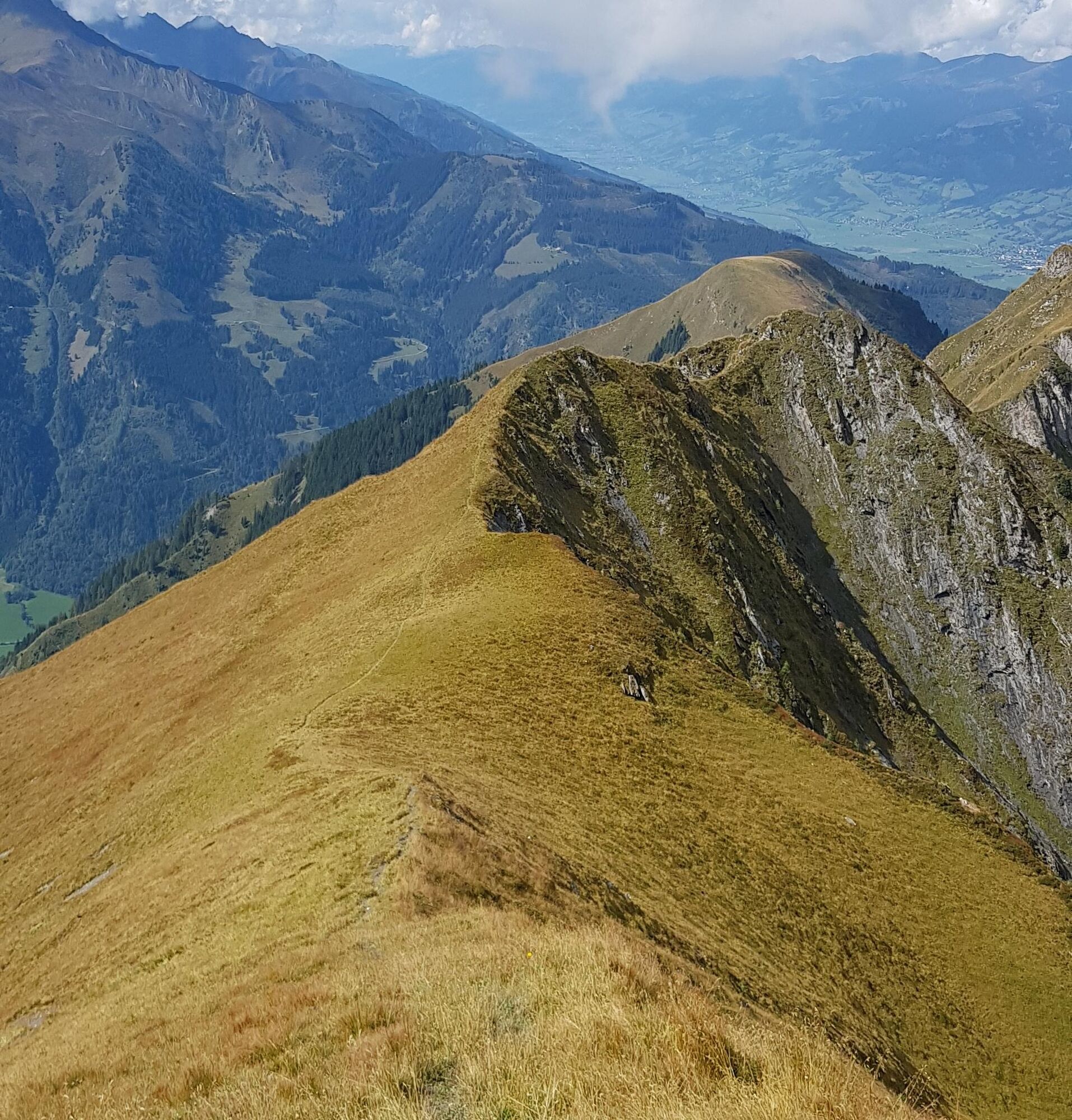
After the alpine pasture, the path continues on a narrow meadow trail. First over a small stream, then over scree fields and finally up a steep gully to the saddle between Breitkopf and Schaflkopf. From here the path starts to become exposed; freedom from vertigo and surefootedness are absolutely necessary!
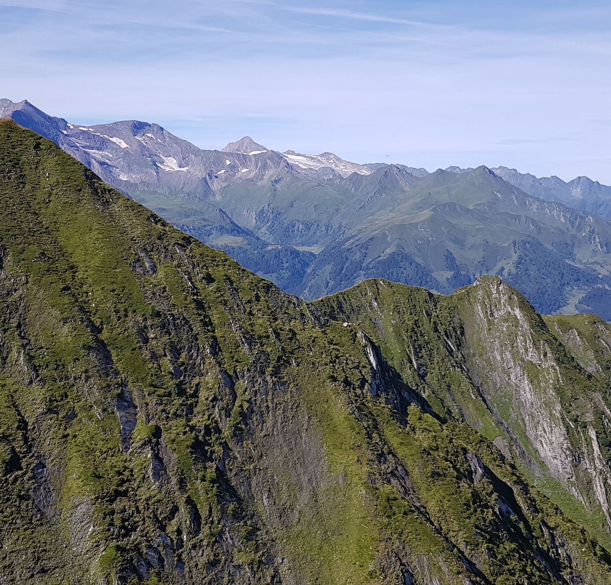
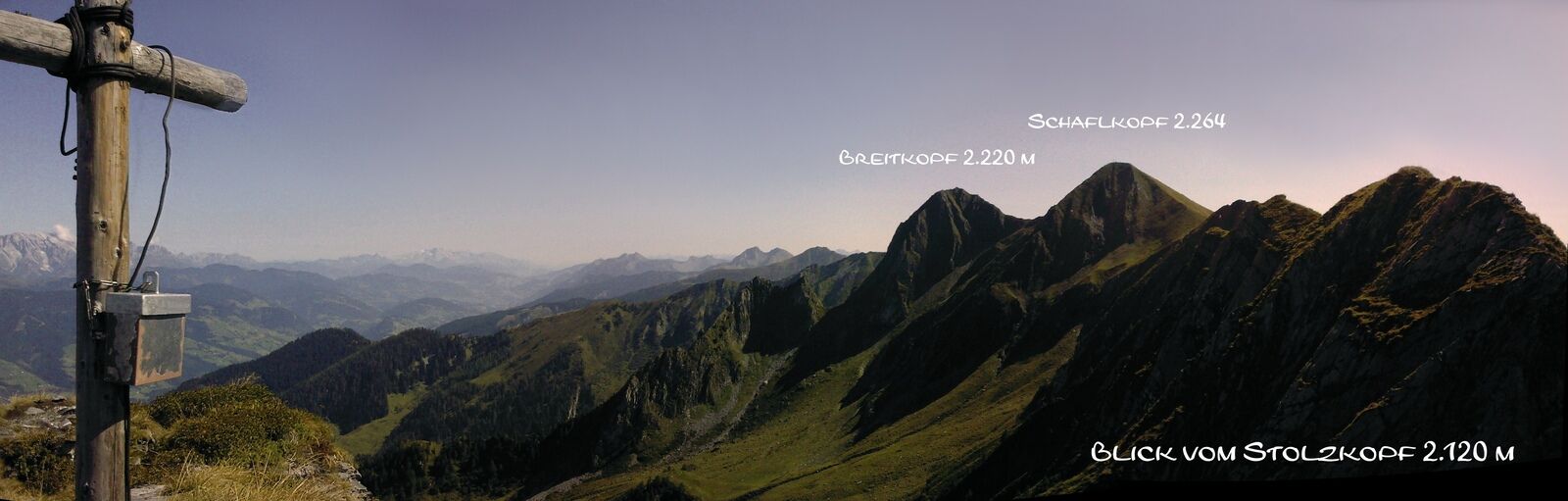
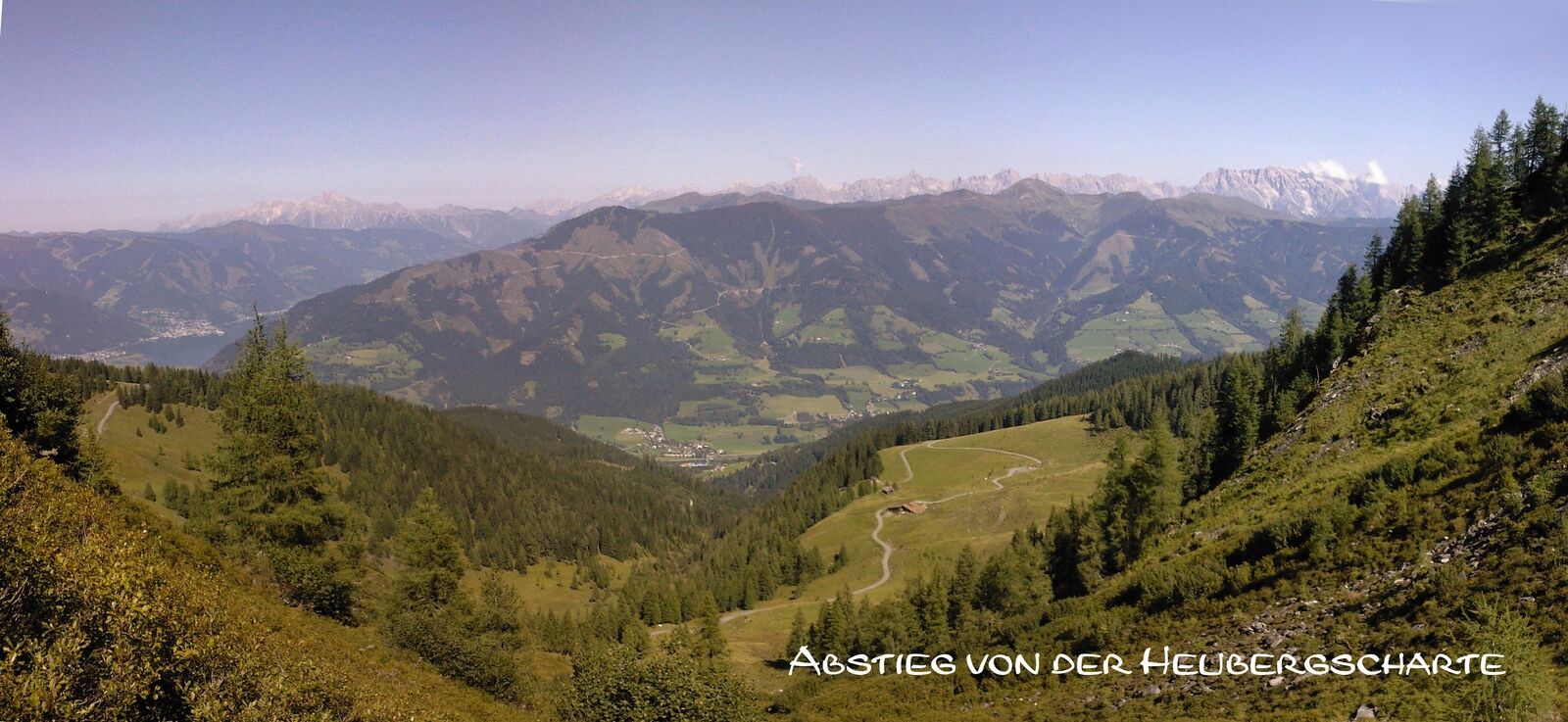
A breathtaking view opens up to the south towards the Hohe Tauern and to the north up to the Steinernes Meer.
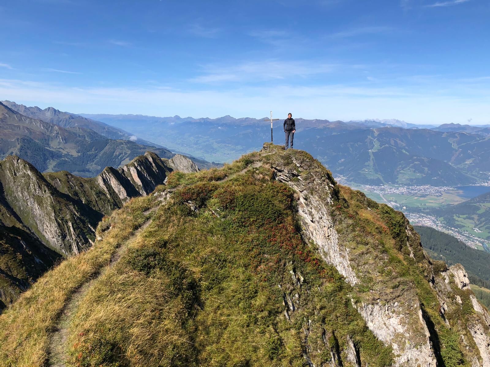
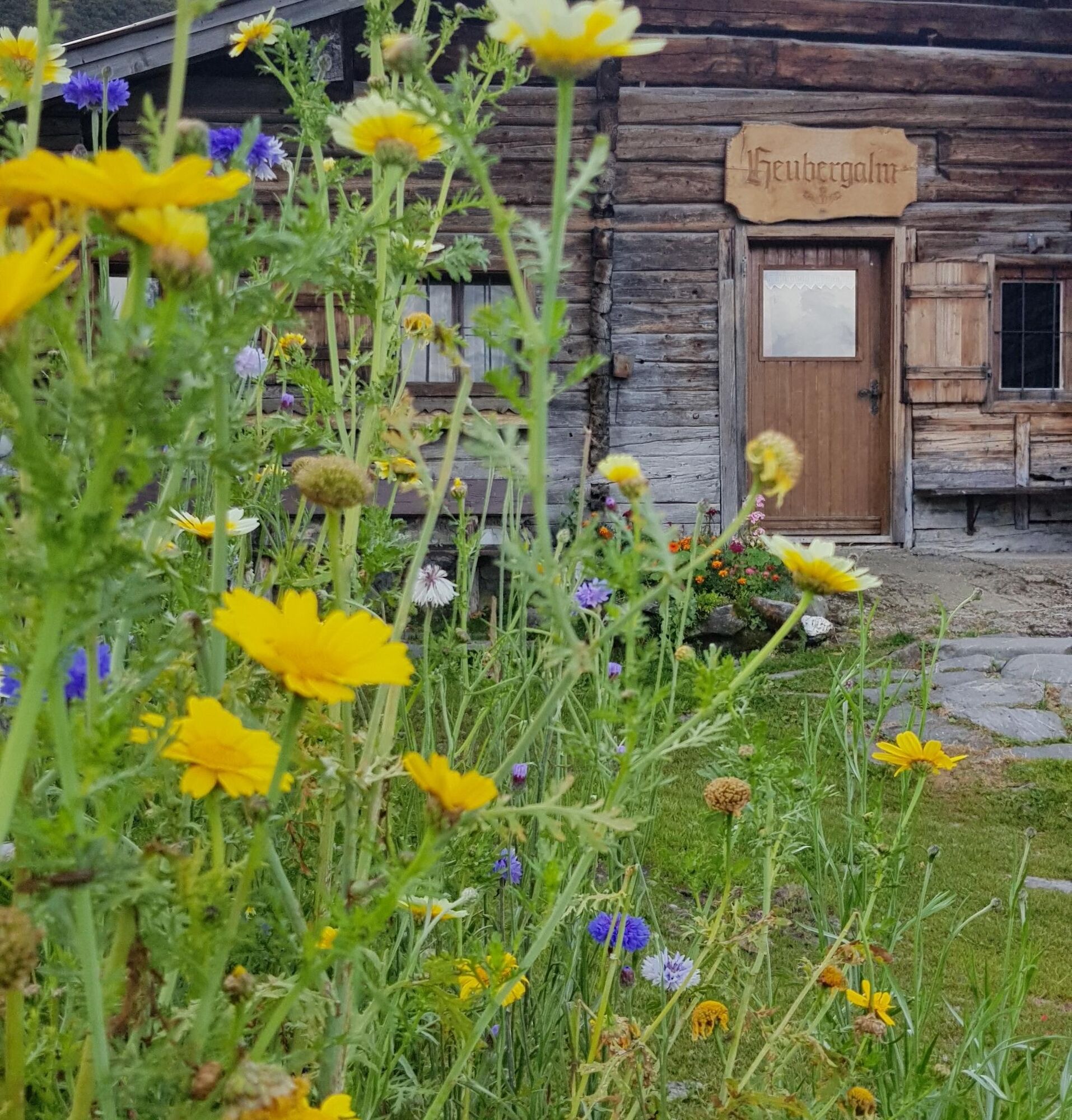
At the saddle, to the left you reach the summit of the 2,220 m high Breitkopf. To the right, the path first leads to Schaflkopf (2,264 m) and from there along the ridge to the third summit, the 2,120 m high Stolzkopf. Down a wide grassy ridge it goes to the Heubergscharte (1,915 m), then branching right further over meadows and pastures down to the forest road and along it to the Heubergalm (1,663 m).
Then back along the forest road to the junction Erlhofalm and the same way as the ascent back to the parking lot.
Walking time to Erlhofalm 1¾ hours; total crossing time approx. 6 hours.
From the paid hiking parking lot (2 €) above the holiday farm Oberreit, hike up the forest road through the forest; in some curves and switchbacks - past streams and wildflowers - to the alpine pasture area. At the fork in the path, either turn left to Erlhofalm or right to Heubergalm (both not managed).
If you follow the path southeast to Erlhofalm (1,653 m), you can already see the northern flank of the Drei Brüder above the meadows and pastures.
After the alpine pasture, the path continues on a narrow meadow trail. First over a small stream, then over scree fields and finally up a steep gully to the saddle between Breitkopf and Schaflkopf. From here the path starts to become exposed; freedom from vertigo and surefootedness are absolutely necessary!
A breathtaking view opens up to the south towards the Hohe Tauern and to the north up to the Steinernes Meer.
At the saddle, to the left you reach the summit of the 2,220 m high Breitkopf. To the right, the path first leads to Schaflkopf (2,264 m) and from there along the ridge to the third summit, the 2,120 m high Stolzkopf. Down a wide grassy ridge it goes to the Heubergscharte (1,915 m), then branching right further over meadows and pastures down to the forest road and along it to Heubergalm (1,663 m).
Then back along the forest road to the junction Erlhofalm and the same way as the ascent back to the parking lot.
Walking time to Erlhofalm 1¾ hours; total crossing time approx. 6 hours.
Da
Sturdy footwear + standard hiking equipment
From Bruck by car a short stretch on the Pinzgauer Federal Road towards Taxenbach to the exit at the Heimhofer sawmill. Over railroad tracks and Salzach river, up the road to the junction “Feriendorf Oberreit.” Up the narrow farm road Kesselriß, past the holiday village Oberreit, to the parking lot (paid) in front of the barrier at 1,180 m.
Alternatively, take Postbus line 640 to the stop Bruck/Glocknerstraße Hauserdorf and continue on foot from there (additional 3.8 km and 470 m ascent)
Postbus line 640 to the stop Bruck/Glocknerstraße Hauserdorf and then continue on foot (additional 3.8 km and 470 m ascent)
Parking (paid) in front of the barrier (1,180 m)
Tururi populare în vecinătate
-
4,5
Sigmund Thun Klamm
luminăExcursie 3,10 km -
4,7
Fusch: Gleiwitzer Hütte
greleExcursie 8,26 km -
4,6
3 Oktober Fusch Walcher Grung und Hohalm
mediuExcursie 8,57 km -
4,8
Sigmund Thun Klamm, Klammsee, Bürgkogel
luminăExcursie 4,56 km -
4,4
Thumersbach, Runde um den Zeller See
luminăExcursie 13,3 km -
4,7
Von Embach zum Kitzlochklamm und über Maria Elend zurück
mediuExcursie 9,36 km -
Fusch an der Glocknerstrasse: Zum Fuschertörl
Mountainbike 25,4 km -
4,9
Großes Wiesbachhorn 3564 mnv Kaprun, Austrija
greleExcursie 13,4 km -
4,6
Areitweg - Plettsauerkopf - Rundwanderung
mediuExcursie 11,8 km -
4,2
Fusch: 727 | Käfertal nature adventure path
luminăExcursie 5,95 km

Drumeții și urmărire


Nu ratați ofertele și inspirația pentru următoarea dvs. vacanță
Adresa dvs. de e-mail a fost adăugat la lista de corespondență.