


Großarl: Gründegg, 2,168 m


Fotografii ale utilizatorilor noștri
-
 © Helen LöfflerCreat pe 09.02.2025
 -
 © Helen LöfflerCreat pe 09.02.2025
 -
 © Peter De Smedt2Creat pe 08.10.2025
 -
 © Ilka LöserCreat pe 04.08.2025
 -
 © Peter De Smedt2Creat pe 08.10.2025
 -
 © Peter De Smedt2Creat pe 08.10.2025
 -
 © Peter De Smedt2Creat pe 08.10.2025
 -
 © Peter De Smedt2Creat pe 08.10.2025
 -
 © Peter De Smedt2Creat pe 08.10.2025
 -
 © Peter De Smedt2Creat pe 08.10.2025
 -
 © Peter De Smedt2Creat pe 08.10.2025
 -
 © Peter De Smedt2Creat pe 08.10.2025
 -
 © Noah RoeCreat pe 07.09.2025
 -
 © Olaf SchmidtCreat pe 07.09.2025


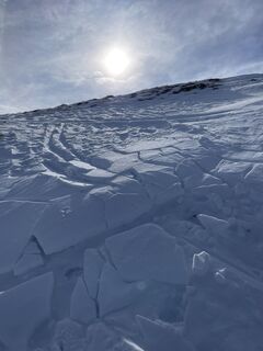
This scenic, moderate ski route requires appropriate experience and skiing skills for the descent.
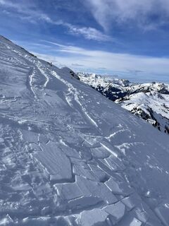
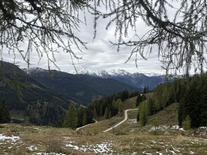
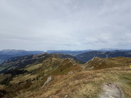
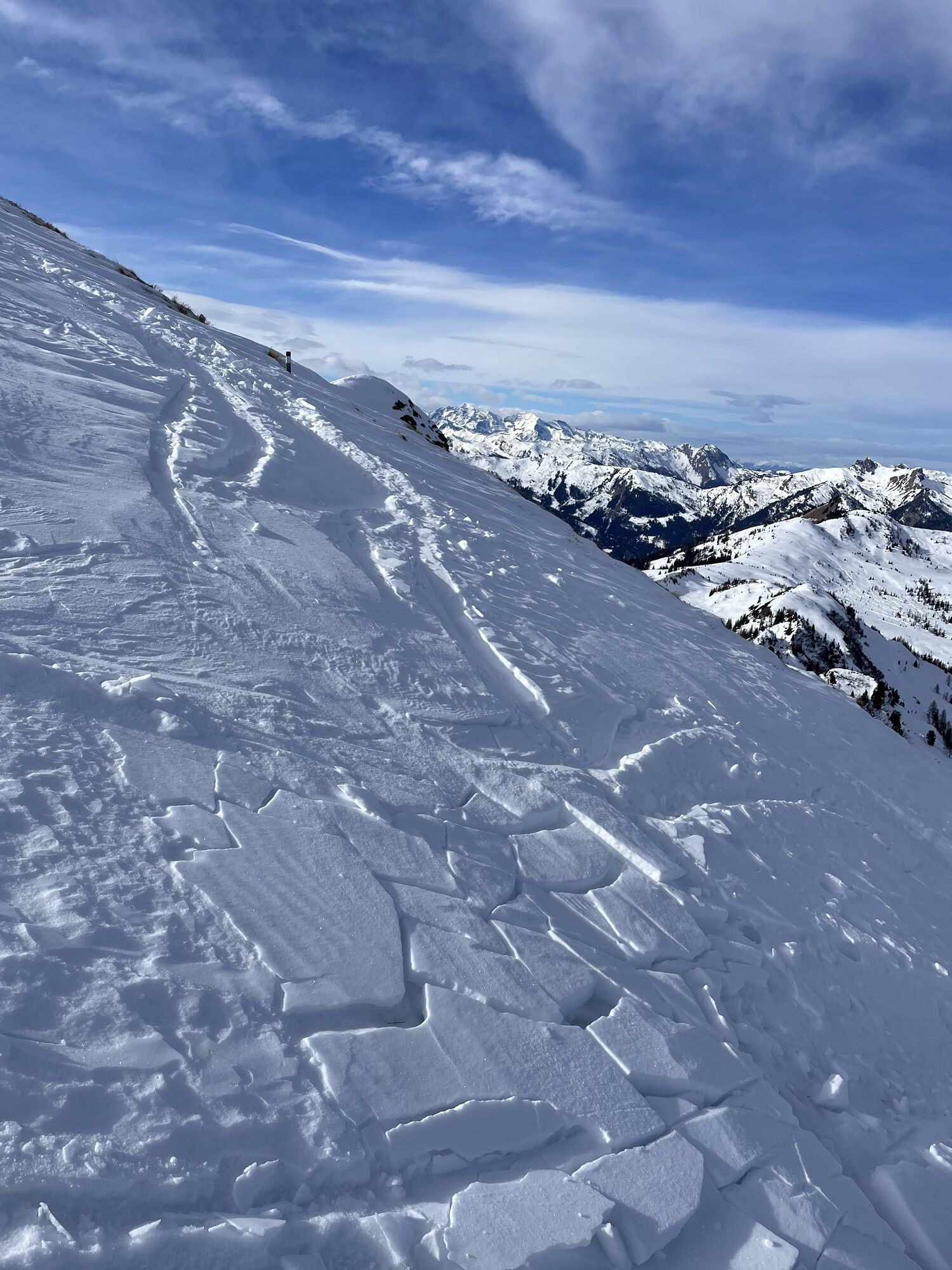
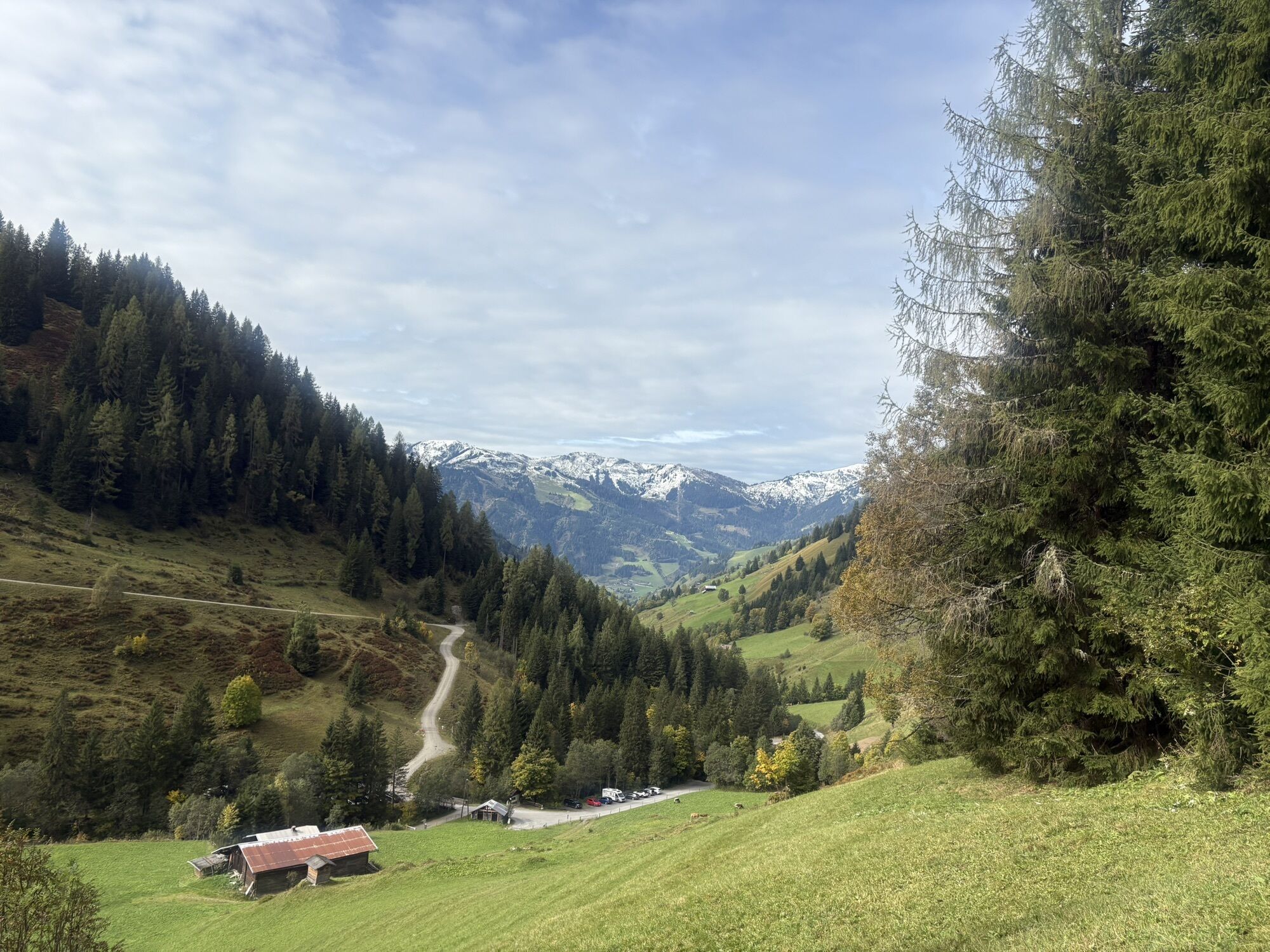
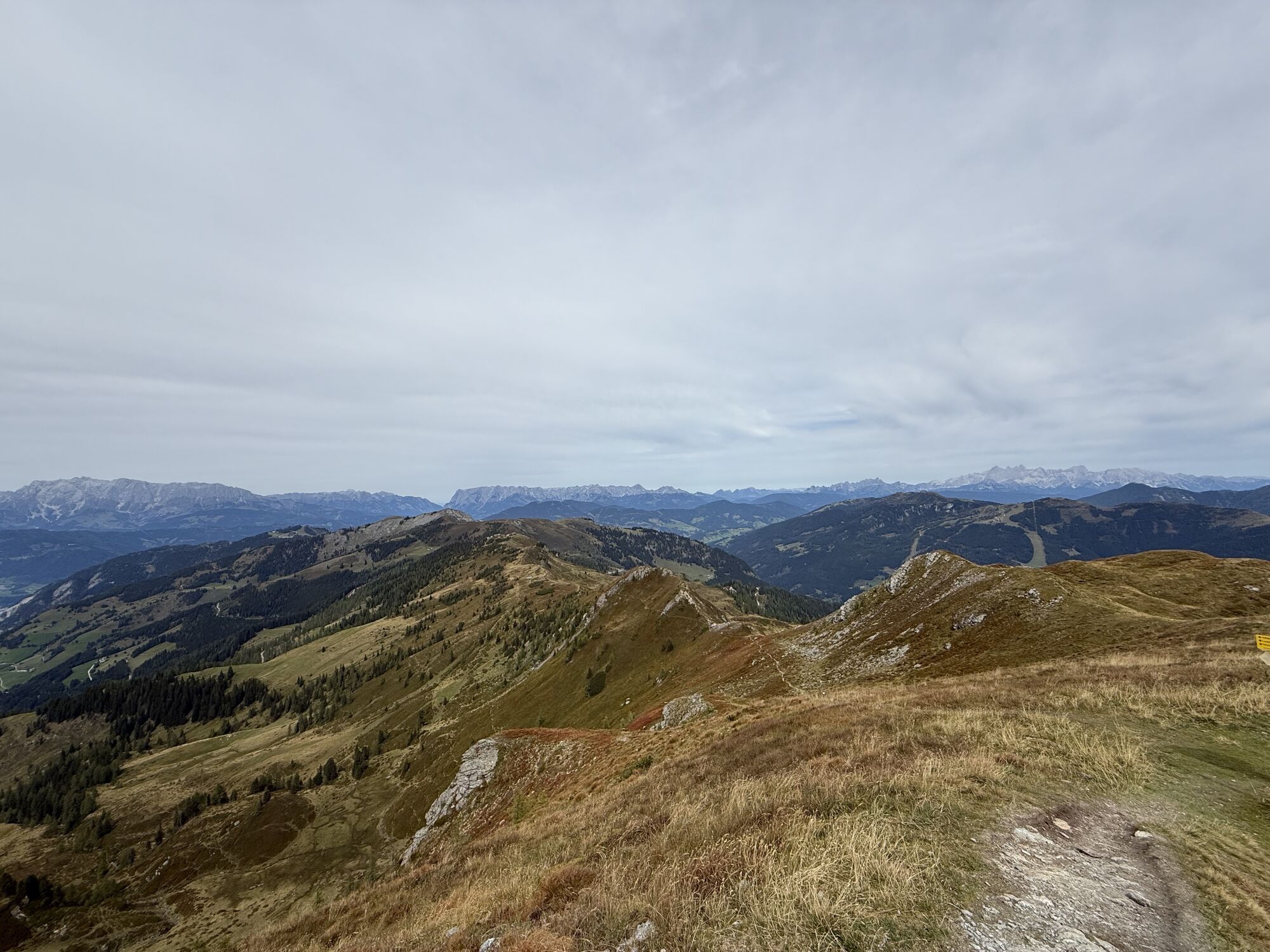
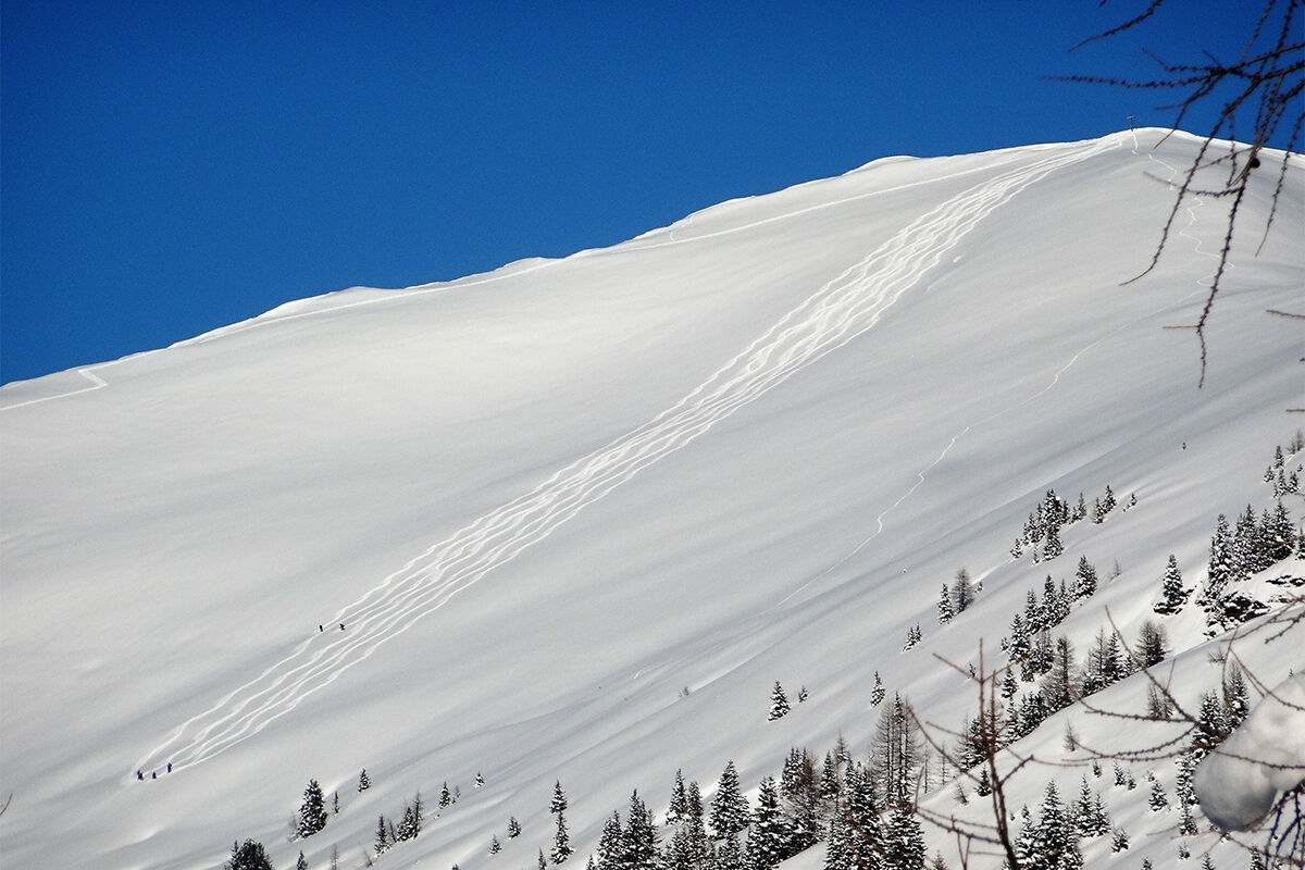
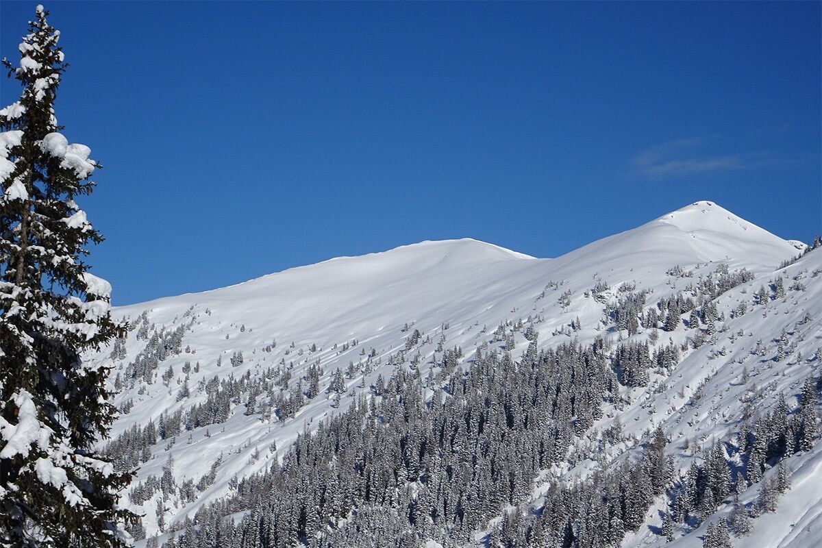
From Gründegg you have a wonderful view of the surrounding mountain world. The panorama stretches over...
This scenic, moderate ski route requires appropriate experience and skiing skills for the descent.
From Gründegg you have a wonderful view of the surrounding mountain world. The panorama stretches over Großglockner, Sonnblick, Schareck, Ankogel group with Ankogel/Keeskogel/Tischlerkarspitz/Preimlspitz, Weißeck, Mosermandl, Faulkogel, Dachstein, Bischofsmütze, Tennengebirge, Hagengebirge, Hochkönig massif, Steinernes Meer and far in the back just visible the Wilder Kaiser.
ASCENT: approx. 2.5 hours
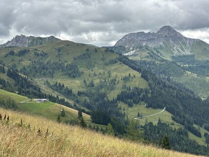
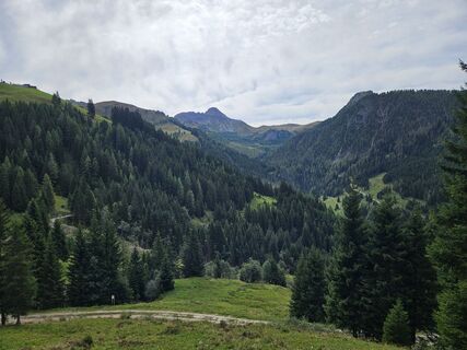
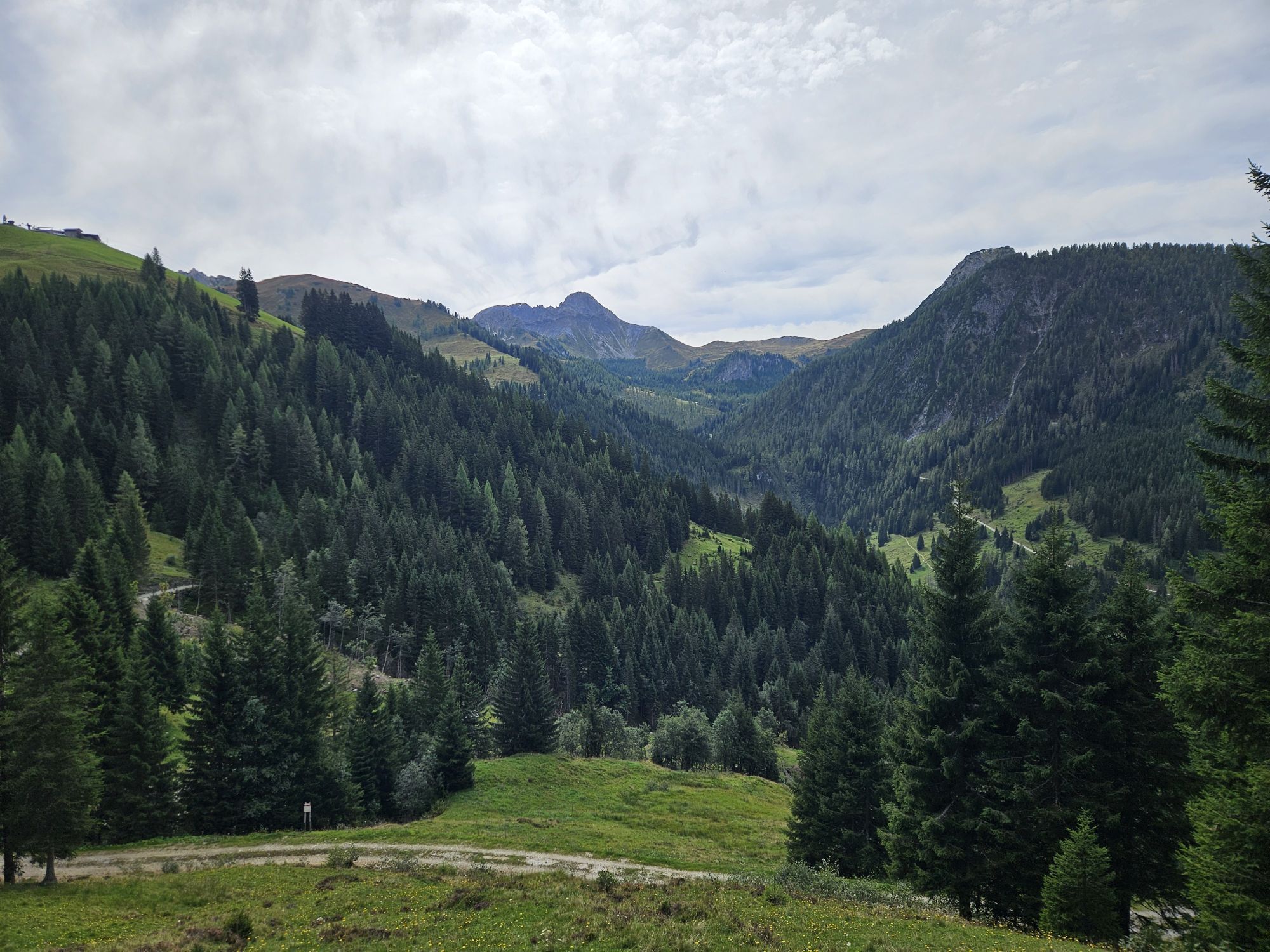
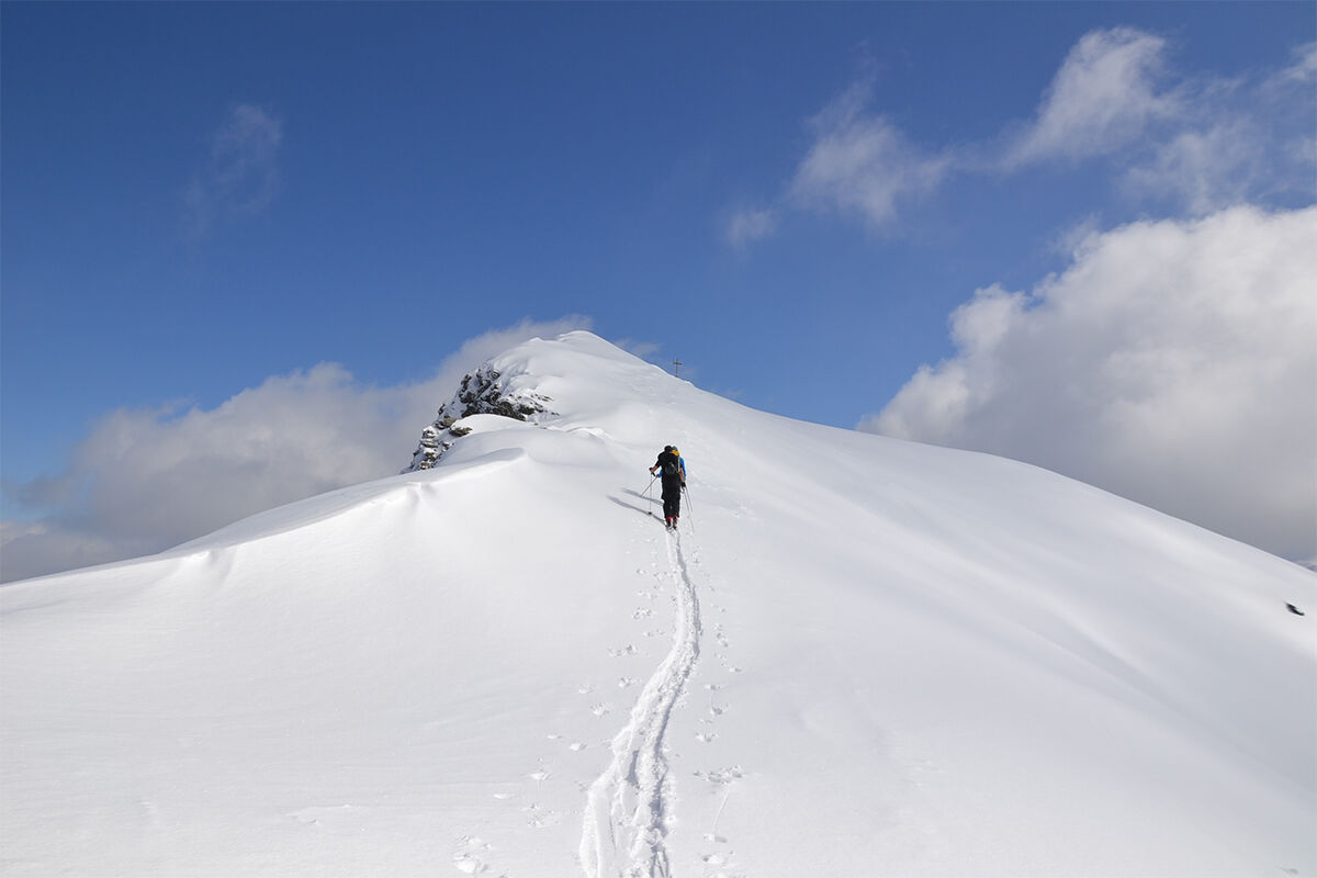
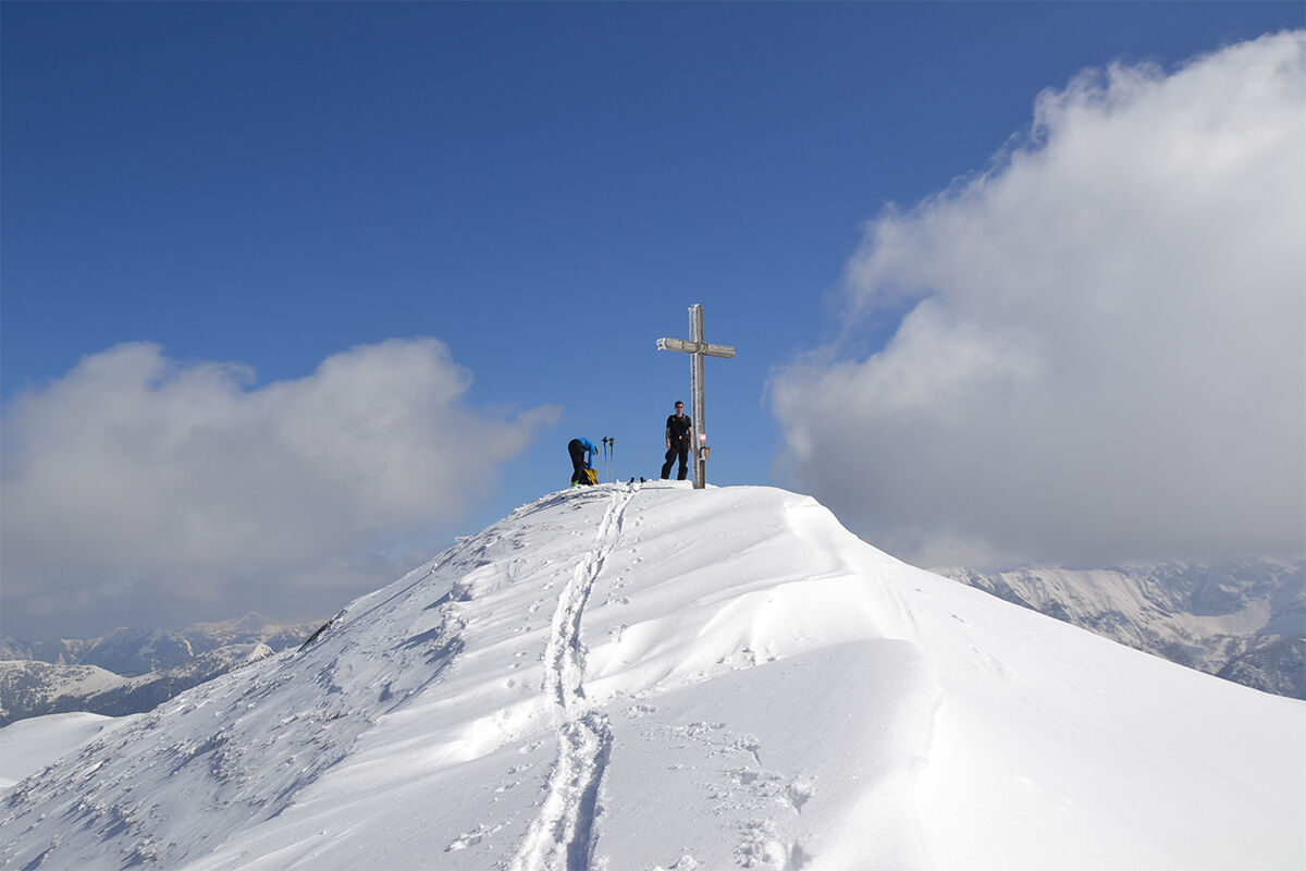
From the Grundlehen parking lot (avalanche transceiver checkpoint), follow the hiking trail past the Ellmau-Heimalm to the Ellmaualm, 1,794 m. From there, ascend moderately steeply over open slopes to the mountain ridge. Turning right on this ridge and heading east, first a bit flatter, then over a short steep section to the summit cross of Gründegg, 2,168 m.
DESCENT: approx. 1 hour
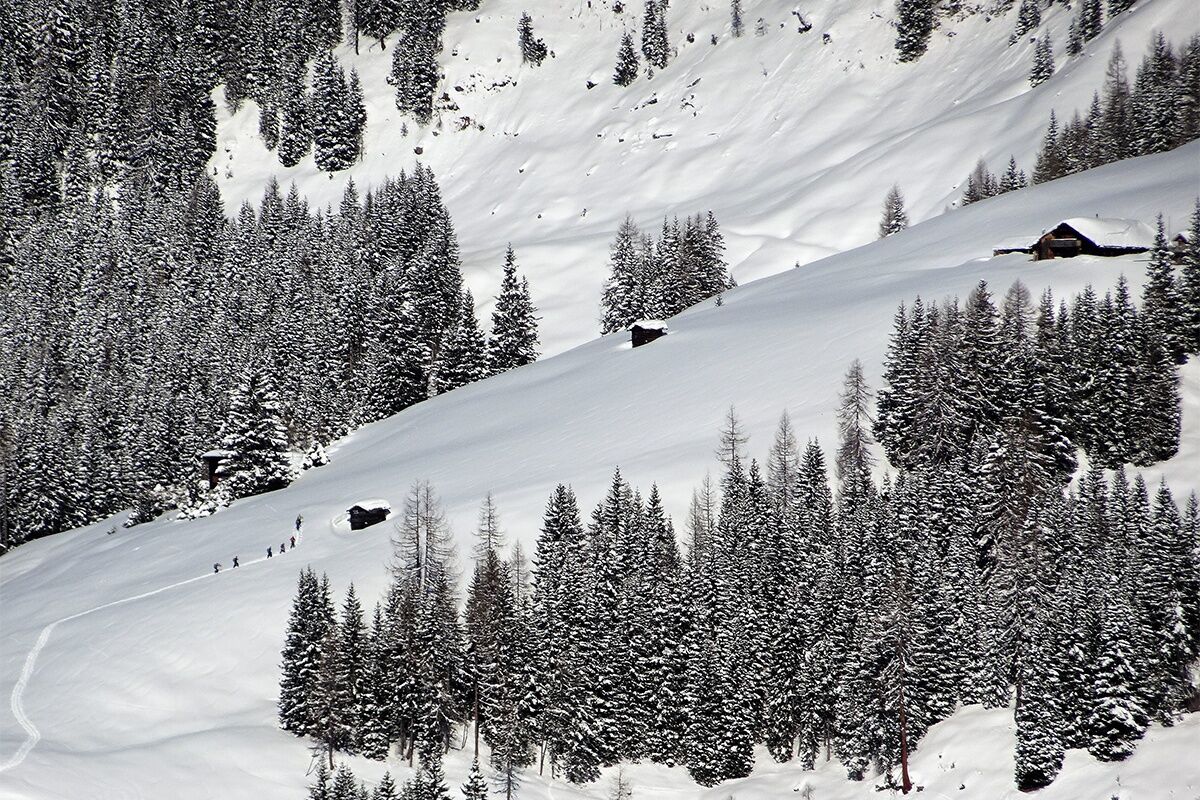
Along the ascent track to Ellmaual or, if snow conditions are safe, directly in the fall line from the summit to Ellmau-Heimalm. The last section is best skied along the ascent track following the hiking trail.
Da
Da
Ski touring equipment, avalanche transceiver, shovel, probe, mobile phone, first aid kit, and bivy sack. An airbag system increases chances of survival.
The starting point for this route is the Grundlehen parking lot (avalanche transceiver checkpoint), 1,333 m. It can be reached from St. Johann im Pongau via the Großarler Landesstraße (L109) as follows: At the Großarl-Mitte roundabout, take the 3rd exit to Ellmau valley, continue to the market square, turn left there, and drive about 5.5 km into the Ellmau valley.
Public bus Ellmautal No. 541 to Klausbauer
Grundlehen parking lot
In combination with Loosbühel, this route is a nice day outing.
Tururi populare în vecinătate
-
4,5
Mosermandl Windischscharte, Salzburger Land/Österreich
greleExcursie 14,6 km -
4,2
Ennskraxn (2410m)
greleExcursie 14,7 km -
4,6
Gasteiner Höhenweg von Bad Gastein nach Bad Hofgastein
luminăExcursie 8,58 km -
4,6
Ski route Lackenkogel
mediuSkitour 7,82 km -
4,2
Großarl: Unterwandalm - Karseggalm - Breitenebenalm
mediuExcursie 5,93 km -
4,4
Wasserfall Bad Hofgastein
luminăExcursie 3,89 km -
4,4
Ski tour Liebeseck
greleSkitour 14,1 km -
4,8
Großarl: Mooslehenalm – Niggeltalalm – Viehhausalm
mediuExcursie 5,44 km -
4,5
Penkkopf via Kleinarler hut from Kleinarl
mediuSkitour 4,35 km -
4,8
Liechtensteinklamm mit Helix
luminăTraseu tematic 3 km

Drumeții și urmărire


Nu ratați ofertele și inspirația pentru următoarea dvs. vacanță
Adresa dvs. de e-mail a fost adăugat la lista de corespondență.