


Bike & Hike Pichlalm–Lausköpfe – BIKING SECTION


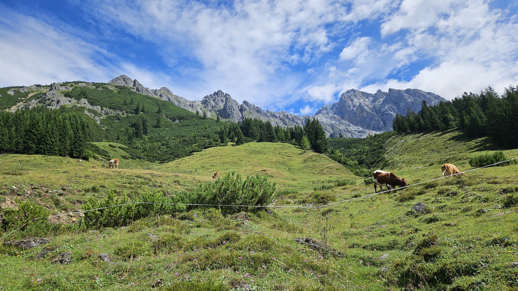
The bike section of the Bike & Hike tour takes you from Dienten with your (e-)mountain bike up to the Pichlalm, where the hike to the Lausköpfe begins.
The starting point is the Dienten Ski Center, where...
The bike section of the Bike & Hike tour takes you from Dienten with your (e-)mountain bike up to the Pichlalm, where the hike to the Lausköpfe begins.
The starting point is the Dienten Ski Center, where you can also rent a bike. From there, turn right onto Dientner Landesstraße until you reach the roundabout. Continue towards Filzensattel/Saalfelden (B164). After about 1.5 km of steep climbing, turn right onto the farm road no. 67, which leads directly towards Rohrmoosgut. Just before the farm, a rough gravel road branches off to the left — this is where the exciting ascent to the Pichlalm begins. At the alpine hut, you can park your bike and start your hike to the Lausköpfe.
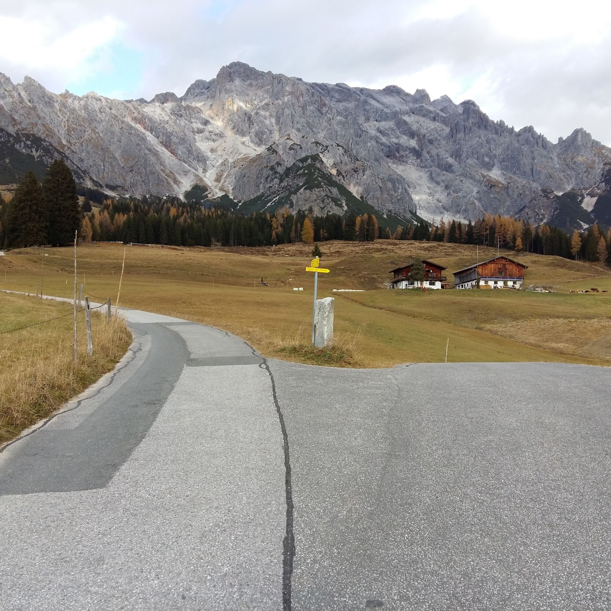
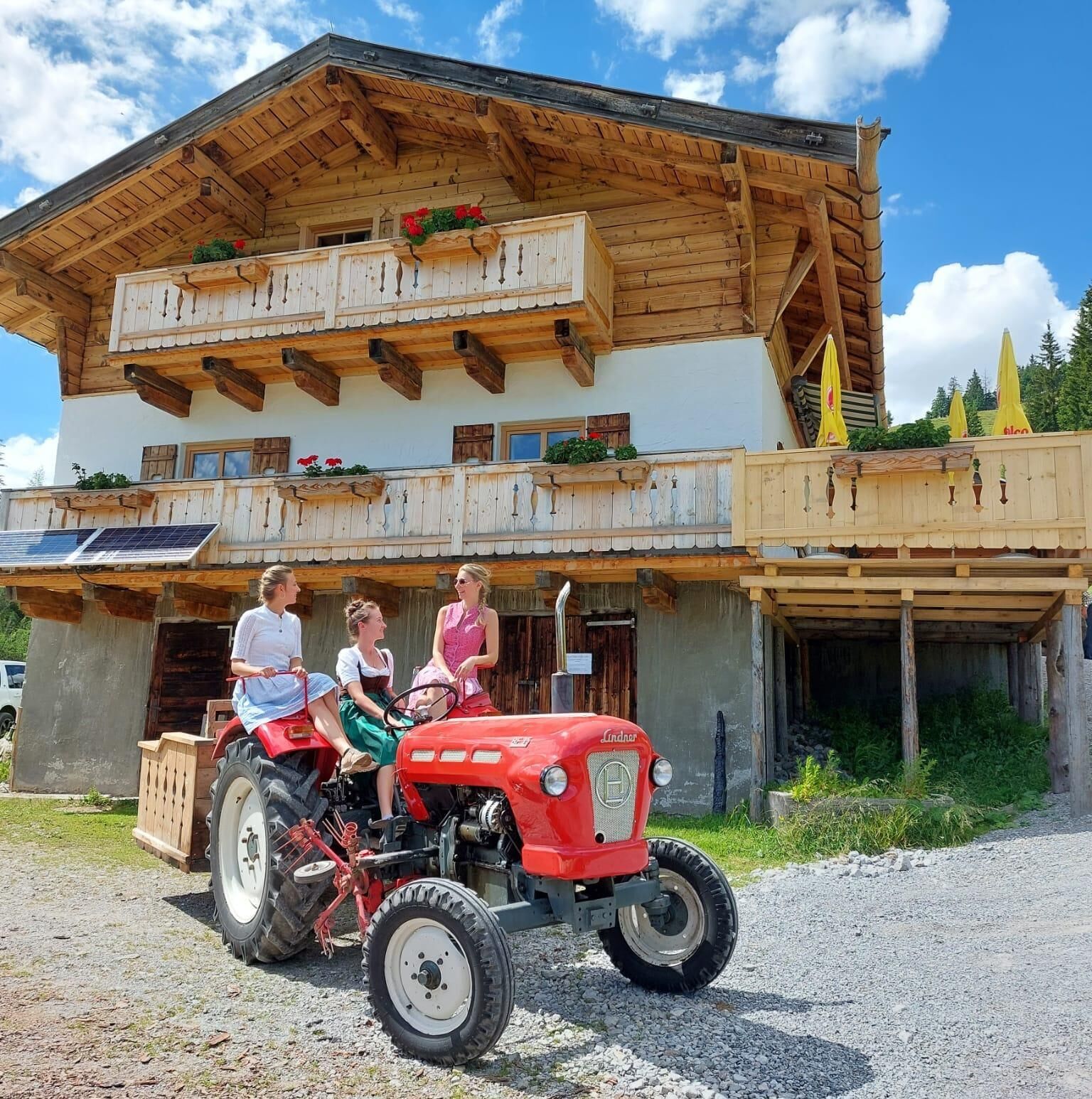
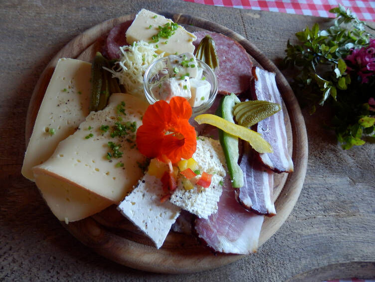
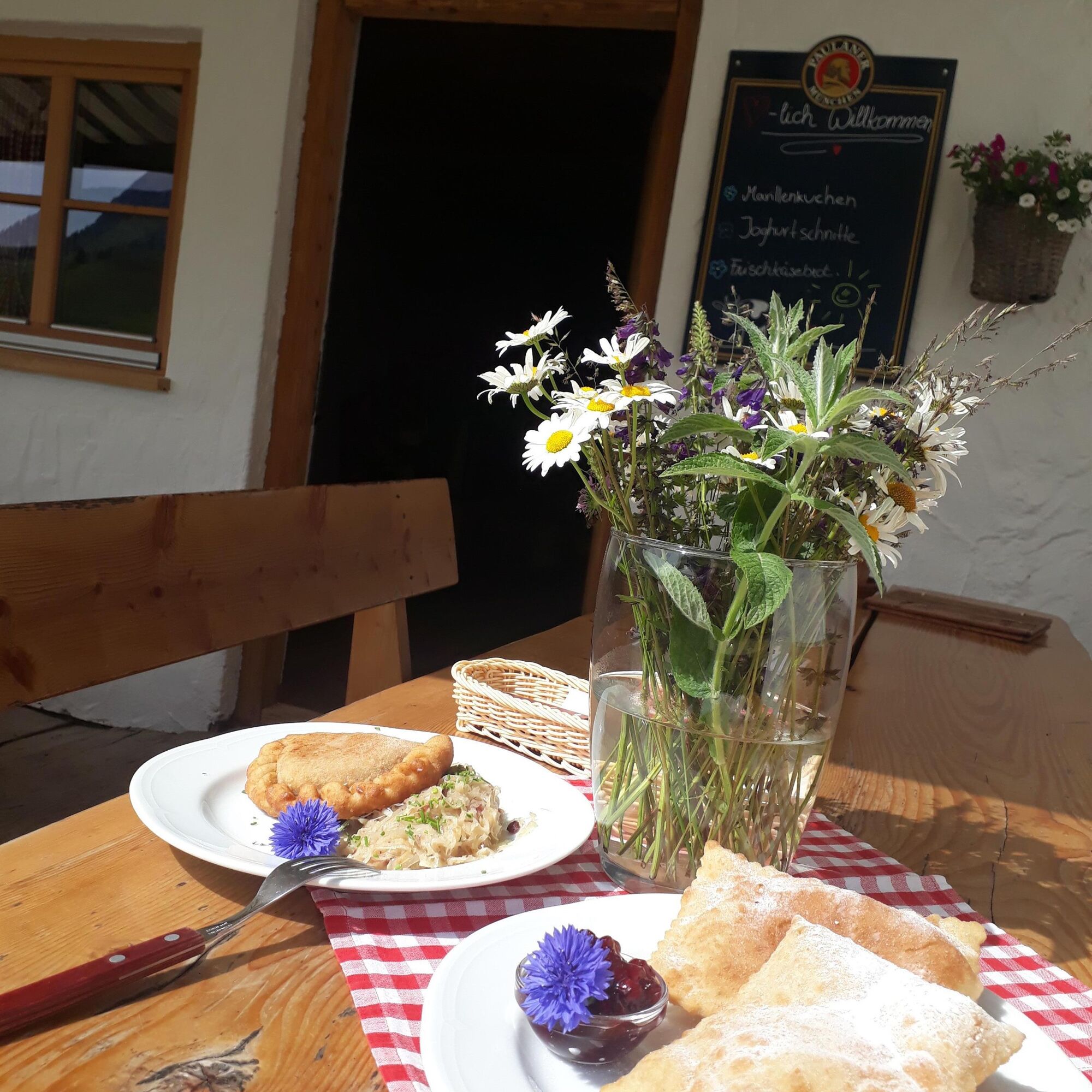
Our tip: Treat yourself before or after the hike with a visit to the Pichlalm, which offers many products straight from the farm, before biking back down to the valley. In July, August, and September, every Thursday is “Bladltag” (sweet and sour) at the Pichlalm!
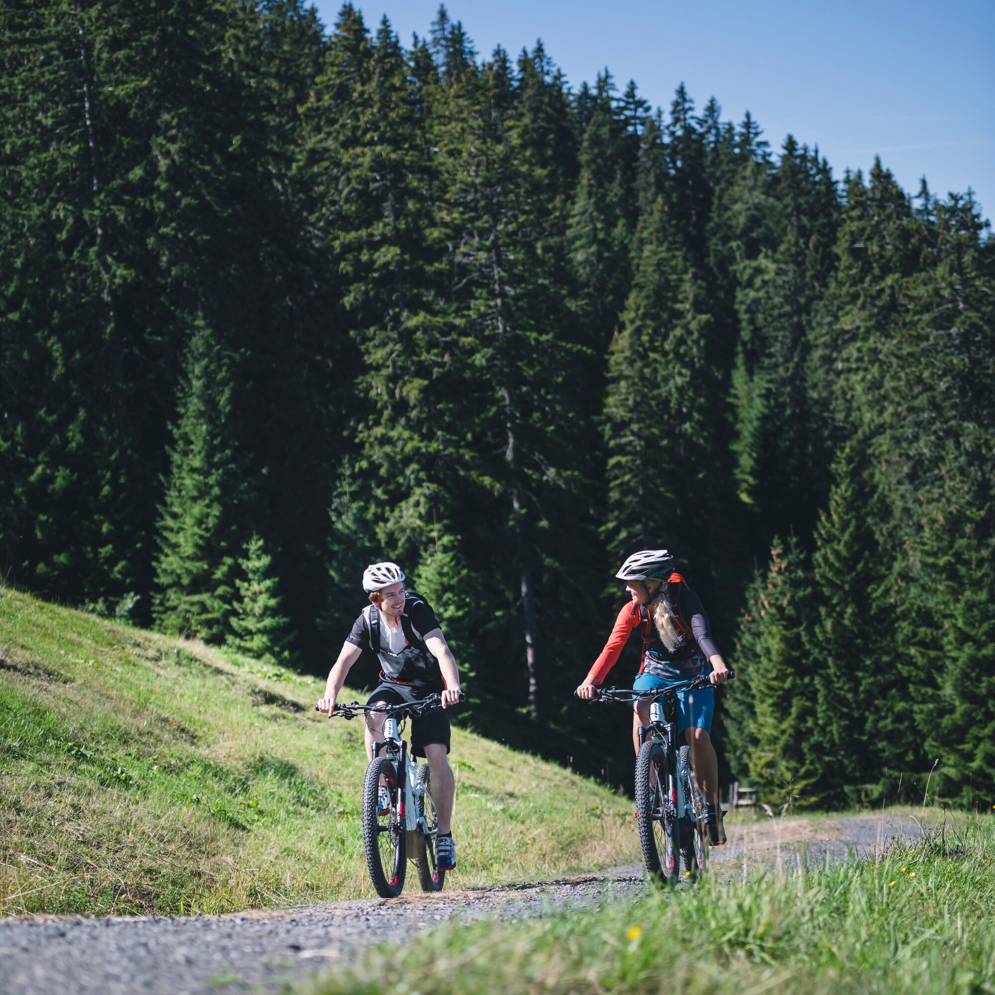
Simply follow the signs for the "DI 02 Pichlalm Tour." Starting from the Dienten Ski Center (MTB and eBike rental and charging station), turn right onto Dientner Landesstraße and follow the road until you reach the roundabout. From there, continue towards Filzensattel/Saalfelden (B164). After about 1.5 km of steep climbing, turn right onto the farm road, which leads towards Rohrmoosgut. Just before the farm, a rough gravel road begins on the left, leading up to the Pichlalm. The coarse gravel makes the short ascent to the hut a bit challenging. The return route follows the same path back to the starting point. This bike route offers not only an exciting ride but also the chance to enjoy the nature and landscape around Dienten!
Kontrollierte Bikeausrüstung mit Helm
Sonnenbrille
Sonnenschutz
Regenschutz
Getränke und eine kleine Jause
Notwendige Medikamente
Erste Hilfe Set
Bikekarte
Fair Play!
Ride only on marked trails!
Close all gates, barriers, and pasture fences!
Obey the traffic regulations!
Overtake only at walking pace!
Be respectful towards other nature users and forestry and hunting staff!
Show consideration for animals!
Do not leave any litter in nature!
Act responsibly!
Check the weather forecast—fog and bad weather can come suddenly.
Emergency numbers: Alpine emergency: 140 International emergency: 112 Rescue: 144
Arrival from Salzburg: Take the A10 motorway to the Bischofshofen exit, then continue on the B311 towards Bischofshofen. Follow the Hochkönig federal road (B164) to Mühlbach and onward to Dienten.
Arrival from Innsbruck / Kufstein: Take the Loferer Straße (B178) towards St. Johann in Tirol, then continue via the Hochkönig federal road (B164) through Saalfelden and Maria Alm to Dienten or to Filzensattel.
A valid motorway vignette is required for using Austria’s motorways and expressways. It is also mandatory to carry a first aid kit, warning triangle, and high-visibility vest in your vehicle. For more information, visit ASFINAG.
Free parking available at the Dienten Ski Center.
Further Information on Bike Tours and Activities in the Hochkönig Region
For detailed information about maps, the opening hours of mountain lifts, huts, and alpine pastures during summer, we recommend visiting the local service center. There you will also receive valuable tips on the best tours and current conditions.
Summer opening hours of the mountain lifts: The mountain lifts operate with varying schedules during the summer months, which can change depending on weather and season. Please check the current operating times in advance.
Summer opening hours of huts & alpine pastures: The huts and alpine pastures in the region are ideal rest stops for hikers and bikers. Their opening hours may vary depending on the season and day of the week. The friendly hosts will be happy to advise you on local specialties and current offers.
For more information, please visit our website: 🌠www.hochkoenig.at
If you have any questions or need specific information, feel free to contact us:
📧 Email: region@hochkoenig.at 📞 Phone: +43 (0)6584 20388
We look forward to assisting you and wish you lots of fun exploring the beautiful hiking and biking region of Hochkönig!
A visit to the Pichlalm is a must on this tour.
Camere web ale turului
-
Mühlbach am Hochkönig
-
Maria Alm - Hochmaisbahn
-
Bergstation Kings Cab
-
Hinterthal - Urslauerhof
-
Hinterthal - Urslauerhof
-
Matrashaus am Hochkönig
-
Grünegg Alm & Edelbrennerei
-
Dienten - Übergossene Alm Resort
-
Dienten - Almsee
-
Dienten - Übergossene Alm Resort
-
Bergstation Kings Cab
-
Bergstation Kings Cab
-
Bergstation Kings Cab
-
Bergstation Kings Cab
-
Bergstation Kings Cab
-
Bergstation Kings Cab
-
Bergstation Kings Cab
Tururi populare în vecinătate
-
4,8
Summit storming route Taghaube
greleExcursie 6,25 km -
4,9
Hochkönig - Gipfel der Gefühle - Matrashaus
greleExcursie 20,9 km -
3,8
Hochkönig summit route - main ascent
greleExcursie 18,1 km -
4,7
Panorama hike to the Hochkeil
mediuExcursie 6,07 km -
4,8
Summit stormer route Lauskopf
greleExcursie 8,16 km -
3,6
Wanderung zur Ostpreußenhütte in Werfen (1.630 m)
mediuExcursie 11,2 km -
4,7
About the "Four Huts circular route" to Windraucheggalm
mediuExcursie 10,1 km -
3,7
Auf die Ostpreussenhütte
mediuExcursie 16,6 km -
4,4
Riemannhaus
greleExcursie 3,69 km -
3,9
Mühlbacher Höhenweg
mediuExcursie 11,2 km

Drumeții și urmărire


Nu ratați ofertele și inspirația pentru următoarea dvs. vacanță
Adresa dvs. de e-mail a fost adăugat la lista de corespondență.