


Gad-Monfol-Ferro di Cavallo


Path no. 3 in the Parco del Gran Bosco Park covers a total difference in altitude of about 1,000 metres and offers a variety of landscapes. In the lower part, the Rio Gran Comba has left traces of the...
Path no. 3 in the Parco del Gran Bosco Park covers a total difference in altitude of about 1,000 metres and offers a variety of landscapes. In the lower part, the Rio Gran Comba has left traces of the many floods of the past; in the upper part, the path passes by the Chapel of San Domenico, on a sunny and isolated hill that was once cultivated, and then reaches the hamlet of Monfol, in a privileged and panoramic position. The last section crosses an alpine area of woods and pastures.
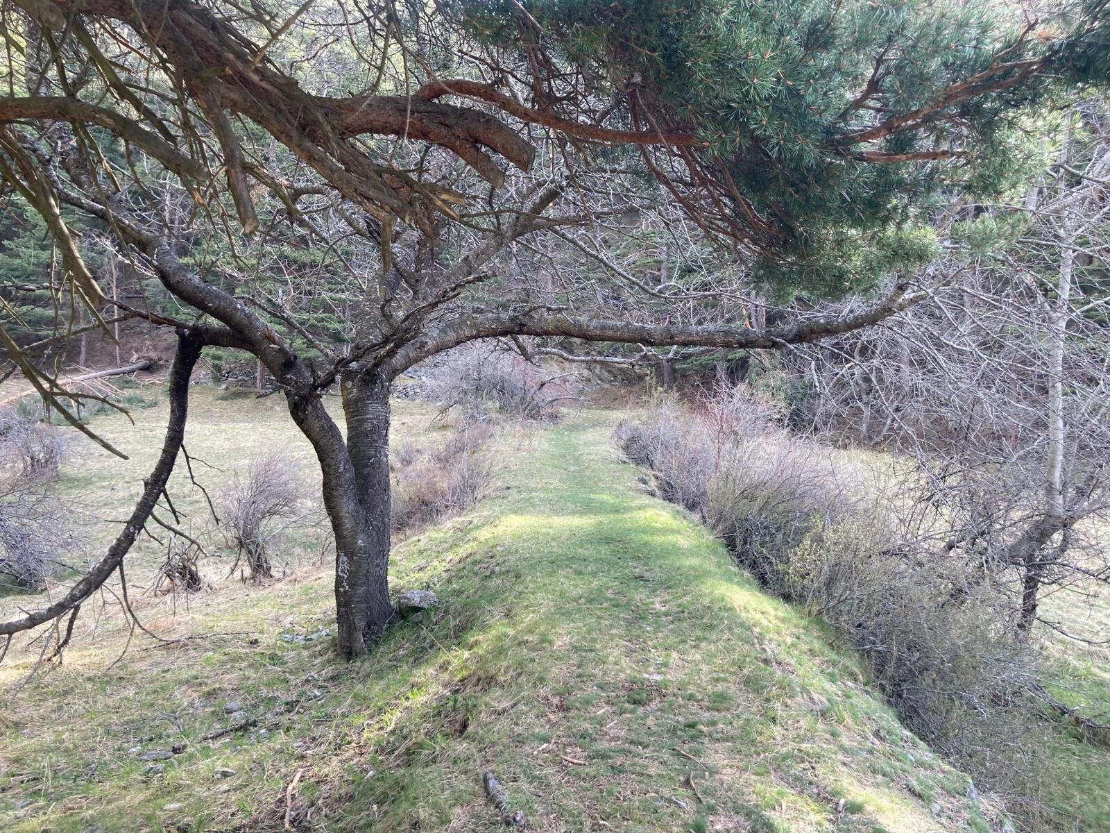
In the first part of the route, the pine forest is a constant presence, while in the second part, the forest also offers fir, larch and cembran pine.
The path is part of the network of paths in the Gran Bosco di Salbertrand Natural Park and is marked by the Park Authority with the number 3.
Assistance and technical description by Barbara Demonte - environmental guide.
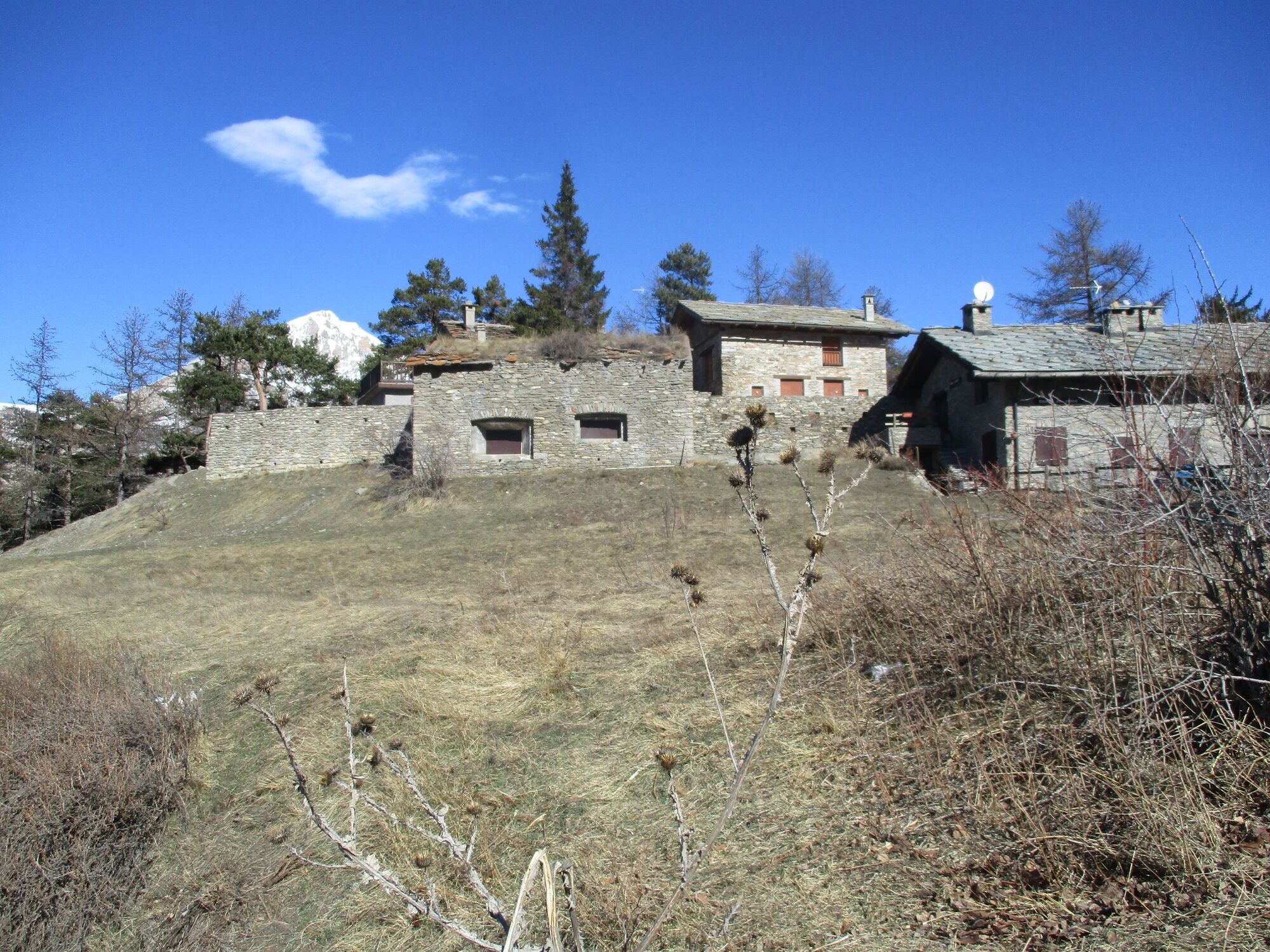
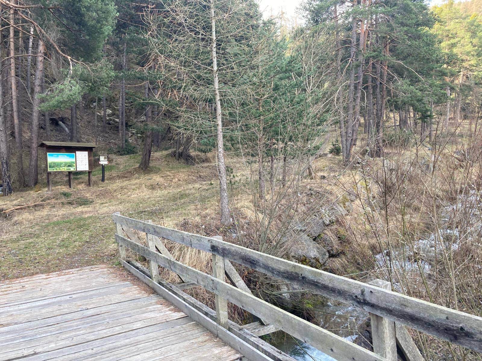
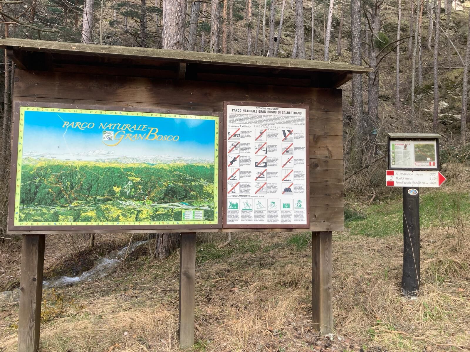
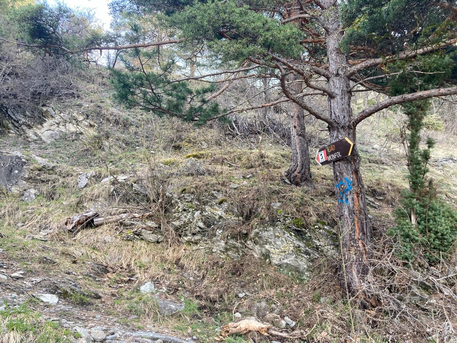
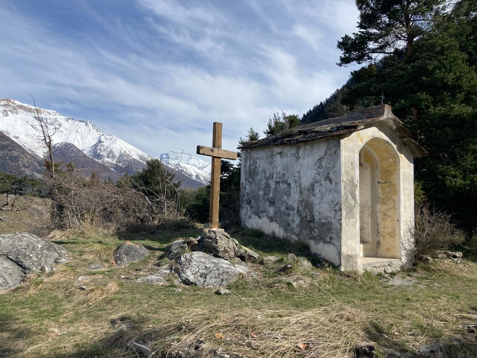
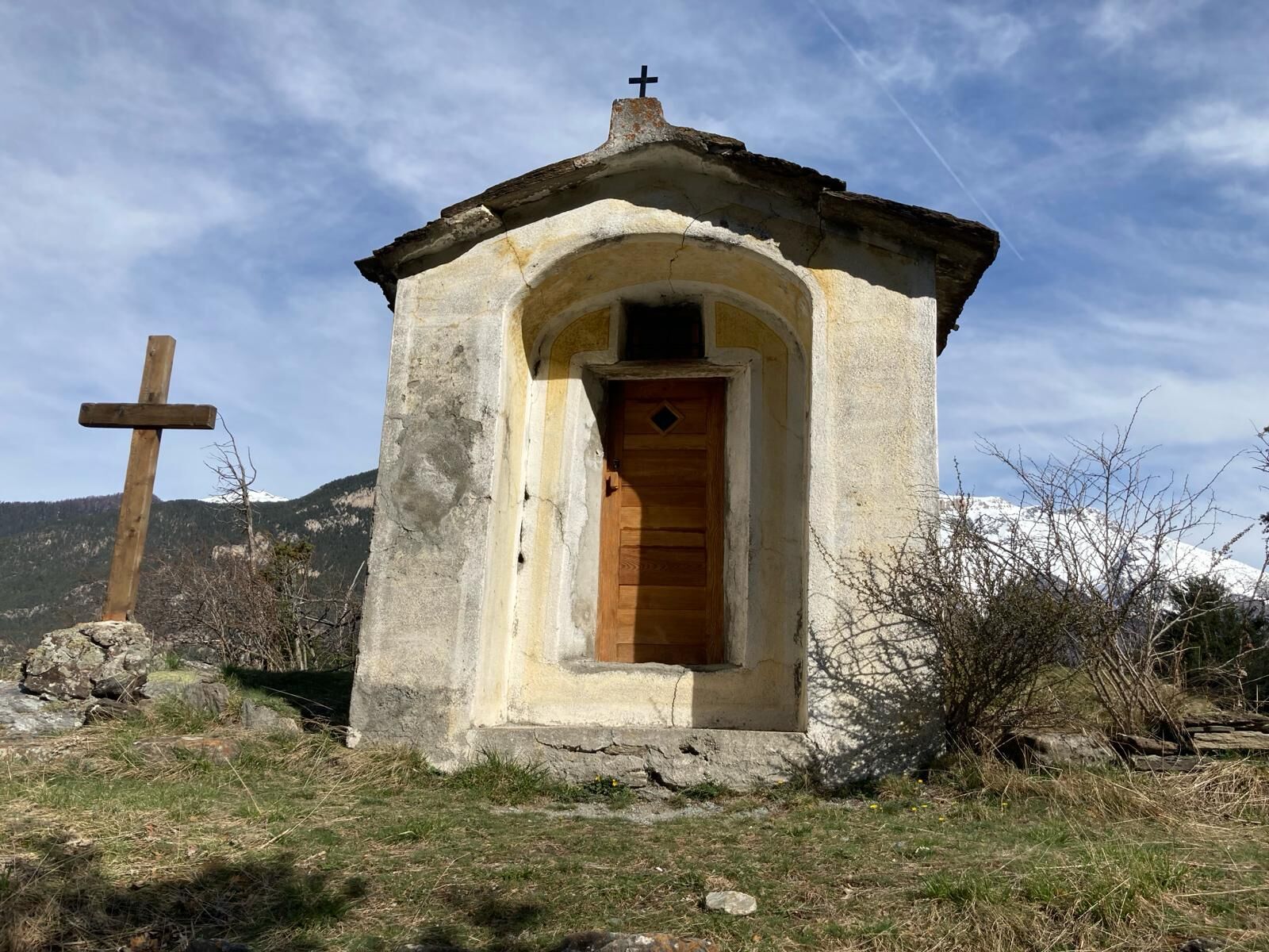
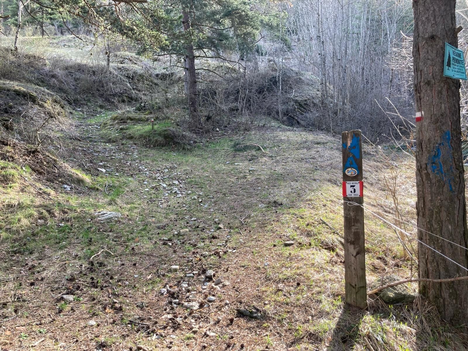
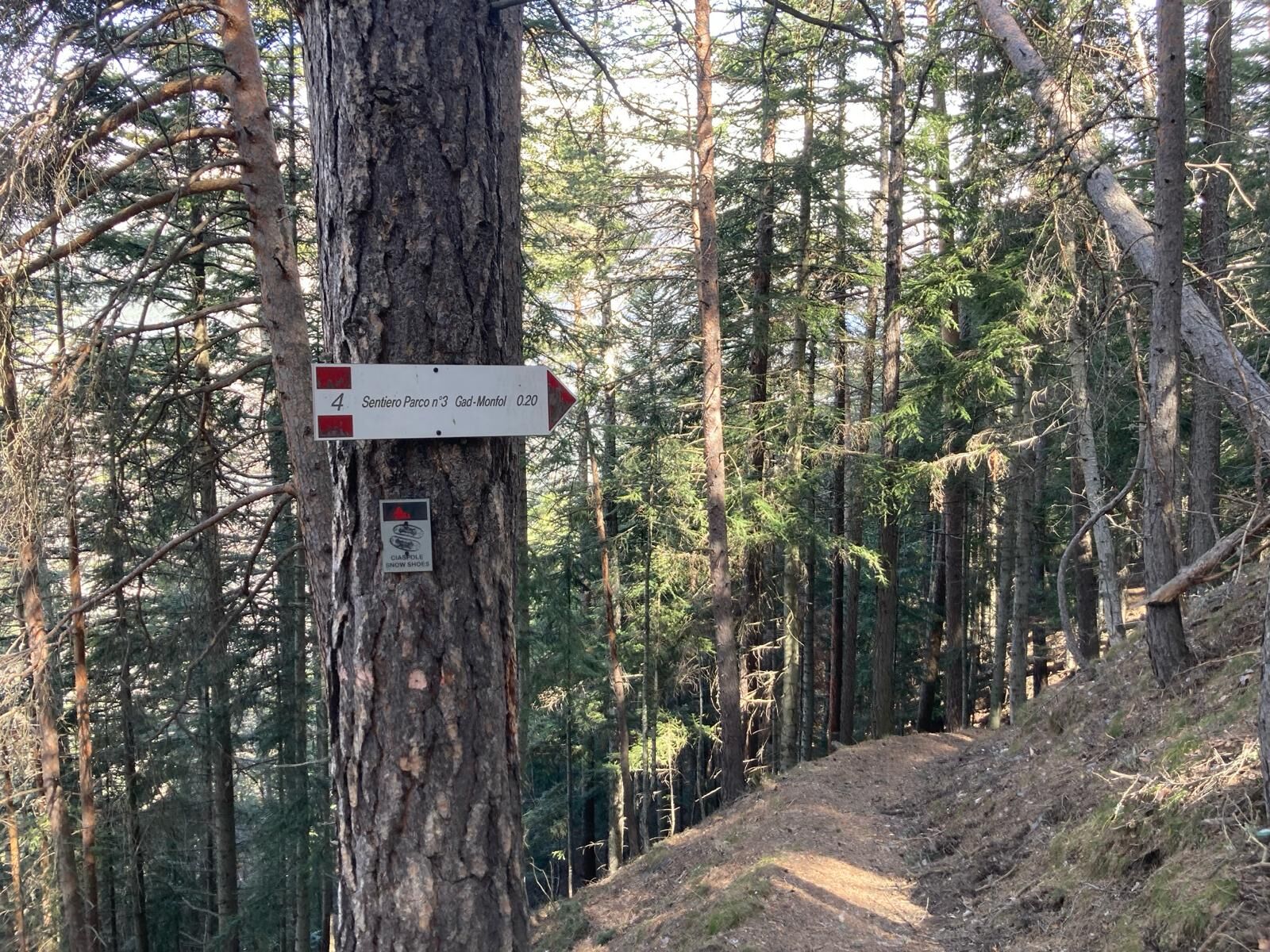
Path no. 3 of the Gran Bosco Park begins in a pine forest upstream from the village of Gad, a hamlet of Oulx located at an altitude of 1,060 metres (parking is available near the "Casetta del Gad" restaurant or at the "Le Baite" shopping centre). Going straight up for about 500 metres, ignoring the forks, you reach a crossroads in the pine forest at an altitude of about 1,130 metres, where path no. 3 begins, signposted for San Domenico and Monfol. After crossing a small bridge over the Rio Gran Comba and shortly after a tiny stream, after a few hairpin bends you reach the small chapel of San Domenico at an altitude of 1,290 metres. The path continues up steep slopes, and after several hairpin bends, at an altitude of around 1,510 metres it crosses path no. 4, which comes from Gran Villar; continue on path no. 3 until Monfol at an altitude of 1,670 metres.
In this first part: difficulty E / approx. 2.300 km / difference in altitude + 530 / time h. 1.30 - altitude beginning at 1,130 m - altitude end at 1,666 m (starting from the centre of Gad you add a length of approx. 900 m and a positive difference in altitude of approx. 70 m)
From Monfol, take the mule track that starts on the west side (towards Sauze d'Oulx) at the edge of the village, near the chapel of San Bartolomeo at an altitude of 1,666 m; pass in front of a wooden fountain and after a steep climb, you will reach the junction on the right with path no. 1 towards Gran Villar, which you ignore, continuing straight uphill. Just above, the mule track forms a sharp bend to the left signposted fairly high up (be careful not to go straight on, the path gets lost); at the next fork, leave the mule track and take the path to the right, again signposted No. 3 towards Enfers and Ferro di Cavallo. After about 1.5 km from Monfol, at an altitude of 1,1920 m, the path crosses the road from Richardette and Enfers, and immediately begins to climb steeply again; at a clearing at about 2,050 m, the path bends to the left (be careful not to go straight on, the trail gets lost); continuing to climb, at about 2,170 m, you reach the "Ferro di Cavallo", a U-bend of the road towards Colle Blegier. From here, it is possible to eventually reach Lake Laune and the mountain pasture of the same name (there is a fountain), turning back briefly and walking downhill to the left along the Park path no. 4 indicated in the clearing just below the 'Ferro di Cavallo'.
In this second part: difficulty E / KM 2 approx. / height difference + 500 / TIME 1.30 - altitude beginning mt. 1,666 - altitude end mt. 2,170
Wear clothing and footwear suitable for the environment and the season.
: the exit from A32 Frejus- Turin motorway is at Oulx ovest.
By car from France: From the UK take the A 43 through the Frejus Tunnel (toll) then A32 motorway as far as Oulx.
Turin airport is just over one hour away and is connected to Sauze d’Oulx and Oulx by private transfer or by public transport - bus to the main railway station in Turin, Porta Nuova; train to Oulx (railway line Torino/Bardonecchia). Train times and fares can be viewed and booked at trenitalia.com.
By train: the mainline railway which connects Paris to Milan by TGV has a station in Oulx. See also: www.snowcarbon.co.uk.
Parking is available near the 'Casetta del Gad' restaurant, but places are limited; alternatively at the 'Le Baite' shopping centre.
Before starting out on any excursion, it is advisable to consult weather bulletins or ask the local tourist offices for information. It is good practice not to undertake a hike alone, always inform yourself of your destination.
Do not throw rubbish into the environment, but take it down to the valley, collecting any rubbish left by others.
The hiking times given are approximate and may vary depending on weather conditions and your own abilities.
Fountains in the hamlet of Gad and in Monfol
Tururi populare în vecinătate
-
5,0
BARDONECCHIA Decauville
luminăExcursie 7,29 km -
BARDONECCHIA Colle Sommeiller
mediuMountainbike 25,4 km -
5,0
CESANA T.SE To Fenils (No. 48)
luminăExcursie 4,29 km -
5,0
BARDONECCHIA Col des Acles - Passo della Mulattiera
greleExcursie 6,57 km -
SESTRIERE Assietta Road
mediuMountainbike 43,3 km -
BARDONECCHIA Punta Colomion - Passo della Mulattiera - Pian del Colle Ring
greleMountainbike 25,1 km -
La Via dei Saraceni (Sauze d'Oulx)
mediuMountainbike 33,6 km -
BARDONECCHIA Punta Colomion - Puys - Beaulard Ring
mediuMountainbike 24,7 km -
BARDONECCHIA Decauville - Rifugio Scarfiotti Ring
luminăMountainbike 34,0 km -
CESANA T.SE Thures - Cima Bosco
mediuExcursie 10,6 km

Drumeții și urmărire


Nu ratați ofertele și inspirația pentru următoarea dvs. vacanță
Adresa dvs. de e-mail a fost adăugat la lista de corespondență.