


Mangart for the normal route
Nivelul de dificultate: T3


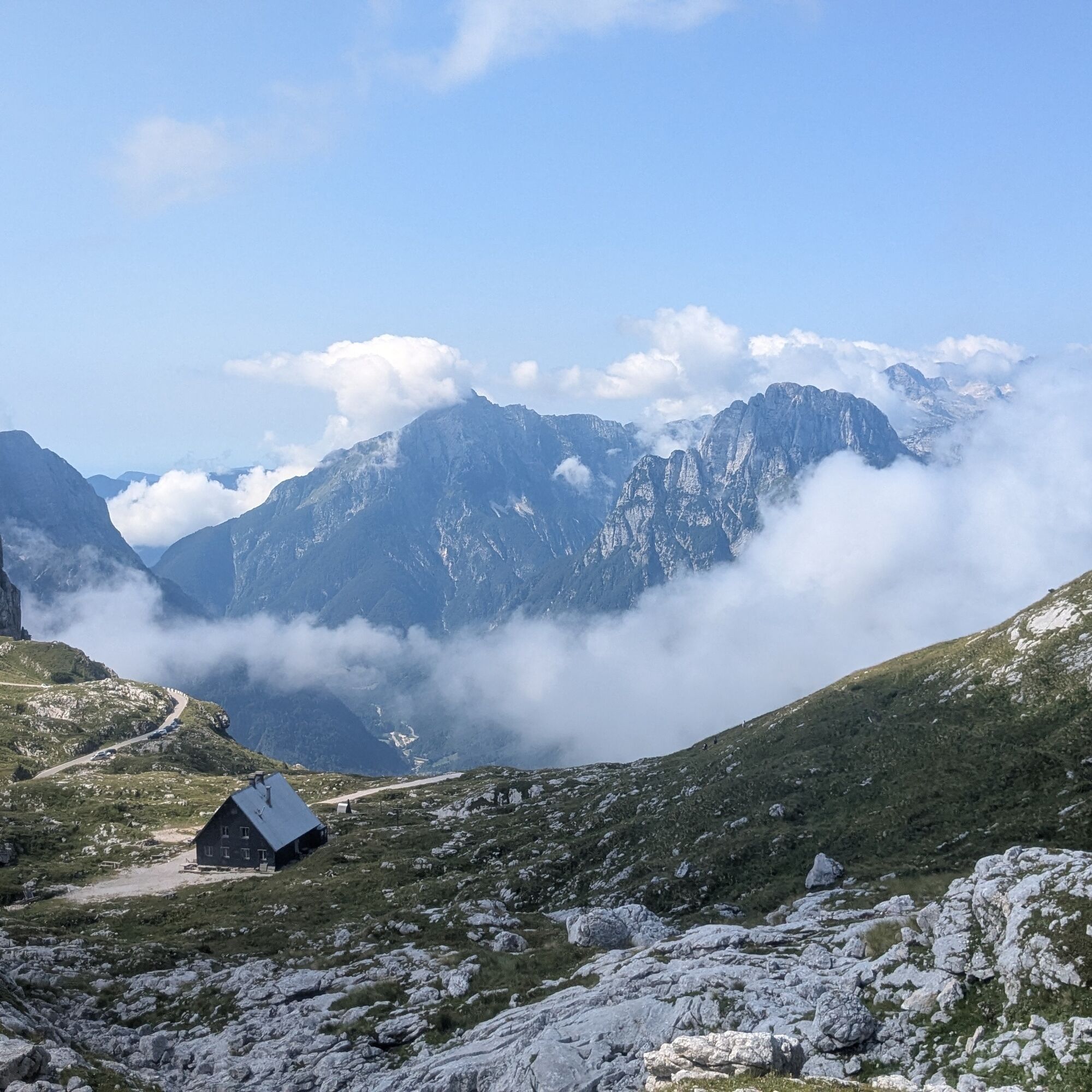
From the Slovenian side, we drive along the Mangart Road (toll road) and leave the car where possible. We climb initially to the Mangrtskem na sedlu hut (1906 m, in 2025 closed for renovations) and ascend...
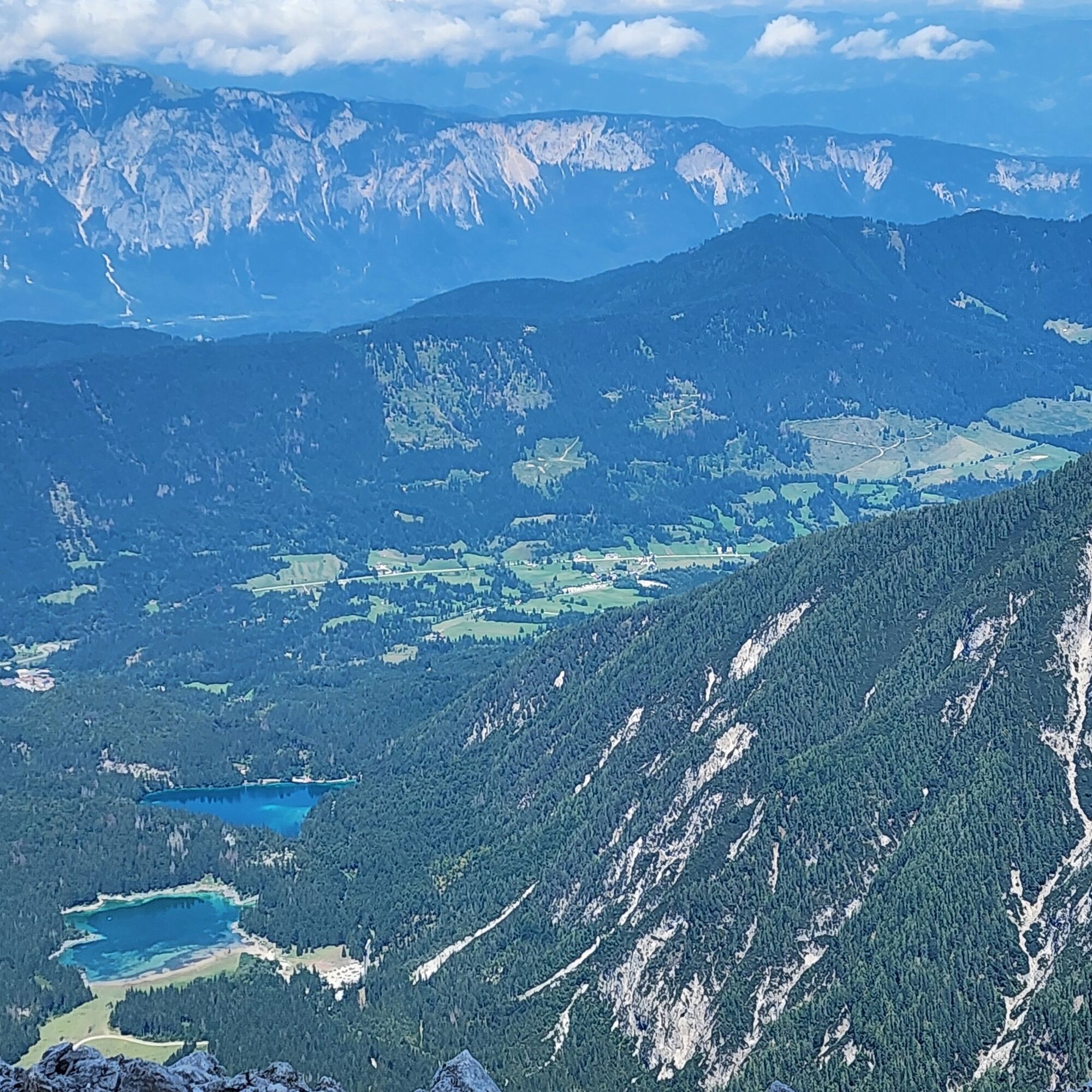
From the Slovenian side, we drive along the Mangart Road (toll road) and leave the car where possible. We climb initially to the Mangrtskem na sedlu hut (1906 m, in 2025 closed for renovations) and ascend along the path on the left (signs to the summit); path that crosses the asphalt road and takes us to the ridge line beyond which, dizzyingly low, are the Fusine lakes, which we see. We follow to the right to the Mangart fork (2263 m): here we continue straight on, avoiding following on the path of the Slovenian ferrata; it is usually very difficult to make a mistake, as the normal route is very busy. The first section of the normal route consists of the ascent of a steep scree, which leads us to the attack of the equipped trail. It is advisable to use the via ferrata kit even though the trail is simple and devoid of verticality; however, a helmet is recommended in any case, given the busyness of the climb.
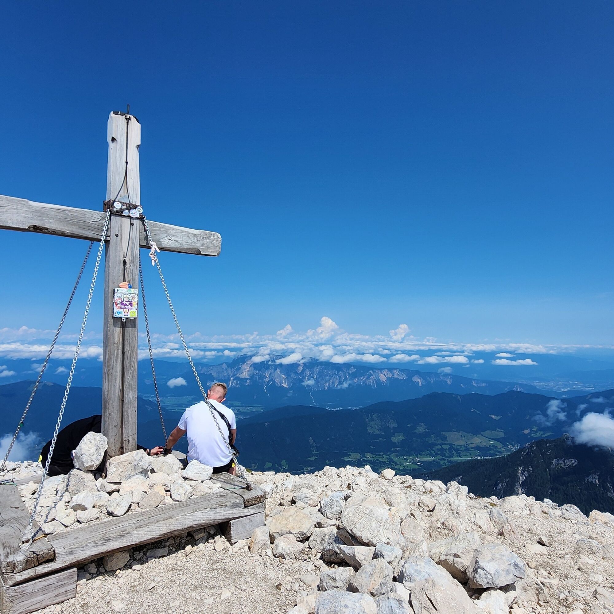
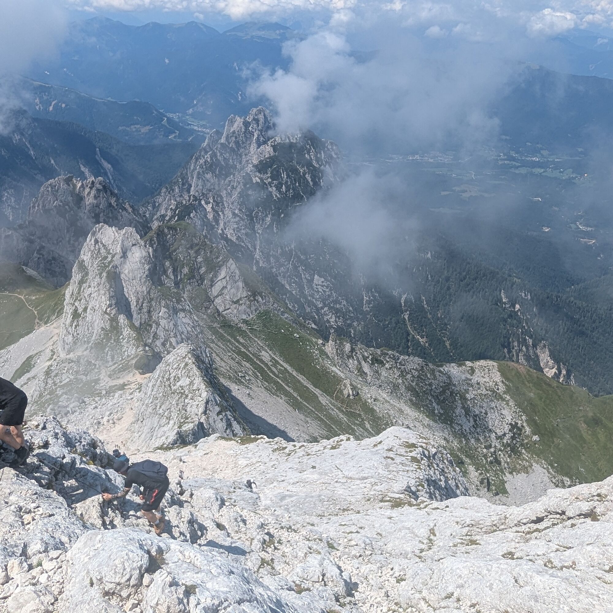
The equipped trail super smooth slabs and several "ledges," and deposits us on a debris ledge that goes around the mountain. Having finished the bypass, we begin to climb the east ridge of the summit on a good path, and without further difficulty we arrive on the broad summit (2677 m).

Da
Da
The via ferrata kit is recommended especially for children and inexperienced people; a helmet is always recommended.
Recommended time: always, in the absence of snow and with excellent weather; days following heavy rains should be avoided.
T3
If the rock is wet, much more care is needed. The equipped trail poses no real difficulty, but crowding recommends securing yourself to the cables in any case.
Tururi populare în vecinătate
-
4,9
Orrido dello Slizza, Tarvisio, Italië
luminăExcursie 2,65 km -
4,5
Zacchi Wanderung Rundweg
luminăExcursie 8,85 km -
4,9
Monte Lussari über den alten Pilgerweg
mediuExcursie 6,43 km -
4,8
Fusine Lakes
luminăExcursie 5,43 km -
4,2
Monte Lussari über den Büßerweg
mediuExcursie 5,66 km -
4,4
Hüttenkult - Koča v Krnici
mediuExcursie 14,9 km -
4,6
Monte Lussari
luminăSkitour 5,35 km -
3,9
Monte Santo di Lussari, Skitour, Pilgerweg
mediuSkitour 9,35 km -
4,5
Spaziergang entlang der Pišnica
luminăExcursie 8,13 km -
4,7
Weißenfelser Seen: Fusine in Valromana - Ai Sette Nani - Seealm
mediuExcursie 10,3 km
Drumeții și urmărire


Nu ratați ofertele și inspirația pentru următoarea dvs. vacanță
Adresa dvs. de e-mail a fost adăugat la lista de corespondență.