Rough, wild, mystical - hike to Tuass
mediu
Excursie
Navigați
Navigați
Obțineți acest tur pe telefonul dvs. mobil
Harta
Rough, wild, mystical - hike to Tuass
mediu
Excursie
11,19 km
Scanați codul QR și începeți navigarea în aplicația bergfex
QR Code
Drumeții și urmărire

Rough, wild, mystical - hike to Tuass

Distanța
11,19 km
Durată
04:15 h
Ascensiune
916 hm
Nivelul mării
497 - 1.433 m
Descărcare piesă
Harta
Rough, wild, mystical - hike to Tuass
mediu
Excursie
11,19 km

Fotografii ale utilizatorilor noștri

The hike up to Tuass starts at Neugrütt by the Mittagsspitze campsite in Triesen. After about 20 minutes, the hiking trail turns right and leads through the forest. The path then winds in switchbacks up...


Descrierea

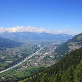
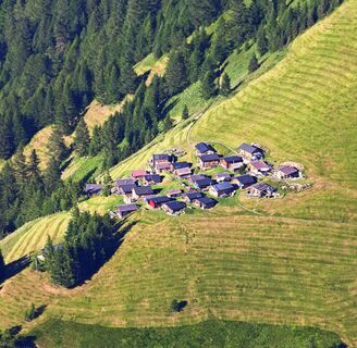
The hike up to Tuass starts at Neugrütt by the Mittagsspitze campsite in Triesen. After about 20 minutes, the hiking trail turns right and leads through the forest. The path then winds in switchbacks up to the Maiensäss Magrüel and ends there at a farm track. Some old hay huts here recall the arduous hay harvests of earlier days. After a few steps, the hiker then has the choice between two paths. The more direct path leads over the Blüemlertobel to Tuass. Alternatively, it is possible to follow the longer, steep mountain path with many switchbacks through the beech forest towards Kemmi. Then it continues past Gorn and Platta. After Platta, the mostly flat hiking path continues until Tuass is reached. The return route first follows a hiking path towards Lawena. Once the wide farm track is reached, the path turns right and leads through the Lawenatobel to the Maiensäss Magrüel. From there, it goes down to the Mittagsspitze campsite.

Ruta
Blüemler
(1.310 m)
Coridor/terren
3,5 km
Restaurant Alte Eiche
(505 m)
Restaurant
11,1 km
Ruta
Harta
Rough, wild, mystical - hike to Tuass
mediu
Excursie
11,19 km
Blüemler
(1.310 m)
Coridor/terren
3,5 km
Restaurant Alte Eiche
(505 m)
Restaurant
11,1 km
Descrierea

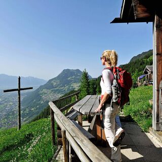
The hike to Tuass is a very special experience; sometimes it feels as if you are stepping into the mountain massif.

Tehnologie
n.a.
Stare
4 / 6
Peisaj
5 / 6
Experiență
5 / 6
Cea mai bună perioadă a anului
Jan
Feb
Mar
Apr
Mai
Jun
Jul
Aug
Sep
Oct
Noi
Dec
Tur de partajare
Harta
Rough, wild, mystical - hike to Tuass
mediu
Excursie
11,19 km
Eroare
S-a produs o eroare. Vă rugăm să încercați din nou.
Informații despre traseu
Ruta

Triesen (Neugrütt) - Magrüel - Blüemetertobel - Tuass - Triesen

Instrucțiuni de siguranță

To undertake a route, careful planning is required. We recommend that you exchange information with local information offices about the trails and weather conditions in advance. Depending on the season and weather conditions, this route may be closed or interrupted.

Informații privind sosirea
Călătoria

Parking spaces at Säga Triesen

Transport public

Bus stop Säga (Triesen) on the Vaduz – Sargans line

Informații suplimentare și sfaturi
Informații suplimentare

Refreshments:

Alte Eiche at Säga (Triesen), none along the way

Overnight accommodation:

Mittagsspitze Campsite (Triesen)
Hotel Garni Säga

Încă nu există recenzii
Scrieți o recenzie

Comentariile ajută alți utilizatori să își aleagă următoarea aventură. Vă rugăm să evaluați doar turul, nu și vremea sau gustarea dumneavoastră.

Selectați una dintre stele pentru a evalua turul
Tur rău
Tur slab
Tur mediocru
Tur bun
Tur excelent
bergfex logo Obțineți informații Întotdeauna live la fața locului cu peste 9.500 de camere web. bergfex Ca utilizator Pro, acum puteți vedea camerele web corespunzătoare pentru multe tururi în aplicația tururi de la. Acest lucru vă permite să vizualizați direct condițiile actuale.
Drumeții și urmărire

Drumeții și urmărire

Drumeții și urmărire
Peste 550.000 de sugestii de excursii, hărți detaliate și un planificator de traseu intuitiv fac din această aplicație un must-have pentru toți pasionații de natură.
Drumeții și urmărire