


The 2000 footpath around Fort de Ronce


Saint-Pierre chapel marks the beginning of your journey. The sounds of the alpine herds echo the marmots' whistles in the distance. The terrace of the 2000 trail seems to trail off to infinity. In the...
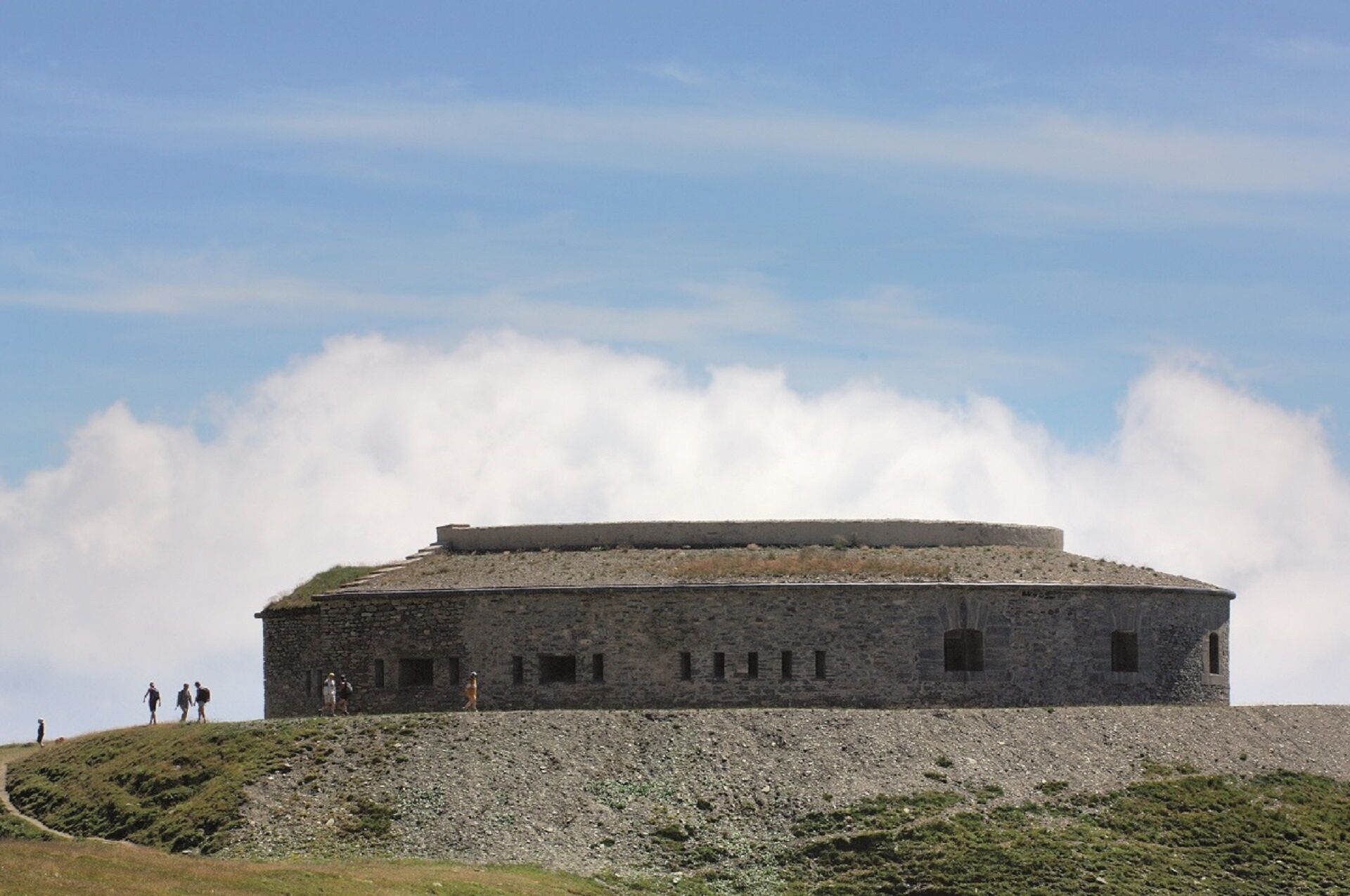
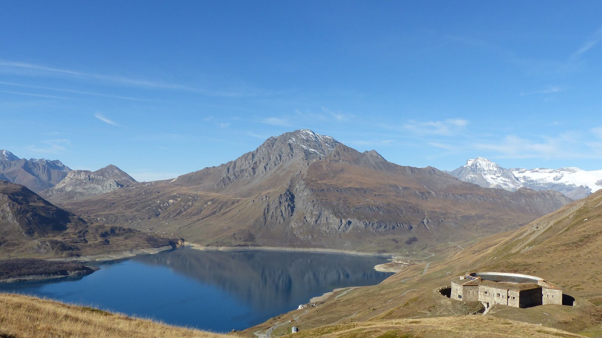
Saint-Pierre chapel marks the beginning of your journey. The sounds of the alpine herds echo the marmots' whistles in the distance. The terrace of the 2000 trail seems to trail off to infinity. In the background, the regal Roche d'Étache cuts the horizon. The stage is set for retracing the military history of Col du Mont Cenis. Give in to the temptation of taking various scenic breaks, made easy by the gentle terrain. Gain a little more height as you overcome the only difficulty of the day and then, take your seat! At almost 2,300 m of altitude, this circular fort is an infallible observation post! Though peace and quiet have reigned here for over half a century, you can still feel the weight of history. As far as the eye can see, ridges draw jagged lines across the sky, reflected in the turquoise waters of the lake. There's no doubt about it: the horizon is all yours!

To guide you in the field, consult the "step-by-step" directional diagram provided in pdf.
Da
The duration of hiking trails is calculated using reference paces: 300 m/h ascent, 500 m/h descent and 4 km/h on the flat.
As hazards may occur at any time on the routes, the GPX tracks provided are not contractual. They are given for information only. Riders use them at their own risk, depending on their level of technological proficiency and their understanding of the terrain.
Camere web ale turului
Tururi populare în vecinătate
-
4,7
Rocciamelone partedjo dalla Riposa. Mompantero, Piemont/Italien
mediuExcursie 10,6 km -
The White Lake
luminăExcursie 4,42 km -
Cycling ascent of the Mont-Cenis Pass from Lanslebourg
greleBicicletă de șosea 9,84 km -
Sentier pédestre des Sculptures - Land Art Montagne
luminăTraseu tematic 5,16 km -
Mont-Cenis Pass from Modane
greleBicicletă de șosea 34,8 km -
5,0
Goldtoni - Alpenbogen A068 Refuge de la Leisse-Termignon Val Cenis
mediuTraseu de drumeție pe distanțe lungi 28,7 km -
Col de l'Iseran from Termignon
greleBicicletă de șosea 38,3 km -
Col du Petit Mont-Cenis
greleBicicletă de șosea 18,0 km -
Walking in the heart of the village of Bessans
luminăTraseu tematic 1,74 km -
little 'Haute-Maurienne Vanoise' circuit
greleBicicletă de șosea 32,0 km
Drumeții și urmărire


Nu ratați ofertele și inspirația pentru următoarea dvs. vacanță
Adresa dvs. de e-mail a fost adăugat la lista de corespondență.