Multiday mountain biking loop : Mountainbiking on Grand Colombier and Retord Plateau - Espace FFC Ain Forestière
grele
Mountainbike
Navigați
Navigați
Obțineți acest tur pe telefonul dvs. mobil
Harta
Multiday mountain biking loop : Mountainbiking on Grand Colombier and Retord Plateau - Espace FFC Ain Forestière
grele
Mountainbike
92,77 km
Scanați codul QR și începeți navigarea în aplicația bergfex
QR Code
Drumeții și urmărire

Multiday mountain biking loop : Mountainbiking on Grand Colombier and Retord Plateau - Espace FFC Ain Forestière

Distanța
92,77 km
Durată
08:00 h
Ascensiune
2.557 hm
Nivelul mării
233 - 1.493 m

Nivelul de dificultate: S2

Descărcare piesă
Harta
Multiday mountain biking loop : Mountainbiking on Grand Colombier and Retord Plateau - Espace FFC Ain Forestière
grele
Mountainbike
92,77 km

With a length of nearly 100 km, this marked loop on the two southern variants of the GTJ allows you to discover the southern end of the Jura Massif in a few days.
From the banks of the Rhône to Culoz at...


Descrierea

With a length of nearly 100 km, this marked loop on the two southern variants of the GTJ allows you to discover the southern end of the Jura Massif in a few days.
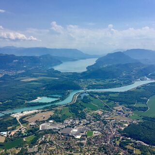
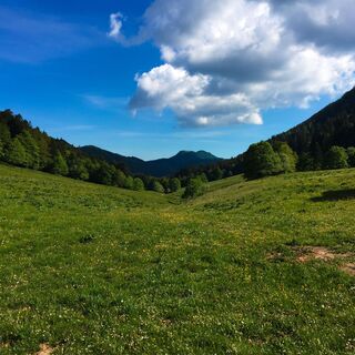
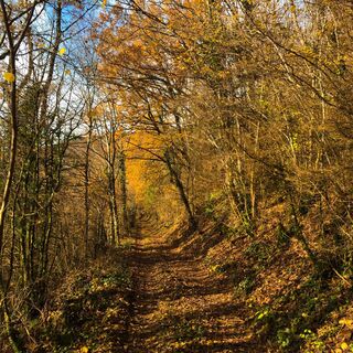
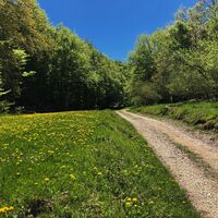
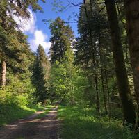
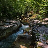
From the banks of the Rhône to Culoz at an altitude of 250 meters at the foot of the giant of Bugey, the Grand Colombier, culminating at nearly 1500 meters, passing through the plateaus of Retord and Hauteville, the circuit takes in varied landscapes and numerous balconies on the chain of the Alps, Mont Blanc and Lake Bourget.

Day 1 : Culoz > La Praille (32 km)
Day 2 : La Praille > Les Plans d'Hotonnes (27 km)
Day 3 : Les Plans d'Hotonnes > Culoz (35km)

Ruta
Ruta
Harta
Multiday mountain biking loop : Mountainbiking on Grand Colombier and Retord Plateau - Espace FFC Ain Forestière
grele
Mountainbike
92,77 km
Les Épicurieux
(235 m)
Restaurant
0,1 km
La Casa della Pizza
(248 m)
Restaurant
0,5 km
Culoz
(247 m)
Sat
0,6 km
En Pontenay
(273 m)
Vecinătate
0,7 km
Le Chevalier
(239 m)
Restaurant
2,5 km
Béon
(268 m)
Sat
2,7 km
Palud
(233 m)
Coridor/terren
3,5 km
Marlieu
(239 m)
Soluționare
7,4 km
Bonnie and Clyde
(245 m)
Restaurant
9,0 km
En Lapeneyaz
(363 m)
Coridor/terren
10,0 km
Champ Perrot
(449 m)
Coridor/terren
10,6 km
Vaux-Morets
(392 m)
Soluționare
12,3 km
Source du Groin
(372 m)
Sursa
12,5 km
Chongnes
(458 m)
Soluționare
13,1 km
La Doue
(467 m)
Sursa
13,3 km
Chapelle de la Doue
(465 m)
Lăcaș de cult
13,3 km
Vieu
(518 m)
Sat
14,6 km
Église romane de l'Assomption
(515 m)
Lăcaș de cult
14,8 km
La Pièce
(508 m)
Vecinătate
14,9 km
Gorges de Thurignin
(406 m)
Punct de vedere
16,2 km
Turignin
(435 m)
Coridor/terren
16,5 km
Sammonod
(478 m)
Soluționare
17,3 km
Vogland
(528 m)
Soluționare
17,7 km
Le Puys des Barres
(837 m)
Soluționare
22,7 km
La Ferme Guichard
(1.097 m)
Restaurant
30,3 km
Auberge gîte La Praille
(1.082 m)
Restaurant
32,6 km
La Praille
(1.080 m)
Coridor/terren
32,6 km
Col de la Croix de l'Orme
(1.099 m)
Șa de munte
33,9 km
Col de Valorse
(1.099 m)
Șa de munte
35,1 km
Les Loges
(942 m)
Soluționare
42,6 km
Le Jorat
(926 m)
Soluționare
47,1 km
Les Plans d'Hotonnes
(1.039 m)
Soluționare
58,1 km
La Combe Merlin
(1.191 m)
Coridor/terren
69,4 km
La Grange d'en haut
(1.257 m)
Adăpost
70,9 km
Grange de Falavier
(1.240 m)
Adăpost
72,7 km
Source de Saint-Arthaud
(1.193 m)
Sursa
73,8 km
Pierre Fillola
(1.426 m)
Summit
80,1 km
Pierre Amion
(1.449 m)
Summit
80,6 km
La Magnine
(371 m)
Coridor/terren
91,0 km
Gîte d'étape Le Cabiolon
(313 m)
Adăpost
91,4 km
La Croix Rousse
(283 m)
Vecinătate
91,6 km
Église Saint-Martin
(262 m)
Lăcaș de cult
91,8 km
Taccons d'En Haut
(265 m)
Vecinătate
91,8 km
Au Campagnard Autrement
(250 m)
Restaurant
91,9 km
La Casa della Pizza
(248 m)
Restaurant
92,0 km
Culoz
(247 m)
Sat
92,1 km
Les Épicurieux
(235 m)
Restaurant
92,6 km
Descrierea

Southern loop of the Grande Traversée du Jura on Mountain bike crossing the Planachat ridges separating Valromey and the Hauteville Plateau, the Retord Plateau and the ridges of the Grand Colombier Massif.

Tehnologie
3 / 6
Stare
5 / 6
Peisaj
6 / 6
Experiență
6 / 6
Cea mai bună perioadă a anului
Jan
Feb
Mar
Apr
Mai
Jun
Jul
Aug
Sep
Oct
Noi
Dec
Tur de partajare
Harta
Multiday mountain biking loop : Mountainbiking on Grand Colombier and Retord Plateau - Espace FFC Ain Forestière
grele
Mountainbike
92,77 km
Eroare
S-a produs o eroare. Vă rugăm să încercați din nou.
Informații despre traseu
Ruta

Follow the GTJ VTT waymarks

Waymarking in progress in spring 2024

Aspecte geologice

Da

Turul summitului

Da

Echipament

It is strongly recommended to have water, food, a helmet, a mobile phone, and a repair kit.

Instrucțiuni de siguranță

This route does not include very technical sections.

However, the route crosses the alpine pastures of the Plateau de Retord, so great caution is advised when encountering a herd. Many herds are accompanied by guard dogs; in this case, it is strongly recommended not to cross the herd but to go around it. We thank you for keeping your dogs on a leash and for always closing the enclosures behind you.

Defective waymarking, incidents/safety, user conflicts, illegal dumping? : locate and share the problem on the national alert system via the SURICATE app or the site https://sentinelles.sportsdenature.fr/

Informații privind sosirea
Călătoria

Culoz is accessible in 1h15 from Lyon, 20 minutes from Aix les Bains, and 45 minutes from Geneva.

Transport public

The starting point is accessible from the Culoz train station on the Lyon - Geneva line.

Parcare

Parking is available at the train station or the Maison du Vélo.

Informații suplimentare și sfaturi
Nivelul de dificultate

S2

Informații suplimentare

APIDAE Tourism data updated on 22/04/2022 by "Aintourisme".
An error on this sheet? Write to the owner mentioning these references:
Sheet name: GTJ VTT Loop from Plateau de Retord to Grand Colombier | Sheet ID: 6043076 | URL (link) of this Outdooractive page.

Sfaturi

Fully waymarked loop, it can be split into three, two, or done in one go for experts with nerves of steel. You will first need to climb the ridges separating Valromey from the Plateau d'Hauteville to gain some altitude. The route becomes much more undulating from the Lèbe Observatory up to the ascent of the Grand Colombier, the highest point of the journey.

This true tour of Valromey via the ridges ends with a descent of more than 1000 meters of elevation down to Culoz.

Restaurants along the route: La Ferme Guichard, L'Auberge de la Praille, L'Auberge du Plâne, Restaurant Berthet in Plans d'Hotonnes, and the Chalet d'Arvières. (Remember to book to avoid unpleasant surprises!).

VTT and e-bike rental available at Servi'Nature in Plans d'Hotonnes.

This route is part of the "Ain Outdoor" selection.

Încă nu există recenzii
Scrieți o recenzie

Comentariile ajută alți utilizatori să își aleagă următoarea aventură. Vă rugăm să evaluați doar turul, nu și vremea sau gustarea dumneavoastră.

Selectați una dintre stele pentru a evalua turul
Tur rău
Tur slab
Tur mediocru
Tur bun
Tur excelent
bergfex logo Obțineți informații Întotdeauna live la fața locului cu peste 9.500 de camere web. bergfex Ca utilizator Pro, acum puteți vedea camerele web corespunzătoare pentru multe tururi în aplicația tururi de la. Acest lucru vă permite să vizualizați direct condițiile actuale.
Drumeții și urmărire

Drumeții și urmărire

Drumeții și urmărire
Peste 550.000 de sugestii de excursii, hărți detaliate și un planificator de traseu intuitiv fac din această aplicație un must-have pentru toți pasionații de natură.
Drumeții și urmărire