Informaţii pentru tur
6,01km
2
- 17m
41hm
41hm
01:40h
- Scurtă descriere
-
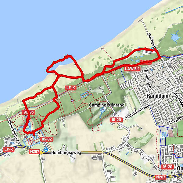
Je wandelt eerst door het bos via verschillende buitenplaatsen naar de strandopgang en loopt een stuk over het strand. Bij natuurgebied De Manteling (duin en bos) ga je het strand weer af en bijna direct loop je het bos weer in.
Je loopt naar het oude Mottekasteel Westhove, via het mooi aangelegde park loop je door bos en duin weer naar de parkeerplaats. - Greutăţi
-
uşor
- Evaluare
-
- Ruta
-
Strandcafé "Bij Karel"1,4 km
- Cel mai bun sezon
-
ianfebmaraprmaiiuniulaugsepoctnovdec
- Cel mai înalt punct
- 17 m
GPS Downloads


Mai multe tururi în regiuni
-
Walcheren
12