
- Scurtă descriere
-
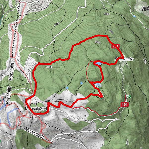
If you don't know the Moosalp yet, this hike is the perfect way to get to know it and acclimatize to the altitude of 2,000 metres. The "Stand" is one of the region's beacons. It is the highest point on the high plateau of the Moosalp and offers you an incredible panoramic view of the entire Upper Valais and twelve four-thousand-metre peaks.
- Greutăţi
-
uşor
- Evaluare
-
- Ruta
-
DorbiaMoosalp (2.048 m)0,0 kmStand1,5 kmPanorama5,3 kmDorbia6,2 km
- Cel mai bun sezon
-
ianfebmaraprmaiiuniulaugsepoctnovdec
- Cel mai înalt punct
- 2.117 m
- Destinație
-
Moosalp
- Profil de elevație
-
 © outdooractive.com
- Autor
-
Turul Panoramaweg Stand (Moosalp) este utilizat de outdooractive.com furnizat.
GPS Downloads


Informaţii generale
Oprire pentru băuturi răcoritoare
Fauna
Promițător
Mai multe tururi în regiuni
-
Oberwallis
1873
-
Unterbäch
934
-
Törbel
150