
- Scurtă descriere
-
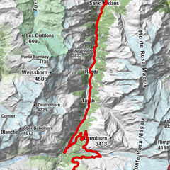
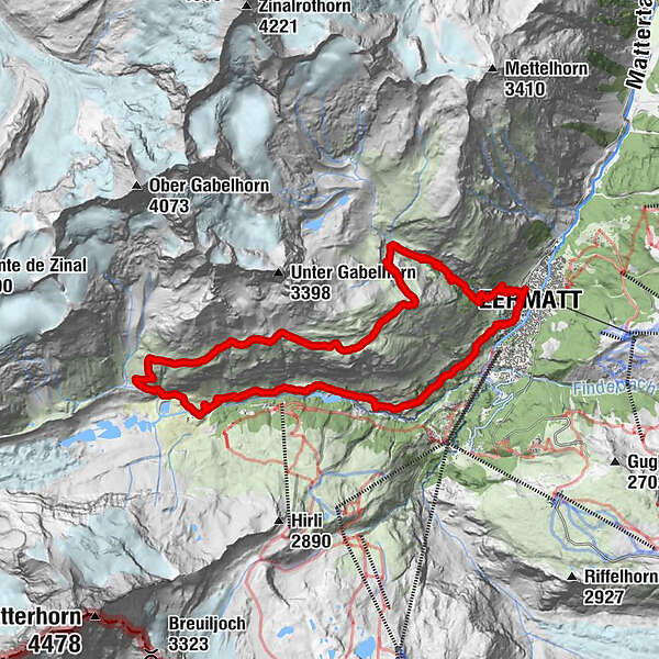
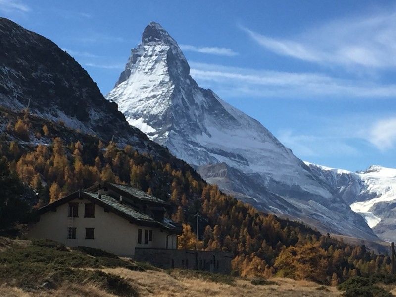
Enjoy an exceptional view of the Matterhorn from this loop which combines a particularly steep start with a long singletrack above the Zermatt valley.
- Greutăţi
-
greu
- Evaluare
-
- Ruta
-
Zermatt (1.608 m)0,0 kmBerggasthaus Trift (2.337 m)3,8 kmZmuttbachfall11,6 kmRestaurant Jägerstube16,2 kmZmutt16,2 kmKirche St. Mauritius19,4 kmZermatt (1.608 m)19,7 km
- Cel mai bun sezon
-
ianfebmaraprmaiiuniulaugsepoctnovdec
- Cel mai înalt punct
- 2.742 m
- Destinație
-
Zermatt
- Profil de elevație
-
 © outdooractive.com


- Autor
-
Turul Zermatt Höhbalmen Loop este utilizat de outdooractive.com furnizat.
GPS Downloads


Informaţii generale
Oprire pentru băuturi răcoritoare
Cultural/Istoric
Sfat din interior
Flora
Fauna
Promițător
Mai multe tururi în regiuni
-
Oberwallis
114
-
Mattertal
34
-
Zermatt
14