
- Scurtă descriere
-
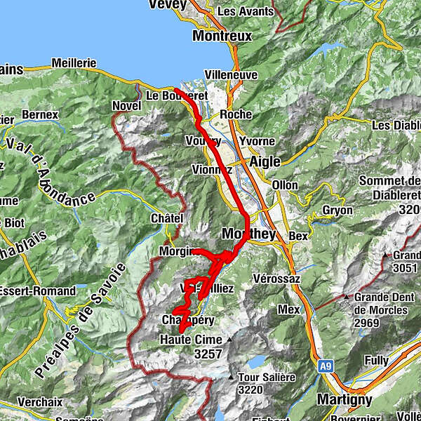
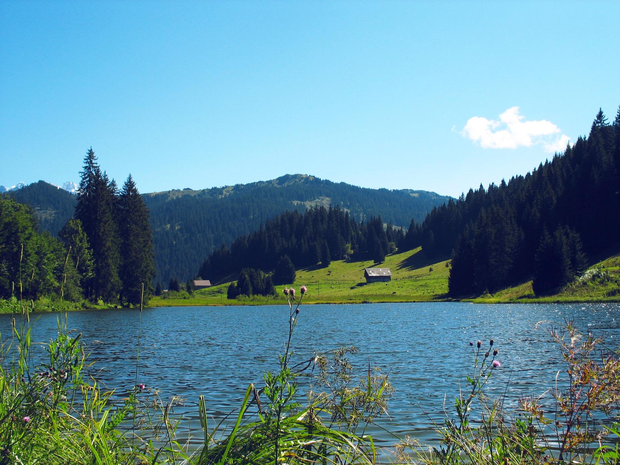
From the base of the Dents du Midi to the shores of Lake Geneva, on this ninth stage you will discover the Vallée d’Illiez on its left side as you descend into the Rhone Valley. You reach Lake Geneva along the Stockalper canal on the banks of the Rhone River.
- Greutăţi
-
mediu
- Evaluare
-
- Ruta
-
Champéry (1.050 m)0,1 kmCantine sur Coux3,7 kmChampoussin9,7 kmAmici10,0 kmVal-d'Illiez (948 m)16,4 kméglise St-Maurice et clocher16,5 kmHotel du Repos16,5 kmTroistorrents19,6 kmTroistorrents33,3 kmMaison Rouge35,8 kmMonthey (430 m)38,3 kmSamui Thai Foods39,4 kmCollombey39,5 kmPré-Géroux42,7 kmVouvry (381 m)49,0 kmChessel (379 m)50,8 kmLes Évouettes53,4 kmLe Bouveret (387 m)56,6 km
- Cel mai bun sezon
-
ianfebmaraprmaiiuniulaugsepoctnovdec
- Cel mai înalt punct
- 1.584 m
- Destinație
-
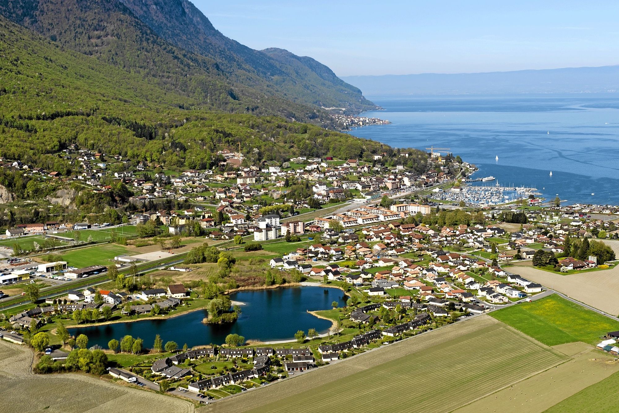
Le Bouveret, Rte du Lac
- Profil de elevație
-
 © outdooractive.com
- Autor
-
Turul Valais Cycling Tour: Champéry - Le Bouveret (stage 9) este utilizat de outdooractive.com furnizat.
GPS Downloads


Informaţii generale
Oprire pentru băuturi răcoritoare
Cultural/Istoric
Sfat din interior
Flora
Fauna
Promițător
Mai multe tururi în regiuni