
- Scurtă descriere
-
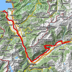
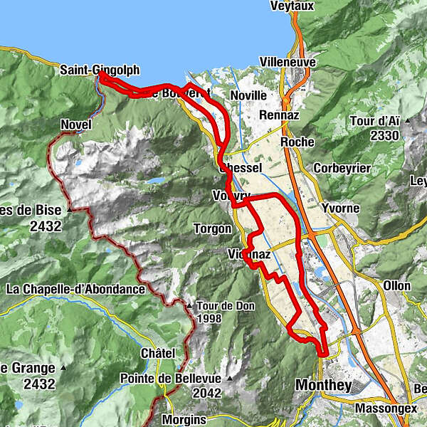
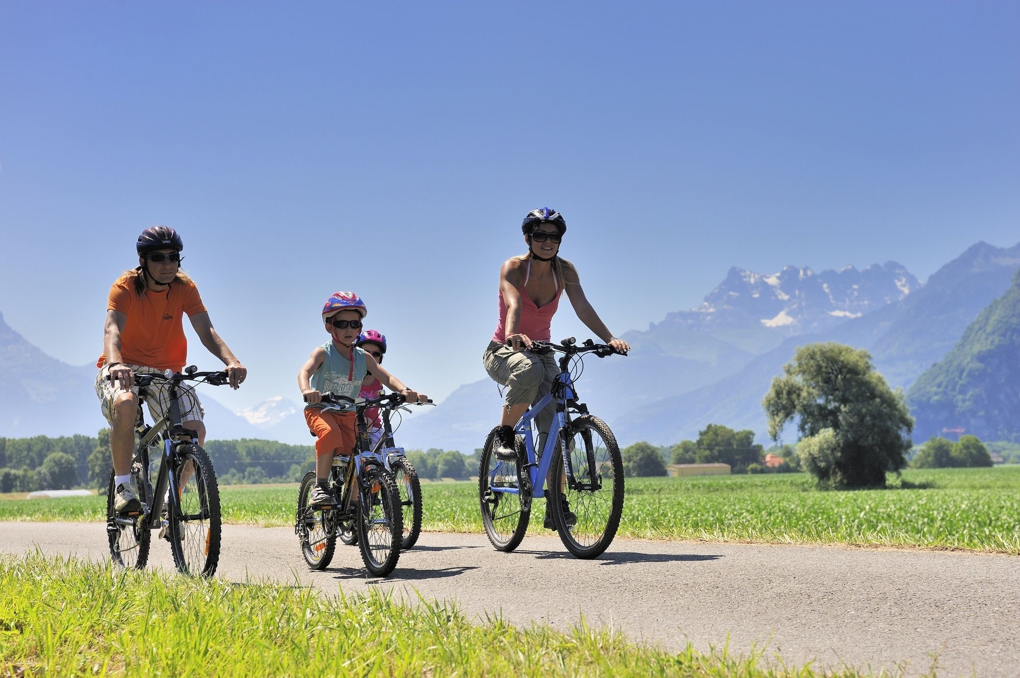
A nice route, easily accessible to everyone, which takes you through the Rhone Valley across farmland and forest belts. A journey on the water's edge: the Rhone, Lake Geneva and the Stockalper channel. Not to mention the picturesque villages and many restaurants.
- Greutăţi
-
mediu
- Evaluare
-
- Ruta
-
Quai à charbon0,1 kmLe Bouveret (387 m)0,4 kmVouvry (387 m)8,4 kmAuberge de Vouvry8,5 kmVouvry (381 m)9,7 kmIllarsaz (384 m)14,7 kmSteakhouse La Fontaine18,8 kmCollombey-le-Grand19,2 kmCollombey20,9 kmMonthey (430 m)21,2 kmMuraz23,7 kmLa Treille23,8 kmPré-Géroux24,9 kmÉglise de Vionnaz29,8 kmVionnaz (392 m)29,9 kmAuberge de Vouvry35,0 kmVouvry (387 m)35,1 kmLes Évouettes39,2 kmLe Bouveret (387 m)42,3 kmLe Bouveret (374 m)42,4 kmChapelle protestant43,3 kmSaint-Gingolph (Suisse) (390 m)47,7 kmSaint-Gingolph47,8 kmChapelle de Saint-Gingolph47,9 kmSaint-Gingolph (373 m)48,1 kmChapelle protestant51,6 kmLe Bouveret (387 m)52,0 km
- Cel mai bun sezon
-
ianfebmaraprmaiiuniulaugsepoctnovdec
- Cel mai înalt punct
- 553 m
- Destinație
-
Le Bouveret train station
- Profil de elevație
-
 © outdooractive.com

- Autor
-
Turul Tour du Haut Lac este utilizat de outdooractive.com furnizat.
GPS Downloads


Informaţii generale
Oprire pentru băuturi răcoritoare
Promițător
Mai multe tururi în regiuni
-
Alpes Vaudoises
103
-
Montreux Riviera
39
-
Vouvry
17