Damüls Fontanella I Türtschalpe und Alpe Unterdamüls

Logo Damüls Fontanella I Türtschalpe und Alpe Unterdamüls
Informaţii pentru tur
12,13km
1.163 - 1.780m
Distanz
686hm
449hm
Ascent
03:00h
 
Durata
Scurtă descriere

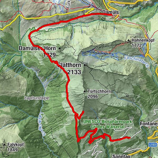
Fontanella - Türtschalpe - Alpe Unterdamüls - Kirchdorf Damüls

Greutăţi
mediu
Evaluare
Tehnică
Condiţie
Peisaj
Experienţă
Ruta
Gadastatt
2,0 km
Türtschalpe (1.641 m)
4,2 km
Türtschalpe
4,4 km
Alpe Unterdamüls
9,1 km
Damüls (1.423 m)
12,0 km

Cel mai înalt punct
1.780 m
Destinație

Damüls Kirchdorf

Profil de elevație

Autor

Evaluarea generală

5

0

%

4

0

%

3

0

%

2

0

%

1

0

%

Eroare
S-a produs o eroare. Vă rugăm să încercați din nou.
Vă mulțumim pentru recenzia dvs.

Ratingul a fost șters

GPS Downloads
  • GPX GPS Exchange Format (XML)
  • KML Google Earth, Google Maps
Coduri de descărcare QR pentru telefoane mobile

Informaţii generale

Oprire pentru băuturi răcoritoare

Tururi populare în zonă

Hiking around the lake Spullersee

uşor
5,58km | 183hm | 01:56h

Glatthorn

mediu
6,49km | 507hm | 02:30h

Damüls | Auf das Portlahorn

mediu
9,62km | 533hm | 04:05h

Panorama hike Dornbirn Karren

mediu
3,43km | 472hm | 01:20h