
Informaţii pentru tur
13,26km
1.329
- 2.393m
886hm
1.307hm
05:10h
- Scurtă descriere
-
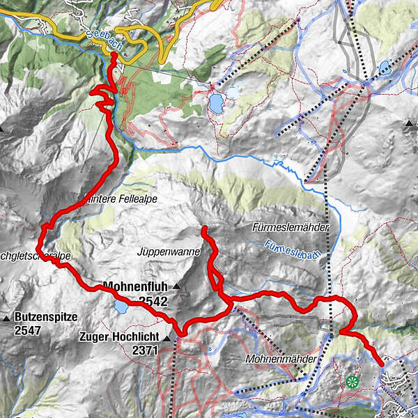
Von Oberlech hinauf auf die Juppenspitze und Abstieg nach Schröcken über den Mohnenfluhsattel/ Jägersteig
- Greutăţi
-
mediu
- Evaluare
-
- Punct de pornire
-
Lech- Oberlech, 1700m
- Ruta
-
Juppenspitze (2.412 m)4,4 kmSchröcken (1.269 m)13,2 kmTannberg13,2 km
- Cel mai bun sezon
-
ianfebmaraprmaiiuniulaugsepoctnovdec
- Cel mai înalt punct
- 2.393 m
- Destinație
-
Schröcken, 1269m
- Odihnă/Retragere
-
Es ist nur die untere Fellealpe bewirtschaftet. Bei Variante 2 zusätzlich noch die Kriegeralpe.
- Material pentru hartă
-
z.B. Kompass Wanderkarte Nr. 33 Arlberg, Verwallgruppe
- Sursă
- schneeberglift
GPS Downloads


Condiții de traseu
Asfalt
Pietriş/prundiş/grohotiş
Livadă/pajişte
Pădure
Stâncă
Expus
Mai multe tururi în regiuni


