© Garda Trentino - Archivio APT Garda Trentino (ph. Calzà)

© North Lake Garda Trentino - Archivio APT Garda Trentino

© Garda Trentino - N. Pellegrini

© Garda Trentino - Archivio Garda Trentino (ph. Watchsome)

© North Lake Garda Trentino - Archivio APT Garda Trentino (ph. Promovideo)

© Garda Trentino - Archivio Garda Trentino

© Garda Trentino - Archivio Garda Trentino

© Garda Trentino - Archivio Garda Trentino (Ph. Jennifer Doohan)

© Garda Trentino - Archivio Garda Trentino (ph. Tommaso Prugnola)

© Garda Trentino - Archivio Garda Trentino (ph. Watchsome)


- Scurtă descriere
-
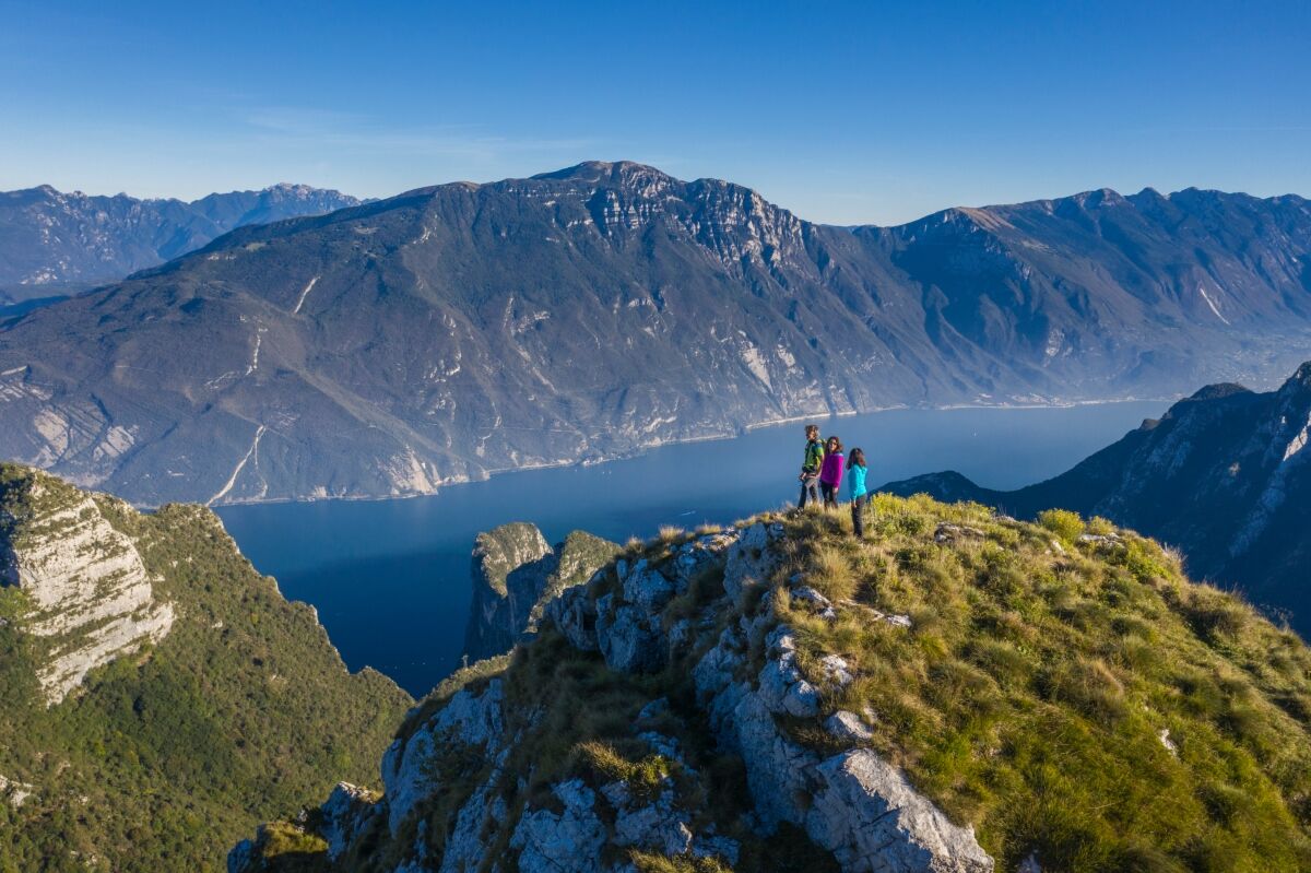
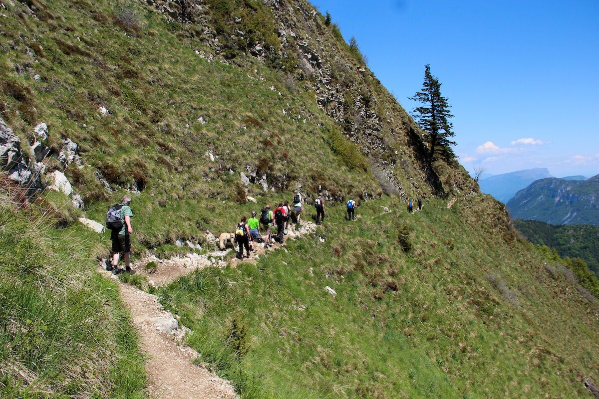
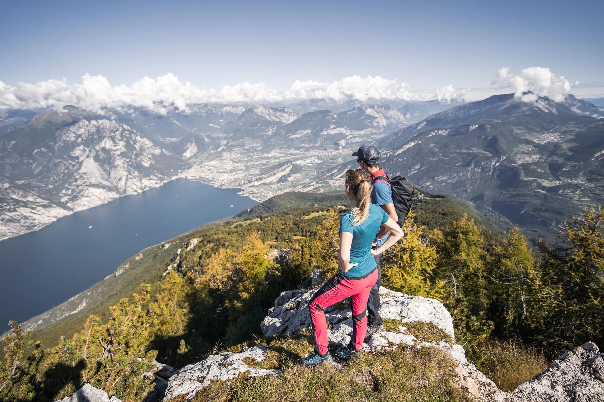
7 challenging stages from one mountain hut to the next, from the shores of the lake to 2000 m and above, touching on all of the peaks surrounding the northern shores of Lake Garda.
- Greutăţi
-
greu
- Evaluare
-
- Ruta
-
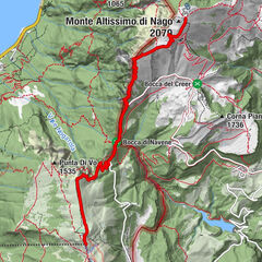
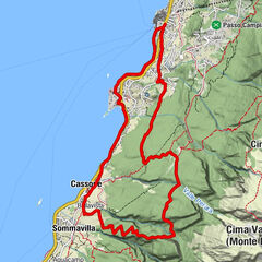
Riva del Garda0,1 kmSanta Maria Maddalena1,2 kmCrazidei3,3 kmCima Sat (1.245 m)4,5 kmBaita Mirella11,6 kmBiavina20,3 kmFrioc22,6 kmVille Del Monte22,9 kmCanale23,1 kmPastoedo23,1 kmBastiani24,3 kmRifugio San Pietro25,6 kmChiesa di San Pietro25,6 kmLa me baita25,6 kmMonte San Pietro (1.067 m)26,7 kmVedese27,8 kmMalga Tovo29,6 kmCima Nanzone (1.134 m)31,0 kmMonte Biaina (1.412 m)32,1 kmPrai da Gom34,6 kmMarcarie35,3 kmSan Giovanni al Monte35,5 kmMalga San Giovanni al Monte35,8 kmDoss del Clef (769 m)38,7 kmMandrea (620 m)39,9 kmArco41,6 kmLe Fontane42,9 kmCeniga45,7 kmCoste di Varino47,3 kmBraila51,3 kmMandrie Alte (1.785 m)60,5 kmRifugio Stivo Prospero Marchetti62,1 kmMonte Stivo (2.054 m)62,2 kmLe Prese (1.480 m)65,0 kmCastil66,0 kmMalga Zanga66,4 kmMonte Velo66,7 kmAgritur Torboli67,5 kmBusata72,0 kmTre Croci (611 m)72,8 kmDorsale Tre Croci (450 m)73,5 kmCastagneto di Nago74,0 kmNago75,2 kmChiesa di San Vigilio75,2 kmChiesa della Santissima Trinità75,3 kmPrimon75,3 kmSegron76,8 kmGrotta Bianca Bini77,4 kmCrepa alle Daine77,5 kmVersante Garda - Gresta78,0 kmDos de la Cronèla (706 m)78,7 kmMalga Zures78,7 kmChiesa Madonna del Faggio79,5 kmMalga Casina (1.025 m)81,2 kmCapanna Caduti del Monte Baldo81,2 kmSorgente Acqua d'Oro81,4 kmPrati di Nago82,4 kmMonte Varagna (1.778 m)84,2 kmBusa Brodeghera (1.990 m)87,1 kmLa Capannina93,7 kmStazione Monte Baldo94,1 kmMonte Baldo (1.738 m)94,1 km
- Cel mai bun sezon
-
ianfebmaraprmaiiuniulaugsepoctnovdec
- Cel mai înalt punct
- 2.052 m
- Destinație
-
Riva del Garda
- Profil de elevație
-
 © outdooractive.com


-
-
AutorTurul Garda Trek - Top Loop: The crown of Garda Trentino este utilizat de outdooractive.com furnizat.
GPS Downloads


Informaţii generale
Oprire pentru băuturi răcoritoare
Cultural/Istoric
Sfat din interior
Flora
Promițător
Mai multe tururi în regiuni
-
Garda Trentino
664
-
Arco di Trento
284