

© Tourismusverband Region Hall-Wattens - Hall Wattens

© Tourismusverband Region Hall-Wattens - Hall Wattens
- Scurtă descriere
-
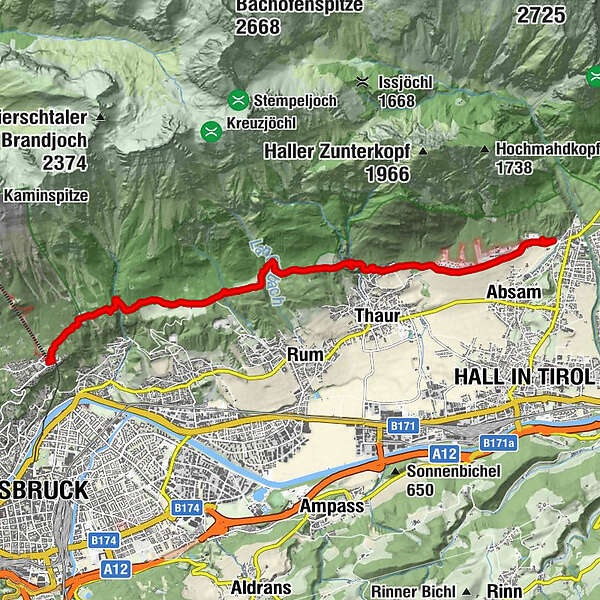
Varied hike across meadows and forests from Absam to the Hungerburg.
- Greutăţi
-
uşor
- Evaluare
-
- Ruta
-
Stollenquelle3,7 km103,8 kmSchlosskirche St. Romedius4,2 kmRomediwirt4,2 kmRumer Mure6,9 kmLoam9,7 kmCafe Pension Alpina11,1 kmHungerburg11,2 kmInnsbruck (574 m)11,2 km
- Cel mai bun sezon
-
ianfebmaraprmaiiuniulaugsepoctnovdec
- Cel mai înalt punct
- 950 m
- Destinație
-
Innsbruck, Hungerburg
- Profil de elevație
-


- Autor
-
Turul Varied hike along the Adolf Pichler Trail este utilizat de outdooractive.com furnizat.
GPS Downloads


Informaţii generale
Oprire pentru băuturi răcoritoare
Mai multe tururi în regiuni


