


E BIKE - HIKE - CLIMB Rosskopf round 1600 hm!


The tour begins with the ascent via the Kühtai High Alpine Road, a route well-known and infamous among cyclists, as it's part of the renowned Ötztal Cycle Marathon. At the bus stop, turn off in the direction...
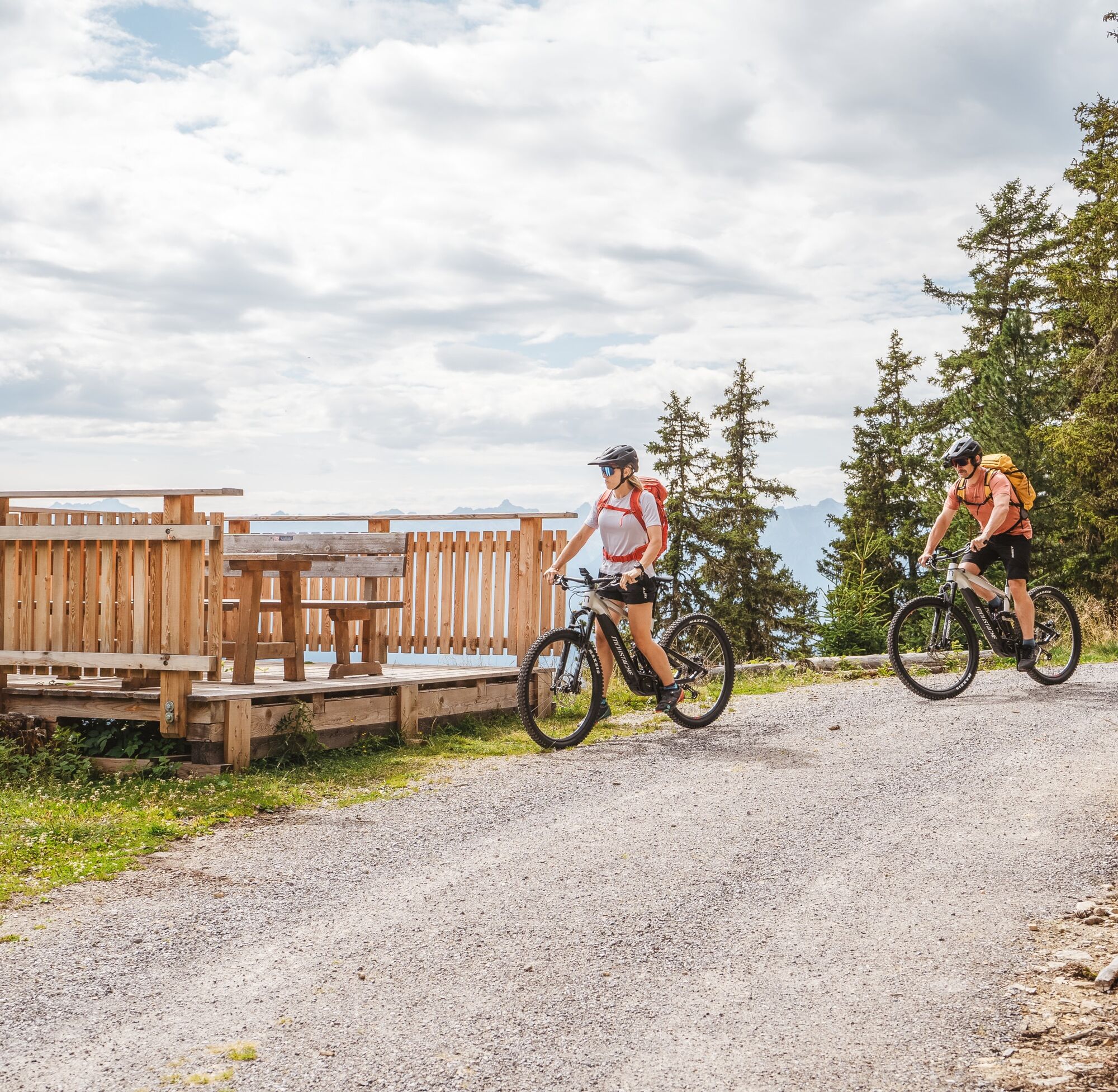
The tour begins with the ascent via the Kühtai High Alpine Road, a route well-known and infamous among cyclists, as it's part of the renowned Ötztal Cycle Marathon. At the bus stop, turn off in the direction of Klingenburg, continue towards Ötzerberg, and follow the gravel road to the Acherberg Alm. This is a great spot for a first break. The sunny terrace offers stunning panoramic views and is perfect for recharging your energy.
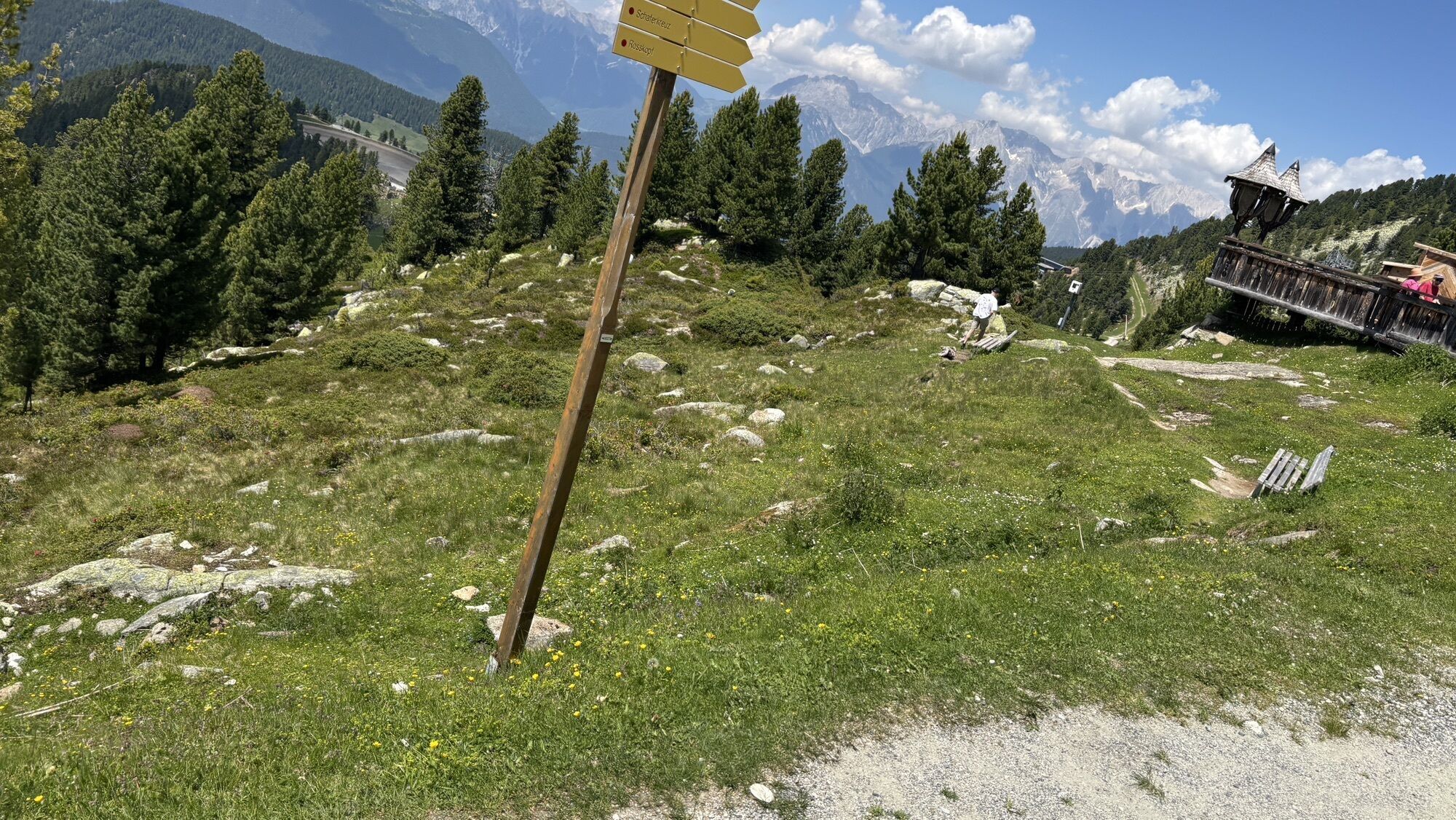
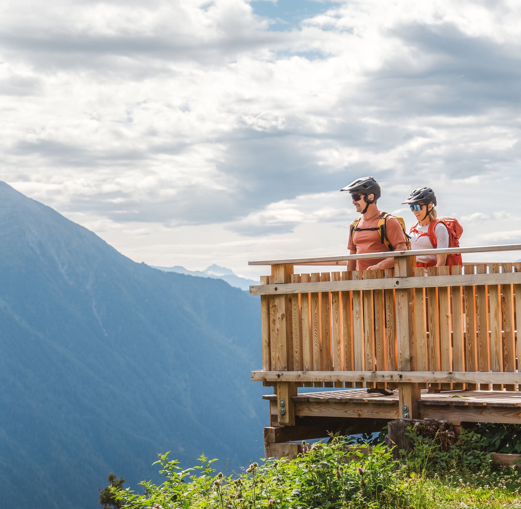
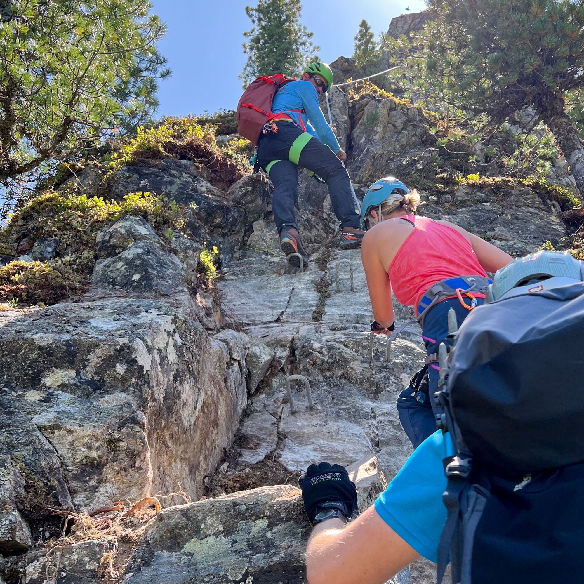
From here, continue by bike to the Panoramic Restaurant Hochoetz, where your bike can be securely parked. The hike to the Rosskopf via ferrata begins here. Follow the well-marked trail toward the Schäfer Kreuz. From here cross, an old sheep trail towards the via ferrata entrance. Helmets are mandatory on this section.
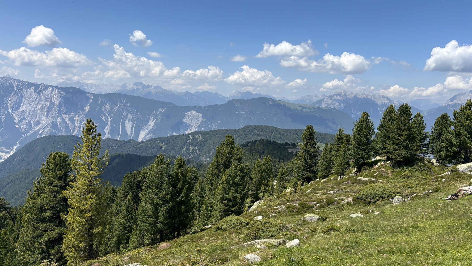
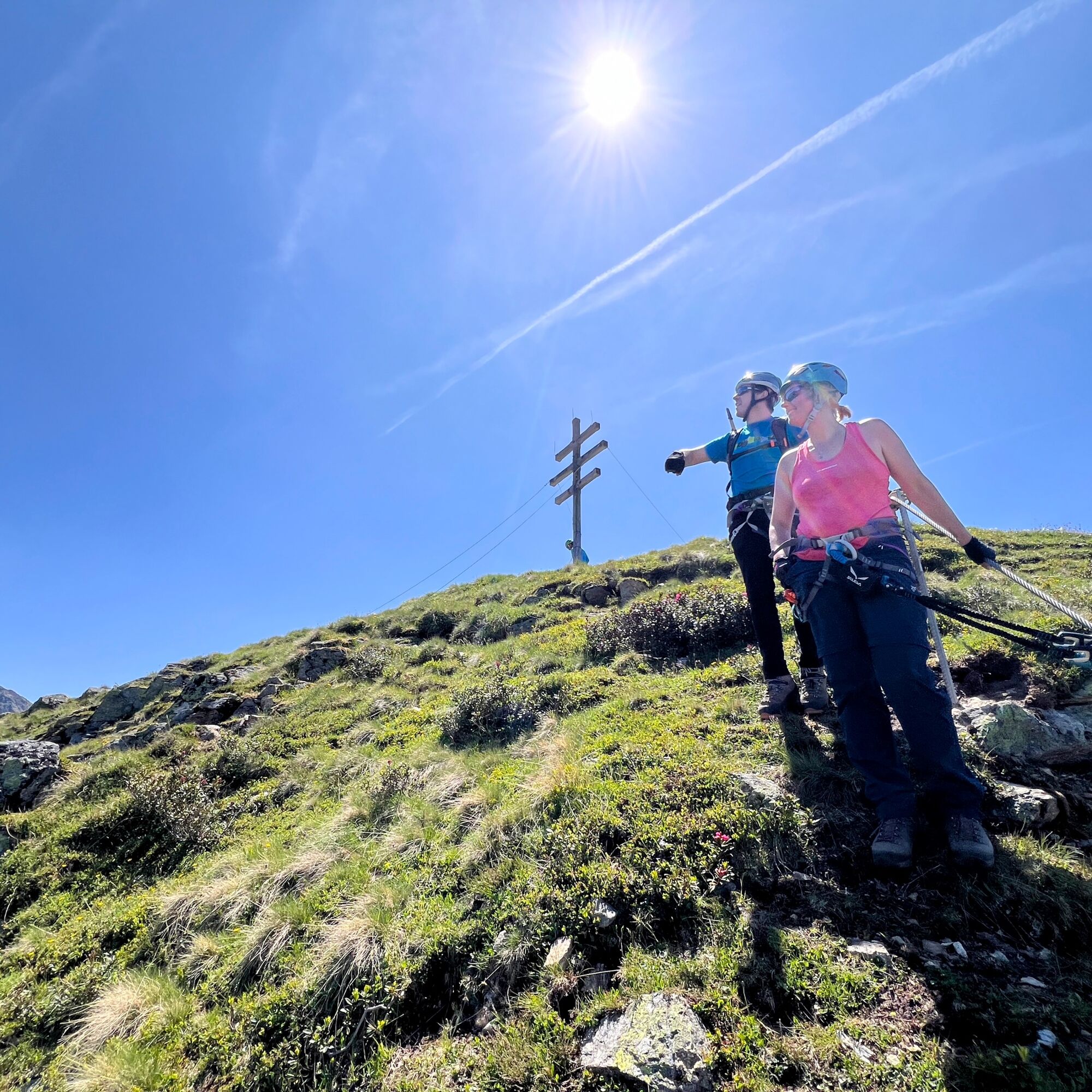
Now the alpine highlight of the tour begins: the Rosskopf via ferrata runs along the impressive northern face of the 2,399 m Rosskopf summit, offering a spectacular panoramic view over the Ötztal valley. The route is mostly rated B to B/C, with a short section rated C. It features a variety of exciting segments, including slabs, short steep climbs, and exposed ridge crossings. Surefootedness and a head for heights are essential.
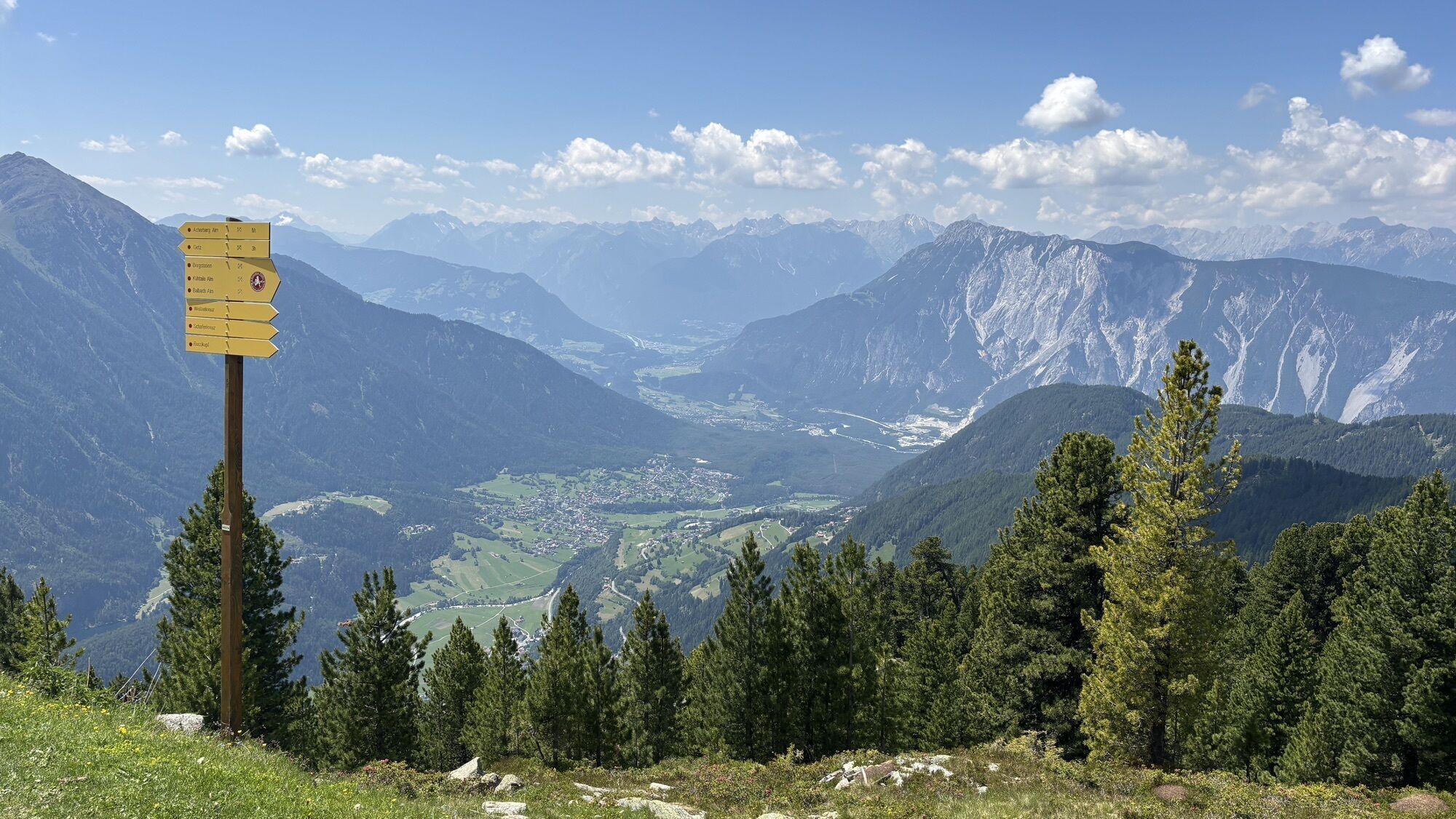
About halfway along the route, a bench on a wide rock plateau invites you to take a short break with a view. The ferrata ends just below the summit. The return route leads down the southern slope of the Rosskopf via a marked hiking trail back to the top station of the Acherkogel cable car (approx. 1 hour walking time, 390 m descent).
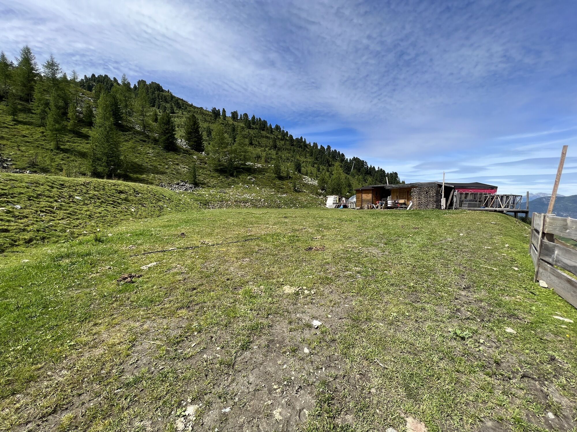
If you haven’t already taken a break at the Bielefelder Hütte, you’ll now have the chance to stop at the Panoramic Restaurant, or along the route at the Kühthaile Alm or Balbachalm. Before heading back into the valley by bike, it's advisable to check your brakes. The descent follows a wide forest road to Ochsengarten, then continues on the Kühtai road back to Oetz.


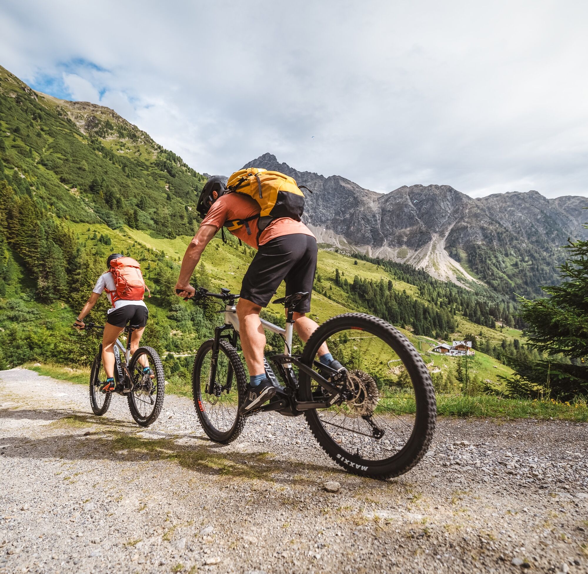
The tour begins with the ascent via the Kühtai High Alpine Road, a route well-known and infamous among cyclists, as it's part of the renowned Ötztal Cycle Marathon. At the bus stop, turn off in the direction of Klingenburg, continue towards Ötzerberg, and follow the gravel road to the Acherberg Alm. This is a great spot for a first break. The sunny terrace offers stunning panoramic views and is perfect for recharging your energy.
From here, continue by bike to the Panoramic Restaurant Hochoetz, where your bike can be securely parked. The hike to the Rosskopf via ferrata begins here. Follow the well-marked trail toward the Schäfer Kreuz. From here cross, an old sheep trail towards the via ferrata entrance. Helmets are mandatory on this section.
Now the alpine highlight of the tour begins: the Rosskopf via ferrata runs along the impressive northern face of the 2,399 m Rosskopf summit, offering a spectacular panoramic view over the Ötztal valley. The route is mostly rated B to B/C, with a short section rated C. It features a variety of exciting segments, including slabs, short steep climbs, and exposed ridge crossings. Surefootedness and a head for heights are essential.
About halfway along the route, a bench on a wide rock plateau invites you to take a short break with a view. The ferrata ends just below the summit. The return route leads down the southern slope of the Rosskopf via a marked hiking trail back to the top station of the Acherkogel cable car (approx. 1 hour walking time, 390 m descent).
If you haven’t already taken a break at the Bielefelder Hütte, you’ll now have the chance to stop at the Panoramic Restaurant, or along the route at the Kühthaile Alm or Balbachalm. Before heading back into the valley by bike, it's advisable to check your brakes. The descent follows a wide forest road to Ochsengarten, then continues on the Kühtai road back to Oetz.
Approproate equipment such as breathable suitable outdoor clothes for the weather, helmet, gloves, glasses, GPS device or detailed maps. If there is no hut on the way please bring a snack and enough to drink.
Preparation and Equipment: The ascent via the Kühtai High Alpine Road is demanding and well-known among cyclists. Make sure your bike is in perfect technical condition. Always wear a bicycle helmet throughout the entire cycling tour. For the via ferrata, a via ferrata set, climbing helmet, and suitable mountain or approach shoes are recommended. Take enough water and food with you.
Helmet Requirement: Wearing a helmet is mandatory from the entrance of the Rosskopf via ferrata.
Tour Character: The Rosskopf via ferrata is alpine and requires surefootedness, a head for heights, and good physical fitness. The difficulty level is mostly between B and B/C, with a short section at C — suitable only for experienced via ferrata climbers.
Weather: Always check the weather forecast before starting the tour. The via ferrata should not be attempted during thunderstorms, rain, or wet conditions — crampons and wet rocks greatly increase the risk.
Breaks and Orientation: Use the Acherberg Alm and the Hochoetz Panorama Restaurant for breaks to recharge. Pay attention to the well-marked hiking trails, especially when transitioning from the hiking path to the via ferrata.
Other: Inform someone about your planned tour and expected return time. Emergency equipment and a charged mobile phone for emergencies should always be with you.
The car drive to the Ötztal valley. Situated in Tirol, the Ötztal valley set off in southerly direction and is the longest side valley in the Eastern Alps. The journey with the car leads you through the Inntal valley to the entrance of the vallly and further on through the valley. Among the toll motorways you can also use the country roads. A route planner will show you the easiest and most convenient way: www.google.at/maps.
Travel safe and comfortable with the train to the Ötztal Bahnhof train station. Last stop and exit point is the train station Ötztal Bahnhof. Afterwards you can travel smoothly and quick with the public transport or out local taxi companies through the valley to your desired destination. Please find the current bus timetable here: fahrplan.vvt.at
The following parking facilities are available in Oetz:
center parking space Oetz, chargeable € 0,50/ car / 30 min
More info about biking, hiking & climbing in the Ötztal: www.oetztal.com
Start early to allow plenty of time for breaks at the alpine huts, to enjoy the via ferrata at a relaxed pace, and to take the return trip chilled
Tururi populare în vecinătate
-
4,6
Summit route Faltegartenköpfl
mediuExcursie 4,04 km -
4,4
Oetz - Piburger See - Oetz
mediuExcursie 7,16 km -
4,2
Hike Stuibenfall - Umhausen
luminăExcursie 2,95 km -
4,4
Stuibenfall Umhausen circular hike
luminăExcursie 9,32 km -
5,0
Larstigalm - Niederthai
luminăExcursie 3,24 km -
4,6
Trip Tirol ➤ Hike to the Blue Grotto in Rosengarten Gorge Imst
mediuExcursie 4,86 km -
4,8
Faltegartenköpfl (01)
luminăSkitour 4,19 km -
4,7
Umhausen - Stuibenfall - Umhausen
mediuExcursie 7,94 km -
4,6
Summit route Weather Cross from Hochoetz
mediuExcursie 3,06 km -
3,7
Auerklamm
mediuExcursie 3,46 km
Drumeții și urmărire


Nu ratați ofertele și inspirația pentru următoarea dvs. vacanță
Adresa dvs. de e-mail a fost adăugat la lista de corespondență.