


Gehsteigalm - Umhausen


From the car park at the primary school in Tumpen, follow the road towards "Grube" - then turn left onto a forest path uphill past the Tumpen waterfall. At the last crossroads, turn left towards "Vordere...
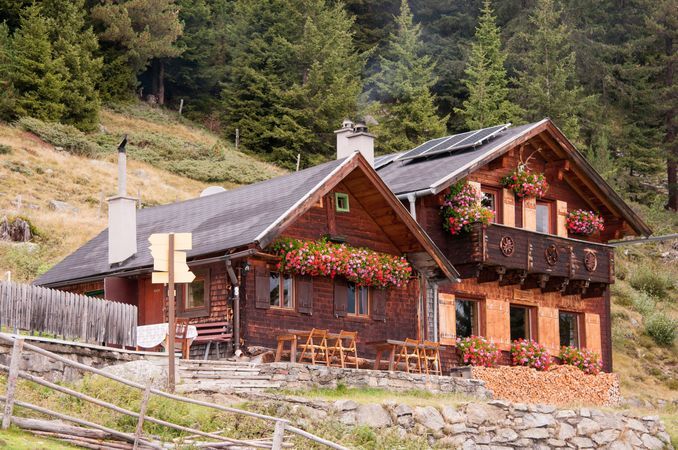
From the car park at the primary school in Tumpen, follow the road towards "Grube" - then turn left onto a forest path uphill past the Tumpen waterfall. At the last crossroads, turn left towards "Vordere Tumpenalm" and "Gehsteigalm". Just before the Vordere Tumpenalm, the forest path then continues to the left up to the Gehsteig Alm (not managed). The small rustic alpine hut, lovingly maintained for several generations, not only impresses visually but also offers a stunning view of the surrounding peaks of the Ötztal and Stubai Alps.

From the car park at the primary school in Tumpen, follow the road towards "Grube" - then turn left onto a forest path uphill past the Tumpen waterfall. At the last crossroads, turn left towards "Vordere Tumpenalm" and "Gehsteigalm". Just before the Vordere Tumpenalm, the forest path then continues to the left up to the Gehsteig Alm (not managed). The small rustic alpine hut, lovingly maintained for several generations, not only impresses visually but also offers a stunning view of the surrounding peaks of the Ötztal and Stubai Alps.
Da
Appropriate equipment such as breathable and weather-appropriate outdoor clothing, ankle-high hiking boots, wind, rain and sun protection, a hat, and possibly gloves are required for all hikes and routes. Carrying a first-aid kit, a mobile phone, and possibly a hiking map, as well as sufficient provisions for hikes without refreshment options, is necessary.
Easy hiking trail; suitable for beginners and walkers
Please note the current
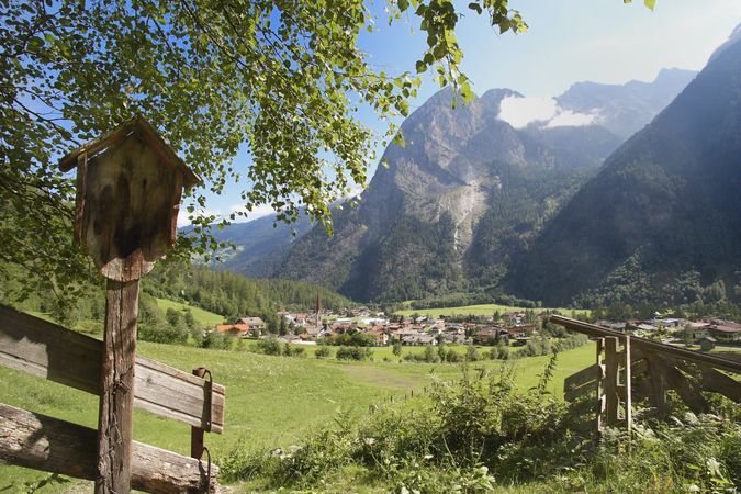
Driving to the ÖTZTAL valley. Located in Tyrol, the Ötztal branches off to the south as the longest side valley of the Eastern Alps. The journey by car leads travelers via the Inn valley to the valley entrance and then along the Ötztal. In addition to the toll motorway, country roads can also be used. With the route planner, your journey can be quickly and conveniently determined.
To the route planner: https://www.google.at/maps
Travel comfortably and safely by train to the Ötztal railway station. The final station or exit point is ÖTZTAL station. Afterwards, you can conveniently and quickly travel via public bus services or local taxi companies through the entire valley to your desired destination! The current bus timetable is available at: http://fahrplan.vvt.at
The following parking options are available in Tumpen:
Primary School Car Park Tumpen | free of charge
More information about hiking in the Ötztal can be found here
Tururi populare în vecinătate
-
4,7
Winnebachsee Hut – Längenfeld/Gries
mediuExcursie 4,74 km -
4,6
Summit route Faltegartenköpfl
mediuExcursie 4,04 km -
4,4
Oetz - Piburger See - Oetz
mediuExcursie 7,16 km -
4,2
Hike Stuibenfall - Umhausen
luminăExcursie 2,95 km -
4,4
Stuibenfall Umhausen circular hike
luminăExcursie 9,32 km -
5,0
Larstigalm - Niederthai
luminăExcursie 3,24 km -
4,6
Trip Tirol ➤ Hike to the Blue Grotto in Rosengarten Gorge Imst
mediuExcursie 4,86 km -
4,8
Faltegartenköpfl (01)
luminăSkitour 4,19 km -
4,7
Umhausen - Stuibenfall - Umhausen
mediuExcursie 7,94 km -
4,6
Summit route Weather Cross from Hochoetz
mediuExcursie 3,06 km
Drumeții și urmărire


Nu ratați ofertele și inspirația pentru următoarea dvs. vacanță
Adresa dvs. de e-mail a fost adăugat la lista de corespondență.