

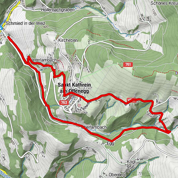
Informaţii pentru tur
7,14km
727
- 1.012m
286hm
285hm
03:30h
- Greutăţi
-
uşor
- Evaluare
-
- Punct de pornire
-
Karlwirt, Schmied in der Weiz
- Ruta
-
KarlwirtSchmied in der WeizLambach1,7 kmMühlental2,9 kmLindenstüberl4,3 kmLandgasthof Steinhauser5,1 kmDorf5,1 kmSankt Kathrein am Offenegg5,2 kmSchmied in der Weiz7,0 kmKarlwirt7,0 km
- Cel mai bun sezon
-
ianfebmaraprmaiiuniulaugsepoctnovdec
- Cel mai înalt punct
- 1.012 m
GPS Downloads


Condiții de traseu
Asfalt
Pietriş/prundiş/grohotiş
Livadă/pajişte
Pădure
Stâncă
Expus
Mai multe tururi în regiuni
-
Hochsteiermark
4075
-
Naturpark Almenland
1766
-
St. Kathrein am Offenegg
476


