


- Scurtă descriere
-
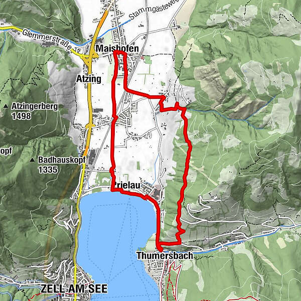
A well varied circuit combining a good track high on the hillside, linking the villages of Maishofen and Thumersbach, with part of the north shore of the Zellersee.
- Greutăţi
-
mediu
- Evaluare
-
- Ruta
-
Maishofen0,0 kmMayerhofen1,4 kmThumersbach5,3 kmWiesenlehen6,0 kmGasthof Wieshof6,3 kmPrielau6,9 kmPrielaukirche7,5 kmUnterreit8,2 kmBadhausfeld8,3 kmAtzing8,9 kmMaishofen9,5 km
- Cel mai înalt punct
- 970 m
- Profil de elevație
-


-

-
AutorTurul HPB Viehhofen: Maishofen & Thumersbach este utilizat de outdooractive.com furnizat.
GPS Downloads


Mai multe tururi în regiuni
-
Zell am See - Kaprun
1501
-
Maishofen
516


