


- Scurtă descriere
-
Should only be undertaken by those with good alpine experience or in the company of a mountain guide.
- Greutăţi
-
greu
- Evaluare
-
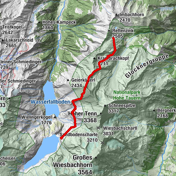
- Ruta
-
Kempsenkopf (3.090 m)4,8 kmObere Jägerscharte (2.752 m)5,6 kmGleiwitzer Hütte8,8 km
- Cel mai bun sezon
-
ianfebmaraprmaiiuniulaugsepoctnovdec
- Cel mai înalt punct
- 3.015 m
- Destinație
-
Gleiwitzer hut or Hoher Tenn
- Profil de elevație
-

-

-
AutorTurul Max-Hirschl-Weg este utilizat de outdooractive.com furnizat.
GPS Downloads

Informaţii generale
Oprire pentru băuturi răcoritoare
Mai multe tururi în regiuni


