Informaţii pentru tur
8,31km
1.579
- 2.412m
311hm
927hm
04:45h

- Greutăţi
-
greu
- Evaluare
-
- Ruta
-
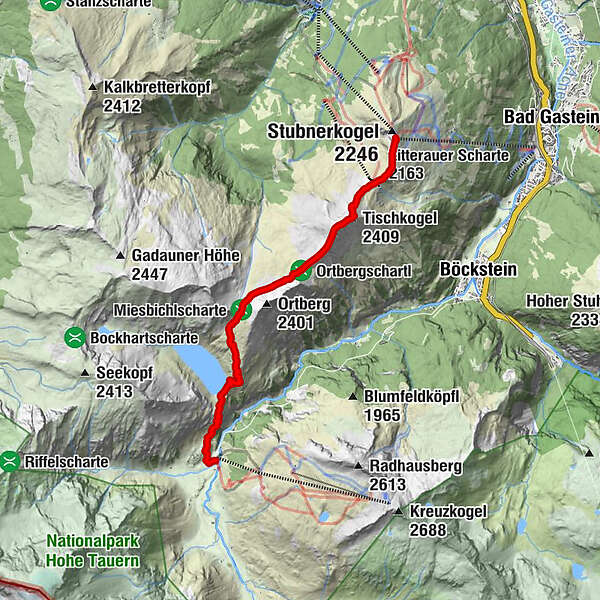
Gipfelrestaurant Stubnerkogel0,1 kmAussichtsplattform Glocknerblick0,3 kmZitterauer Scharte (2.163 m)0,9 kmTischkogel (2.409 m)1,8 kmZitterauer Tisch (2.463 m)2,1 kmZitterauer Alpe4,0 kmBockhartseehütte6,9 kmValeriehaus8,2 kmNaßfeld8,2 kmRestaurant Talstation8,2 kmSportgastein8,2 km
- Cel mai bun sezon
-
ianfebmaraprmaiiuniulaugsepoctnovdec
- Cel mai înalt punct
- 2.412 m
- Destinație
-
Sportgastein/Naßfeld
- Profil de elevație
-

-

-
AutorTurul Bad Gastein: Zittrauer Tisch und Miesbichlscharte este utilizat de outdooractive.com furnizat.
GPS Downloads


Informaţii generale
Oprire pentru băuturi răcoritoare
Cultural/Istoric
Flora
Fauna
Promițător
Mai multe tururi în regiuni