Watzmann-Hochkönig South-Loop: Stage 1: Bischofshofen – St. Martin am Tennengebirge

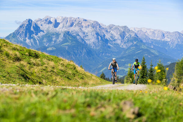
Mountainbike

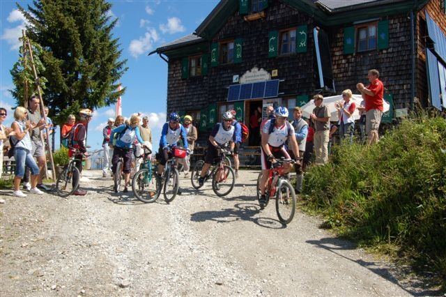
© ARGE Rad - SalzburgerLand, Chiemgau, Berchtesgadener Land - © Heinrich-Kiener-Haus

© ARGE Rad - SalzburgerLand, Chiemgau, Berchtesgadener Land - © Salzburger Sportwelt
Informaţii pentru tur
54,4km
541
- 1.788m
1.951hm
1.532hm
08:25h
- Scurtă descriere
-
With approximately 2150 metres above sea level is this stage, the stage with the most climbs! Already the first section from Bischofshofen leads steepls uphill to the Heinrich-Kam-Haus and the St. Vinzenz Peace church. Here we reach the highest point of the Watzmann-Hochkönig tour at 1792 m above sea level. The descent leads on forest paths down to Eben after which there is again a climb to St. Martin am Tennengebirge again.
- Greutăţi
-
greu
- Evaluare
-
- Ruta
-
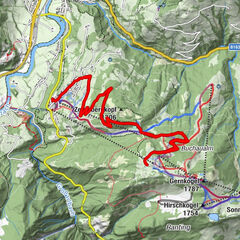
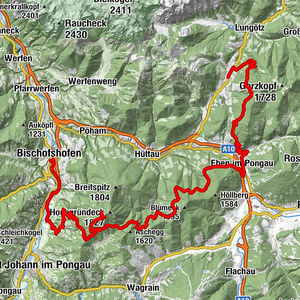
Bischofshofen0,3 kmunder the bridge1,4 kmBrandlehen11,2 kmObergründeck (1.367 m)13,9 kmMittergründeck (1.477 m)16,0 kmHeinrich-Kiener-Haus18,1 kmMittergründeck (1.477 m)20,3 kmSchwaiger38,9 kmSteiner's39,1 kmGasthof Ebnerwirt39,2 kmEben im Pongau39,5 kmSchattbach40,6 kmGasthofberg41,4 kmLerchenrotte53,4 kmSankt Martin am Tennengebirge54,1 km
- Cel mai bun sezon
-
ianfebmaraprmaiiuniulaugsepoctnovdec
- Cel mai înalt punct
- 1.788 m
- Destinație
-
St. Martin am Tennengebirge
- Profil de elevație
-

- Autor
-
Turul Watzmann-Hochkönig South-Loop: Stage 1: Bischofshofen – St. Martin am Tennengebirge este utilizat de outdooractive.com furnizat.
GPS Downloads


Informaţii generale
Oprire pentru băuturi răcoritoare
Flora
Mai multe tururi în regiuni
-
Schladming - Dachstein
405
-
Salzburger Sportwelt
338
-
Hüttau
141