© Fam. Hebelt - Torsten Schröder
- Scurtă descriere
-
Relaxed hiking tour past historic mills
- Greutăţi
-
uşor
- Evaluare
-
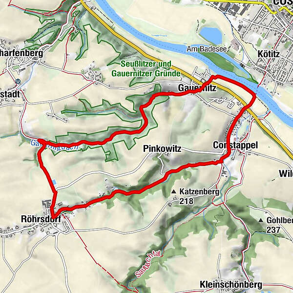
- Ruta
-
Coswig (118 m)0,3 kmGauernitz1,1 kmPinkowitz2,6 kmRöhrsdorf5,9 kmPinkowitz8,1 kmConstappel9,2 kmCoswig (118 m)10,2 km
- Cel mai bun sezon
-
ianfebmaraprmaiiuniulaugsepoctnovdec
- Cel mai înalt punct
- 237 m
- Destinație
-
Elbfähre Coswig/Kötitz
- Profil de elevație
-
 © outdooractive.com

- Autor
-
Turul Through the Gauernitzbach and Regenbach Valley este utilizat de outdooractive.com furnizat.
GPS Downloads


Informaţii generale
Cultural/Istoric
Mai multe tururi în regiuni
-
Dresden Elbland
626
-
Dresden
579
-
Klipphausen
144