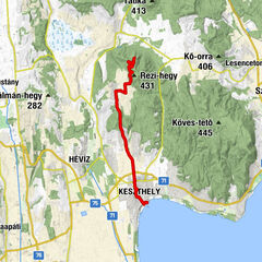
Keszthelygebirge - Bakonyerdö - Pad-Kö Kilato - Szépkilátó ( Balaton Ungarn )

Mountainbike


Informaţii pentru tur
35,61km
100
- 404m
386hm
383hm
03:30h

- Scurtă descriere
-
MTB: Rundfahrt durch das Keszthelygebirge ( Bakonyerdö Tura Balaton Ungarn ); Pad-kő kilátó , Szépkilátó und Szent-Mihaly-Kapolna
- Greutăţi
-
mediu
- Evaluare
-
- Punct de pornire
-
Keszthely
- Ruta
-
Kesthell0,4 kmPénzes-gödör6,4 kmArborétum13,1 kmPadkűi kilátó13,3 kmPad-kő (408 m)13,3 kmGúla-tető14,0 kmBalatongyörök21,0 kmVarga vendéglő21,7 kmRómai-forrás22,7 kmSzépkilátó22,8 kmBalatongyöröki hajóállomás25,4 kmBöngyéres26,0 kmSzent Mihály domb (136 m)27,3 kmSzent Mihály Chapel28,0 kmVonyarcvashegy29,2 kmJaffa Büfé32,8 kmKesthell34,9 km
- Cel mai bun sezon
-
ianfebmaraprmaiiuniulaugsepoctnovdec
- Cel mai înalt punct
- Pad-Kö Kilato (404 m)
- Destinație
-
Keszthely
- Odihnă/Retragere
-
Pad-Kö Kilato (Aussichtsturm)
Balatongyörök - Szep-Kilato (Aussicht / Balaton-Panorama)
Szent Mihaly Kapolna (Aussicht / Panorama) - Material pentru hartă
-
Markierung: "K3" BAKONYERDÖ TURA
www.balcsi.net/images/keszthelyi-hegy...


- Sursă
- Xxlstier
GPS Downloads


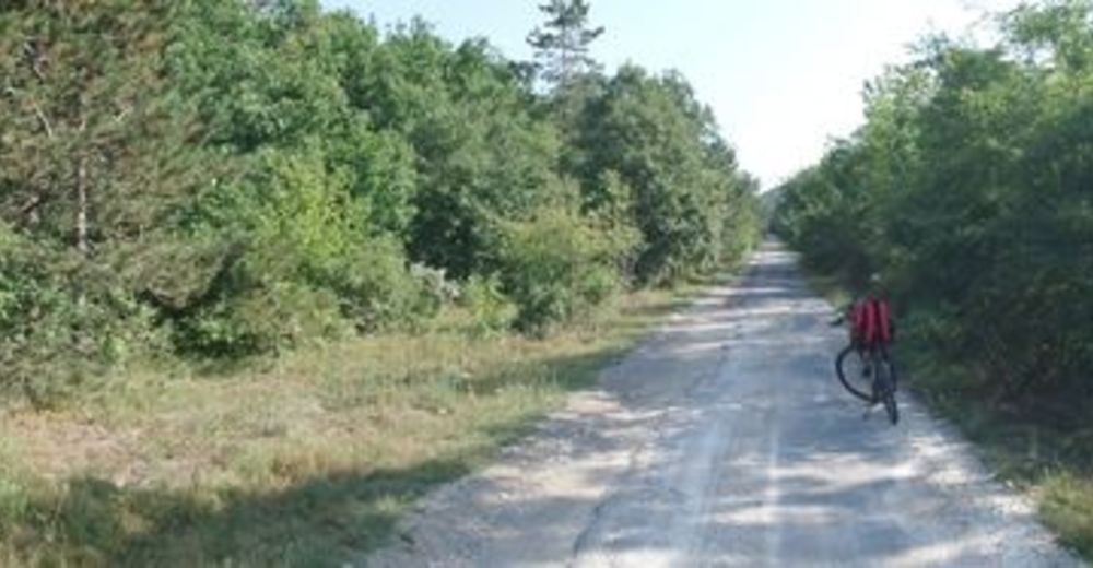
Benzi de circulaţie
Asfalt
(90%)
Pietriş/prundiş/grohotiş
(10%)
Pădure
Drumuri montane
Drumuri înguste/poteci pentru o persoană
Verificare
Circulaţie