

© Schachner
© Schachner
Informaţii pentru tur
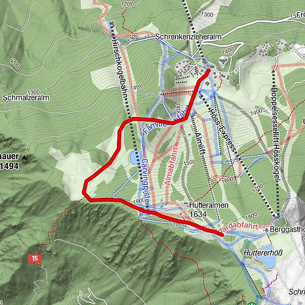
3km
1.384
- 1.841m
454hm
02:30h
- Scurtă descriere
-
Schwierigkeitsgrad: Rot: Schotterstraße
- Greutăţi
-
mediu
- Evaluare
-
- Punct de pornire
-
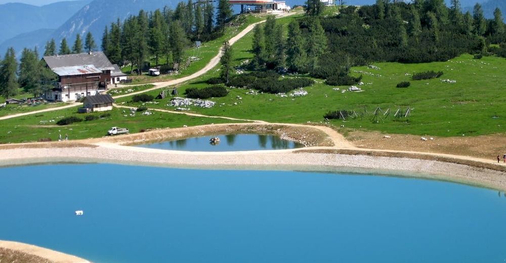
Hutterer Höss
- Cel mai bun sezon
-
ianfebmaraprmaiiuniulaugsepoctnovdec
- Cel mai înalt punct
- 1.841 m
- Odihnă/Retragere
-
Lögerhütt´n, BergGH Hutterer Höss
- Material pentru hartă
-
Wanderkarte Pyhrn-Priel erhältlich in allen Pyhrn-Priel Tourismusbüros!


GPS Downloads


Condiții de traseu
Asfalt
Pietriş/prundiş/grohotiş
Livadă/pajişte
Pădure
Stâncă
Expus
Mai multe tururi în regiuni
-
Traunviertel
1940
-
Urlaubsregion Pyhrn - Priel
1440
-
Hinterstoder
395


