
© Kniewasser

© Kniewasser
Informaţii pentru tur
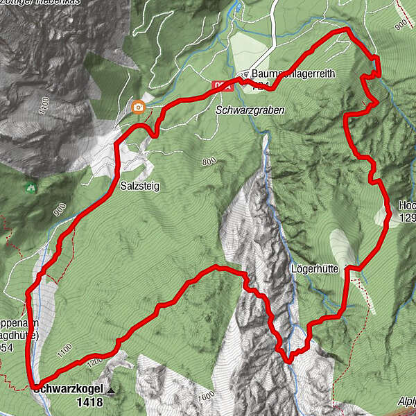
9,29km
719
- 1.414m
718hm
706hm
05:00h
- Scurtă descriere
-
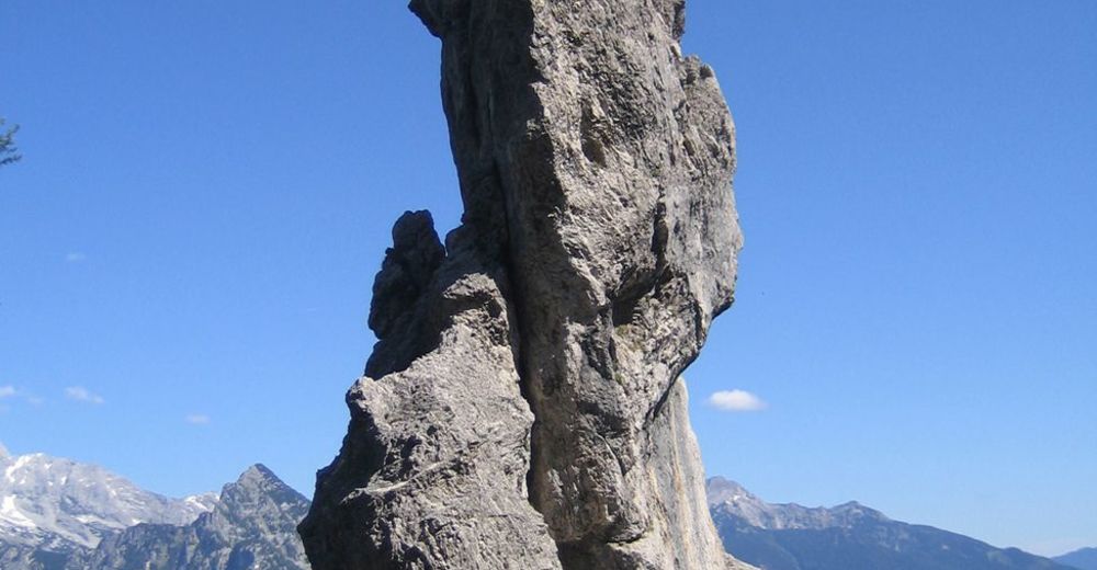
Panoramawanderung; Bergerfahrung und Schwindelfreiheit erforderlich!
- Greutăţi
-
greu
- Evaluare
-
- Punct de pornire
-
Gasthaus Baumschlagerreith
- Ruta
-
Almgasthof Baumschlagerreith0,0 kmAlmgasthof Baumschlagerreith9,2 km
- Cel mai bun sezon
-
ianfebmaraprmaiiuniulaugsepoctnovdec
- Cel mai înalt punct
- 1.414 m
- Odihnă/Retragere
-
GH Bauschlagerreith
- Material pentru hartă
-
Wanderkarte Pyhrn-Priel erhältlich in allen Pyhrn-Priel Tourismusbüros!

GPS Downloads


Condiții de traseu
Asfalt
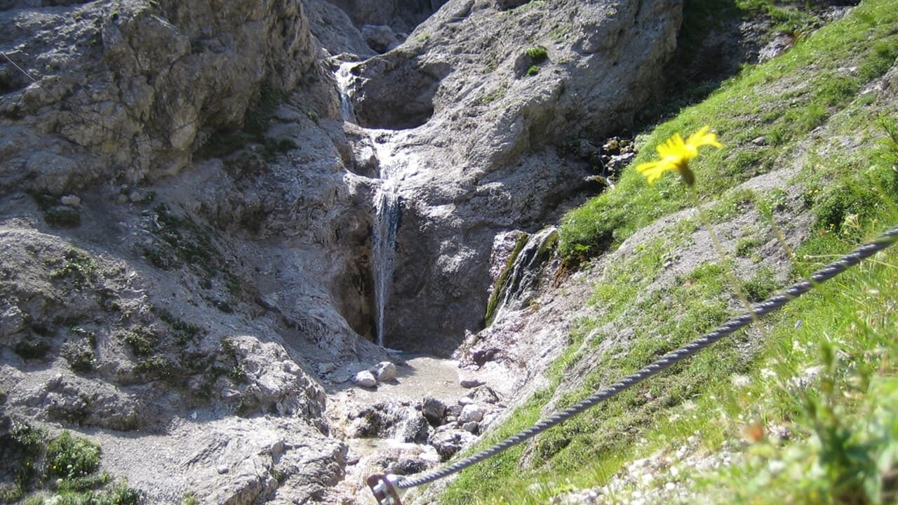
Pietriş/prundiş/grohotiş
Livadă/pajişte
Pădure
Stâncă
Expus
Mai multe tururi în regiuni


