© Graubünden Ferien - WOM Medien GmbH Andreas Meyer

© Graubünden
© Graubünden Ferien - WOM Medien GmbH Andreas Meyer
© Graubünden Ferien - WOM Medien GmbH Andreas Meyer
© Graubünden Ferien - WOM Medien GmbH Andreas Meyer
© Graubünden Ferien - WOM Medien GmbH Andreas Meyer
© Graubünden Ferien - WOM Medien GmbH Andreas Meyer
© Graubünden Ferien - WOM Medien GmbH Andreas Meyer

© Graubünden Ferien - WOM Medien GmbH Andreas Meyer
© Graubünden Ferien - WOM Medien GmbH Andreas Meyer
- Scurtă descriere
-
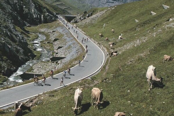
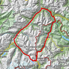
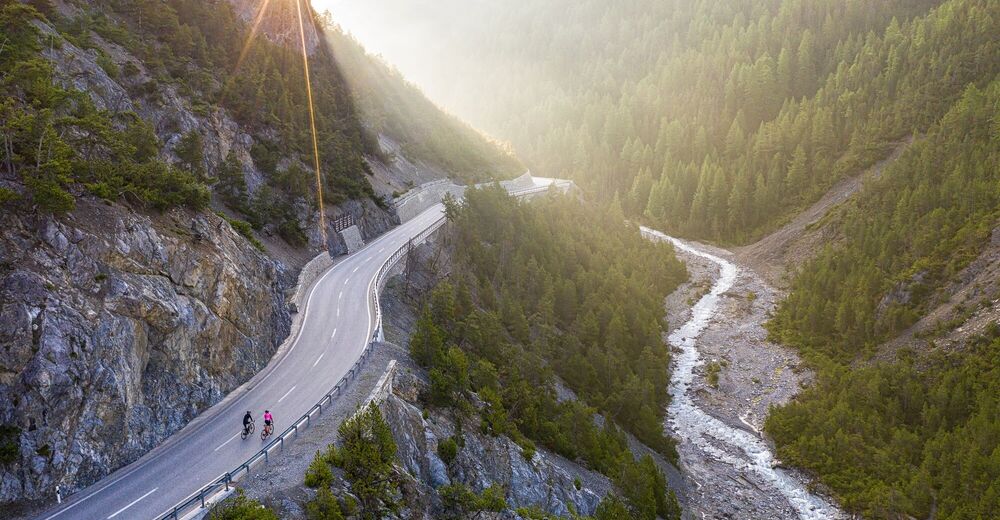
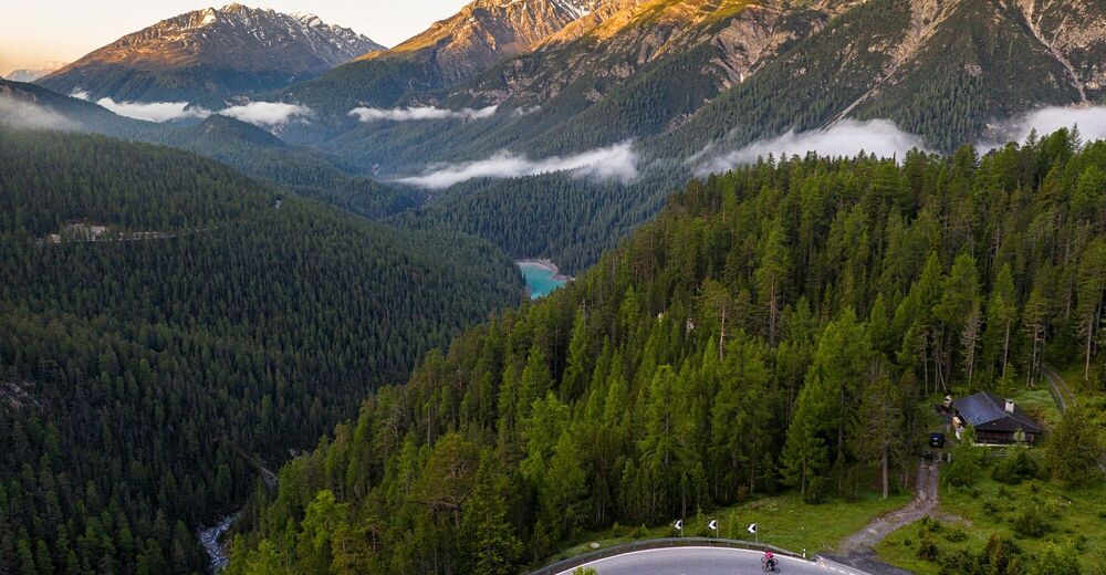
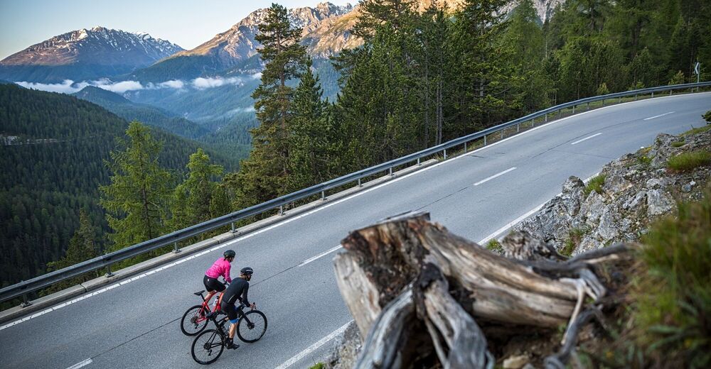
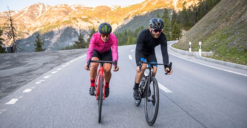
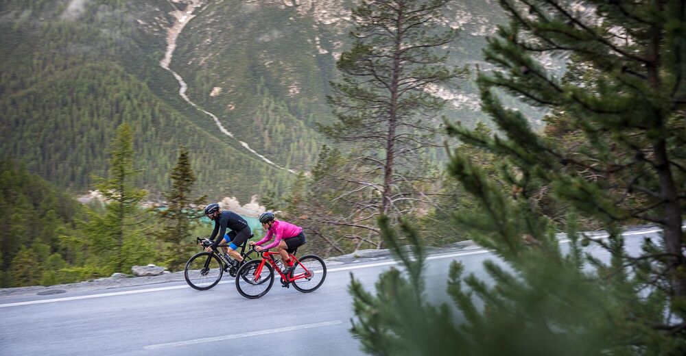
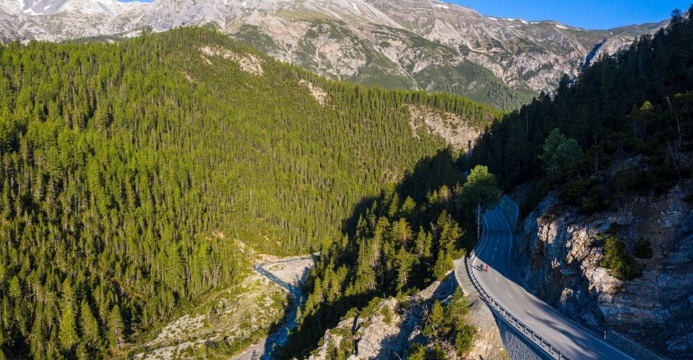
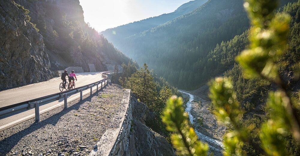
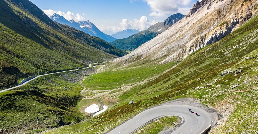
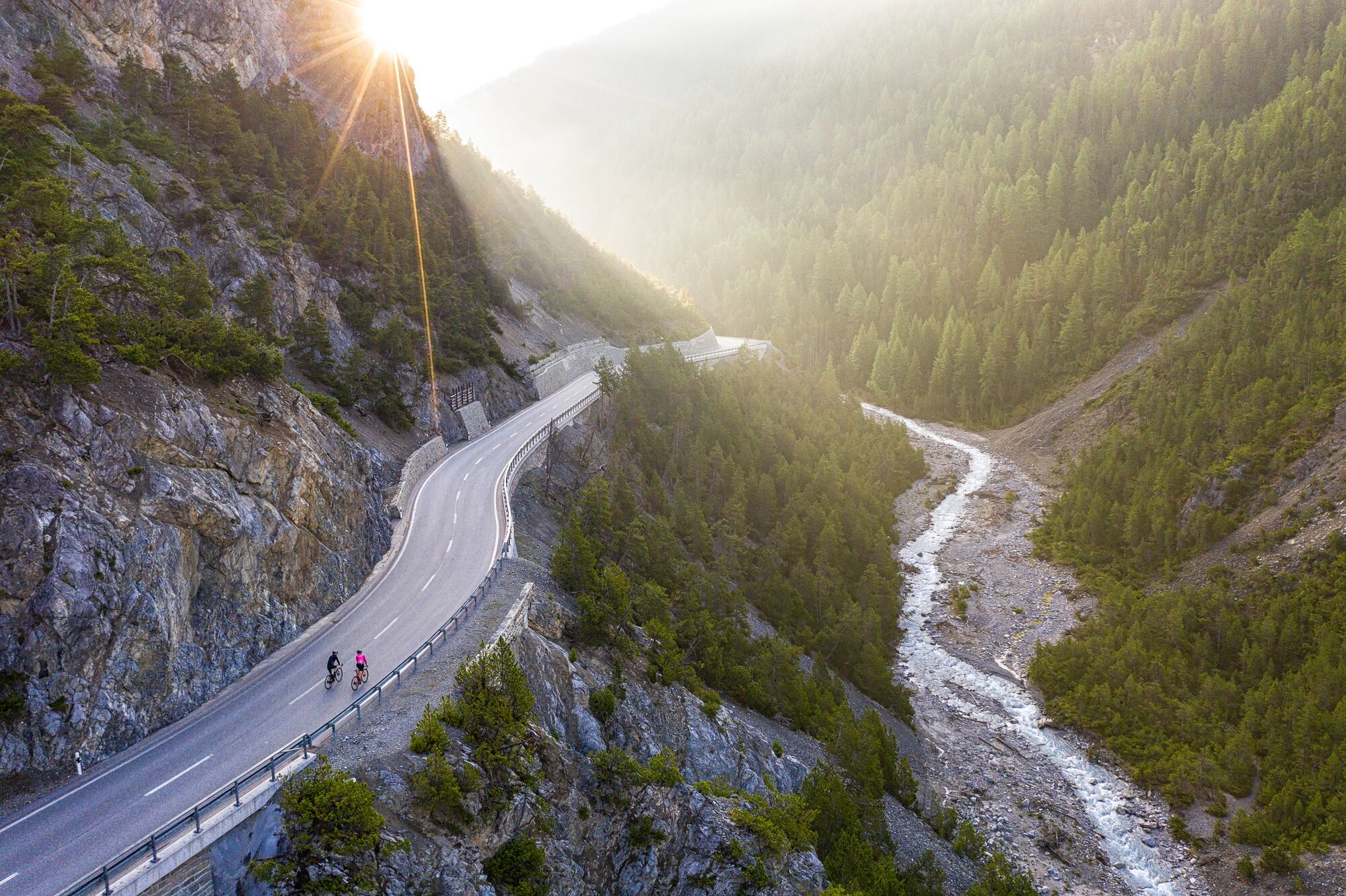
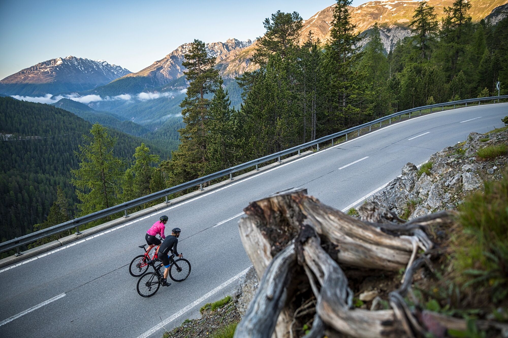
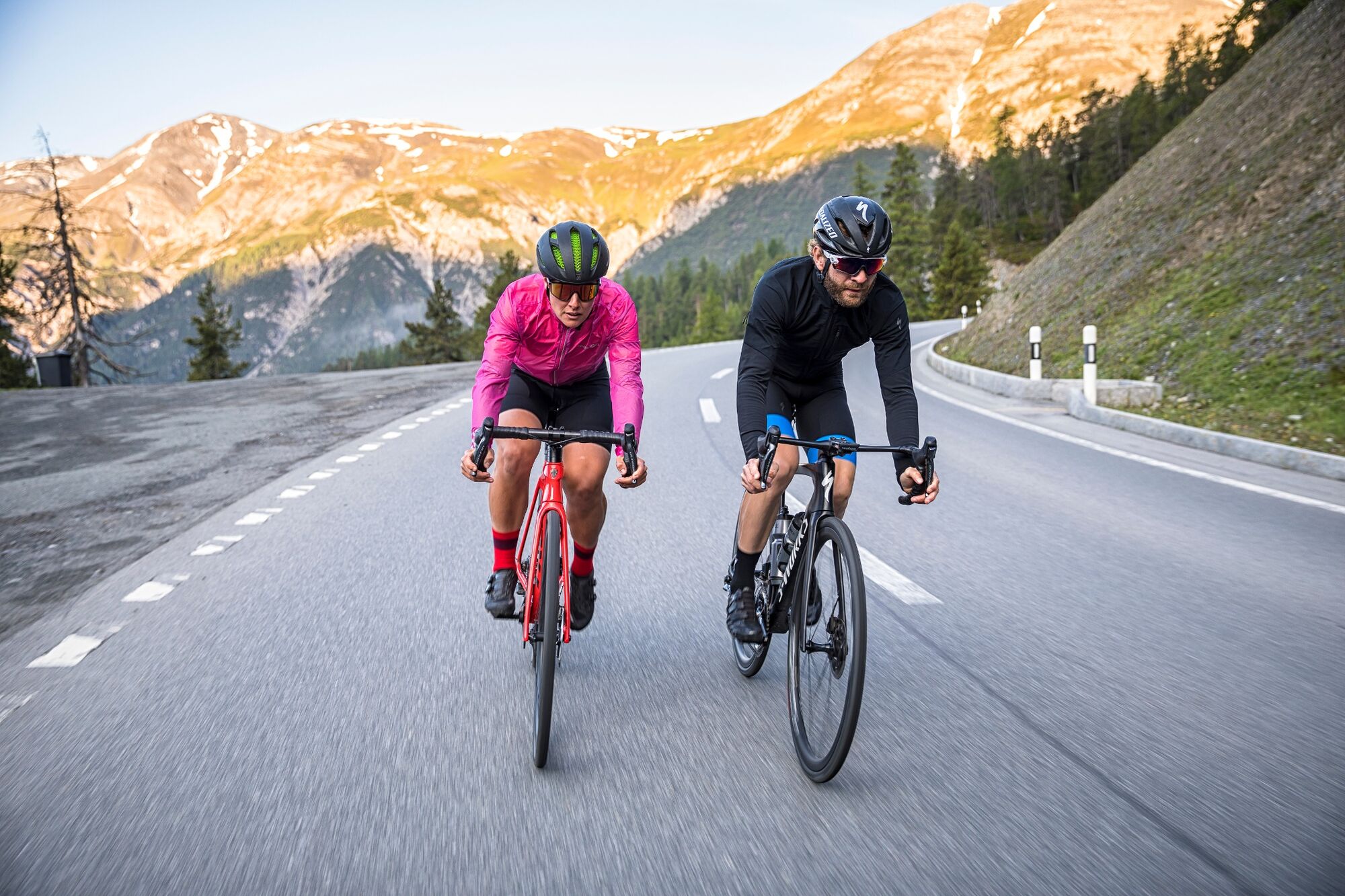
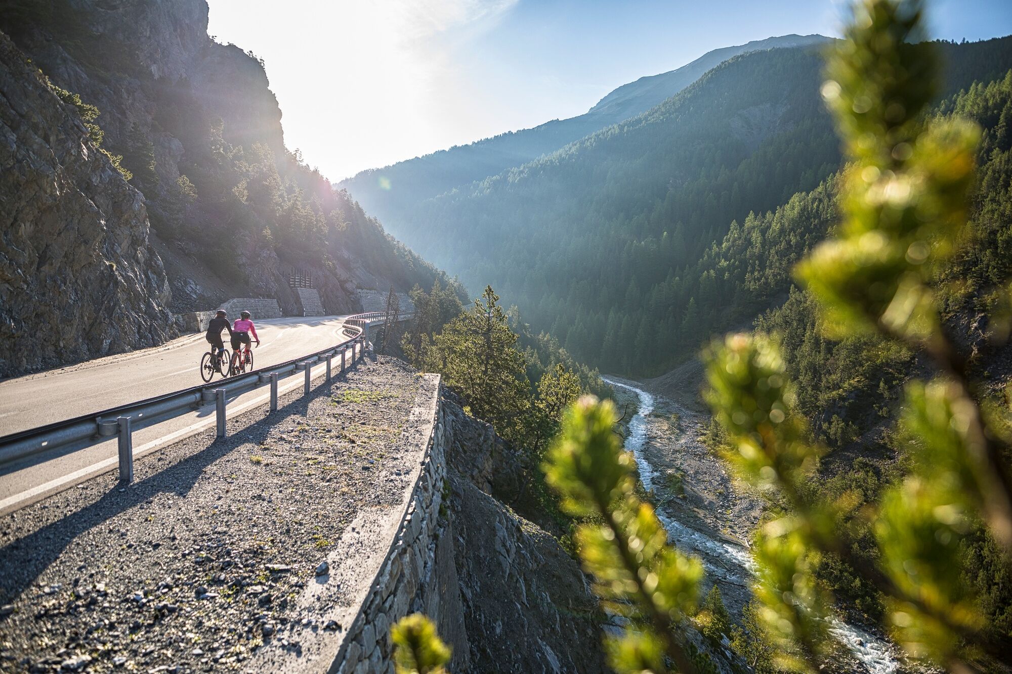
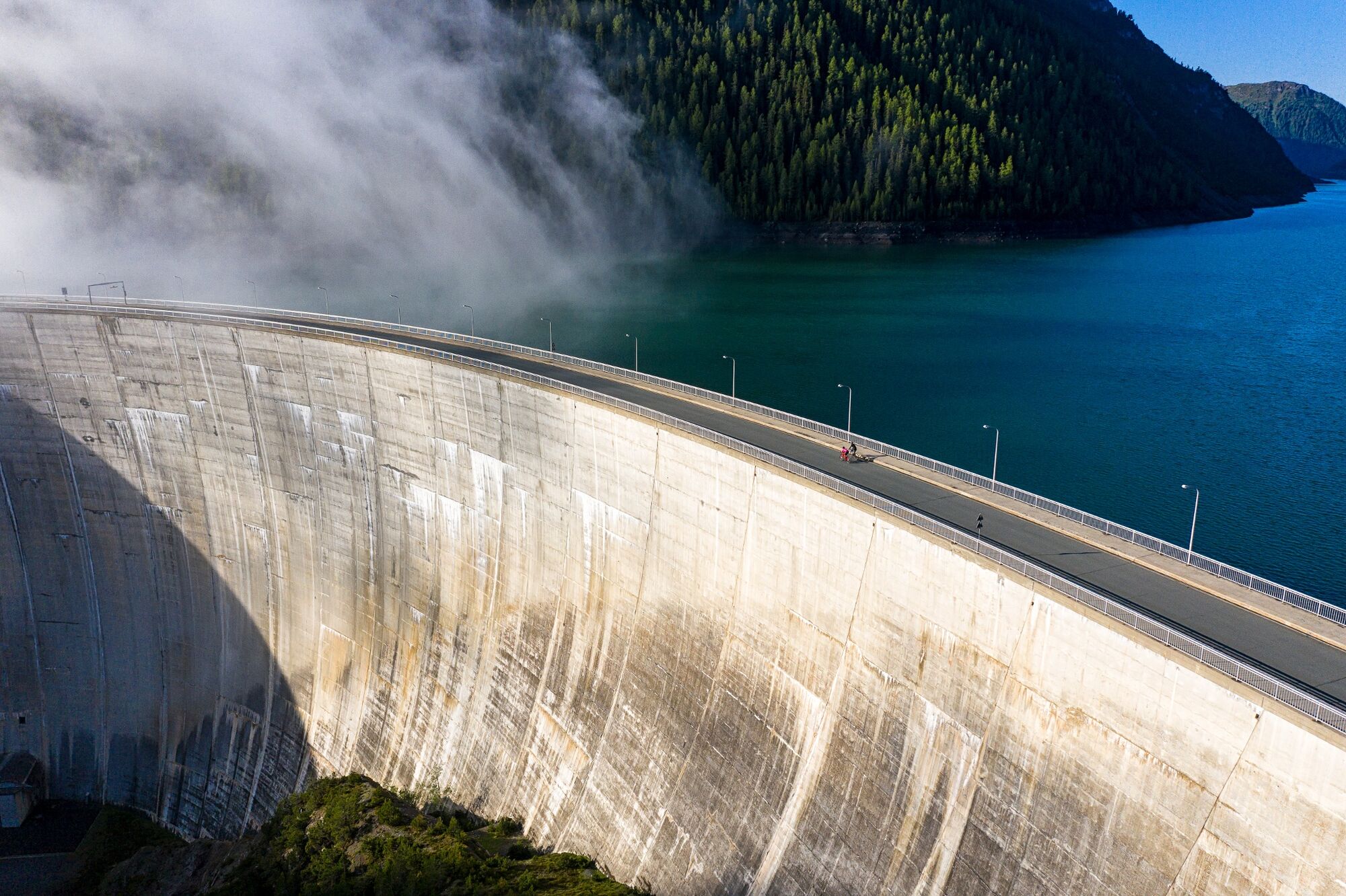
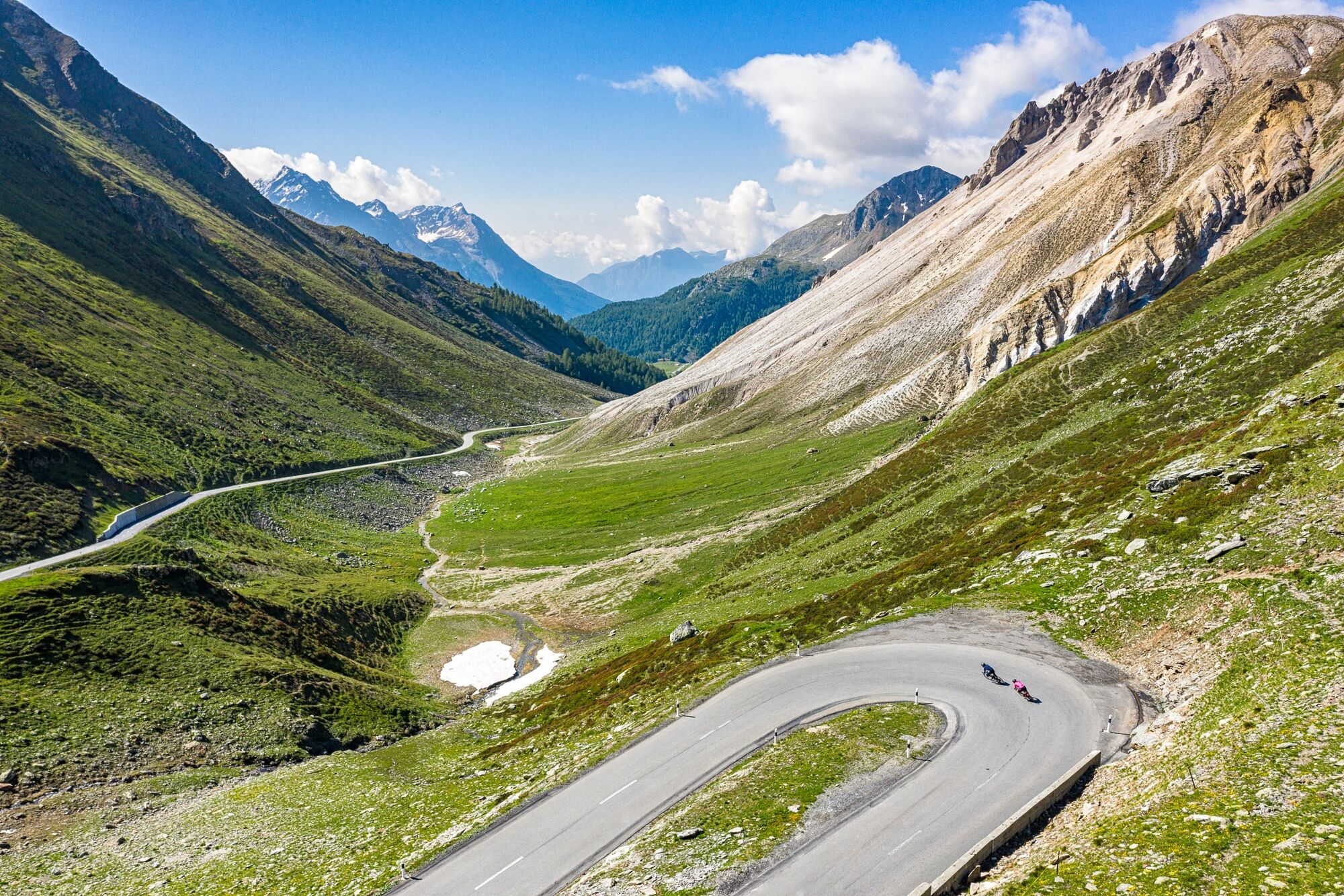
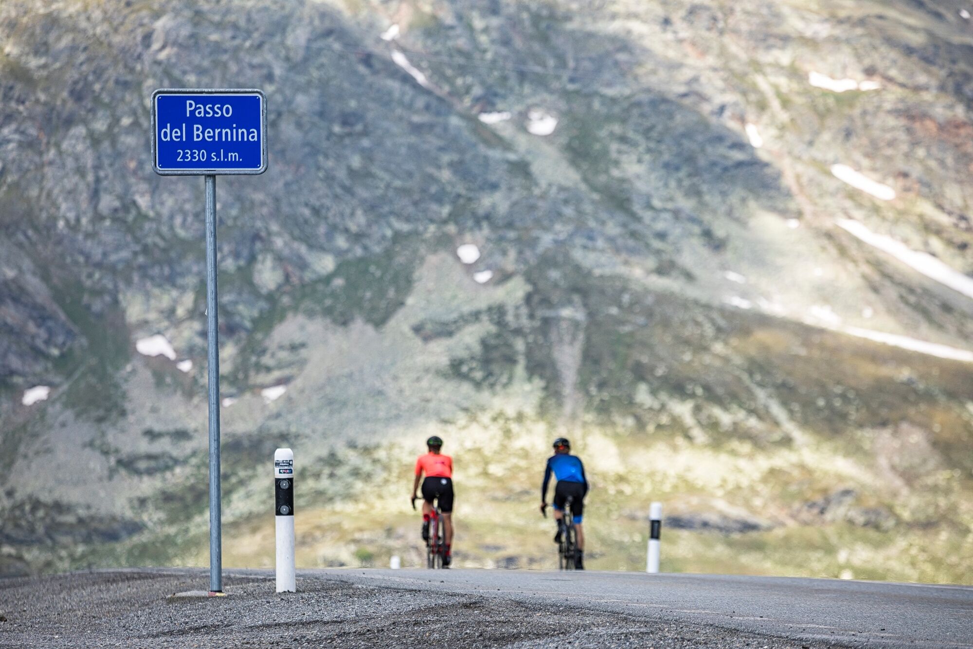
More Road cycling? Impossible! Steep slopes in the Swiss National Park, intoxication with speed in aero position, espresso in Livigno, headwind in the Forcola di Livigno, glacier highlight on the Bernina Pass and motivation training along the Inn.
- Greutăţi
-
greu
- Evaluare
-
- Ruta
-
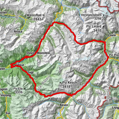
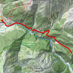
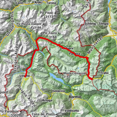
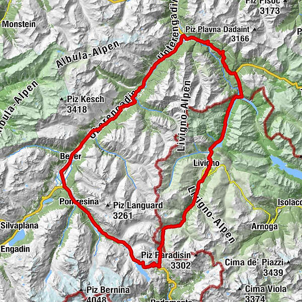
San Antonius0,1 kmZernez (1.474 m)0,6 kmHotel Pizzeria SELVA0,8 kmNaturfreundehaus Ova Spin6,4 kmOva Spin6,5 kmPunt dal Gall (1.805 m)15,5 kmRistoro Fopel19,2 kmPonte del Brum26,0 kmLuwin (1.816 m)28,0 kmTeola29,5 kmBaita Veglia32,6 kmTresenda33,7 kmAlpe Campaccio36,4 kmRifugio Tridentina42,6 kmForesteria 231542,8 kmBerninapass 2330 m ü M.50,3 kmBerninapass (2.330 m)50,3 kmCambrena50,6 kmCurtinatsch55,0 kmBernina Suot (2.046 m)57,1 kmCascata da Bernina59,3 kmFoto-Spot Morteratsch59,7 kmResgia63,5 kmPontresina (1.805 m)64,4 kmPunt Muragl67,4 kmLa Terra 2767,5 kmPunt Muragl (1.728 m)67,8 kmSamaden (1.721 m)69,3 kmBever (1.708 m)73,1 kmReformierte Kirche75,7 kmAlbula75,8 kmFoto-Spot La Punt77,4 kmLa Punt77,4 kmLa Punt Chamues-ch (1.687 m)77,4 kmMadulain (1.697 m)78,9 kmResgia81,1 kmCurtinellas81,9 kmReformierte Kirche83,7 kmS-chanf (1.660 m)84,1 kmKirche St. Ulrich und Nikolaus und Hospiz87,5 kmTulait89,0 kmCinuos-chel-Brail (1.640 m)89,1 kmVeduta89,1 kmSur il Chaunt89,2 kmCinuskel (1.612 m)89,6 kmBrail91,2 kmZernez (1.471 m)97,8 kmZernez (1.474 m)98,3 km
- Cel mai bun sezon
-
ianfebmaraprmaiiuniulaugsepoctnovdec
- Cel mai înalt punct
- 2.325 m
- Profil de elevație
-
 © outdooractive.com


-

-
AutorTurul Giro Parc Naziunal Svizzer este utilizat de outdooractive.com furnizat.
GPS Downloads


Mai multe tururi în regiuni