
Informaţii pentru tur
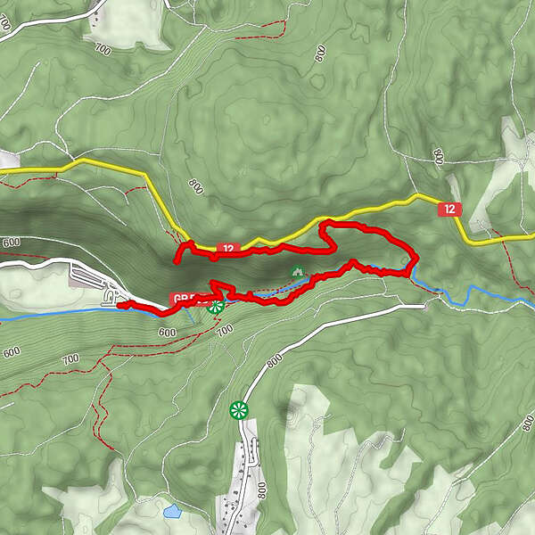
3,67km
518
- 756m
258hm
43hm
01:17h
- Scurtă descriere
-
It’s a walk up to the cascades and a viewpoint at the end
- Greutăţi
-
uşor
- Evaluare
-
- Ruta
-
Relais de l'Éventail0,1 kmCascade de l'Éventail0,5 kmCascade de l'Éventail0,8 kmL'Éventail0,8 kmGrand saut (bas)1,2 kmBelvédère du grand saut1,3 kmGrand Saut1,4 kmGour Bleu1,5 kmSaut de la Forge1,9 kmChâteau Garnier1,9 kmBelvédère de l'Éventail3,6 km
- Cel mai înalt punct
- 756 m
GPS Downloads


Mai multe tururi în regiuni
-
Jura
267
-
Grandvallière
172