
- Scurtă descriere
-
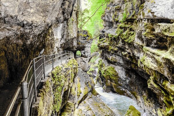
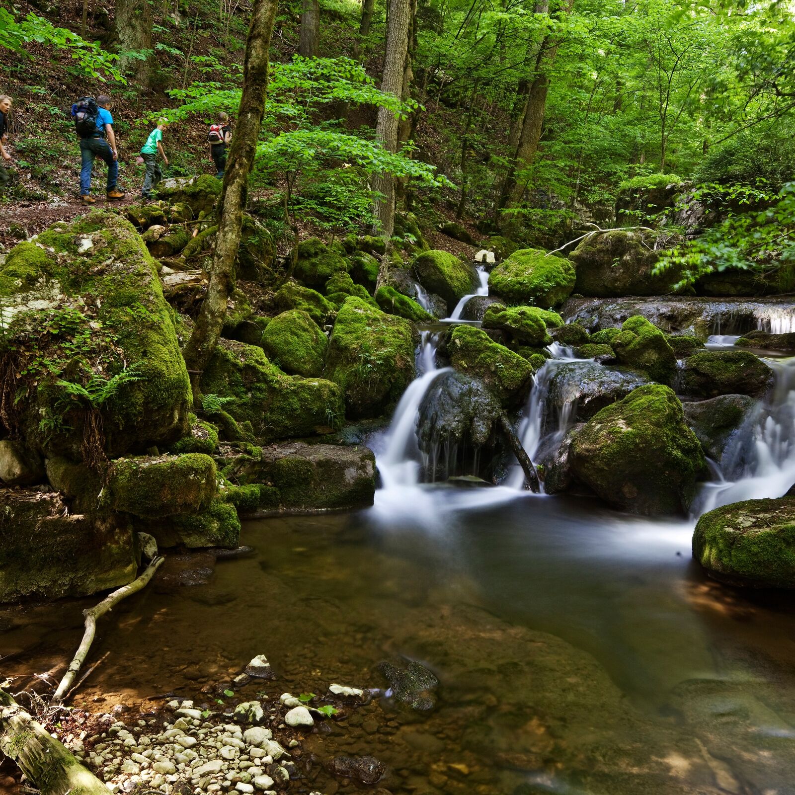
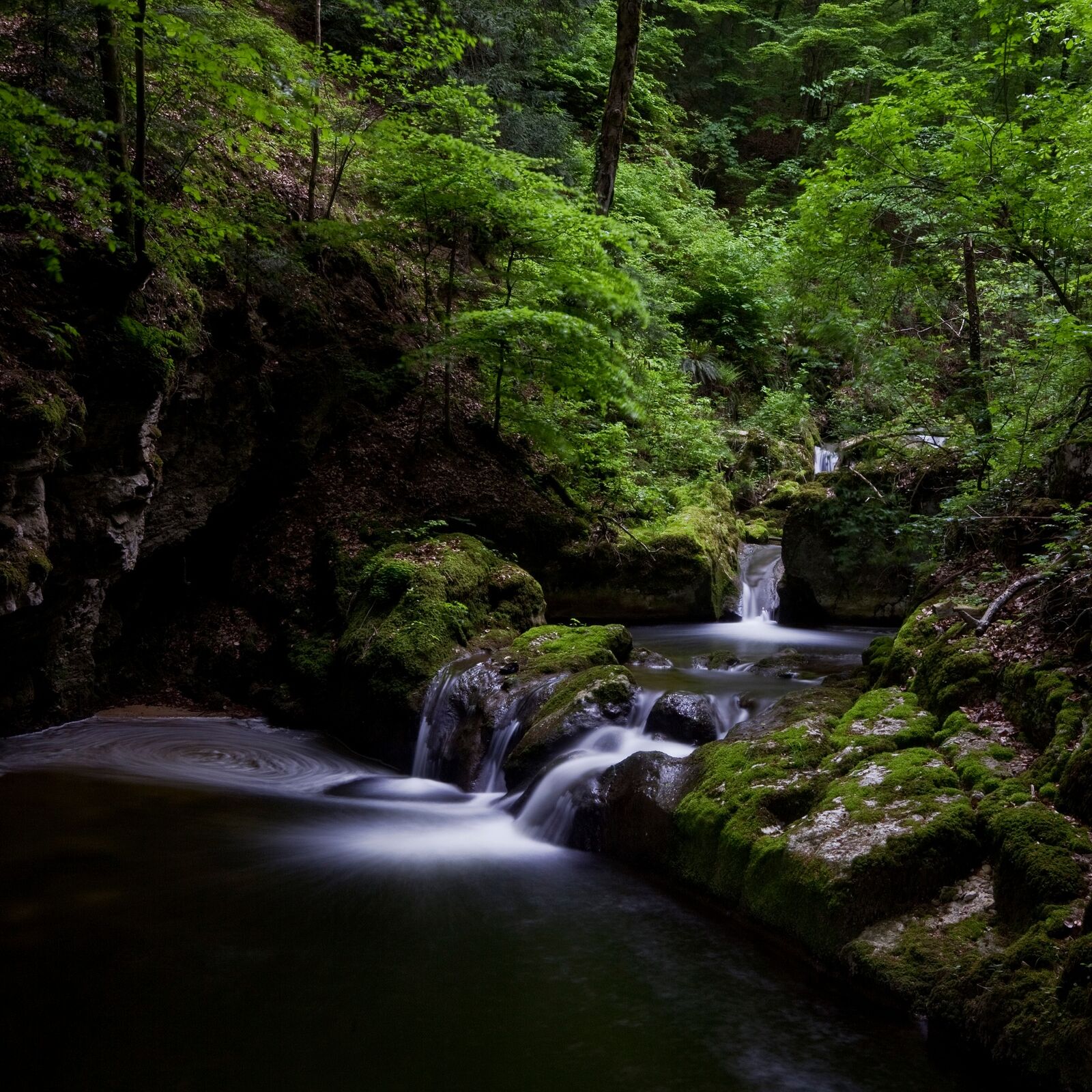
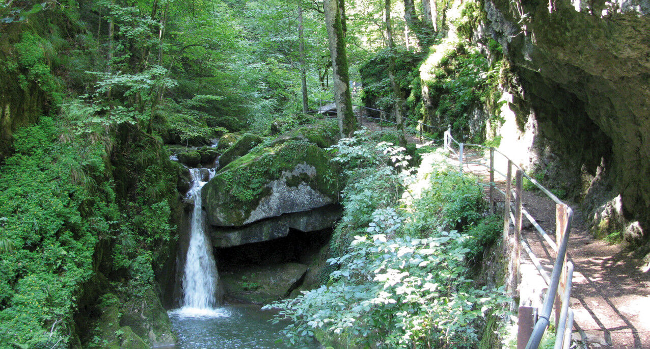
This is a popular, scenic hike across the forested back of the chain of lakes. The descent is through the cool Twann river gorge to the shores of Lake Biel (Take care in wet weather: slippery stone slabs!). Along the way, you will encounter the administration facilities of the Swiss Federal Office of Sport and the Twannberg Holiday Village Foundation building, both of which blend harmoniously into the landscape. Minimal hard-surfaced areas outside of townships.
- Greutăţi
-
uşor
- Evaluare
-
- Ruta
-
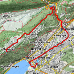
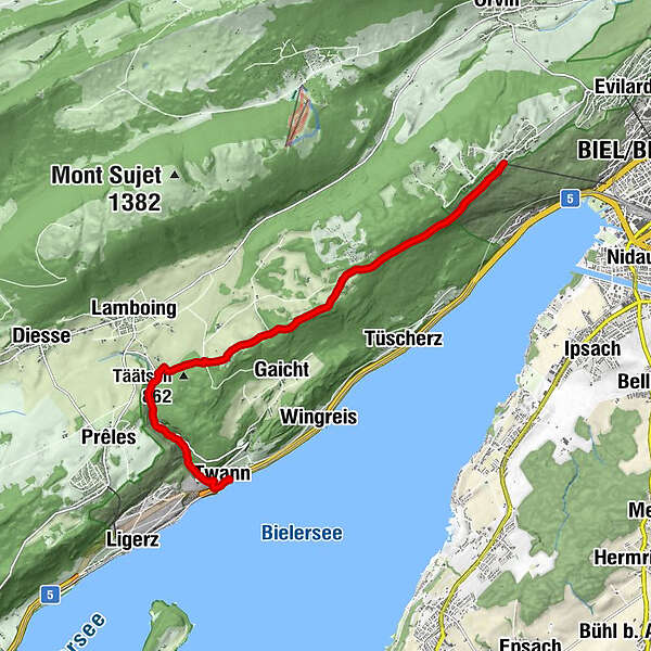
Magglingen (875 m)Biel/Bienne (434 m)Bellavista0,2 kmTwannberg5,6 kmTäätsch (862 m)6,4 kmLes Moulins6,9 kmGlas-Atelier7,0 kmKänzeli9,3 kmTwann (434 m)9,7 kmTwann (434 m)9,8 km
- Cel mai bun sezon
-
ianfebmaraprmaiiuniulaugsepoctnovdec
- Cel mai înalt punct
- 976 m
- Destinație
-
Twann
- Profil de elevație
-
 © outdooractive.com
-

-
AutorTurul Twann river gorge (Twannbachschlucht) este utilizat de outdooractive.com furnizat.
GPS Downloads


Informaţii generale
Oprire pentru băuturi răcoritoare
Cultural/Istoric
Sfat din interior
Promițător
Mai multe tururi în regiuni
-
Biel Seeland
782
-
Bielersee / Twann - Ligerz - Tüscherz
336
-
Twann
118