© Berner Wanderwege - Wanderleiter (ZD) Berner Wanderwege

© Berner Wanderwege - Wanderleiter (ZD) Berner Wanderwege


© Tourenplaner SCHWEIZ - Jochen Ihle

- Scurtă descriere
-
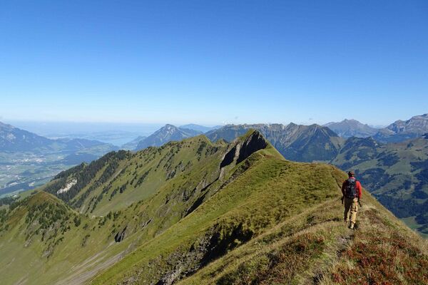
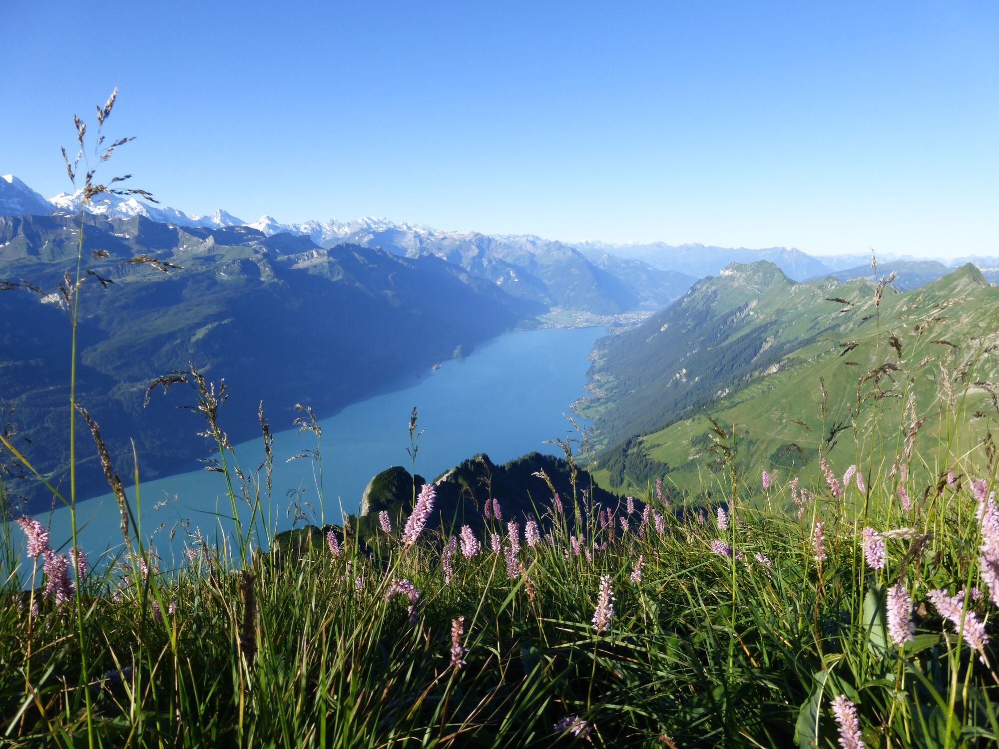
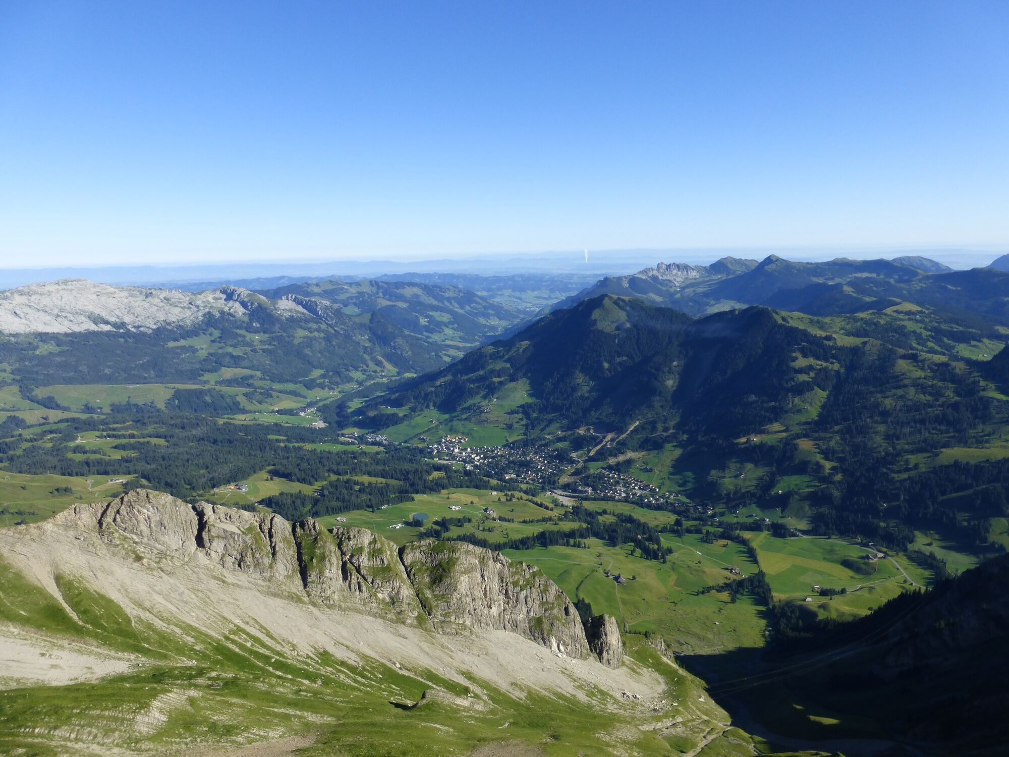
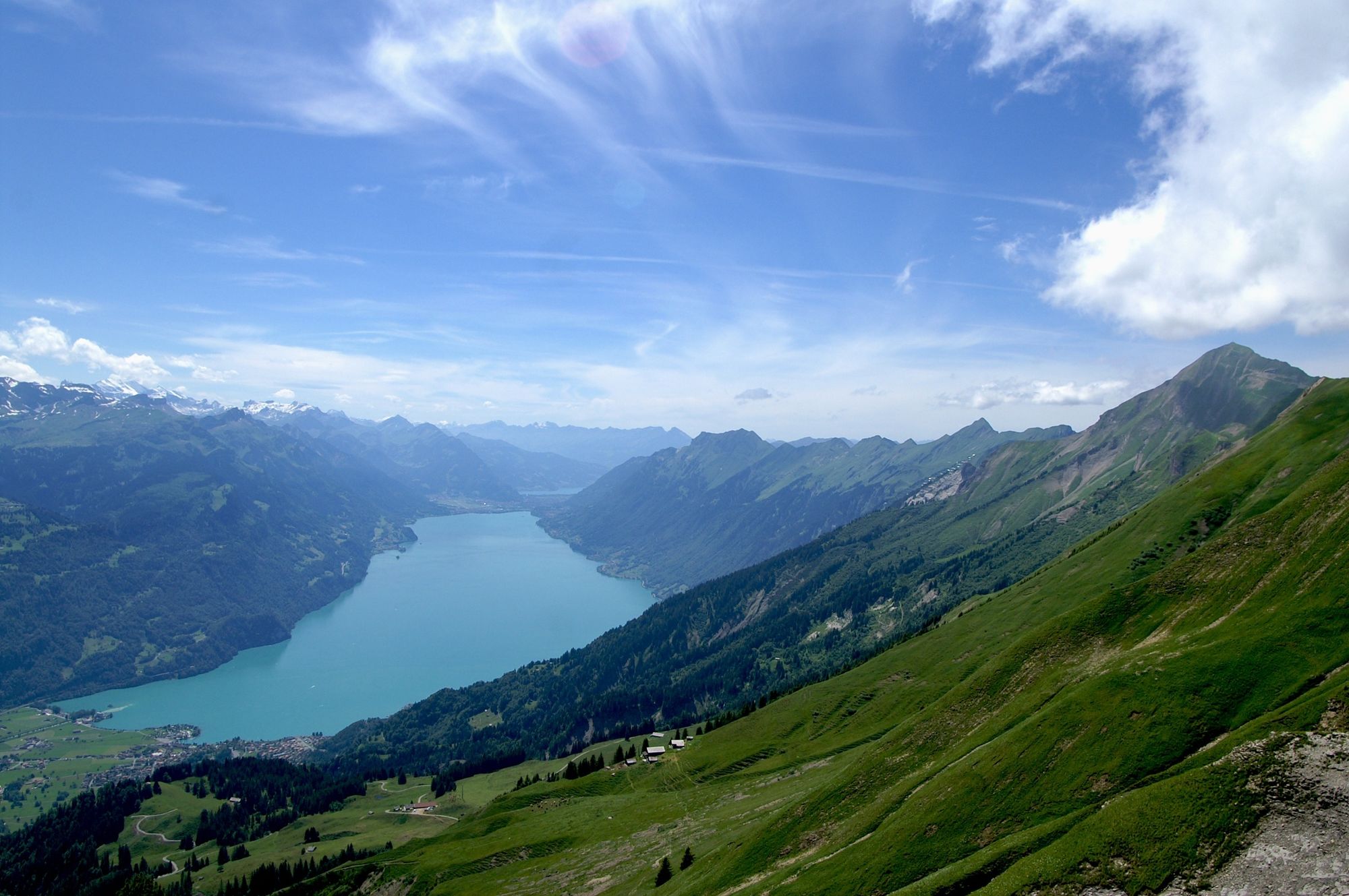
Das Brienzer Rothorn bietet bei klarer Sicht ein „sensationelles Hochalpenpanorama mit atemberaubenden Tiefblicken auf den Brienzersee“. So preist die Webseite von Wanderland Schweiz diese Etappe des Grenzpfades Napfbergland an. Wenig Hartbelag.
- Greutăţi
-
mediu
- Evaluare
-
- Ruta
-
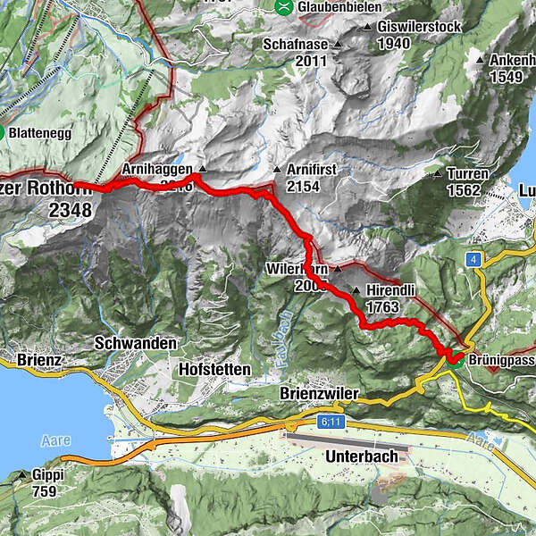
Brienzer RothornRothorn0,1 kmGipfel Restaurant Rothorn0,3 kmBrienzer Rothorn (2.348 m)0,5 kmBrienzer Rothorn1,0 kmSalewang7,1 kmSchäri10,1 kmBrünig11,8 kmBrünigpass (1.005 m)12,0 kmPasshöhe 101312,0 kmBrünig-Hasliberg12,2 km
- Cel mai bun sezon
-
ianfebmaraprmaiiuniulaugsepoctnovdec
- Cel mai înalt punct
- 2.322 m
- Destinație
-
Brünigpass
- Profil de elevație
-
 © outdooractive.com
-

-
AutorTurul Brienzer Rothorn, der Drei-Kantone-Gipfel este utilizat de outdooractive.com furnizat.
GPS Downloads


Informaţii generale
Promițător
Mai multe tururi în regiuni
-
Obwalden
2014
-
Brienzersee
1054
-
Brienzwiler
302